

dendrite
-
Posts
67,926 -
Joined
Content Type
Profiles
Blogs
Forums
American Weather
Media Demo
Store
Gallery
Posts posted by dendrite
-
-
64.9°
I had to laugh at Watertown being almost 80° all night. West of the CRV is on fire.
-
 1
1
-
-
Yup…ice slows warming. It sucks up a lot of heat trying to phase change. Keep losing all of that year to year up there (permafrost, glaciers, sea ice) and all of thermal energy goes into warming instead of melting. Our Canadian source region gets hotter and warmer earlier and now it’s practically cut off for weeks or over a month at a time in the heart of summer. Just some impotent fronts that give us dew downs or ooze in from the NE via a BD.
-
3
-
 2
2
-
 1
1
-
-
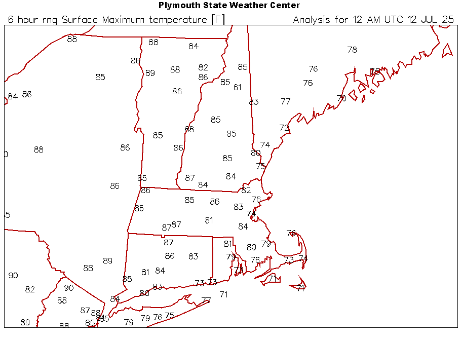
ORH was 83° today…+3F. Yesterday was 81° (+1F). Like Scoot said…we need mank to go BN this time of year. It takes a miracle to do it with a cP airmass out of Canada now.
-
1
-
-
3 minutes ago, ineedsnow said:
we live in Fitchburg? the weather between here and there is night and day sometimes.. it was cloudy alot of the day here from the storms to the west and ones that developed close by
lol if everyone around you is AN then you are too. Your avg high is just lower. What are we even doing?
-
 1
1
-
-
Upper 80s are BN now. Unreal.
-
1
-
-
3 minutes ago, ineedsnow said:
its 2 weeks out and not above by much
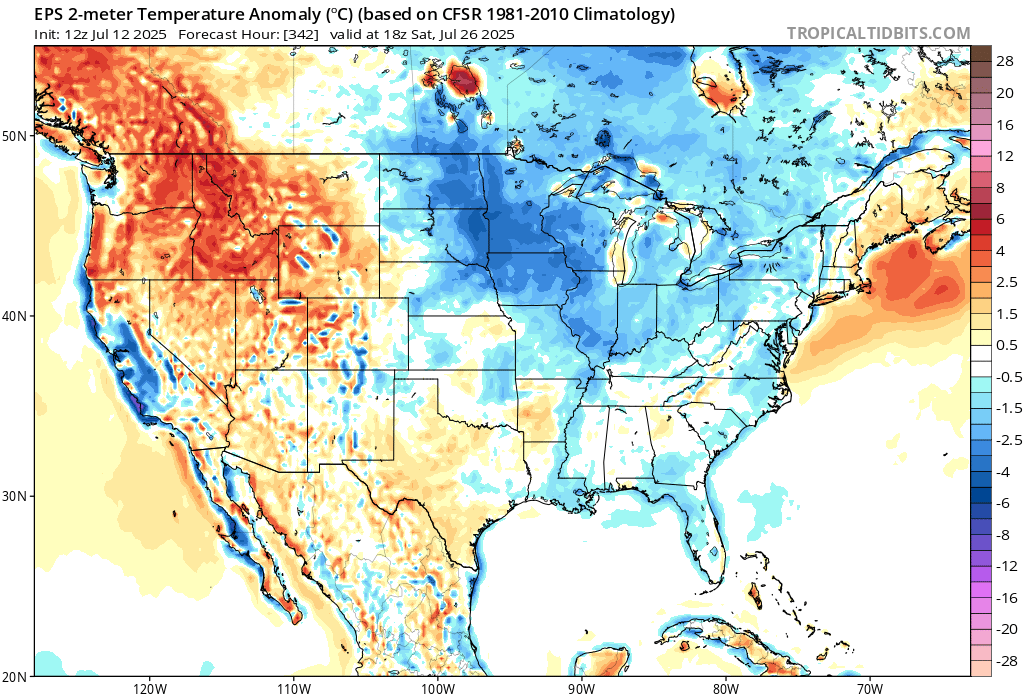
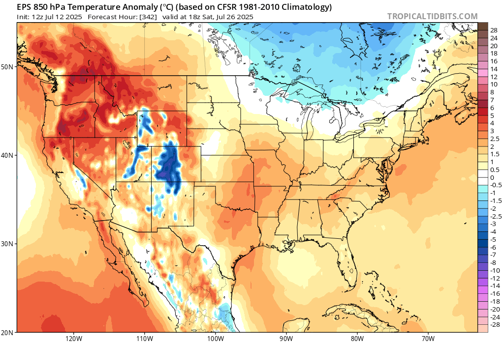
I do think we’ll get some mild downs in there, but 15-17C pops 90° in the lower els. We’ll be AN.
-
1
-
-
1 minute ago, ineedsnow said:
but that would include overnight temps .. its not a hot pattern.. if it wasn't for overnight lows this month might average below by the time its finished
Lol no
Those 18z anomalies are voodoo. Sorry. They paint half of the country blue at 18z and it flips to orange at 00z 6hrs later. Pull out the godsmack.
-
2 minutes ago, ineedsnow said:
@dendrite why don't you use afternoon temps
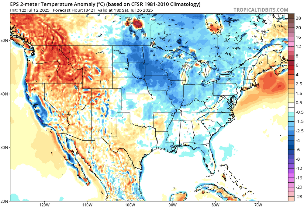
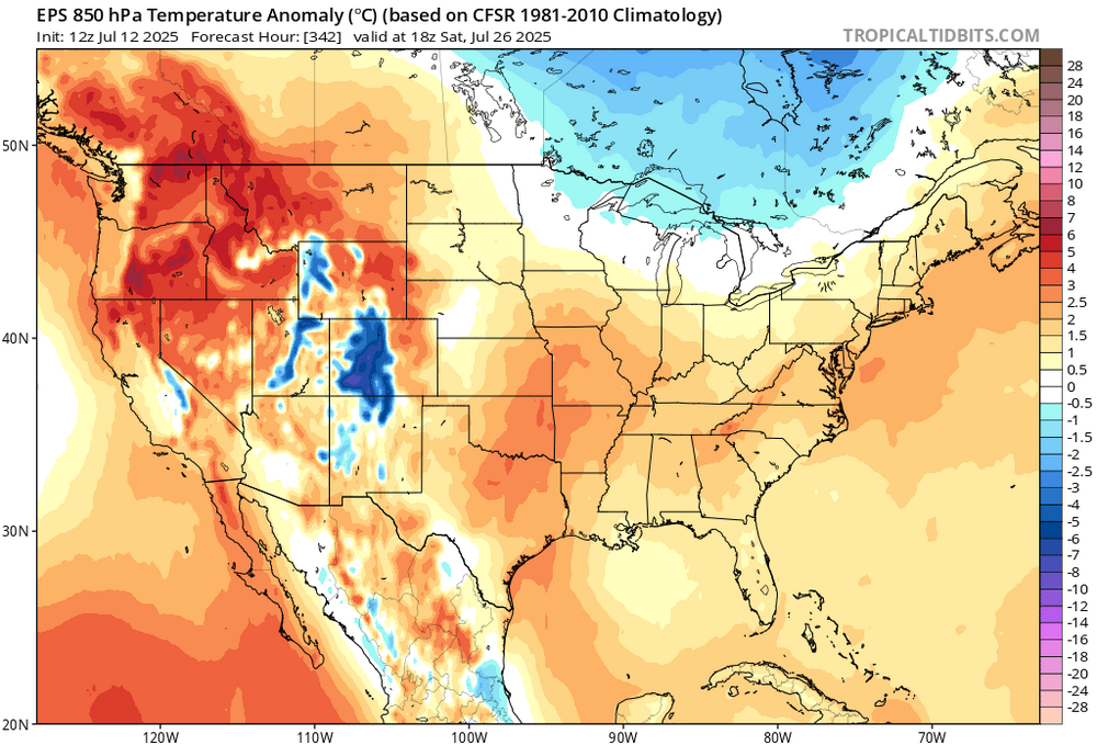
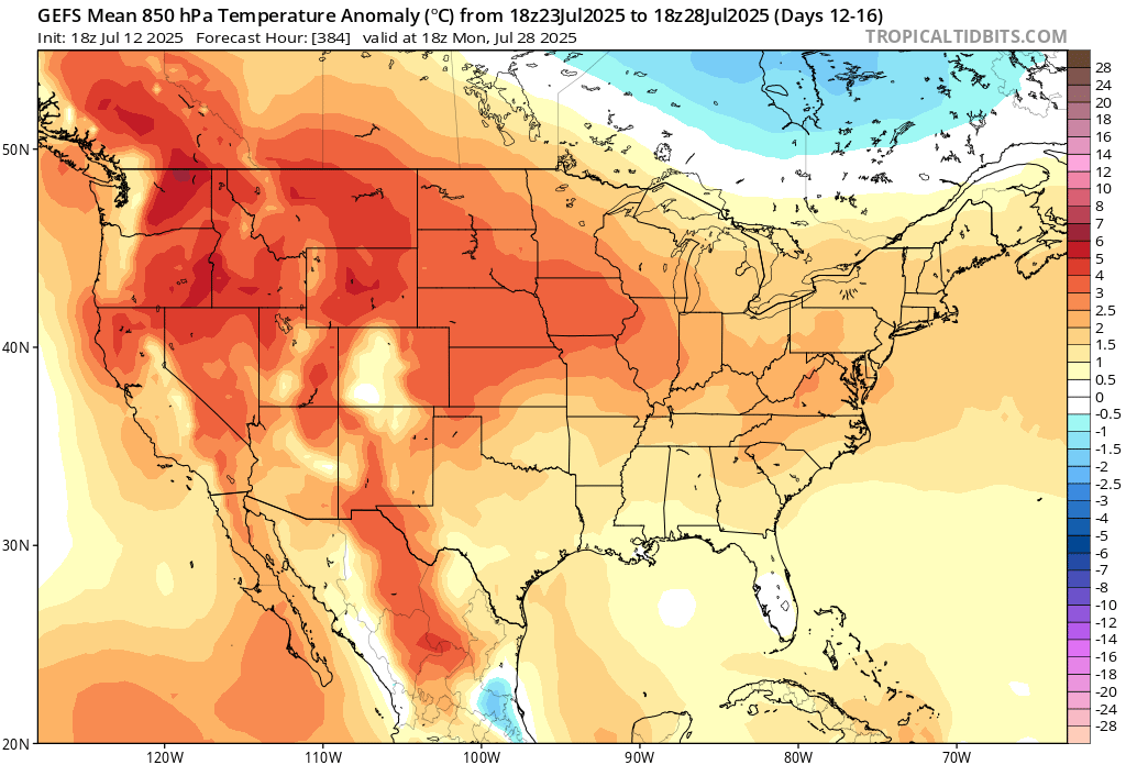
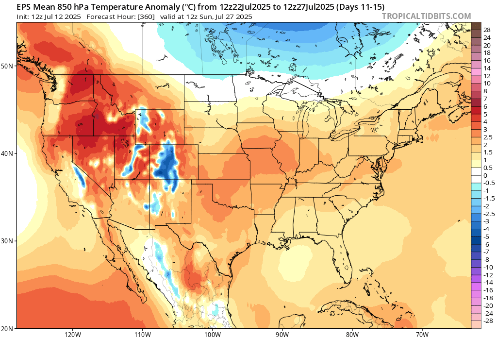
Good luck with that 18z 2m anomaly voodoo. 850s are AN.
-
1
-
-
Don’t use 5d 850 T anomalies? Beer?
-
1
-
-
9 minutes ago, ineedsnow said:
cool pattern starts next weekend
Looks epic. Is this the arctic backbreaker?

-
13 minutes ago, Damage In Tolland said:
ACATT has nothing but sweaty ass cracks, burning and chafing from not wiping enough and gas from
weight gain from dews bloating
All chafe all the time?
-
 1
1
-
-
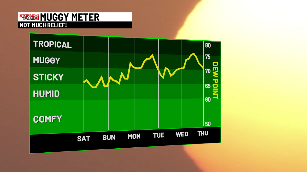
52 minutes ago, BrianW said:
You know the dews have been so special when your local news puts a muggy meter...

I remember when graphics like that stopped at 75°. We weren’t supposed to ever go above that.
-
3
-
-
1 hour ago, CoastalWx said:
I chose not to go up fearing the SE flow wedging that shit in. Glad I stayed here.
Nice now but 4pm ftl. A late push to 80°.
-
29 minutes ago, weatherwiz said:
I wonder if that’s KBYX radar
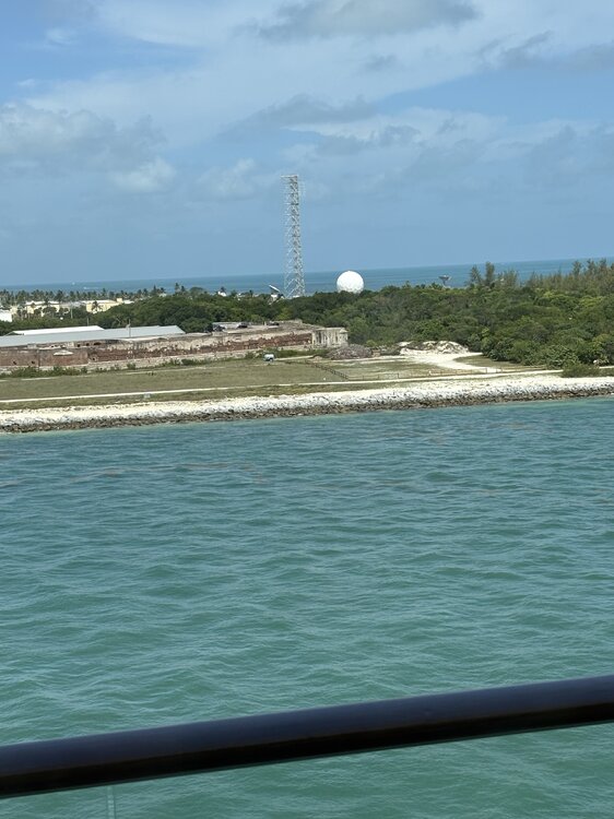
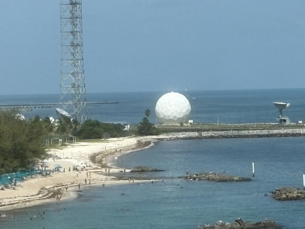
Epcot Center
-
1
-
5
-
-
jfc I just saw visible. fml
-
59 minutes ago, moneypitmike said:
Pouring. Make if stop!!!
66*
Make it start!
74.6° OVC
-
56 minutes ago, RUNNAWAYICEBERG said:
It would be wolfie’s lifetime achievement if he could be one of the cops there.
Undercover? Sneaky wolfie.

-
3
-
 1
1
-
-
Only a +8 min for CON this morning.
You can’t stop her. You can only hope to contain her.

-
1
-
5
-
-
Min 67°
Cold!
-
1
-
 1
1
-
-
5 minutes ago, powderfreak said:
High of 88F here, HI got to 91F. Average high of 79F.
+4 start to the month.
A warm and muggy day outside of ENE.
-
1
-
-
Dews were near 70° all day. That used to be high end mugginess. Now ineedsnow is meh’ing 80/75?
What happened to the saying “it’s not the heat, it’s the humidity”?
-
1
-
 1
1
-
-
The warm mins are a product of high dews. It's all part of the sensible weather.
-
2
-
-
80/71
Muggy and deep summer.
-
Warm, humid afternoon.
81.8/70
-
1
-

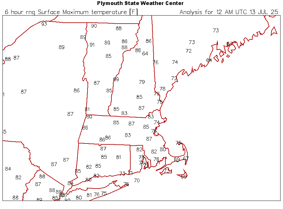
July 2025 Obs/Disco ... possible historic month for heat
in New England
Posted
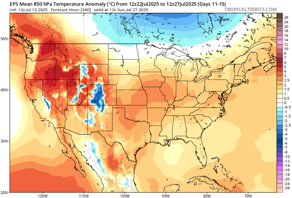
The big ridging is moving out west. So like I said, we’ll threaten some mild downs at the end of that period if things hold. But I’d still lean a bit AN.