

dendrite
-
Posts
67,796 -
Joined
Content Type
Profiles
Blogs
Forums
American Weather
Media Demo
Store
Gallery
Posts posted by dendrite
-
-
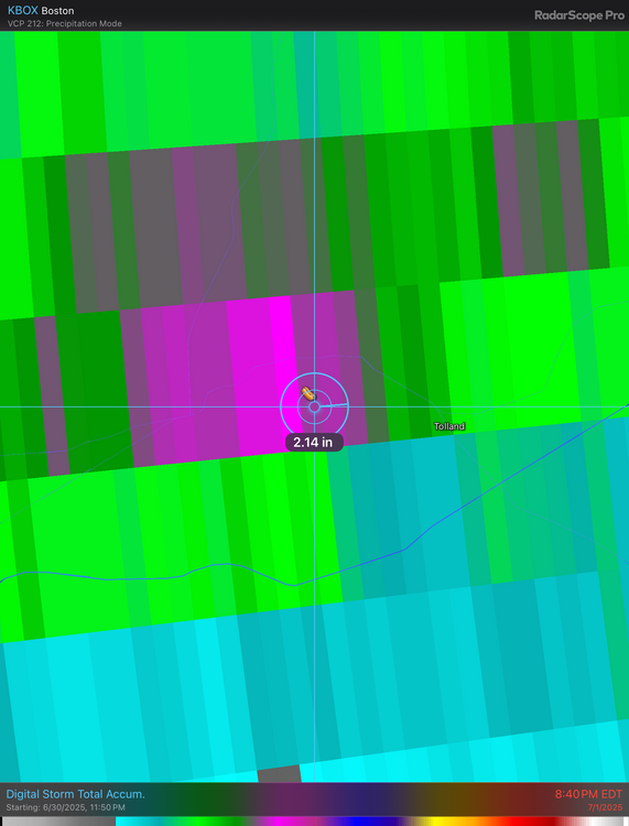
9 minutes ago, Damage In Tolland said:
2.56”
You beat your June total in 1 day.
-
1 hour ago, Damage In Tolland said:
That pixel is literally over my hood here . I feel like I’m standing naked and free on top of Brokeback Stowe
Yeah I have your exact lat long in here.
-
-
54 minutes ago, ineedsnow said:
87/69 this crap sucks
-
 2
2
-
 1
1
-
-
21 minutes ago, Damage In Tolland said:
83/77… out here moving shaking and enjoying
Hips n’ lips?
-
I just let the mosquitoes annihilate me at this point. If I haven’t gotten EEE or WNV at this point I must be immune. lol
-
 1
1
-
-
Min 64.5°
73.3° -SHRA
0.03” in the tipper
-
Touchytiger upset over a tailpipe joke when they're posted hundreds of times over missed events in winter.
-
2
-
2
-
-
Just now, Torch Tiger said:
perverse and sick joke
lol what?
-
1
-
1
-
-
4 minutes ago, amarshall said:

Weymouth right now
.Awesome. Works in the winter too if you just hook it up to the exhaust.
-
13
-
 1
1
-
1
-
 1
1
-
-
Heat indices run of the mill
-
81.4°
Heat has been kinda meh up here today despite full sun. Only 85° at CON so far.
-
GWDLT
We moist
-
56.4°
Should be toasty this afternoon.
-
2
-
-
Spraying sucks. No.
Attract more dragonflies.
-
2
-
1
-
-
BOS was thisclose to an official 103° last Tuesday. Just needed one more minute of it.
BOS,BOSTON/LOGAN INTL,2025-06-24 21:12,101
BOS,BOSTON/LOGAN INTL,2025-06-24 21:13,102
BOS,BOSTON/LOGAN INTL,2025-06-24 21:14,102
BOS,BOSTON/LOGAN INTL,2025-06-24 21:15,102
BOS,BOSTON/LOGAN INTL,2025-06-24 21:16,102
BOS,BOSTON/LOGAN INTL,2025-06-24 21:17,102
BOS,BOSTON/LOGAN INTL,2025-06-24 21:18,103
BOS,BOSTON/LOGAN INTL,2025-06-24 21:19,103
BOS,BOSTON/LOGAN INTL,2025-06-24 21:20,102
BOS,BOSTON/LOGAN INTL,2025-06-24 21:21,101
BOS,BOSTON/LOGAN INTL,2025-06-24 21:22,101-
2
-
 1
1
-
-
Made it up to 75°, but 7/8 clouds.
-
4 minutes ago, ineedsnow said:

Why do we want this for the 4th? Lots of self destructive sunshine. The only positive would be low WBZs so maybe we could pull off some low topped small hailers. But it’s not great for the cookouts.
-
1
-
1
-
-
Lots of clouds and low 70s up here. Lots of selfdestructive taint.
-
59 minutes ago, dendrite said:
60.1° -DZ
Boundary is hung up sorta like this currently
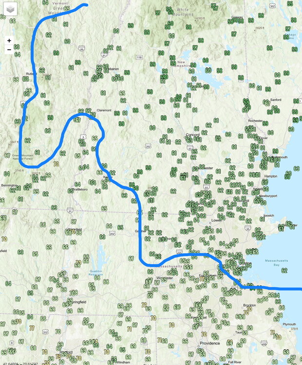
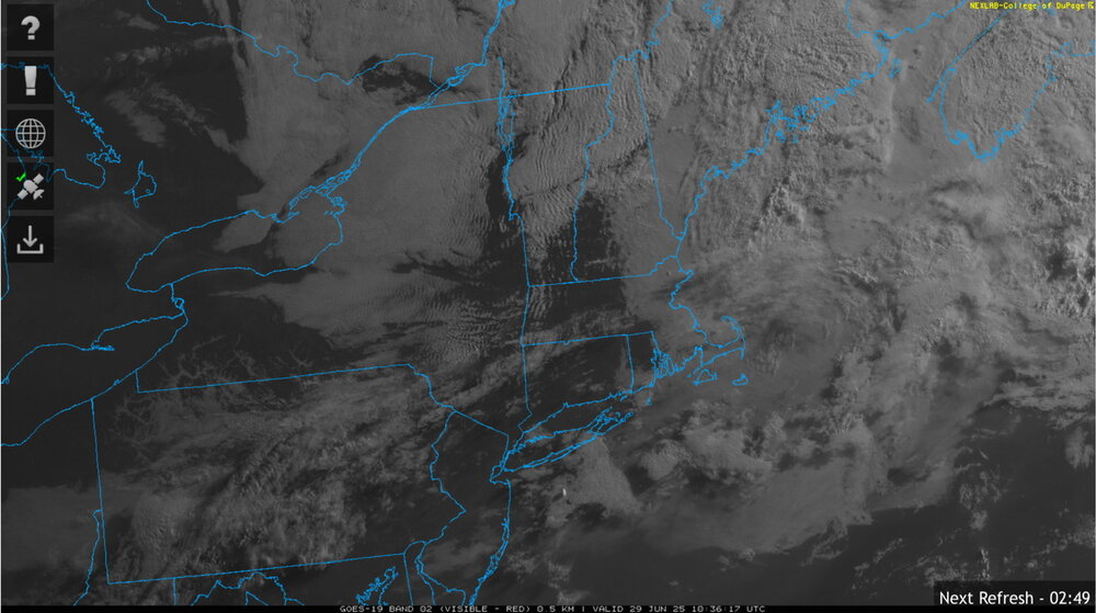
Vis probably shows the true boundary better
-
60.1° -DZ
Boundary is hung up sorta like this currently
-
1
-
-
15 minutes ago, Damage In Tolland said:
One of these ain’t like the others
One of them is saving $$$.
-
1
-
-
29 minutes ago, weatherwiz said:
GWDLT.
would need a jacket sitting outside
Congrats on clearing out mid afternoon. Sounds like an epic day.
-
59.9° OVC
No AC
-
2
-


July 2025 Obs/Disco ... possible historic month for heat
in New England
Posted
Tolland this morning.