-
Posts
9,977 -
Joined
-
Last visited
Content Type
Profiles
Blogs
Forums
American Weather
Media Demo
Store
Gallery
Posts posted by LithiaWx
-
-
8 hours ago, LithiaWx said:
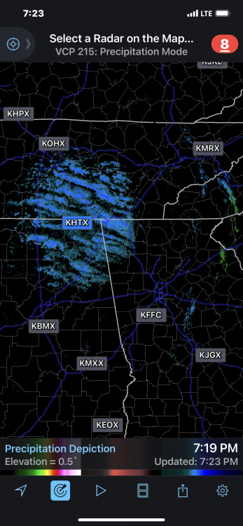
Rain sleet snow mix in Kennesaw nkw
Lasted about ten minutes briefly changed over during the highest rates as we usually see with these things. Zero accumulation but technically we did see some mangled slop today lol.
-
Rain sleet snow mix in Kennesaw nkw
-
3 hours ago, LithiaWx said:
Mother in law in locust grove can’t get to her house due to downed trees. She isn’t sure if her house was hit or not yet.
She made it home and her house is ok. The damage in Locust grove/ Jenkinsburg is pretty decent. Based on what I’ve heard probably EF-1+ but curious what the experts see during the survey. Lots of trees down and some damage to buildings.
-
 1
1
-
-
Mother in law in locust grove can’t get to her house due to downed trees. She isn’t sure if her house was hit or not yet.
-
 1
1
-
-
Here in the heart of the enhanced risk. On the Dallas/Kennesaw area of northwest Atlanta.
-
1 hour ago, GaWx said:
RDU received significant snowfall the last two late January's (2.7", 1.6"). Based on the ensembles as they look now, it appears that they'll have a halfway decent shot for a third wintry late January in a row. Anyone want to make a prediction on whether or not they'll get 1"+ of SN/IP and/or 0.10"+ of ZR between January 21st and 31st?
This impending pattern change for late January looks fun to me and that's even with me having very little chance for wintry precip due to poor climo for that this far south. I just enjoy cold patterns. Many times in late January we don't have this kind of change to look forward to. So, I feel fortunate. In the meantime, the last week or so of wx here has been quite enjoyable for walking. I'm also looking forward to the upcoming cold weekend with highs of only 50-55 and lows of 30-35. The weekend looks to average ~8 BN with very low dewpoints. Great for outdoors!
I’d take +300 odds on that if you’re offering lol.
-
 1
1
-
-
-
Sitting in NW Atlanta watching this one.
-
26 minutes ago, NEGa said:
Current temp 36 with a dew point of 29. What I am really liking is the wedge is coming in and it’s obvious lol. There is quite a ne wind right now. Usually when a storm is a complete bust I don’t notice the wind before hand. This morning it is quite noticeable yay
I think NE GA above 2000-2500 feet is going to do very well.
-
 4
4
-
-
Warm noses are always served piping hot.
-
 3
3
-
 3
3
-
 2
2
-
-
I’m in gatlinburg through Sunday afternoon for this one. Hoping for at least a few inches but I’m on the wrong side of the mountains. Might be able to navigate I-40 then down to Maggie valley if I want to see the deep stuff though. Just worry about lack of 4x4.
-
 1
1
-
-
Severe watch up for north GA. Yesterday had a tornado come within five miles of my house. EF-1
-
-
More snow headed towards home in west GA
-
Had to come down off the mountain. Roads were covered. Wind was howling. Was blizzard like.
-
-
-
Ripping
-
 4
4
-
-
Snow/sleet and 36
-
Rain/snow and 37 now
-
-
I’m at woody gap. 43 temp dropping FAST. Ten degrees in last 25 mins. Will report with photos from Twitter and post here once the white stuff starts to fly.
-
 1
1
-
-
Just now, MotoWeatherman said:
Woody Gap. Brass town will close the entrance road which means hike to the top of thats what your after. Woody typically does well in these situations. Or hwy 136 near Big Canoe. Also goes over 3k up
I’ve had lots of luck at Woody Gap. Seems to be perfect for that sweet spot of ease of access and elevation. Plus they treat the roads. Thank you for the tip about the access road to brasstown getting shut down.
-
 2
2
-
-
Snow chase #2 for this season is here!! I’m debating targeting Brasstown Bald at 4700’ or Woody Gap at 3200’. My initial thoughts are the 1500’ won’t make a big difference and to stick with familiar chase territory at Woody Gap.
-
 1
1
-


Mid to Long Range Discussion ~ 2023
in Southeastern States
Posted
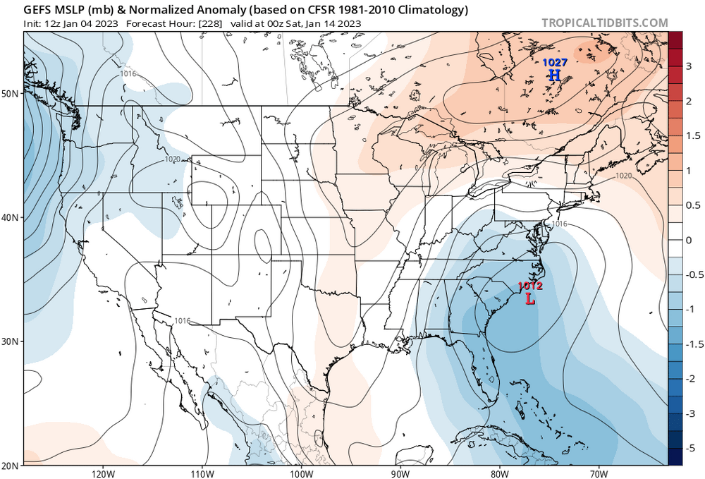
Hopefully we are setting up for a wild late January into mid Feb.