HoarfrostHubb
-
Posts
58,734 -
Joined
-
Last visited
Content Type
Profiles
Blogs
Forums
American Weather
Media Demo
Store
Gallery
Everything posted by HoarfrostHubb
-
Heading out to a restaurant where I will possibly be tasting fermented shark. Forget the ‘vid, this might kill me
-
Sadly leaving tomorrow. Just in time for a torch
-
This afternoon car thermo was reading 19C. So 66F or so. Sun feels strong though. Plus it doesn’t set until after 10. Our hotel room (plus restaurants and stores) is very warm.
-
One downside to Iceland. No A/C and they keep everything on “warm” since the heat is basically free. Not so good if temps are 18-22C.
-
Anyway...going to do some Icelandic horse driving. Apparently these things have 5 speeds instead of the typical 4. And don’t call them ponies (even though I probably weigh more than some of them)
-
None of us had a good camera. Just iPhones
-
Not bad. Their roundabouts/rotaries are a bit different but not an issue. Also driving a stick for the first time in a few years (other than on occasion ). Thankfully the flat happened near a small town. If it had been in parts of yesterday or the day before we might have had issues.
-
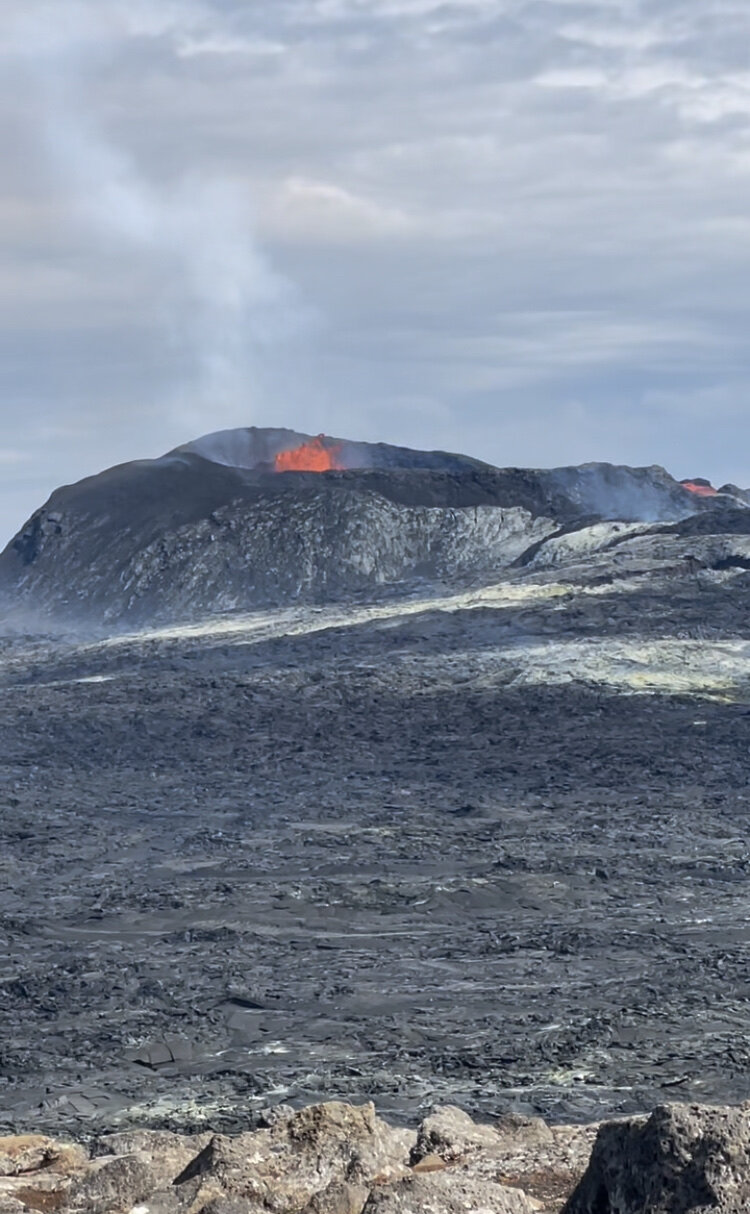
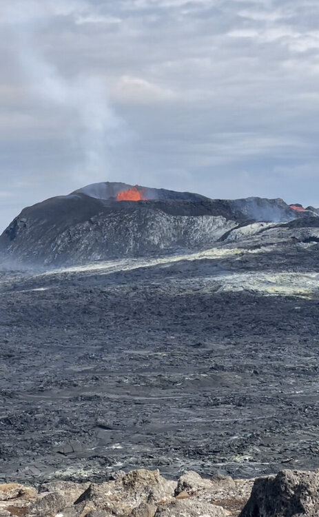
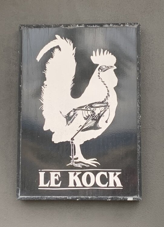
Hiked the volcano Pretty epic if not as good as May. Long walk up and down. Got a flat after leaving. Rental car had baloney skins on the wheels so not surprised. After cleaning up at the hotel had a decent lamb burger at an over priced outdoor restaurant. People watching in Reykjavik is interesting. Walking around the city we saw this : another restaurant Figured some would enjoy it. Carry on with the silliness
-
Sorry about the crappy quality. This was taken out the car windshield. Just mile after mile of this.
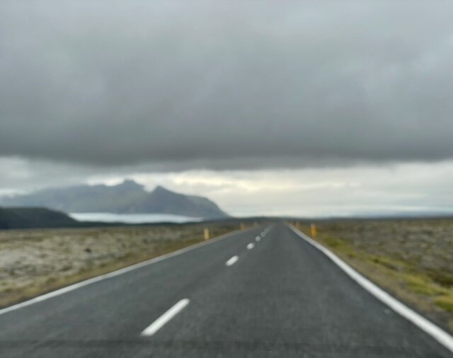
-
We then drove 2.5 hours from Vik (tiny town) through 200+ km of pretty much nothing. Such incredible swaths of the most incredibly bizarre flat landscape covered by moss and lava rock with distant mountains. Felt like another planet. We then reached our destination by the Jökulsárlón glacier. We will be kayaking that in the morning. Our air b n b has a small (but tall) waterfall behind it and overlooks the distant ocean
-
Sadly, it tasted like (going by old memory) something like Killian’s Irish Red ? (Fake stuff by Coors). I think the server brought the wrong one. He said there was a red brew and a green. The green was supposedly more flavorful. What he brought looked red and was...bland? I did try a brand here called Einstock Pale Ale that was excellent.
-
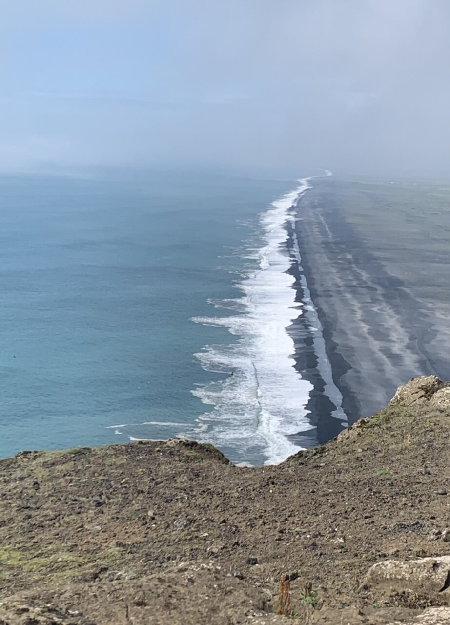
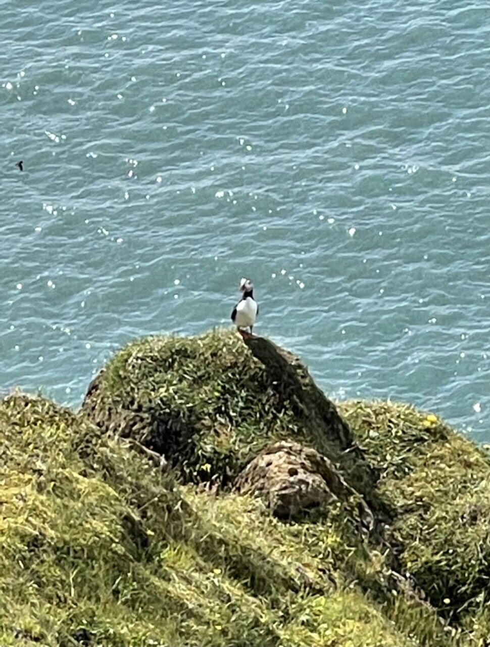
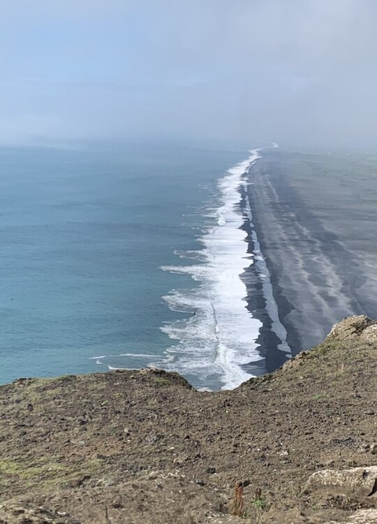
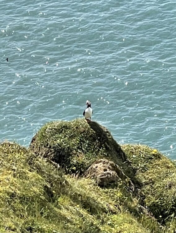
Yes. That was from (let me check the spelling) Dyerholeay (maybe?). Decent hike up to a lighthouse. Thousands of puffins on the cliffs below.
-
So far it has been decent. Expensive but the prices include tax and you don’t tip. We just ate some fish sandwiches for a late lunch. Each one was around $23. So that would be around an $18 sandwich at home? Had some excellent pastries and coffee our first morning. Lunch was meh at a museum. Dinner I had trout. Best trout I’ve had I think. Yesterday and today we had breakfast at the hotel. Decent continental style. We are lunch yesterday at a tomato greenhouse. Excellent food. I had tomato beer and tomato ice cream.
-
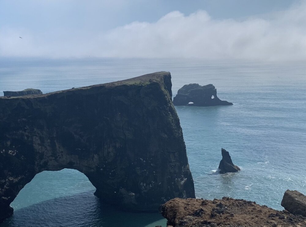
The arches are nice.
-
I can’t even describe it. You can see 30 miles in all directions and then giant cliffs and mountains rise up. So green. So many horses.
-
Same cliff. Different view.
-
That ocean was like 500’ down. The cliffs were nuts
-
Meanwhile... puffins!!!
-
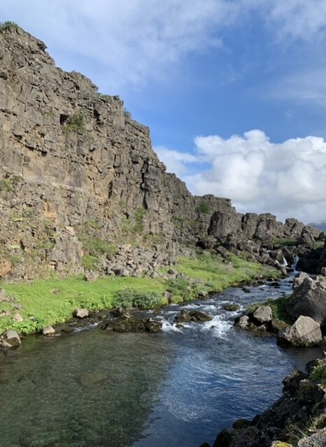
Yeah. It is not really like straddling 2 plates there. Think of it like a scar after a big surgery. The National park is on the scar itself. You can measure the plates pulling apart using spots that are distant but there isn’t a spot you can actually tough two plates that way. Still cool. We were watching snorkelers and divers entering the crystal clear 2 degree water there. We almost signed up for that but $$$
-
Also, no AC here. Heat is pretty close to free so they crank it up everywhere. And does anyone on here have a towel dryer/warmer? So need to get one
-
It was pretty warm when we were out and about. 15-17C. Lots of sun in the morning. Some decent rain when we were driving back from Geysir. I wonder if they have ever had a tornado here.
-
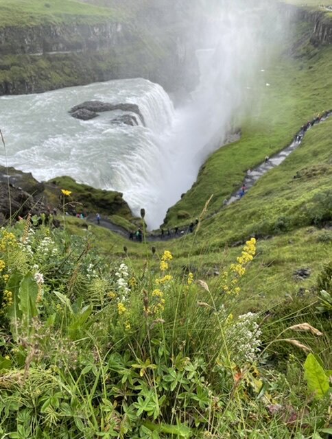
Yeah. Gullfoss was more impressive than I though. We thought Thingvellir National Park was the best though. That’s where you can measure the plates pulling away 2cm per year Saw our first glacier today from Gullfoss. Kayaking a glacial lagoon Friday
-
I wish pics could do it justice here.
-
We saw some small sections of them. But I think July is when there are big fields of them.
-
This country is stunning. I highly recommend visiting