

CentralNC
-
Posts
532 -
Joined
-
Last visited
Content Type
Profiles
Blogs
Forums
American Weather
Media Demo
Store
Gallery
Posts posted by CentralNC
-
-
5 minutes ago, msuwx said:
Say what you will, having 3 winter weather events, to some degree, in 20 days is very impressive to me. Some spots in western NC had snow on snow on snow, which is pretty dang rare (I've never experienced it personally before), outside of the higher mountain spots.
actually had 4 at my location. 1/3, 1/16, 1/21, 1/28. Of course 2 of those very small/minor
-
 1
1
-
-
We ended up with a quarter to half inch dusting. 30 degrees
-
1
-
-
Snow mixing in Lewisville
-
Snow mixing in Lewisville
-
41 light rain
-
3 minutes ago, PantherJustin said:
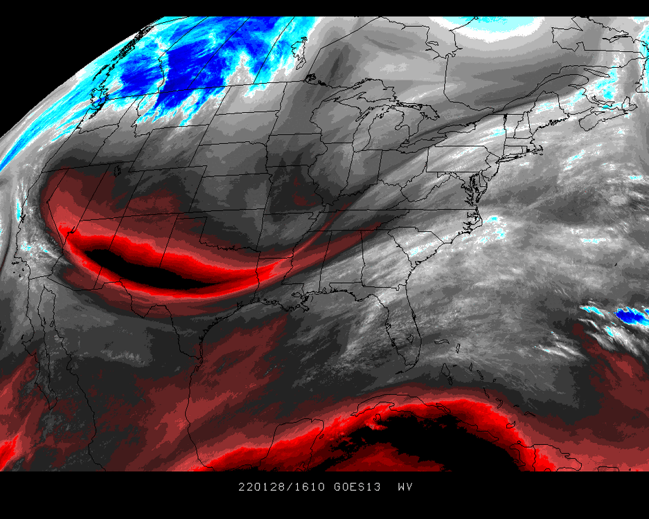
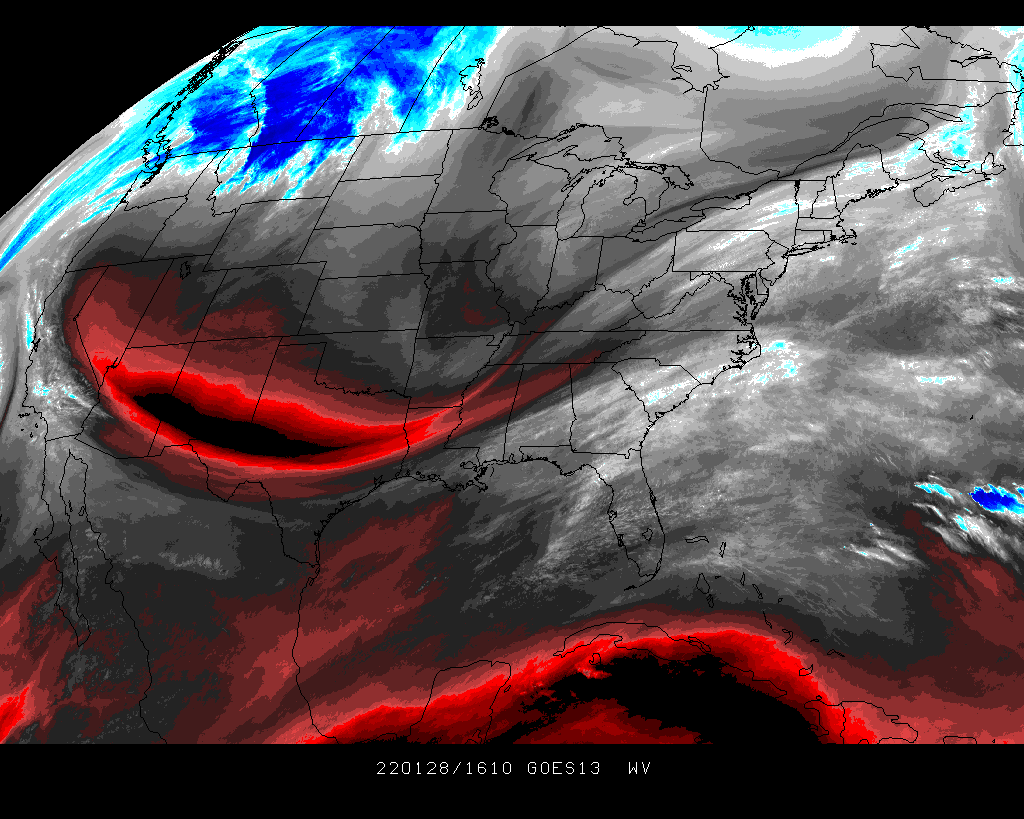
that is quite a trough.
-
36, cloudy skies
-
1 minute ago, wncsnow said:
A lot of what is showing up on radar is virga
True, but looking like sunshine will be at a minimum at my location. RAH is already lowering daytime highs in the north. Looks like low 40s max where I am.
-
2 minutes ago, TARHEELPROGRAMMER88 said:
Radar looks much more juiced than the models are showing. Hmm.
Noticing the same thing. Flip to snow earlier? I think I am in a good spot where I am.
-
5 minutes ago, HKY_WX said:
One thing to watch this evening is as the upper low begins to form and take shape off of the NC coastline there will be a nice deformation axis likely 100 -150nm to the west of the 850mb low. This is where there could be some banding/enhancement. If this were to occur a bit earlier or more dramatically than forecasted (aka phasing), obviously that would impact totals in a positive way. Something to keep in mind. Otherwise I will go with the below:
HKY:T-1 inches
CLT: 1-2 inches
GSO: 1-3 inches
RDU: 1-2 inches
ORF: 2-4 inches
Yes, I fully expect somewhere in NC to overperform with this. Selfishing, I am hoping I77 corridor but Raleigh is not out of the game either.
-
1
-
-
Should we create an obs thread for this event or just go with the obs thread already there?
-
 1
1
-
-
32 with snowy look to the sky. Nowcast time.
-
2
-
-
6 minutes ago, PackGrad05 said:
Cue the local mets showing trends decreasing with euro ensemble probabilities.
GSP in their afternoon AFD sound more promising for the piedmont. All in all still a guessing game
-
1
-
-
2 minutes ago, StantonParkHoya said:
yeah, ULL, blah blah blah. I'm not buying CLT does better than RDU with a 998 low of HAT.
Correct. We rarely score with these setups back where we are.
-
 1
1
-
-
NAM has to be considered at outlier at this point unfortunately.
-
1
-
 1
1
-
-
5 minutes ago, CaryWx said:
Wasn't this storm on the gfs just a couple days ago
Yep. Signal still there
-
1
-
-
18 minutes ago, BornAgain13 said:
Anyone have any ground truth to the band west of Winston salem?
Nary a flake here by the Yadkin river.
-
1
-
-
3 minutes ago, ForsythWx said:
There have already been reports outside of the mountains of flurries / snow showers. And the snow blips on the radar are just getting bigger and moving east / NE. But I agree, my excitement for this whole event is pretty minimal for my county. Still cool to see and nowcast.
Problem is there will be a screwzone on the NW side of the precip due to dry air intrusion. It will be somewhere in the western piedmont I believe.
-
Just now, ForsythWx said:
Radar quickly starting to light up south and west of Winston-Salem area.... interesting how much juicier radar looks compared to models at this time.
need to see some ground truth before I get too excited. mountains dont count lol
-
2
-
1
-
-
5 minutes ago, StantonParkHoya said:
Starting to think things may get going here in Raleigh before 5 based on short range high res models
Agree. Radars look pretty good
-
1
-
-
30 degrees. Nary a flake from the frontal passage. Dont expect much from the slider, but good luck to you peeps down east.
-
1
-
-
2 minutes ago, BornAgain13 said:
Also in twitter. He is actually a pretty good met in Richmond area (just ask him), but also a first class jerk. Does a pretty good job of explaining his reasoning but don't dare disagree with him or he'll call you names like a 7 year old
-
3
-
-
2 minutes ago, PackGrad05 said:
At this point I'm looking at high-res short-term models anyway. NAM 3K and 12K look great.
Trends I will admit do not look good, but there can always be surprises at nowcast time. I'm pretty skeptical for us back here in the western piedmont, but anywhere east of Burlington I would not give up.
-
2
-
-
24 minutes ago, ILMRoss said:
RDU worrying about the best totals going to the east and relying on the NW trend to throw precipitation back? This must be what it feels like to live in Winston Salem.
Yup!
Potential 1/28-1/30 2022 winter storm
in Southeastern States
Posted
Wow not even 1/2 inch here in Lewisville