

mississaugasnow
-
Posts
1,241 -
Joined
-
Last visited
Content Type
Profiles
Blogs
Forums
American Weather
Media Demo
Store
Gallery
Posts posted by mississaugasnow
-
-
Ill gladly take freezing rain from this system.
-
Not to go off topic regarding the storm but the windchills following the storm are going to be impressive. -36F monday morning in Toronto, Environment Canada calling for frostbite within minutes, first time ive ever seen that.
-
 1
1
-
-
Staying up to follow this storm for a bit longer. Tight cutoff in the GTA area. Temperature dropped from 15F to 5F in 2 hours here on Hamilton Mountain
Good luck to those in WNY and CNY, looking forward to seeing some of the totals you guys get.
-
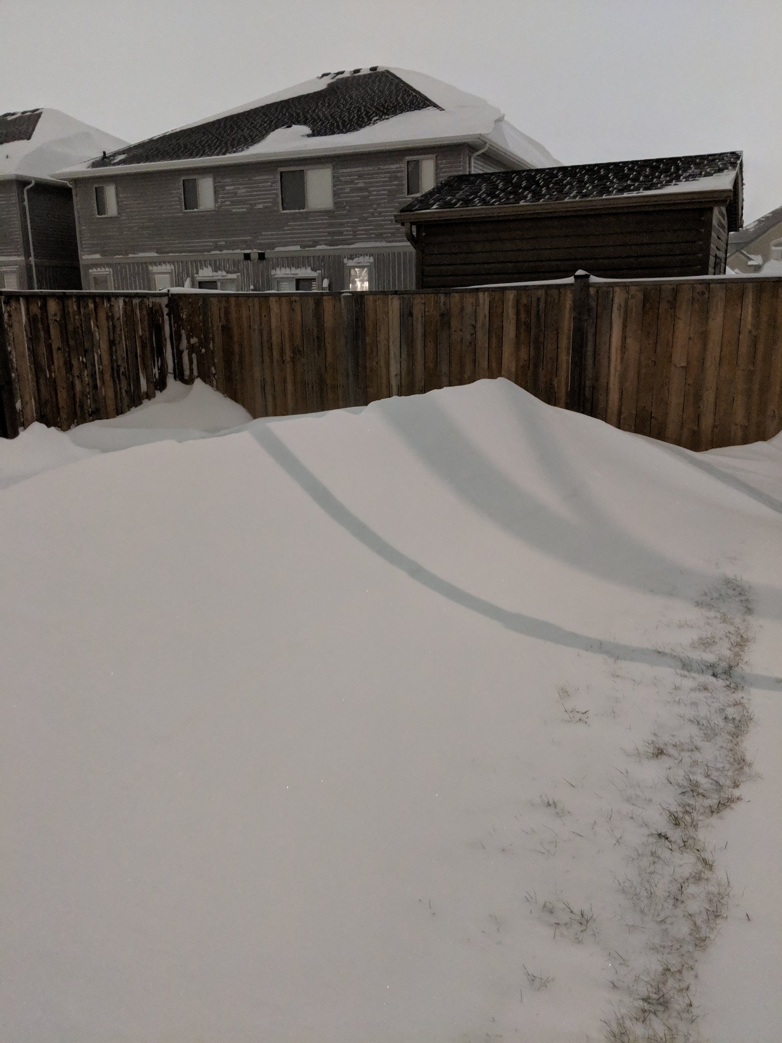
Parts of Hamilton Ontario will end up with around 2 feet of snow from this system + lake effect. Toronto will/should end up with at least 4" possibly as a high as 6".
-
Its also still snowing here. I hope the band stays just far enough north for parts of toronto to get at least 6" from this storm. It will be close
-
3 minutes ago, ayuud11 said:
I live on hamilton mountain and can confirm that there is a small area in Hamilton that received 40-50cm (16-19"). I sadly missed the main band by 8km. The met that reported it is also reputable and works at the weather network.
-
 3
3
-
-
15 minutes ago, Ottawa Blizzard said:
Pretty much what I was going to say. I think heavier snow is expected between 10 PM and 2 AM. Is it ever looking cold tomorrow night. Lows down to about 10 below Fahrenheit without the windchill factored in.
Yep, as much as it sucks missing out on the 12-20" totals across the border at least almost everyone in the GTA will have 2-6" (6-15" for the winter storm warning areas) to go with the cold. Bare ground and cold would have been awful.
-
8 minutes ago, snowcaine said:
1.5" in Toronto so far. Snow has stopped for now.
We really do have a talent for getting utterly screwed with every system. Our last >8" storm was 4 years ago. Our last >12" storm was 6 years ago.
I think the northern edge scrapes most of the GTA with better snow than the pixie dust earlier. I think this evening will bring an additional 2-4" which might bring some areas especially close to the lake to almost 6"
-
1
-
-
5 minutes ago, CNY-WXFREAK said:
I'm posting this in here because its relevant to our situation in either WNY-CNY but can be even more intense across our area as the system will be strongest as it passes by just to our S&E!
Areas affected...Northeast Indiana...northwest Ohio and southwest
   Michigan

   Concerning...Heavy snow

   Valid 191609Z - 191915Z

   SUMMARY...Moderate to occasionally heavy snow will continue into the
   afternoon. Snowfall rates of 1 to 1.5 inches per hour are expected.

   DISCUSSION...A large precipitation shield has developed north of a
   deepening surface cyclone moving into the southern Ohio Valley.
   North of the rain/snow line, currently located just south of Marion,
   Indiana to near Delaware, Ohio, moderate snowfall has developed. A
   band of enhanced snowfall rates has developed from Rochester,
   Indiana to near Ann Arbor, MI. The location of this band matches 12Z
   NAM cross sections which had an area of negative saturated
   equivalent potential vorticity (EPV) above the low-level
   frontogenesis forcing. This area of conditional symmetric
   instability(CSI) is expected to wane by 18Z and then redevelop
   between 18Z and 21Z across northwest Ohio. Snowfall rates beneath
   these heavier bands will likely exceed 1 inch per hour with snowfall
   rates above 1.5 inches per hour possible. Outside of these stronger
   bands, snowfall rates will be around 0.5 to 1 inch per hour.
The Detroit AFD has also mentioned the system is slightly further north and west of guidance. Should be good for the Buffalo-Niagara crowd
-
1
-
-
Just now, n1vek said:
Can confirm here in Royal Oak, MI. Current rates and radar trends have me thinking this will be a bit of an over performer.
Thats great news for the GTA. Toronto just needed a slight bump north and west to go from 2-5" into the 4-8" range.
-
Im thinking someone in SE MI and maybe even Metro Detroit gets 6-8" out of this storm. The updated AFD mentions that they've bumped snow totals up a bit and that the system is slightly further north and west of guidance.
-
1
-
-
waving the white flag. Winter 2018-2019 has not been kind and now after missing to the south this weekend followed by brutal cold it looks like rain next week. Bring on spring and the GTA can roll the dice again on maybe a decent winter next year.
-
1
-
 1
1
-
-
Im waving the white flag on this winter. Miss to the south, rain next week. Biggest snow this year has been 3" and its almost February, bring on spring
-
2 minutes ago, CNY-WXFREAK said:
I don't like what the NAM is selling at all!
go on... lol
-
Winter Storm watches up for portions of the GTA. Current forecast is 2-4" northern Suburbs, 4" Downtown, and where the winter storm watches are (west end of GTA to border) up to 10".
-
Just now, CNY_WX said:
What is Toronto’s yearly average snowfall? Being on the wrong end of Lake Ontario and not in a favorable synoptic location it’s probably fairly low.
About 51" We have a climate similar to Detroit/Chicago. Most of our big storms are terrible for about 90% of this sub because they cant transfer to coast and generally have to pass right over Rochester.
-
Just now, Thinksnow18 said:
Nice!!! That's really great news and further solidifies a more northern shift
Yep, though the northern suburbs probably wouldn't mind another bump north. As of right now the northern suburbs are looking at 2-4", Downtown Toronto and west to Hamilton 4-6" and Hamilton-Niagara 6-10"
-
Winter Storm watches up for portions of the GTA. Looking around 6-10" here which I will gladly take because this winter has been awful.
-
2
-
-
2010 F-250 Diesel, with all season tires. Last year I had a 2011 f-150 4x2 and it was a disaster in most snowfalls and it never left the GTA. The 250 this year was cruising around Muskoka in the New Years snowstorm no problem. The girlfriend drives a 2012 Hyundai accent hatchback.
-
Lets go Clemson. I hate saying that as a Michigan fan because I hate both those teams, but I hate Alabama a little bit more.
-
46 minutes ago, michsnowfreak said:
FWIW It looks like a warm up after the cold snap later this week is in the cards, but it has looked that way for a while. Actually I'm a little surprised at the cold snap coming this week, at one time it looked like all out torch until around the 20th. Thereafter is when this alleged colder than average weather will hit. I'm assuming that's the warm up that NWS BUF was talking about, I cannot imagine a NWS forecast discussion discussing something more than 2 weeks down the road.
Buffalo regularly spells out the pattern they think might happen. They even mention "looking further down the road" which means they are looking well beyond day 7. Time will tell, but the pattern change and cold and snowy forecasters have gone all in on the 20th here and on social media. They havent left much room for wiggle if the pattern fails to materialize.
-
9 minutes ago, buckeye said:
interesting observation. I actually feel the opposite. Last week it was looking like the calls for a brutal cold end of Jan into Feb were in trouble, but everything I've seen since than has flipped back to that potential brutal cold period happening. As someone else said, cousin Eddy just brough Clark's boss to him with a christmas bonus + 20% higher than last year

JB is now back to bringing up 77-78 and claiming a brutal 30 to 60 day period on the horizon.... shocking... I know. (as much as I'd love snow, it would almost be worth going back to a December pattern just to see him meltdown again).
Only time will tell. Heres Buffalo AFD. Since they're talking about beyond January 15th time frame, it looks like they arent sold on the idea of a cold second half.
Looking further down the road...while we will be experiencing below normal temperatures during this period...a large impressive storm system over the northern Pacific in the vcnty of the Emperor Seamounts will set the stage for a warm up. A strong East Asian jet supporting this storm system will extend across the Pacific by the end of this forecast period...and this should encourage Pacific modified air to flood the country during the ensuing week. The influx of the maritime airmass into the center of the country with a pattern that typically induces ridging east of the Rockies will favor a spell of warmer weather for our region for the week following the end of this specific forecast period. Stay tuned.
-
I can tell that the longer we go without a big storm or big cool down is slowly overwhelming those forecasting for cold. A few local weather individuals I follow on twitter have now stepped back from a prolonged cold and snowy 2nd half of January and February.
The Buffalo NWS also says that beginning next week they expect a substantial warm up.
-
Just now, buckeye said:
No doubt, today was beautiful. As far as the pattern change....i just hope if it happens we,keep the boobie pattern, (credit angrysummons), and just get things a little colder. That way at least we have trackable storms without the crushing, suppressive brutal cold. I have no desire to see the PV park over the northern lakes....
Ill take brutally cold weather and random 1-2 inch snowfalls from alberta clippers. I enjoy legit winter storms but at this point ill take highs between 10-15F and lows below 0F with consistent snow cover.
-
3
-

Winter Storm? Jan 18-19th, 2019
in Lakes/Ohio Valley
Posted
could have been worse. For a while there it looked like Toronto would get only 1"