WxKnurd
-
Posts
1,428 -
Joined
-
Last visited
Content Type
Profiles
Blogs
Forums
American Weather
Media Demo
Store
Gallery
Posts posted by WxKnurd
-
-
Just now, Elev3999 said:
28 and snow is steady here.
Yea it picked back up down here below you, some good size to the flakes too. Looks like you have 4” or so.
-
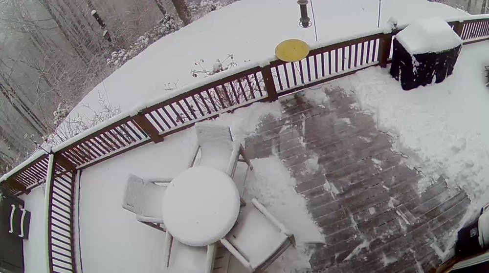
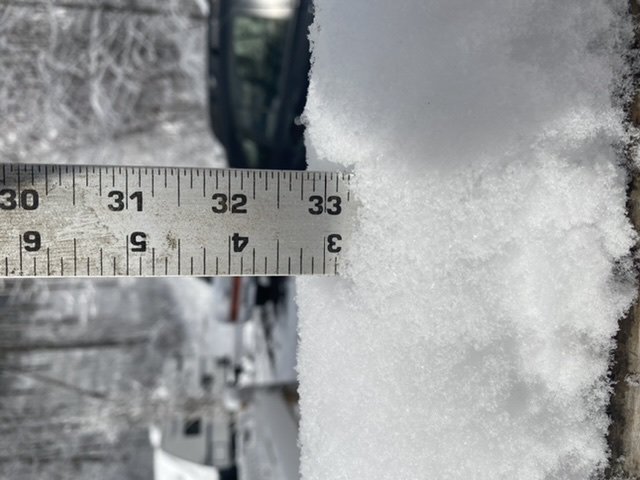
Light snow falling, looks like we are sitting around 2.5 inches, maybe 3. I guess now we see what the ULL does. I want to break the 4” mark, have yet to do so since moving here.
-
 1
1
-
-
Tried to stay up to see if the Meso discussion would turn out accurate but I’m done, calling it a night. From the looks of radar, I should wake up with a decent amount. 3/4” is the tally as of now while waiting for more returns to roll in.
-
12 minutes ago, Met1985 said:
We have been in a lule but looks like things are going to pick up.
Just walked out to my truck and went from nothing falling when looking out before getting my keys to big nickel sized flakes starting to fall moderately.
-
1
-
-
Forgot to add, measures basically 1/2” earlier as I had suspected. Wife blames me, said it was pouring snow before I got home. So y’all can all yell at me haha.
-
1
-
-
5 minutes ago, Sw NC weather said:
I know it’s early but according to radar and latest models I’m about ready to write this one off. Hope you guys in central and northern mnts can score a decent event!
It’ll be interesting but I don’t think you can write it off yet. I wasn’t expecting the good stuff til after midnight myself anyway. Dryslot sucks but it does look to be filling in as Rainforest said. All depends on if that’s the case as well as what that moisture batch in north Alabama does.
-
4
-
-
1 hour ago, kvegas-wx said:
Where are all the snow reports from the mountains? Radar lighting up everywhere out west!
Nevermind...I see all those altitude afflicted folks are too good to come over here and post in the obs thread. They have their own little special drinks and probably even a secret handshake for get togethers.

39.9 in the heart of the Triad. 36 on the farm in Stuart. Progress!
We do. It’s learned when you move up in a very Free Mason like ritual. Obs is dry slot where I am on the Haywood/Jackson line with 1/2”-ish on the ground. Waiting impatiently for the ULL to hopefully bring the goods. My wife blames me, was ripping until I got home

-
Well I am in a dry slot now, so just waiting for that batch of moisture back in Alabama to pivot through. Still snowing up at your place Met?
-
1
-
-
Was ripping fatties coming up 74 to the house, but got to the house and flake size had decreased. Was like a quarter inch 15-20 min ago when I got here. Looking like a half inch now. Hoping to get some great rates with big, nickel Sized flakes.
-
2
-
-
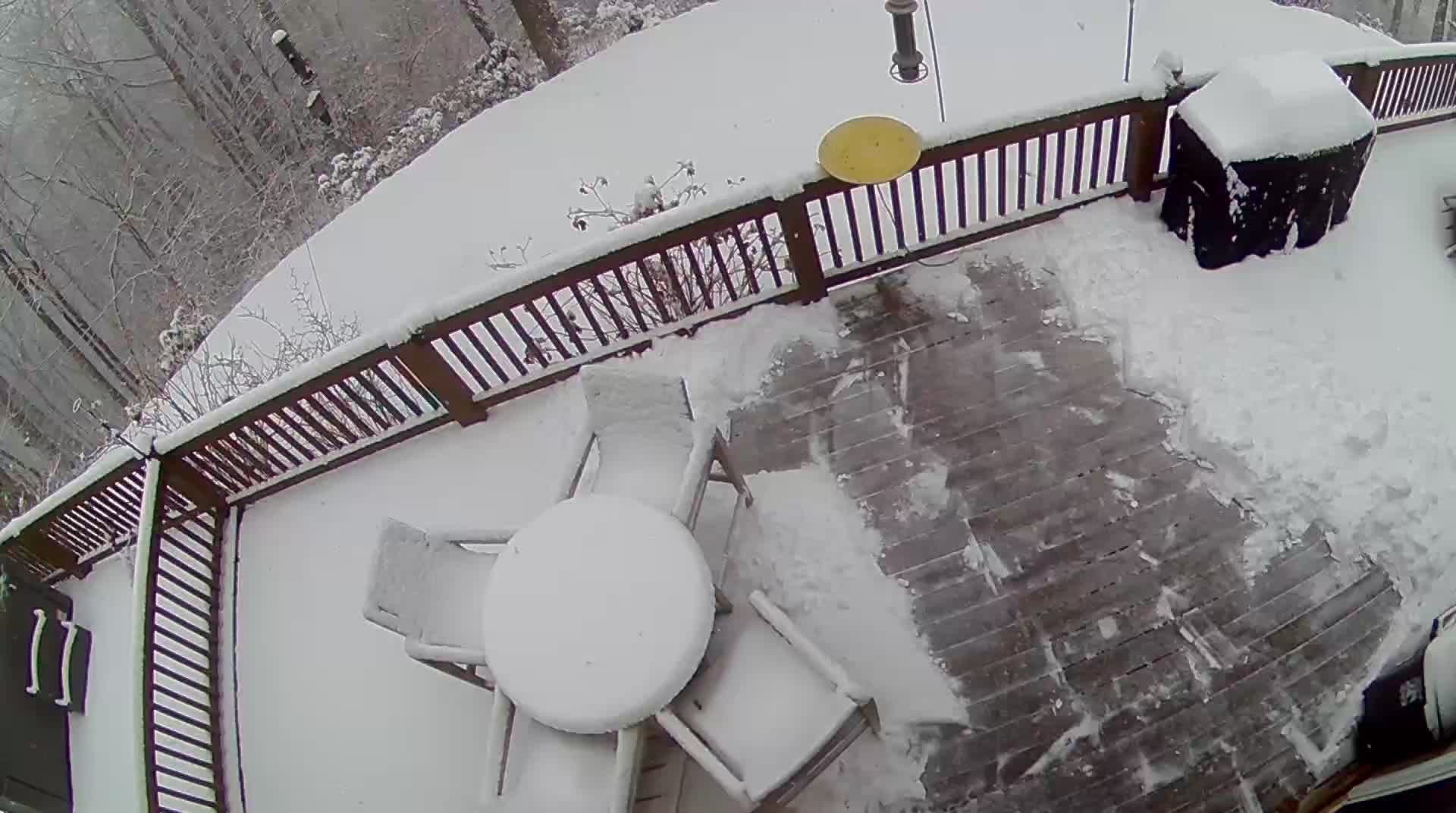
So my obs so far. Hit light snow in Candler area, then a moderate rain/snow mix as I got to the Haywood line that went to mostly snow then all, moderate to heavy snow where 74 splits off that turned to what I think was about all rain for a good stretch until climbing the hill into Waynesville when I basically went to all snow again. Can’t make up it’s mind consistently on flake size or rate yet but it’s starting too. So I’m thinking we are finally saturated well and cooling the column entirely. Time to grab some beer and then head the final 10 minutes to hone up in Balsam.
-
4
-
-
5 minutes ago, Met1985 said:
Ill be drinking Balvenie double wood 12 year old scotch whiskey.
I’ve got some Evan Williams 12 yr Single Barrel I need to open. Leaving Kingsport here shortly, I’ll swing by Ingles in Hazelwood for some porters and stouts before I head to the house. Like where I’m sitting, this is the kinda storm I’ve been waiting on.
-
3
-
-
HRRR has burned me so many times down in CLT I can’t trust it. But damn if I don’t want to, Haywood is the jackpot on that map. Over a foot at my house.
-
2
-
-
That’s Highlands-Cashiers-Glenville area would be my spot. Might be able to snag a Airbnb in Glenville on the lake or with views of the lake. Highest elevation “big” lake on the East Coast.
-
1
-
-
3 minutes ago, Local Yokel Wx said:
A Southwest Special indeed. The Southern Highlands Plateau to the Great Balsams and most of southern Haywood should do really well. We're sticking to our snowcast map from yesterday and will narrow the ranges some, but your 3 - 6" for Balsam call is what I'm telling my friend up Chad Crawford.
If you're jonesing for snow and want to ride it out cabin style, the Highlands - Cashiers - Lake Toxaway corridor will be the easiest setup. Just be safe out there!
One of the things I'll be watching with this event is the front and back end snowfalls. I wonder if the Smokies will win out for highest totals compared to say Richland Balsam (or anywhere along the Great Balsams) bc of NW flow on the backside, but alas, we'll may never know the totals up and along the Great Balsams with so little observations.
I work for a non profit that manages the Shining Rock and Middle Prong Wilderness Areas and will reach out to our ranger to see if they can give us data/pics from their daily walkabout.
Depending on how crazy I feel I might take a LONG hike on Saturday up to a hunting spot I never made it to this season in that area between Richland and Balsam off the parkway. Sits above 5000’. Lots of vert gain from the valley floor outside Cullowhee to the top so we will see, if I do I’ll take some pics and get some measurements. I think a 4” storm total is our highest at our house since we moved here in Feb of ‘19, so I’m hoping to finally break that at some point this season. Feel confident it happens by Tuesday next week but we will see. Still wanting a double digit storm too sooner rather than later lol.
-
2
-
-
Been keeping an eye on models and everyone’s thoughts. Working up in Kingsport so gotta make the tricky drives over Sam’s Gap, through the Newfound Mtns and then the final one up to the house so trying to figure out if I need to head out Thursday night or if I’ll actually be able to work a few hours Friday. At least it’s all major Highway. All depends first on timing and then on amount, I’d rather drive when it’s clear and then get dumped on or navigate 1-2” of snow while I’m driving instead of driving during a paste bomb. Figuring 3-6” at the house is probably a good call. Southern Haywood on the rim of the Great Balsams looks to get raked.
-
2
-
-
Everyone says it’s packed but I’m not seeing it outside of the usual high traffic areas being even more high traffic i.e. Black Balsam. But I also tend to gravitate to non-trailhead areas as well as Nantahala areas instead of Pisgah.
-
1
-
-
56 minutes ago, strongwxnc said:
Can confirm, it is pouring!
-
Same in Haywood, heavy frost that I thought “did we get a dusting overnight?” At first.
-
1
-
-
2 hours ago, Sw NC weather said:
Big bust on temps today forecast was 54* and I only managed to get to 41 with a couple sleet/snow showers this morning.
Yep, breaking 40 was a struggle here too. Fog eventually creeped down from up top. Mid 50’s out towards Mills River around 11 and right at 40 at home when I got back at noon.
-
1
-
-
We were single digits, I think down close to 5 at some point. Dusting of diamond dust was all we got after we got home.
-
2
-
-
2 minutes ago, BullCityWx said:
Long way from southern lake Norman!
Truth. I might or might not had taken elevation and snow chances in to consideration when picking out a house with the wife. Couldn’t talk her into 5000’ near the state line though lol.
-
2
-
-
Flurries/light snow but it’s pounding across 74 it looks like, can’t see the mountain anymore. Hoping the flow sets up where I can pick up an inch or so overnight.
-
2
-
-
Wind has picked up here and clouds thickened back up, @Sw NC weather seems like I’ll be getting what you are seeing soon.
-
3
-
-
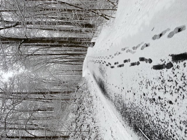
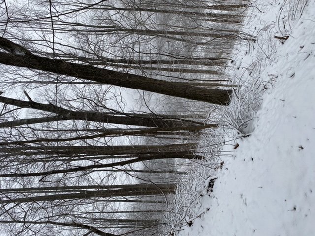
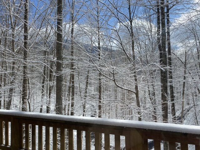
Back in Balsam, 19 degrees in a winter wonderland with flurries flying. Most consistent measurement is a touch over 3” so that’s what I’m going it. Puts me at 6”+ for the year which is already more than half of what we ended up with last year. Wonderful Christmas scenery!
-
8
-

2020/2021 Fall/Winter Mountain thread
in Southeastern States
Posted
Measured close to 2.75” of paste. Was a tricky forecast, mid-level dry air that worked in per GSP disco hurt for sure. Maybe we add another inch during the day, two if we get under some decent rates and have ample moisture in the dendrite growth region. A little disappointed based on the potential we were seeing on modeling up until the HRRR right at go time and the radar showing there was truth in it. That said, I know this is a tough setup to forecast with lots of pieces involved. Back to moderate snow here.