WeatherGeek2025
-
Posts
1,682 -
Joined
-
Last visited
Content Type
Profiles
Blogs
Forums
American Weather
Media Demo
Store
Gallery
Everything posted by WeatherGeek2025
-
the models did but weather forecasts were downplaying it. Pittsburgh got 3-5 inches and the forecast was for less than an inch
-
the snow in PA is definitely a surprise for many. Pittsburgh is getting heavy snow right now
-
snowman do you think we'll get more snow this winter/spring?
-
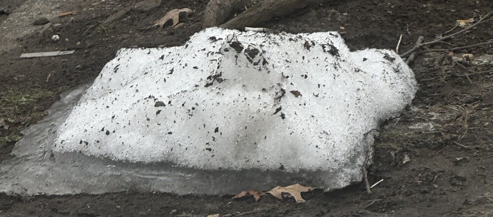
this was mine a few days ago lol
-
you too right?
-
you think we have a warm and humid summer? I sure hope not
-
it's almost over but i just had a deja voo with with @CoastalWxill be peeking at the models until april 1st
-
oh that's a nice storm! i wish i lived in Traverse City for the next week right now
-
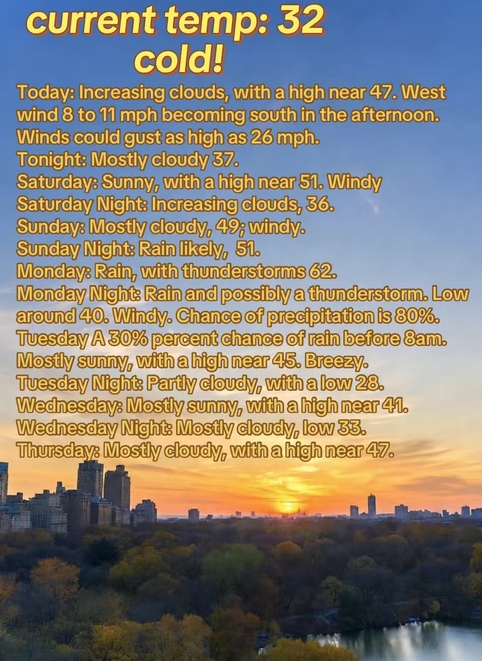
gotta watch this potential also here's your 7 day forecast

-
just had a deja voo and what happens next is this one doesn't work out but we have a major storm after this one can't remember if it was a snow event or not but i swear just had a deja voo
-
how many inches?
-
that was the worst winter ever for me i think we got a surprise snowstorm late in March otherwise there was no snow at all. I don't want to see that again, it was miserable! the snow wasn't even predicted it was supposed to sleet and rain but a surprise came in early am and we got 5 inches
-
gotta watch this potential

-
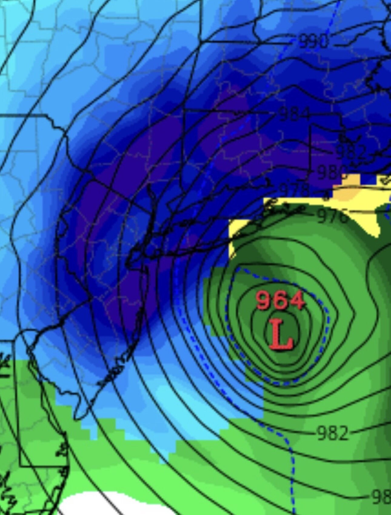
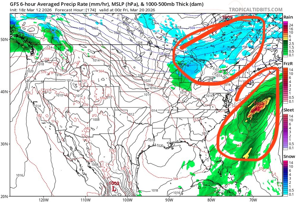
next big potential
-
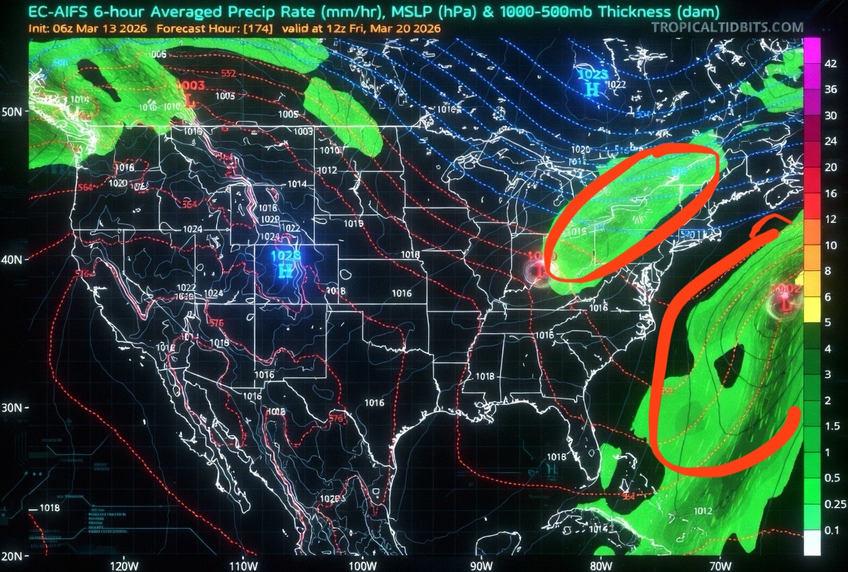
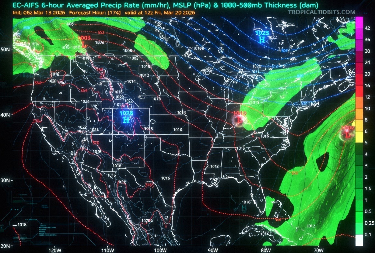
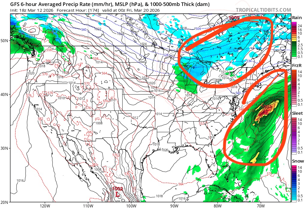
going to watch this! see if we could phase those two systems

-

Rain/Thunder and Anafrontal Snow
WeatherGeek2025 replied to WeatherGeek2025's topic in New York City Metro
Tuesday morning looks like a good chance of FROPA. Maybe some tail end snow! -
Rain/Thunder and Anafrontal Snow
WeatherGeek2025 replied to WeatherGeek2025's topic in New York City Metro
moderate snow in the bronx right now -
Rain/Thunder and Anafrontal Snow
WeatherGeek2025 replied to WeatherGeek2025's topic in New York City Metro
Richmond looks to get in on it! -
Rain/Thunder and Anafrontal Snow
WeatherGeek2025 replied to WeatherGeek2025's topic in New York City Metro
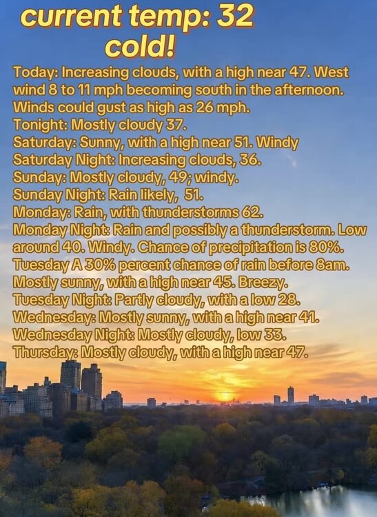
42 and cloudy in midtown. Radar looks like it can't miss us, so whatever falls it'll either be cold rain, mix or snow! I'm happy with it! -
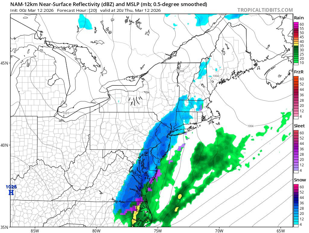
80 Degrees to Ripping Snow: March 12th
WeatherGeek2025 replied to SnowenOutThere's topic in Mid Atlantic
this is crazy dc was in the 80's all week and now it's snowing! -
Rain/Thunder and Anafrontal Snow
WeatherGeek2025 replied to WeatherGeek2025's topic in New York City Metro
most models lost the little snow that was forecasted oh well we rain -
Rain/Thunder and Anafrontal Snow
WeatherGeek2025 replied to WeatherGeek2025's topic in New York City Metro
there's gotta be some severe weather there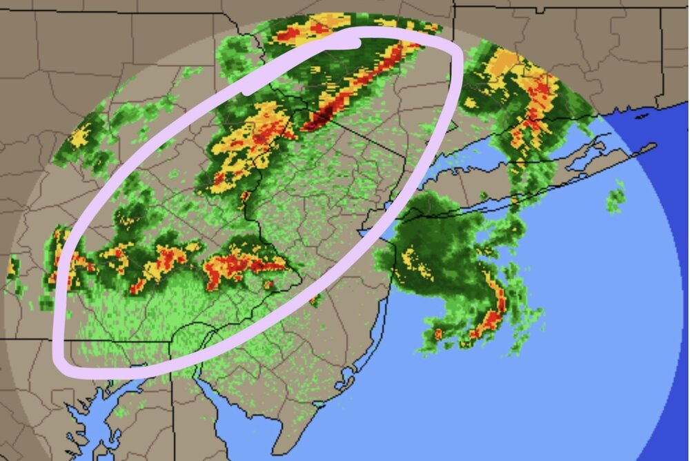
-
changed the thread name to rain/thunder and anafrontal snow
-
Rain/Thunder and Anafrontal Snow
WeatherGeek2025 replied to WeatherGeek2025's topic in New York City Metro
nam just gave us a few inches lol
-
now we wait for the other line later on tonight and than the snow event tomorrow night