wthrmn654
-
Posts
3,953 -
Joined
-
Last visited
About wthrmn654

- Birthday 04/05/1988
Recent Profile Visitors
13,490 profile views


-
Balmy 47 here
-
Remember where I am located and what surrounds me lol if it's sunny no wind then highly possible
-
Haven't hit 50 yet since.... looks like Jan 14th. Let's see how long i can keep that record going
-
Man its been cold the past few days. Other then 1 day of 46 it was 33-35 past could days. Currently 35
-
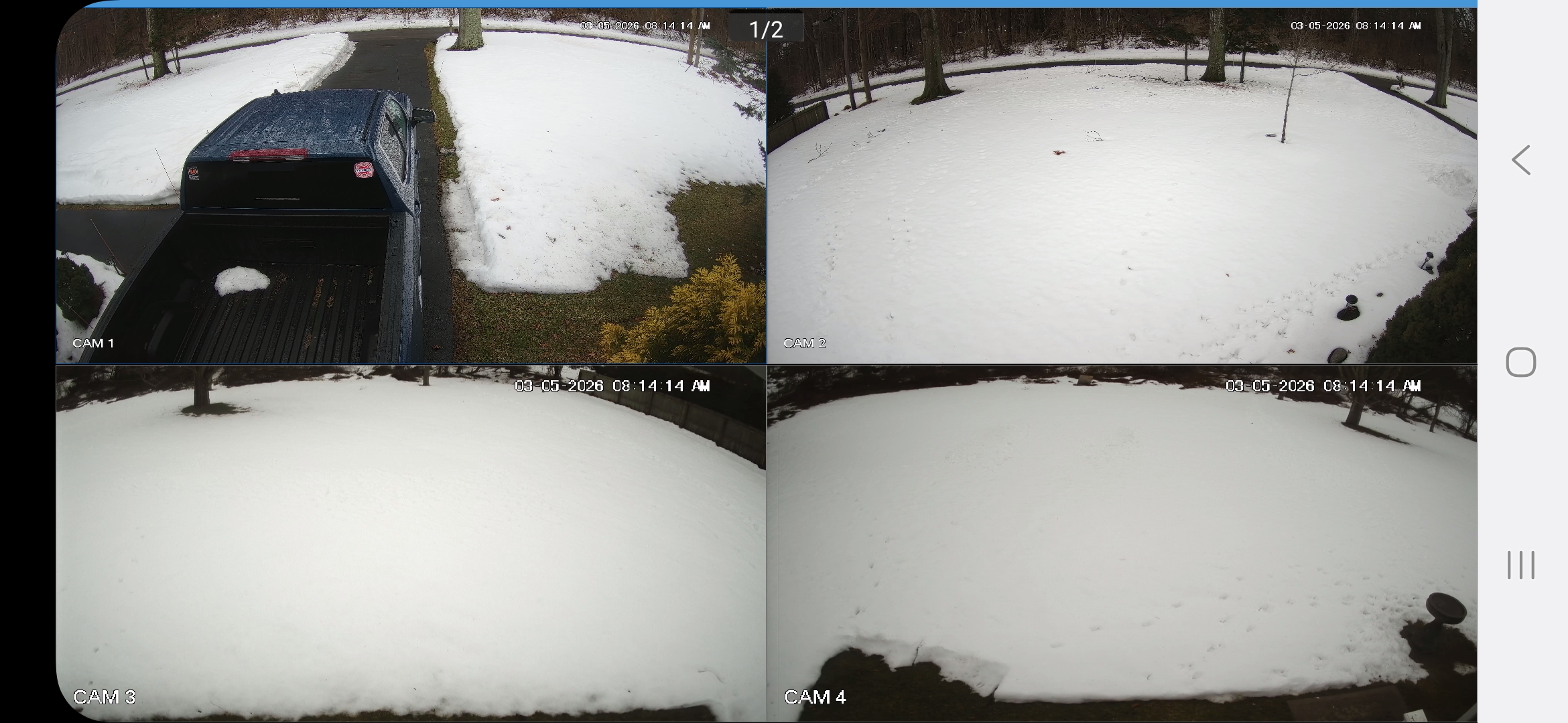
What's been also relentless is my snow pack.. I still have a snow pack dating back to what.. January snow sleet storm and then the blizzard? This is from a few mintues ago. I'm guessing 3-5 inches still solid snow pack with snow on my roof and other roofs in areas still....

-
Man those snow depth#s are all over the place. 18 inches in one place in CT and less then 50 miles east 8? Lol
-
For those on long island, what is your current snow depth? Over a foot?
-
Wow some really big flakes right now
-
I'm not ready i want to keep the tourists away for ad long as possible! You work at a state park in ny and tell me your wouldn't feel the same way lol
-
Man, 60 and 70s so early on models? That's not to my liking at all
-
Would seem fitting if we got hit by a big hurricane now this summer after this monster we are still dealing with
-
Reports of near 30 inches of snow in the Hamptons already and that was like 1015 am
-
970 mb at 16z analysis
-
OK bank to plowing I've been sitting here 20 Montoya in drive not moving lol
-
2 killel bands have now setup. One western area and other over eastern Suffolk county and it's stationary!