
wake4est
-
Posts
779 -
Joined
-
Last visited
Content Type
Profiles
Blogs
Forums
American Weather
Media Demo
Store
Gallery
Posts posted by wake4est
-
-
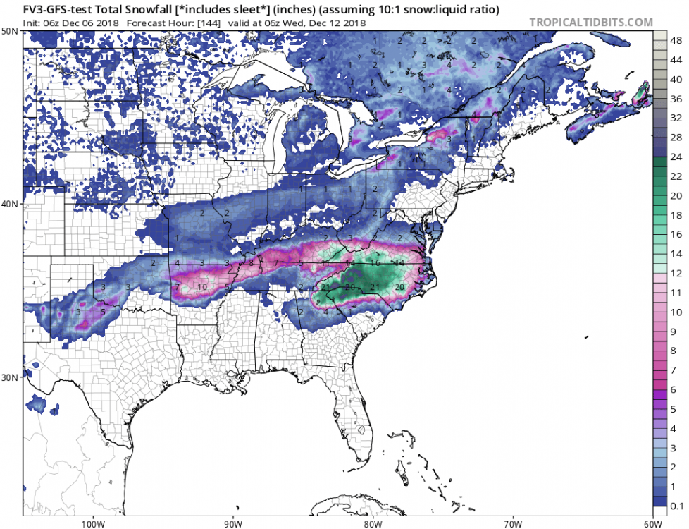
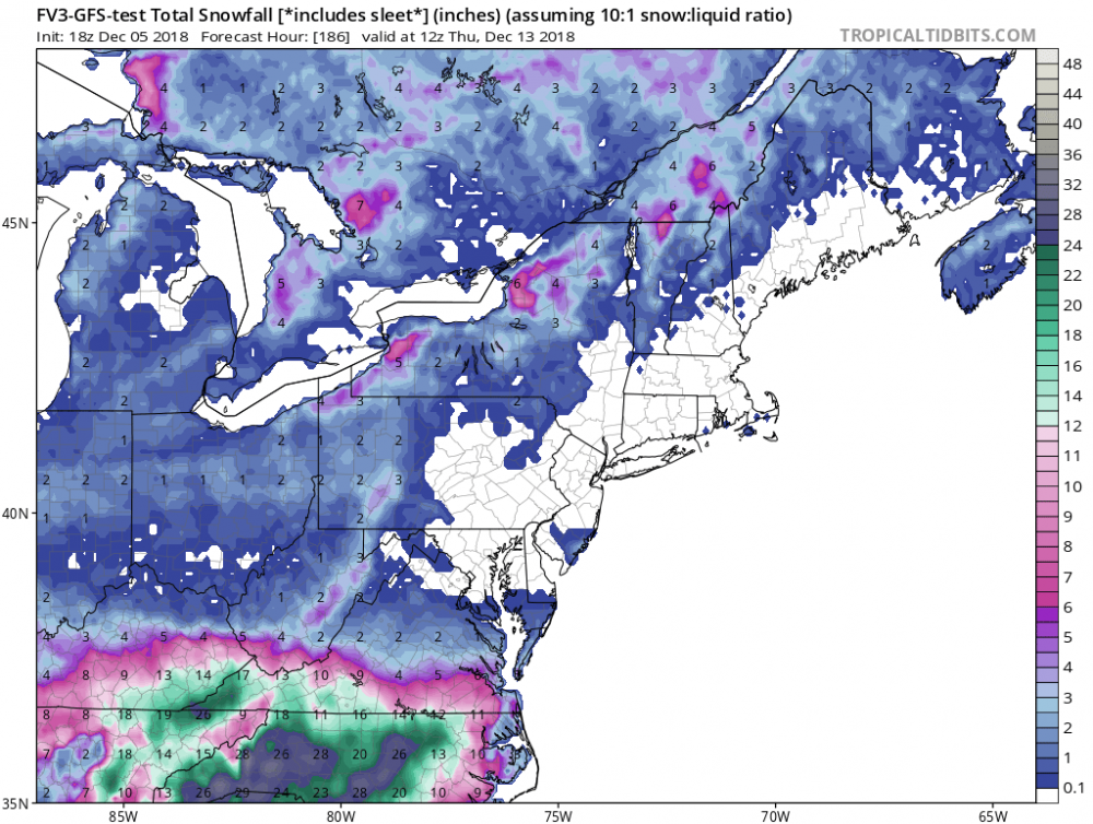
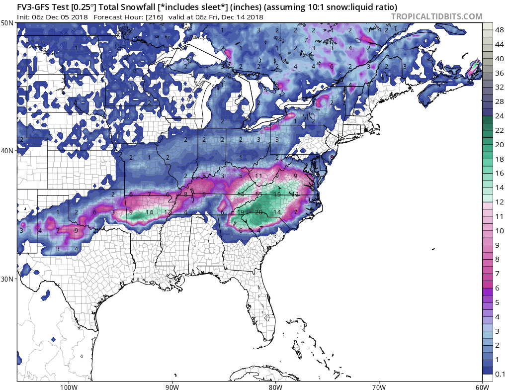
Like I KNOW the non-Kuchera fv3 clown maps are unrealistic but they are just astonishing. Like old-school DGEX snow outputs. They make my eyes happy.
-
 4
4
-
-
Just now, Wow said:
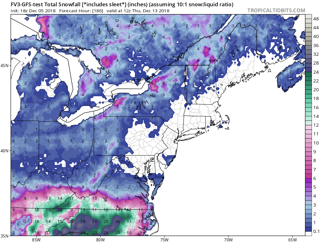
Despite the N trend from early yesterday, the GEFS popped back and is even further south prior to that trend

Looks eerily like the 6z Euro
-
3 minutes ago, ajr said:
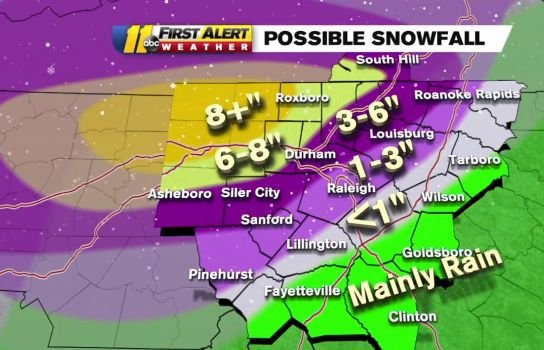
 WRAL snowfall map - seems bullish to me
WTVD for comparison
-
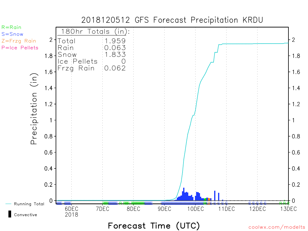
Anybody have soundings across NC from the 6z Euro? Precip looks perfect for much of the state if all snow. I wonder how much is sleet.
-
GFS has a finger of precip earlier at 30.
-
NAM could be impressive....
-
 1
1
-
-
11 minutes ago, WidreMann said:
The December 8th storm, probably, which ended up being snow in the NW quadrant of NC, rain mixed with sleet and some snow over the Triangle and otherwise just a cold mess.
Weird I have no functional memory of that. Must have been really terrible for us.
-
Found this on my laptop from one year ago today. Did anything become of this? I cannot remember what we were chasing.
-
Dang the fv3 is robust with precip into Monday evening
-
2
-
-
It's so juicy.
-
1
-
-
I don’t get why the fv3 just did this
-
LOL what

-
1
-
 1
1
-
 1
1
-
-
2m temps increased by 1 or 2 on the NAM but the DPs are still way better than the GFS.
Just now, Brick Tamland said:Looks like some folks are worried about the NAM being too warm for my neck of the woods.
-
2
-
-
3 minutes ago, lilj4425 said:
Got the one for south of there? For S.C., Georgia, and Tennessee?
sure

-
1
-
 1
1
-
1
-
-
Is the FV3 recognizing a stronger CAD than the old-n-busted GFS? If so that will be a nice upgrade in itself.
-
-
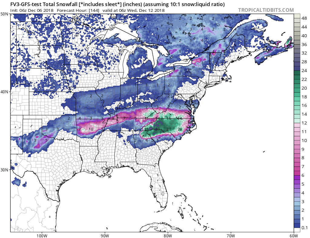
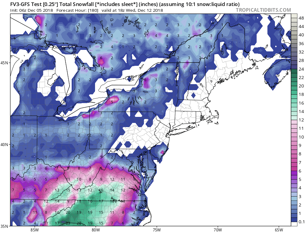
The NAM is primed to bring a fat juicy storm to the SE when it gets in range...
-
3 minutes ago, AsheCounty48 said:
Just remember, people down here become idiotic really quick when it snows compared to up there lol.
Hey we’re idiots all the time thank you very much
-
1
-
6
-
-
Lol Control Run gives 10" + for all of Wake County.
-
1
-
-
They seem really sold on the idea of strengthening over land as it leaves NC. What would be responsible for that?
-
Winds at FL of 94
-
-
22 minutes ago, Orangeburgwx said:
18z GFS ticked back south
FV3 did not
-
And we’re back
-
1
-

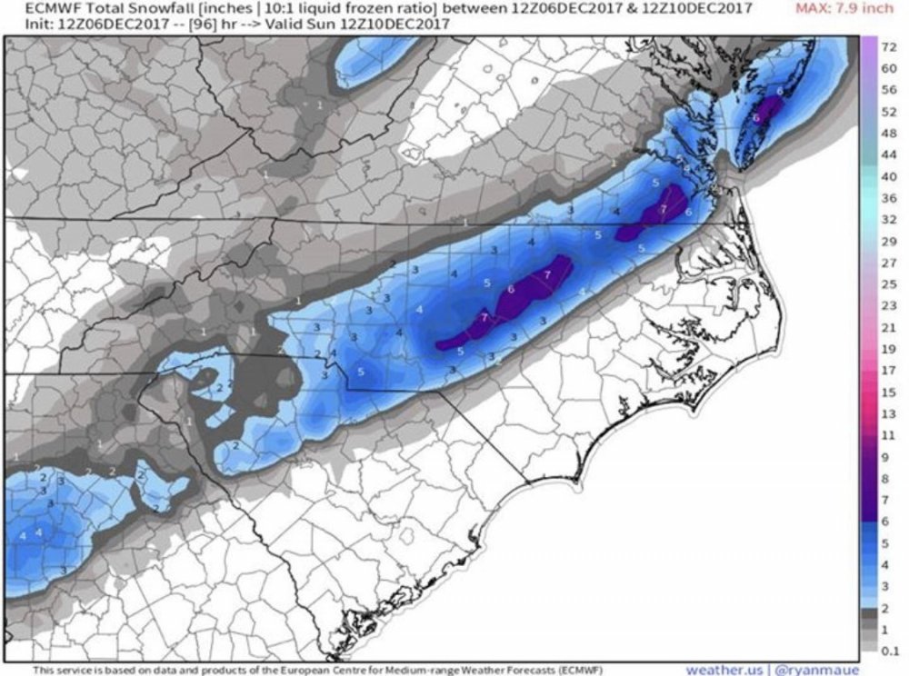
December 8-10, 2018 Winter Storm
in Southeastern States
Posted
It's there on TT. Hasn't finished the run yet.