
wake4est
-
Posts
779 -
Joined
-
Last visited
Content Type
Profiles
Blogs
Forums
American Weather
Media Demo
Store
Gallery
Posts posted by wake4est
-
-
3 minutes ago, Grayman said:
Could anyone tell me how to get a Sref for my area? Trying to learn
-
1 minute ago, sarcean said:
Hard to put faith into a map that doesn’t even include a B on it
The real question is: WHAT ABOUT ZONE G?
-
 3
3
-
 7
7
-
 2
2
-
-
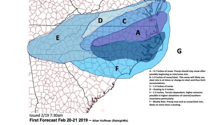
Allan's 1st call map is out.
-
1
-
-
Backside action was robust. Wow.
-
1
-
-
HWRF, HMON, Euro, NAM all are liking something close to an Oak Island landfall. New GFS keeps it offshore.
-
Yuck
-
9 minutes ago, FallsLake said:
I thought you guys got ~1 with the December storm; then it got washed away.
We got like .5" of sleet where I am. No snow in it.
-
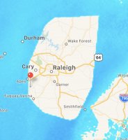
If a single flake falls here in SW Wake County it will be the most snow have had all season.
-
For the Wake County people the Canadian clown is classic...
-
fv3 to become officially operational on March 20.
-
The current wind chill difference between RDU and Fargo is over 100 degrees.
-
2
-
-
We’re all going to die from frostbite looking at the Lunar eclipse Sunday night
-
The NAM has been showing a weaker and weaker wedge the last few runs.
-
^ Those might be the most visually unappealing weather maps I have ever seen
-
6
-
3
-
-
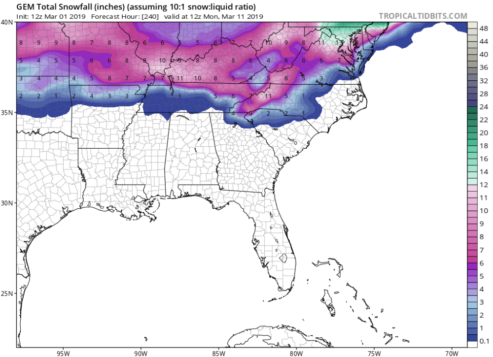
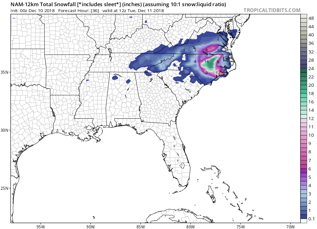
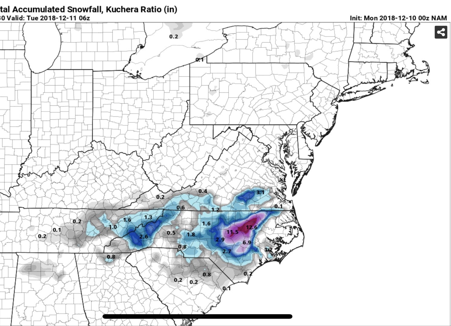
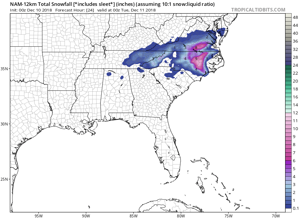
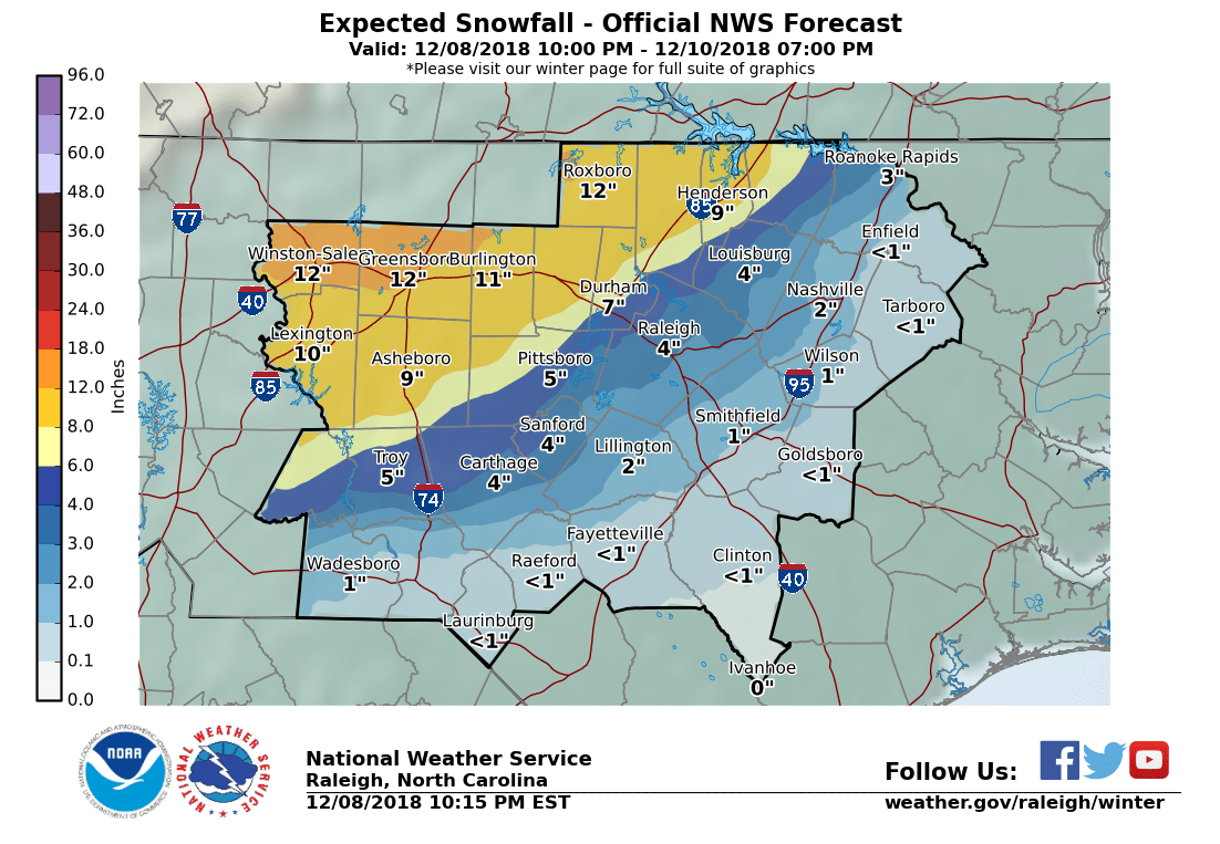
3 minutes ago, FallsLake said:
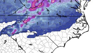
18z GFS 10:1 ratios. Most of central NC totals are from the Monday event:
Yeah it had a weird little fart of frozen something Sunday night and then filled in a tiny bit more. Interesting for sure, but not optimistic.
-
No joke, they brined the roads today in Raleigh.
-
3 minutes ago, FallsLake said:
Looking at the latest models you would think late Saturday night. RAH has snow starting in our area ~1pm on Saturday:
SaturdayA chance of snow after 1pm. Cloudy, with a high near 39. Chance of precipitation is 40%.Saturday NightSnow likely. Cloudy, with a low around 33. Chance of precipitation is 60%.SundayA chance of rain and snow. Cloudy, with a high near 39. Chance of precipitation is 40%.What's interesting is they're focused on more snow being the predominant type. This could be a case where meteorology trumps models more than normal.Try clicking a few miles south and you'll see the rain enter the forecast for southern Wake. The point-and-click is already showing the traditional rain/snow line through Wake.
-
Because why not
-
Hahahahaha

-
 1
1
-
-
UMMMM.....

-
2
-
1
-
-
UM....

-
3
-
1
-
-
Rain in Holly Springs since 8am on top of the 1.5” of slop. Heavy rain. Just a few miles away from the half-foot totals.
-
6 minutes ago, FallsLake said:
Looks like the snow/sleet line runs from around Apex to Knightdale in Wake County. I'm racing another heavy band to by SE and this transition line. Might have another hour or so.
Yeah here in Holly Springs we woke up to what looks like 1-2” of frozen something topped with crusty sleet. Currently zr falling.
-
Updated. Tick lower.
-
 1
1
-

One More Shot: Feb 20-21 Event
in Southeastern States
Posted
Yeah the NAM has been showing a nice backside for a few runs.