
wake4est
-
Posts
779 -
Joined
-
Last visited
Content Type
Profiles
Blogs
Forums
American Weather
Media Demo
Store
Gallery
Posts posted by wake4est
-
-
3 minutes ago, Jet Stream Rider said:
Yes, and any slight change will have rather large ramifications inland as you have noted. Thursday night and Friday will be nerve wracking. We are not out of the woods yet, and I know many are still in the thick of it, but there is a chance. Carolina Beach, Kure Beach, Wrightsville Beach, the whole of Topsail Island look to be ravaged.
Not that it is the horse to bet on, but the CMC highlights this possibility.
I'm genuinely curious to watch how the ridge will actually stop this thing on a dime like the models show.
-
 2
2
-
 1
1
-
-
Interesting the GFS doesn't have such a deep sickle shape as the Euro in its westward movement.
-
1
-
-
-
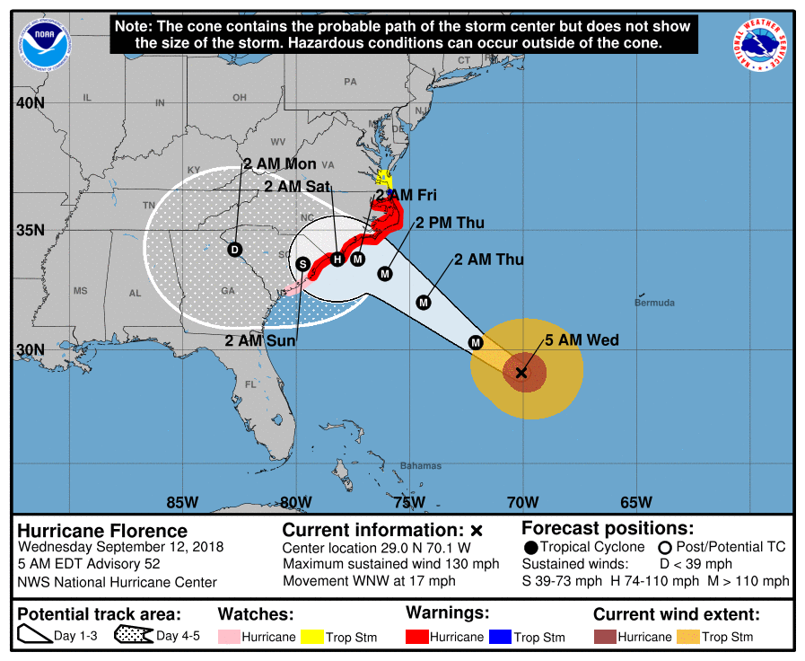
Big shift south on nhc track
-
3 minutes ago, griteater said:
It goes both ways though. If the latest Euro and FV3 are correct, Raleigh NWS will have to change their maps
Yeah but they do so in a measured fashion, rather than hugging every model run like us internet people like to do.
-
1
-
-
3 minutes ago, Regan said:
Right I was just confused why Wral was saying gusts 30-40 mph here. Not sustained. But gusts.
That map they showed was based off the weird south Euro run entirely
-
5 minutes ago, Regan said:
But it just seems so high for this to weaken so much at the coast and track more south. We will keep watching. Forecasts will keep changing.
I guess the NWS doesn’t buy the models weird tracks after the stall.
-
1
-
-
3 minutes ago, Regan said:
This is where it gets shady because all the tv station local and non local are still at the minute saying gusts 30-40 and sustained lower here in Wake. This says significantly more.
Listen to the NWS.
-
2
-
-
-
-
Is there an intermediate advisory at 8pm?
-
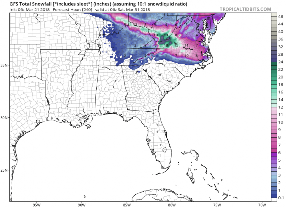
The gfs has it redevolping after it leaves land off of nc and aims AGAIN towards SC day 10
-
The new nhc cone seems like the best choice given model data.
-
1
-
-
Can you imagine trying to put out the actual NHC cone this afternoon?
-
2
-
-
They just posted it, seemingly implying it was the recent run.
-
-
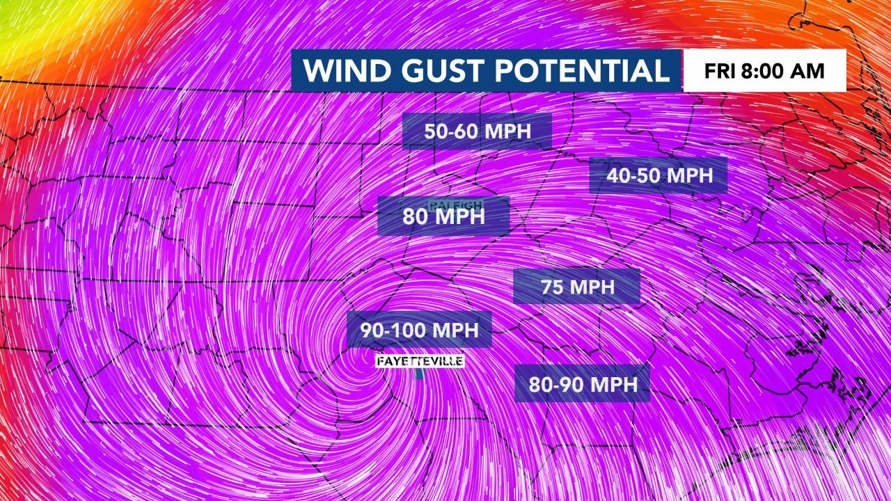
Brick see WRAL Weather’s last 3 FB posts. They are maps of wind gusts during the storm based on Euro.
sorry can’t post them at the moment
-
8 minutes ago, StoneColdWeatherAustin said:
If the SREF currently goes out to 0Z on the 25th. With DST now in place, does that translate over to 8pm Saturday evening?
0z = 8pm EDT
-
Holding serve
-
Looks like it would all fall between 8pm and 2am...
-
19 minutes ago, PackGrad05 said:
Latest runs of the HRRR look better than earlier today... but still doesn't look all that promising.
Yeah each run pushes it south.
-
1
-
-
Interesting....
-
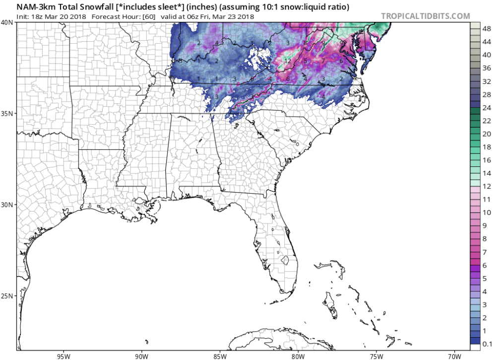
Man, the NAM is just crushing DC with 2 feet of snow.
-
NAM is north


Hurricane Florence
in Southeastern States
Posted
Canadian does too