
wake4est
-
Posts
779 -
Joined
-
Last visited
Content Type
Profiles
Blogs
Forums
American Weather
Media Demo
Store
Gallery
Posts posted by wake4est
-
-
1 minute ago, Buddy1987 said:
 12z RAOBS coming in with higher heights than 00z GFS across the W US, though less near the shortwave entering WA/OR compared to the downstream ridge. Also note lower ON heights. To me this suggests we might see today's guidance slow the storm down a bit and possibly wobble SE.Twitter · 19 mins ago
Eew. Don't want slower.
-
 1
1
-
-
5 minutes ago, PackGrad05 said:
It still looks like a major winter storm for our area, unless you are just looking for only snow....
Agreed. Around here i'm guessing we'll see a little front end snow that annoyingly changes to sleet earlier than we would want, ultimately changing to freezing rain for much longer than we'd like, followed by rain at the end that nobody likes.
-
 1
1
-
 1
1
-
-
27 minutes ago, buckeyefan1 said:
I see canada decided to show up to the party last night


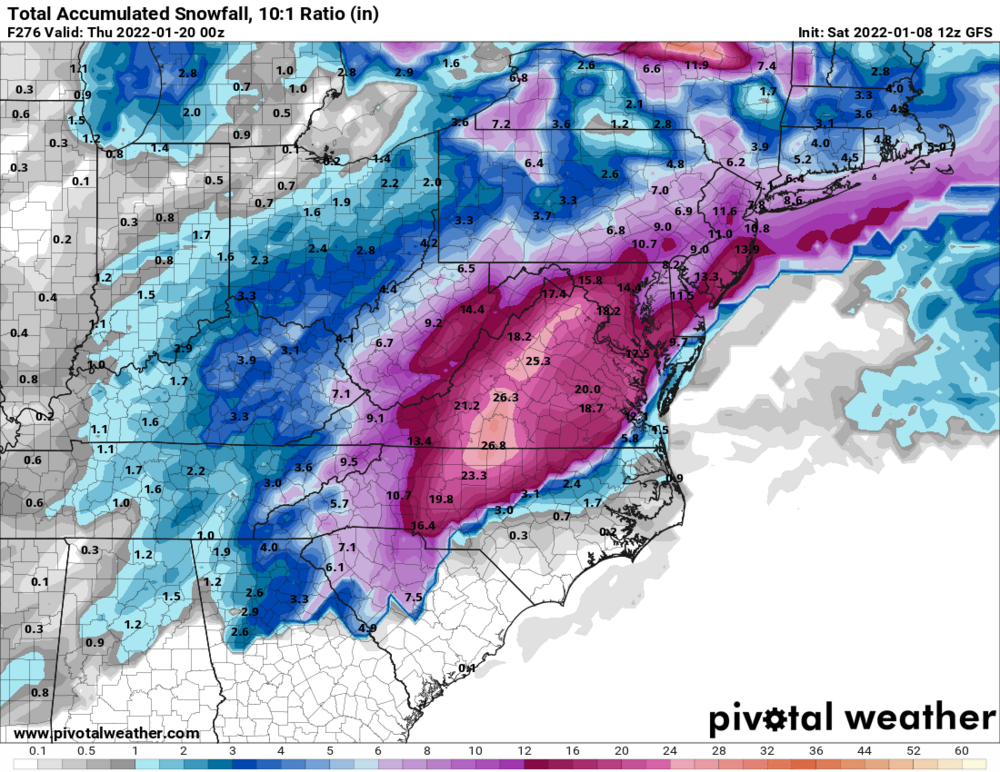
I think those totals are high due to the storm next weekend. It was a weird run for this weekend's storm.
-
Just now, Beach Snow said:
Does 18z euro only run to 90 for surface and precip types?
Yep
-
1
-
-
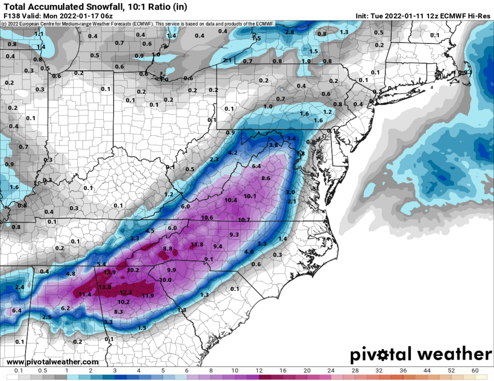
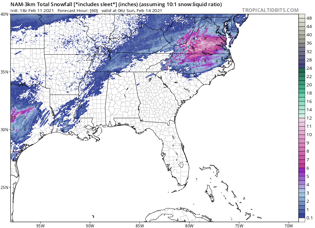
Verbatim for RDU it drops almost no snow and like 0.1" of freezing rain.
ETA: the Low is right over the triangle at 108.
-
Lol gives Charlotte 2" of ZR
-
1
-
-
For RDU the Weather Channel has 5-11” from sat nite thru Sunday. BANK IT!
-
5
-
-
Impressive for WNC
-
5
-
-
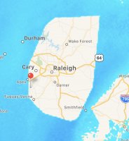
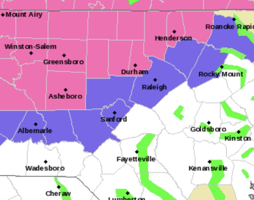
Lol at the Wake County gradient
-
1
-
-
I don't think I have ever seen more water on the roads in Western Wake than I did this morning.
-
1
-
-
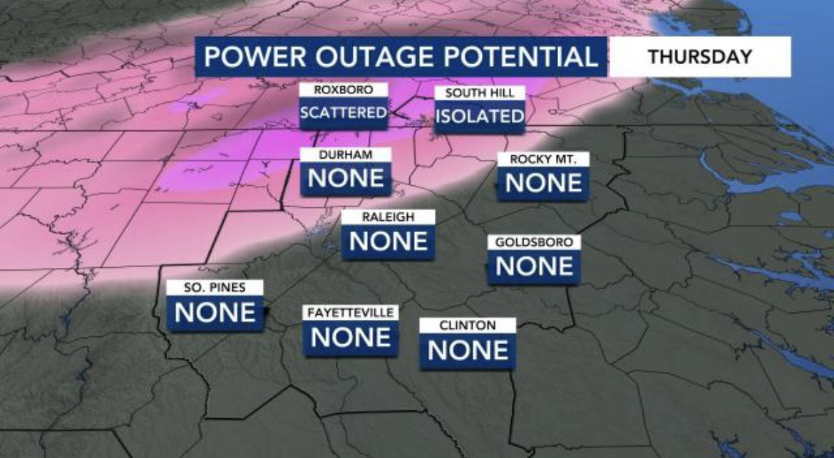
2 minutes ago, BullCityWx said:
Yet they are still pushing this graphic

-
2
-
 2
2
-
-
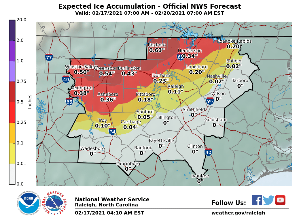
RAH AFD has no real changes at all with the forecast
-
Isn’t ISW criteria .5”+?
-
-
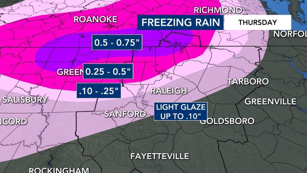
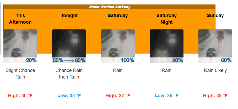
RAH has gone all in. WWA looks like it’s for .1” and the WSW is for .25-.5”.
edit: Blacksburg changed the watches to warnings as well with .5-.75” of ice
-
A Winter Weather Advisory for Rain.
-
1
-
1
-
 1
1
-
-
HRRR has .22 of ice in Wake County, .5" for the Triad

-
What the NAM

-
Yikes. Where did the low go?

-
And Le Canadien...

-
1
-
-
Eww. Para vs. OG.


-
GFS Para hates the Triad and wants to see it suffer. 1.65" of zr in Winston-Salem. Also, the Para decided to work finally.
-
1
-
1
-
 1
1
-
-
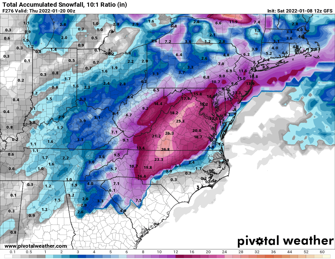
Interesting local forecast on Wunderground for Wake County snow . Really shows the reloading going on next weekend:
Thursday Night - 1"
Friday 1-3"
Friday Night - 1"
Saturday - 0"
Saturday Night - 0"
Sunday - 1-3"
Sunday Night - 1"
Monday - 0"
Monday Night - 1-3"
Tuesday - 1-3"
Tuesday Night - Flurries
Whatever they use to generate their forecast is definitely seeing possibility after possibility in the 10 day.
-
Lol from hour 60 to 66 on the gfs it dumps over 6" on Wake county.
-
2
-
1
-


Jan 15-16 Winter Storm
in Southeastern States
Posted
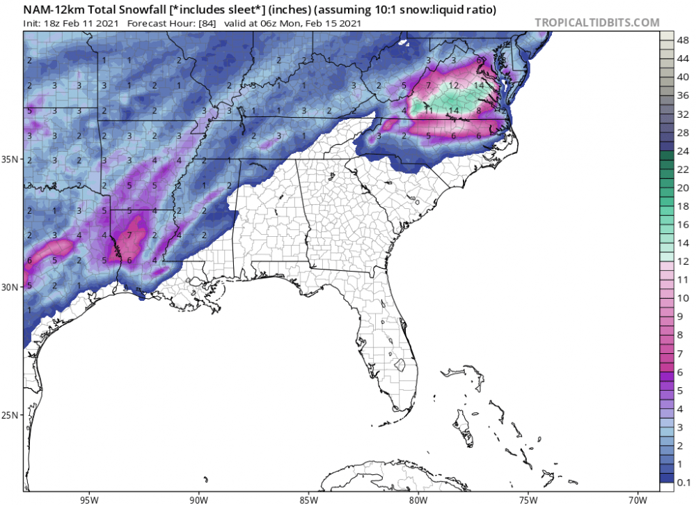
Kuchera snowfall map has 29" near Asheville.