migratingwx
-
Posts
109 -
Joined
-
Last visited
Content Type
Profiles
Blogs
Forums
American Weather
Media Demo
Store
Gallery
Everything posted by migratingwx
-
Richmond Metro/Hampton Roads Area Discussion
migratingwx replied to RIC Airport's topic in Mid Atlantic

-
Richmond Metro/Hampton Roads Area Discussion
migratingwx replied to RIC Airport's topic in Mid Atlantic
-
Richmond Metro/Hampton Roads Area Discussion
migratingwx replied to RIC Airport's topic in Mid Atlantic
-
Richmond Metro/Hampton Roads Area Discussion
migratingwx replied to RIC Airport's topic in Mid Atlantic
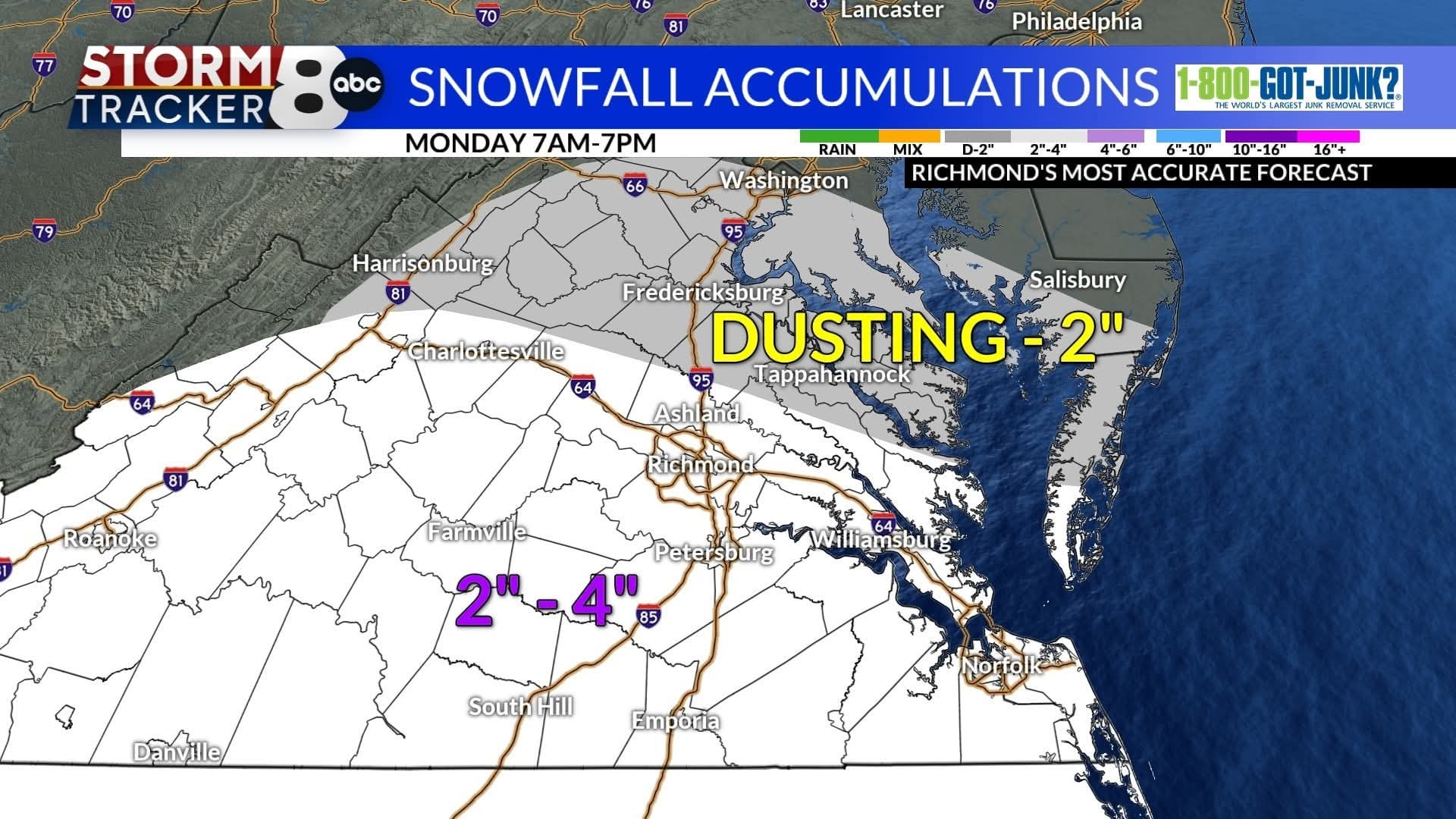
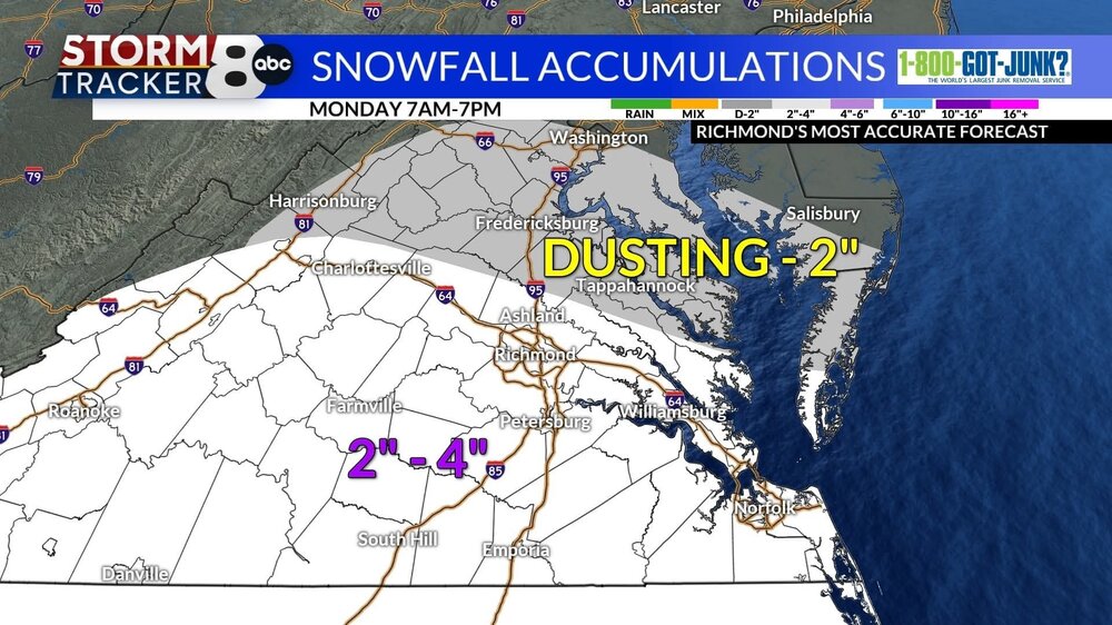
URGENT - WINTER WEATHER MESSAGE National Weather Service Wakefield VA 210 PM EST Sun Dec 7 2025 VAZ061-068-069-081-082-513>516-080315- /O.NEW.KAKQ.WW.Y.0011.251208T1100Z-251209T0300Z/ Cumberland-Amelia-Powhatan-Prince George (including Hopewell and Petersburg)-Charles City-Western Chesterfield-Eastern Chesterfield (Including Col. Heights)-Western Henrico (Including the City of Richmond)-Eastern Henrico- 210 PM EST Sun Dec 7 2025 ...WINTER WEATHER ADVISORY IN EFFECT FROM 6 AM TO 10 PM EST MONDAY... * WHAT...Snow expected. Total snow accumulations between 2 and 3 inches. * WHERE...Portions of central, east central, and south central Virginia. * WHEN...From 6 AM to 10 PM EST Monday. * IMPACTS...Plan on slippery road conditions. The hazardous conditions could impact the Monday morning and evening commutes. PRECAUTIONARY/PREPAREDNESS ACTIONS... Slow down and use caution while traveling. Call 511 for road information. -
Richmond Metro/Hampton Roads Area Discussion
migratingwx replied to RIC Airport's topic in Mid Atlantic
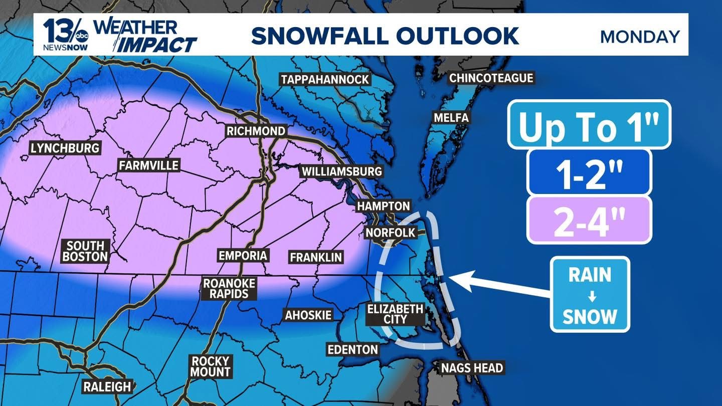
Short range models are looking really good for you guys. Could be a nice 2-4" event for many tomorrow. -
Dec 6-7th (It's not a clipper) Clipper
migratingwx replied to Chicago Storm's topic in Lakes/Ohio Valley
Another great event to add on to what we had. The timing of the event was unfortunate, with it happening so late into the night and wrapping up around sunrise, I barely got to see some good rates.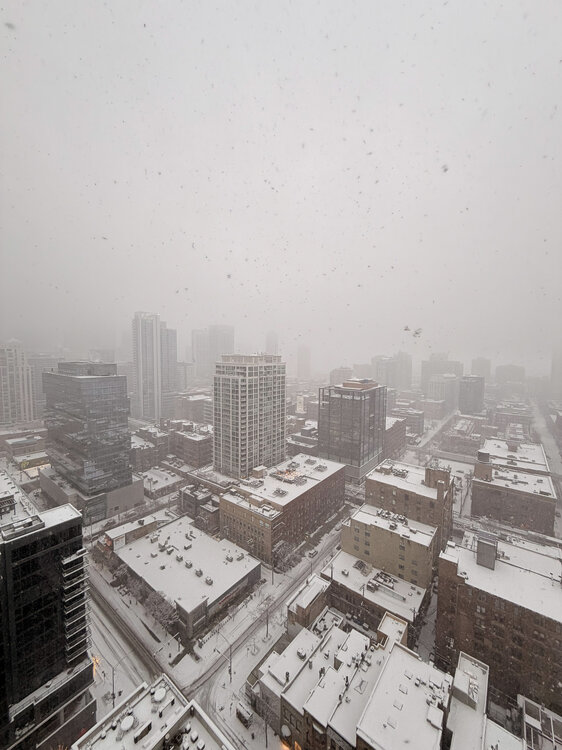
-
Richmond Metro/Hampton Roads Area Discussion
migratingwx replied to RIC Airport's topic in Mid Atlantic
Sharing as much as I can from Chicago. We're getting another few inches tonight on top of what we've already been getting starting a week ago. -
Richmond Metro/Hampton Roads Area Discussion
migratingwx replied to RIC Airport's topic in Mid Atlantic
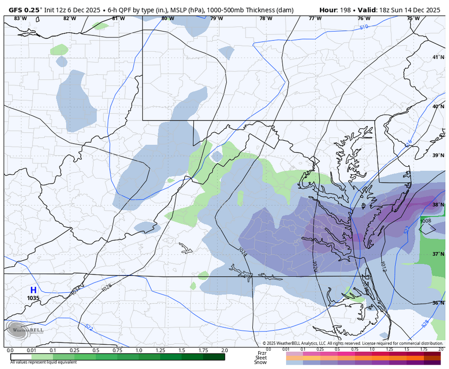
GFS has another threat next weekend.
-
Dec 6-7th (It's not a clipper) Clipper
migratingwx replied to Chicago Storm's topic in Lakes/Ohio Valley
Nice little event shaping up.
-
Richmond Metro/Hampton Roads Area Discussion
migratingwx replied to RIC Airport's topic in Mid Atlantic
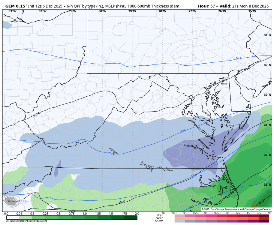
Here is the 2z GFS for Monday still showing the next potential. The Canadian has it farther north.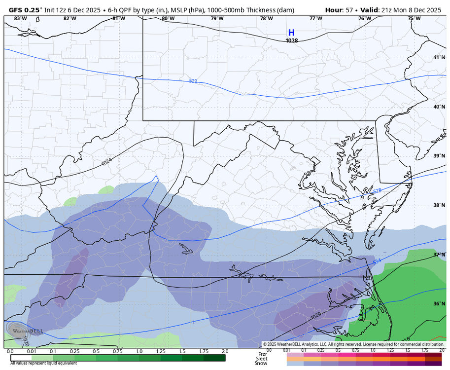

-
Richmond Metro/Hampton Roads Area Discussion
migratingwx replied to RIC Airport's topic in Mid Atlantic
18z GFS hot off the press also suggest to keep an eye out on Monday.
-
Richmond Metro/Hampton Roads Area Discussion
migratingwx replied to RIC Airport's topic in Mid Atlantic
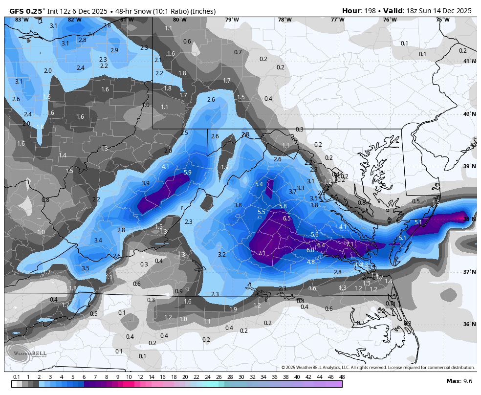
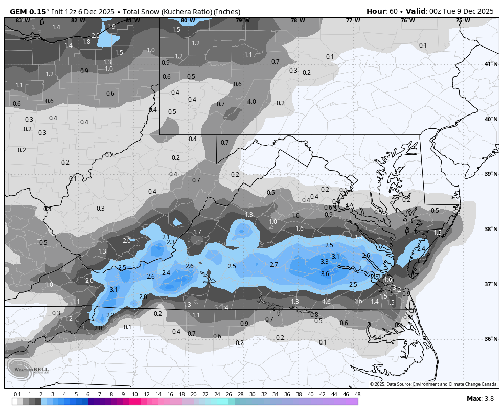
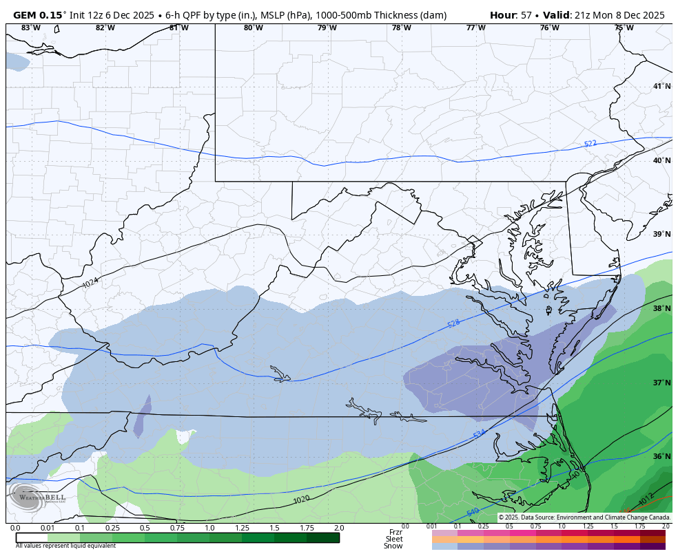
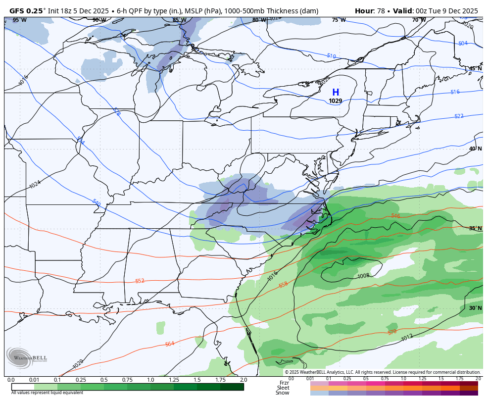
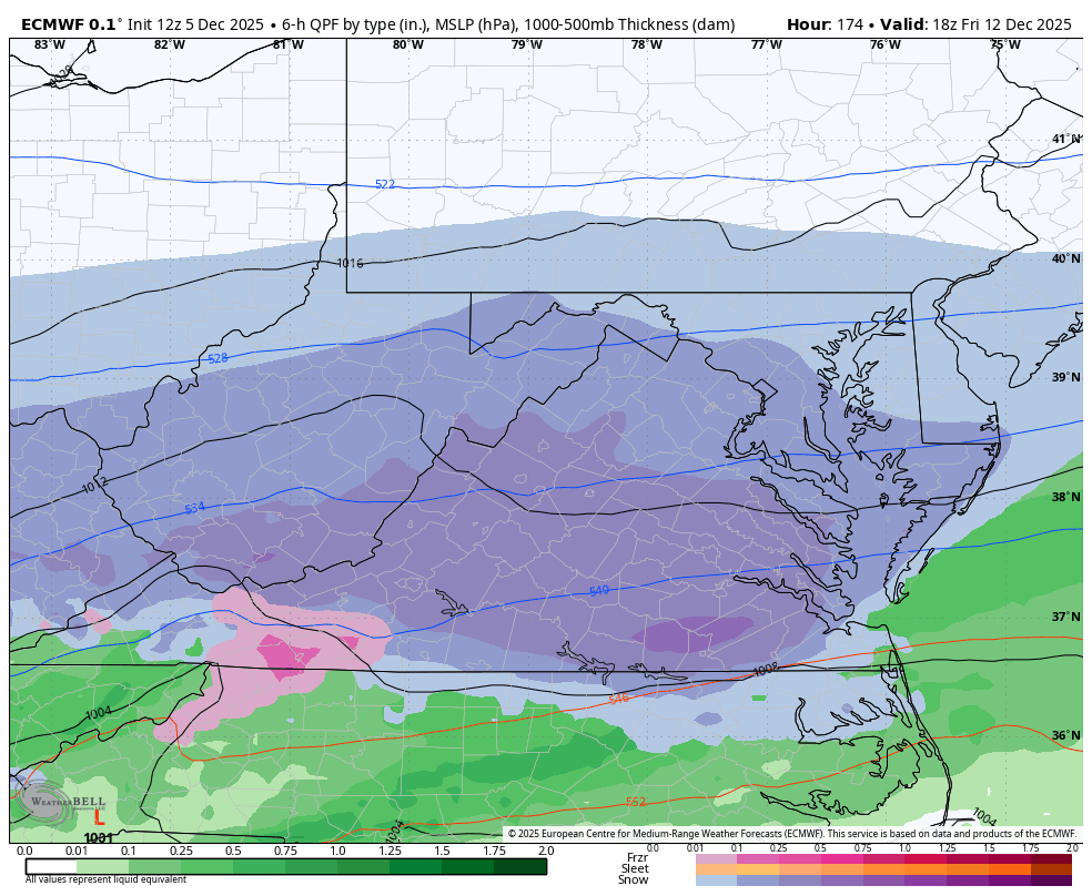
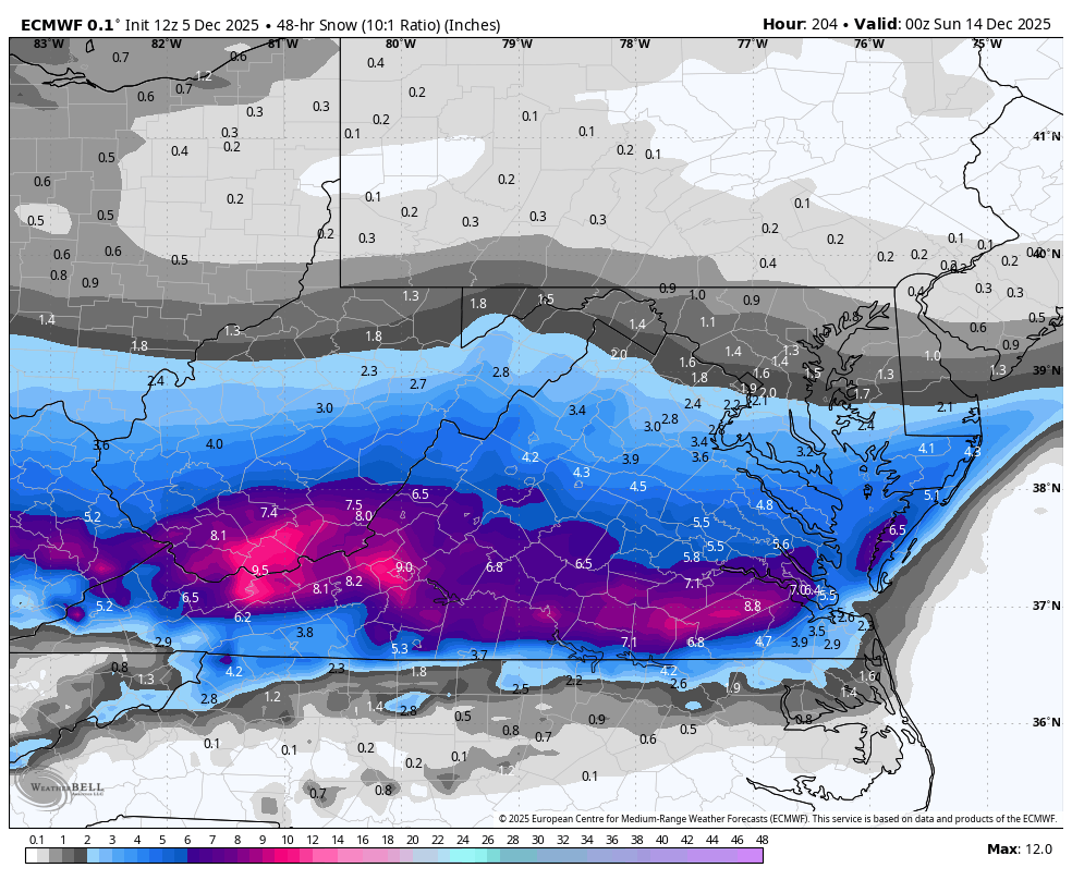
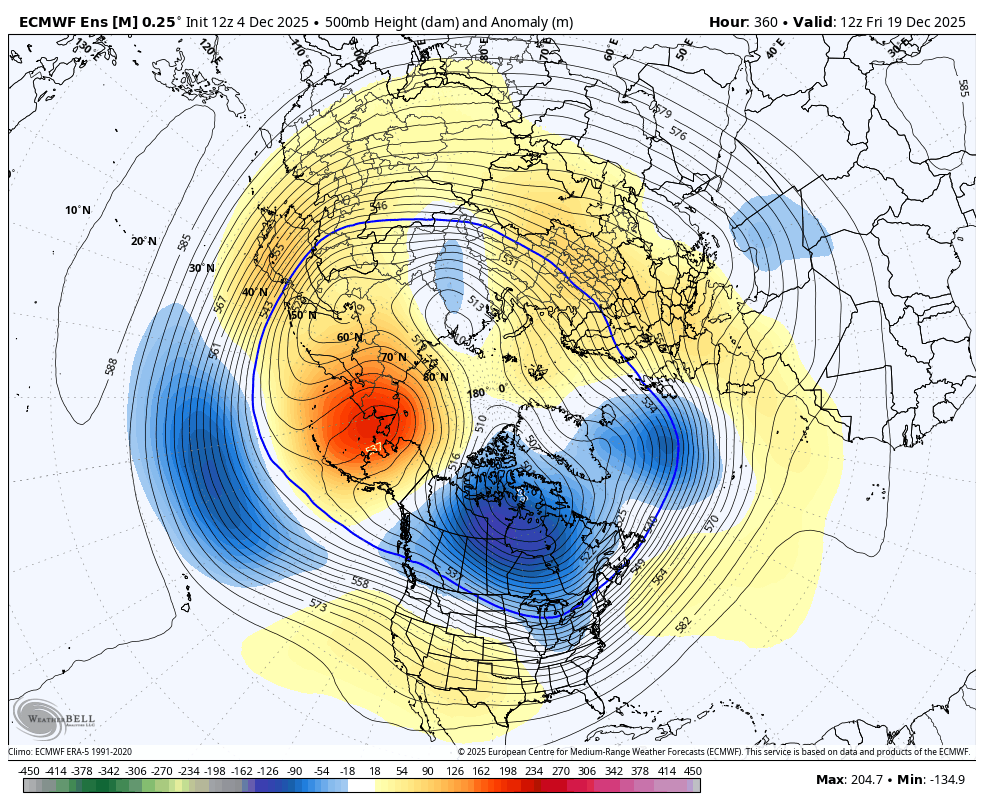
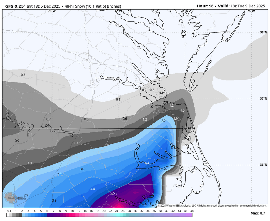
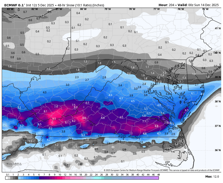
Hey, this is me, just under a different name. I wish I had that sort of power, but there was some discussion years ago to use a nearby COOP station "for" the airport, but it had to be within 5 miles of the airport. The Varina COOP station was being used for some reports, such as the 12/9/2018 storm, but last I checked, that station had closed down, and they were looking for another nearby observer. I'm not sure what is happening now. I don't mind chiming in here from time to time. I'm glad I was able to share some snow and cold. We had a big snow here last Saturday, so I've been posting in the forum covering this area. 2.0" on 12/5 is a good start for the winter, and RIC is long overdue for a 20"+ season, so maybe this is it? There are two more threats for you all that need to be watched for Monday and possibly next Friday. Below ICON for the possible Monday event and then today's 12z Euro showing next Friday's threat.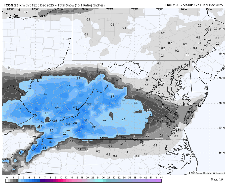

-
Richmond Metro/Hampton Roads Area Discussion
migratingwx replied to RIC Airport's topic in Mid Atlantic
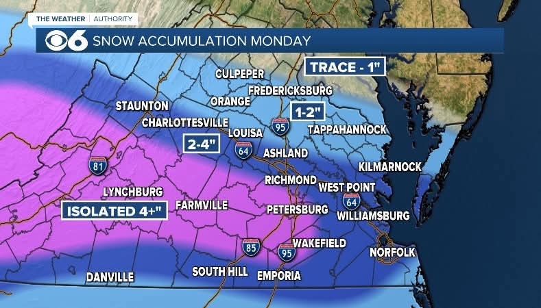
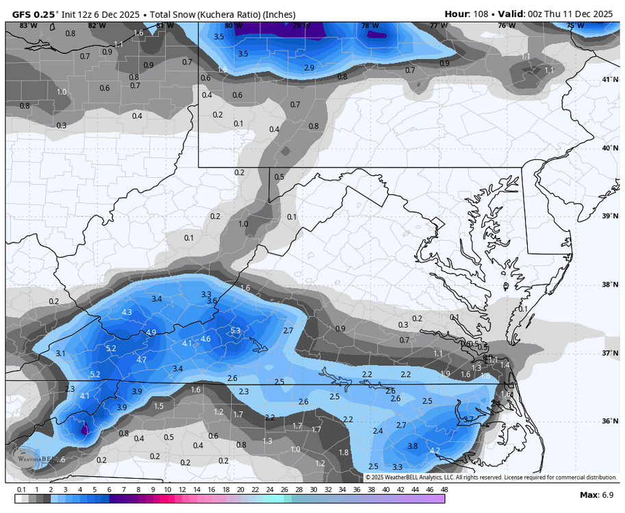
RIC reported a 2" snow depth at the 7 am ob, so by that point at least 1.5" had fallen. CLI won't come out until around 5:30, although it's possible AKQ sends a PNS with a total before then. The daily snowfall record is 4.2" from the 12/5/2002 snowstorm, so that remains safe. Earlier, when I mentioned breaking the record, I unfortunately used 12/6 instead of 12/5. Nonetheless, not bad for early December. -
Winter 2025-26 Medium/Long Range Discussion
migratingwx replied to michsnowfreak's topic in Lakes/Ohio Valley
Today's 12Z EPS suggests that any mid month moderation will be short lived. Earlier in the week, it was becoming apparent there would be a modest warm up in the 3rd week of December. However, EPS no longer even gets the ridge east of the Mississippi. It makes it midway, then gets squashed to the SW as another trough develops in the East at the end of the run.
-
Richmond Metro/Hampton Roads Area Discussion
migratingwx replied to RIC Airport's topic in Mid Atlantic
Good luck! Sending you all snow and cold from Chicago. Posting back in here under my new name. -
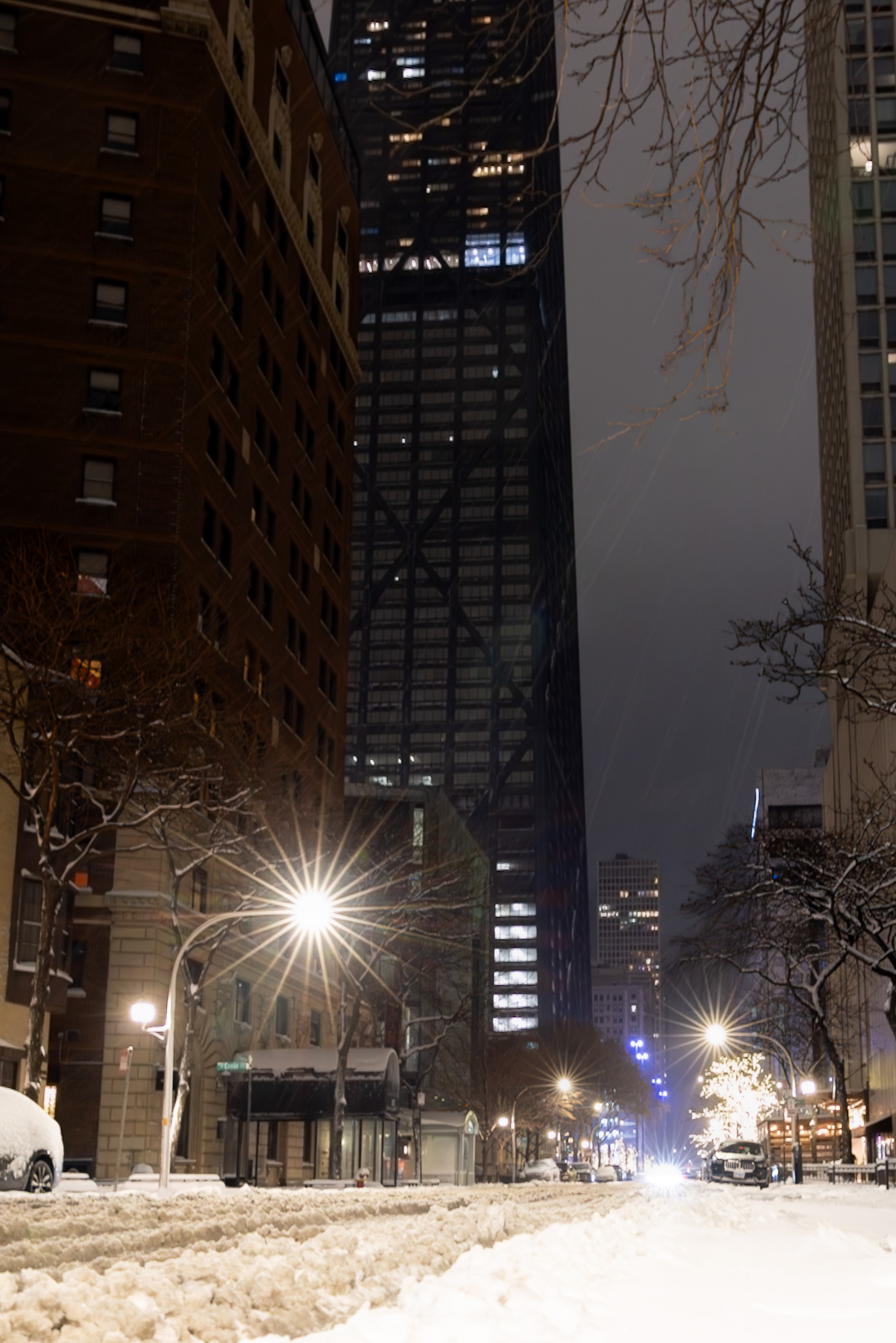
That's a wrap here. Always a treat to have a bonus event. A couple of pics from this evening.


-
Picking up pretty decently out now.

-
Ceilings lowered, flurries have commenced here as well.
-
A few days ago, I paid to upgrade to the Ultimate Subscription package. The fee was charged to my credit card, but so far, I have not reaped the benefits. For instance, my upload space hasn't changed, and I never received a confirmation email or anything else indicating a change. Could someone look into this, or is it still processing? Thanks.
-
Nov 28-30th Post Turkey Day Winter Storm
migratingwx replied to Chicago Storm's topic in Lakes/Ohio Valley
What a great event! A couple of night time shots from around where I live.

- 711 replies
-
- 12
-

-
Nov 28-30th Post Turkey Day Winter Storm
migratingwx replied to Chicago Storm's topic in Lakes/Ohio Valley
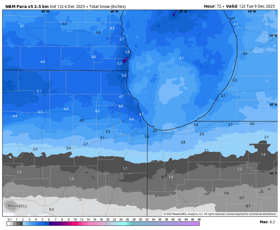
18z 3k NAM came in nice and healthy. -
Nov 28-30th Post Turkey Day Winter Storm
migratingwx replied to Chicago Storm's topic in Lakes/Ohio Valley
18z HRRR -
Nov 28-30th Post Turkey Day Winter Storm
migratingwx replied to Chicago Storm's topic in Lakes/Ohio Valley
-
Nov 28-30th Post Turkey Day Winter Storm
migratingwx replied to Chicago Storm's topic in Lakes/Ohio Valley
00z vs 18z below -
Nov 28-30th Post Turkey Day Winter Storm
migratingwx replied to Chicago Storm's topic in Lakes/Ohio Valley
Here we go!