migratingwx
-
Posts
109 -
Joined
-
Last visited
Content Type
Profiles
Blogs
Forums
American Weather
Media Demo
Store
Gallery
Everything posted by migratingwx
-
Richmond Metro/Hampton Roads Area Discussion
migratingwx replied to RIC Airport's topic in Mid Atlantic
This is why you can't get too excited until you're about 48 hours out, which isn't until Thursday. Rooting for you all even though I no longer live there. -
Richmond Metro/Hampton Roads Area Discussion
migratingwx replied to RIC Airport's topic in Mid Atlantic
So much can still change when you're four days out, but there are warning signs that this may not be an all snow event. Not saying anything people don't already know, but something to keep in mind, especially if you are south of CHO to an EZF line and certainly if you are on southside Hampton Roads, those areas are typically the most vulnerable to mixing during these events. -
Richmond Metro/Hampton Roads Area Discussion
migratingwx replied to RIC Airport's topic in Mid Atlantic
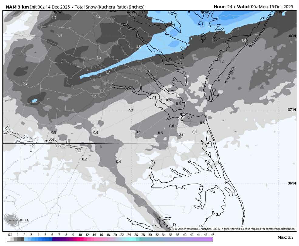
It’s probably a good idea to expect 4 to 8 inches of snow before any mixing occurs. The mixing signal we observe on the Euro model is hard to overlook, and in the past, warmer air has typically moved in quickly. The interesting question is whether RIC will receive 6.0 inches of snow, as that hasn’t happened since December 2018, even though ORF has experienced two or three such events since then. -
Richmond Metro/Hampton Roads Area Discussion
migratingwx replied to RIC Airport's topic in Mid Atlantic
-
Winter 2025-26 Medium/Long Range Discussion
migratingwx replied to michsnowfreak's topic in Lakes/Ohio Valley
Well, this is an interesting development.
-
Subscription Package Not Applied
migratingwx replied to migratingwx's topic in Forum Information & Help
I figured it out, the PayPal option worked, but the credit card function never fully processed. The authorization was pending on my account, but never posted. -
O'Hare has reached -2°F and Midway -1°F so far.
-
Richmond Metro/Hampton Roads Area Discussion
migratingwx replied to RIC Airport's topic in Mid Atlantic
AKQ just issued an advisory. -
Richmond Metro/Hampton Roads Area Discussion
migratingwx replied to RIC Airport's topic in Mid Atlantic
The GFS was even more bullish for tomorrow morning with 2-3" from Richmond to Norfolk.
-
Richmond Metro/Hampton Roads Area Discussion
migratingwx replied to RIC Airport's topic in Mid Atlantic
00z NAM followed suit and was pretty aggressive, I'd say a dusting to an inch is certainly possible many areas tomorrow morning. Maybe a few lucky spots exceed an inch?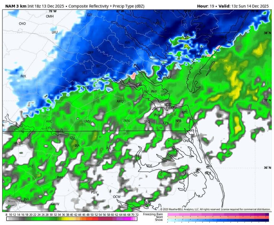

-
Richmond Metro/Hampton Roads Area Discussion
migratingwx replied to RIC Airport's topic in Mid Atlantic
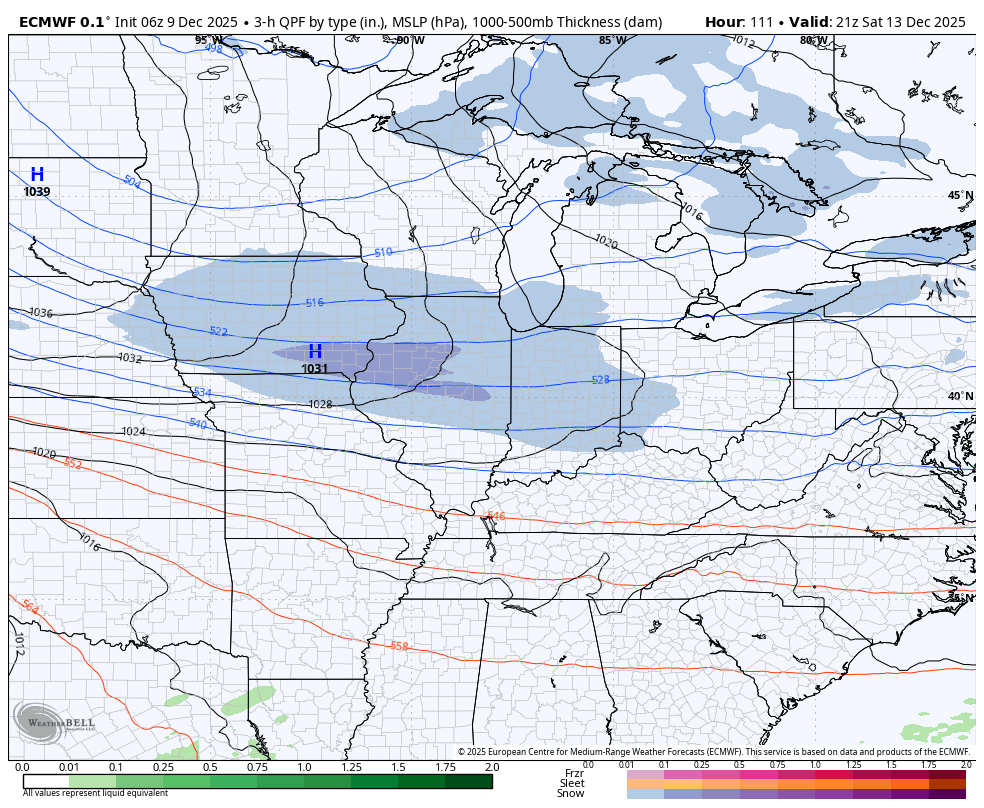
On the HRRR, the temperature at RIC starts at 36°F when the precipitation arrives, then drops to 30°F before it ends. There is about a 1-2 hour window to accumulate before tapering off. I believe the GFS was the first model to highlight the idea of a farther southward expansion of the precip along and east of I-95 in Virginia and over towards Hampton Roads.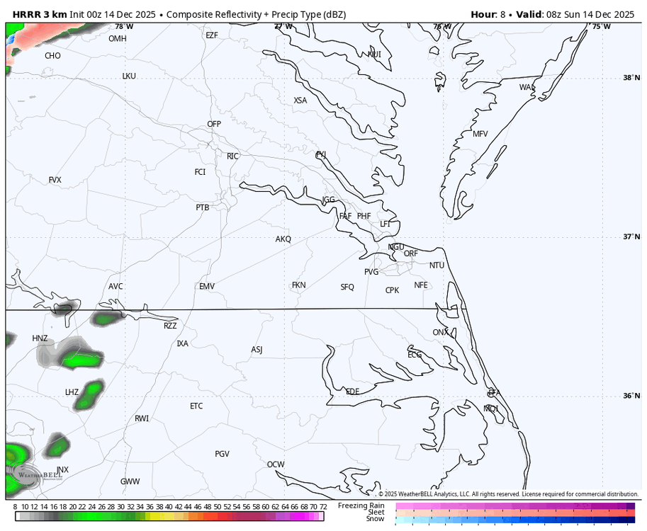
-
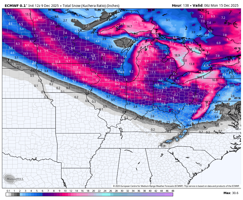
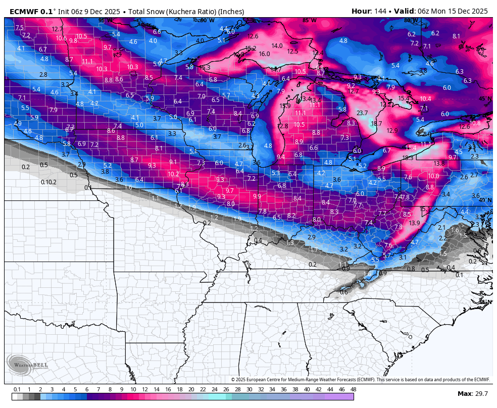
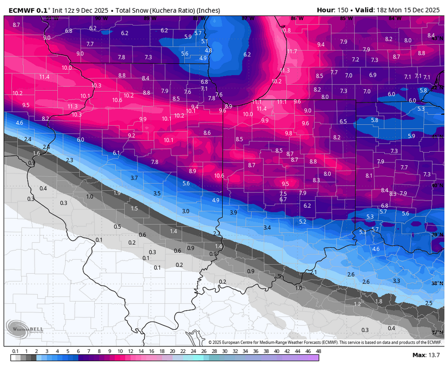
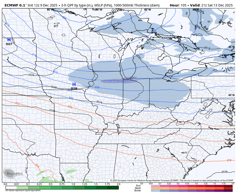
Winter 2025-26 Medium/Long Range Discussion
migratingwx replied to michsnowfreak's topic in Lakes/Ohio Valley
A southward shift on the 18z Euro vs 12z below.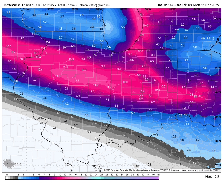
-
Winter 2025-26 Medium/Long Range Discussion
migratingwx replied to michsnowfreak's topic in Lakes/Ohio Valley
Euro has shifted north from earlier runs for the Friday and Saturday systems. 12z vs 6z bottom 2 maps below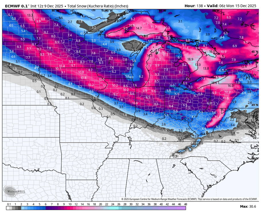


-
Winter 2025-26 Medium/Long Range Discussion
migratingwx replied to michsnowfreak's topic in Lakes/Ohio Valley
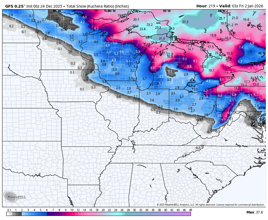
12z GFS still favoring a southern track, with the heaviest snows staying south of Chicago.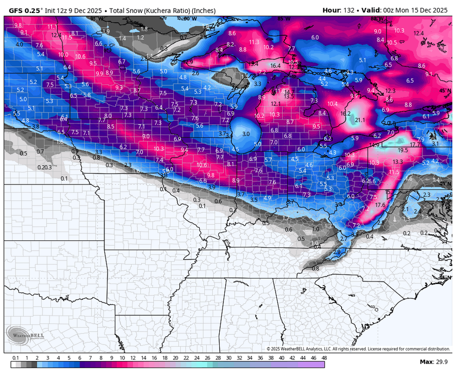
-
Richmond Metro/Hampton Roads Area Discussion
migratingwx replied to RIC Airport's topic in Mid Atlantic
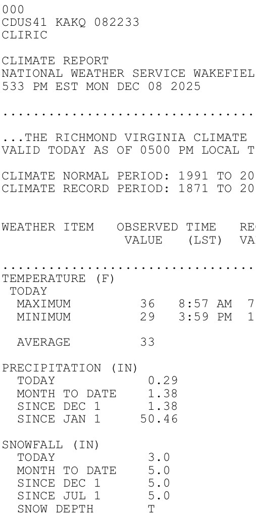
The final storm total for RIC was 4.0". -
Richmond Metro/Hampton Roads Area Discussion
migratingwx replied to RIC Airport's topic in Mid Atlantic
The Varina COOP observer updated their total as of 8pm to 3.5" and there could be another tenth or two added based on the radar trends. Looks like they may be using that observer for the Richmond airport, @JB Fins. -
Richmond Metro/Hampton Roads Area Discussion
migratingwx replied to RIC Airport's topic in Mid Atlantic
Beautiful home! Snow changes everything especially with Christmas decorations up. -
3.0” through 5pm at RIC, not too sure there will be much more than this based on radar. Lots of 4-6” reports just south and east of the airport.
-
Richmond Metro/Hampton Roads Area Discussion
migratingwx replied to RIC Airport's topic in Mid Atlantic
Officially 3.0” at RIC, but I’ve seen quite a few reports of 5.0” south and east. -
Richmond Metro/Hampton Roads Area Discussion
migratingwx replied to RIC Airport's topic in Mid Atlantic
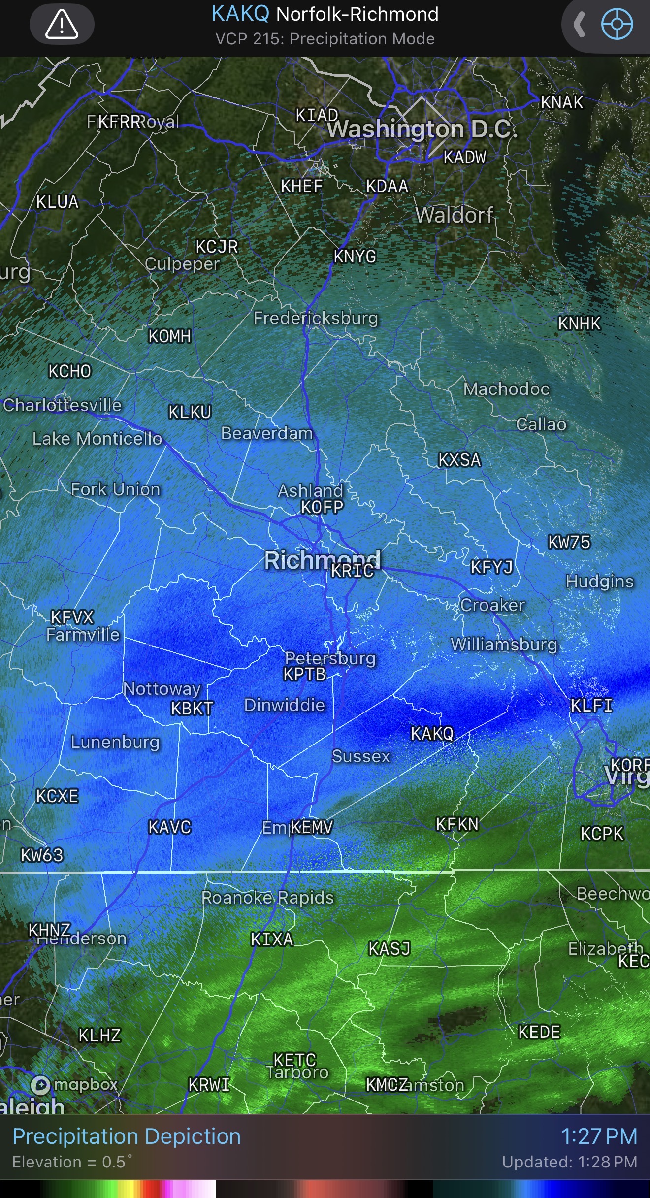
Nice heavier ban moving towards RIC from Farmville so things could pick up soon.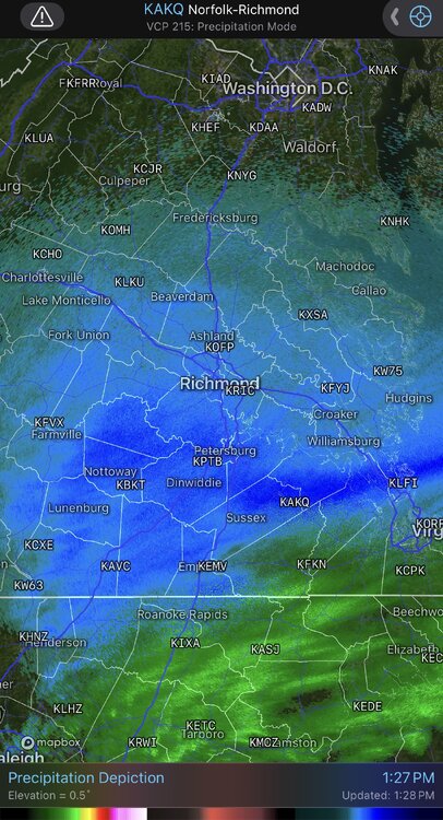
-
Richmond Metro/Hampton Roads Area Discussion
migratingwx replied to RIC Airport's topic in Mid Atlantic
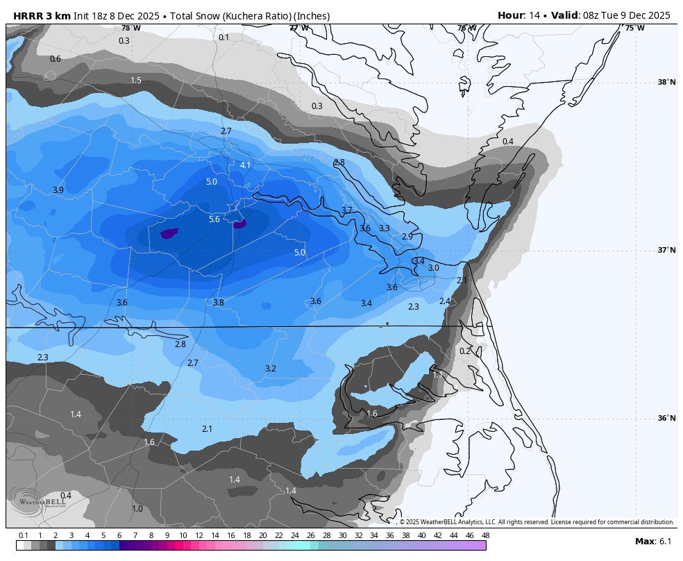
Latest HRRR, fwiw.
-
Richmond Metro/Hampton Roads Area Discussion
migratingwx replied to RIC Airport's topic in Mid Atlantic
Rooting for you all from Chicago. Plenty here to share, we've had the snowiest start to winter since 1978 and even more on the way. Happy to see my first winter here going well.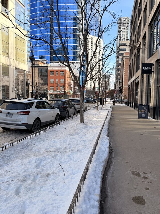
-
Richmond Metro/Hampton Roads Area Discussion
migratingwx replied to RIC Airport's topic in Mid Atlantic
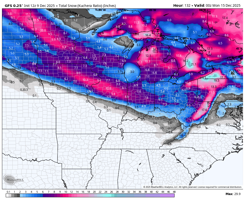
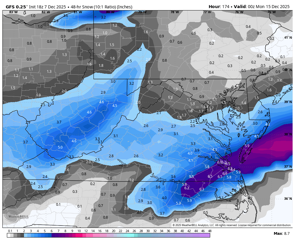
00z GFS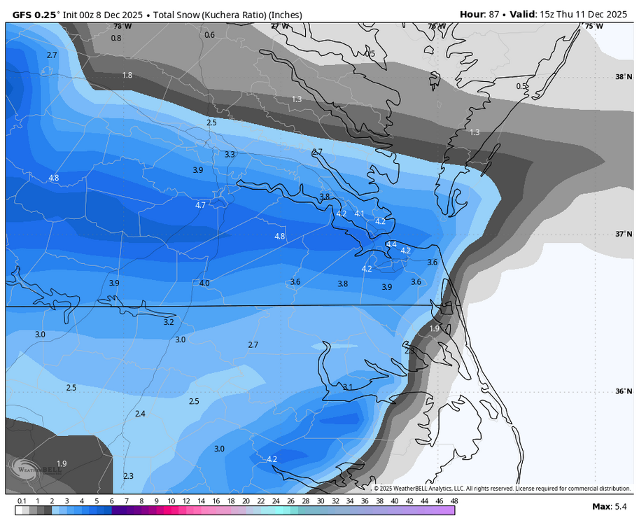
-
Richmond Metro/Hampton Roads Area Discussion
migratingwx replied to RIC Airport's topic in Mid Atlantic
GFS had the next threat a week from now.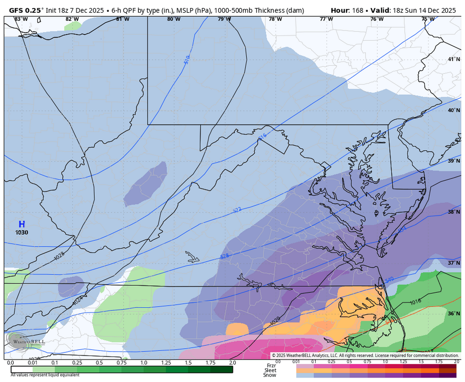

-
Richmond Metro/Hampton Roads Area Discussion
migratingwx replied to RIC Airport's topic in Mid Atlantic
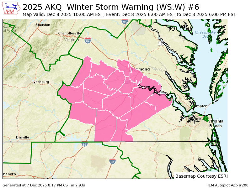
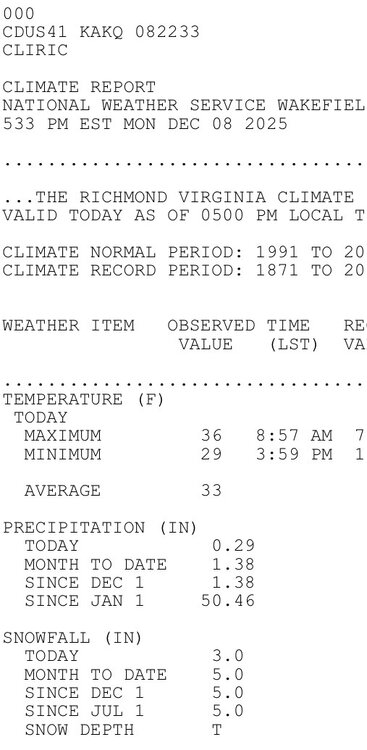
AKQ just upgraded RIC metro to a warning. URGENT - WINTER WEATHER MESSAGE National Weather Service Wakefield VA 917 PM EST Sun Dec 7 2025 VAZ061-068-069-081-082-513>516-081030- /O.UPG.KAKQ.WW.Y.0011.251208T1100Z-251209T0300Z/ /O.NEW.KAKQ.WS.W.0006.251208T1100Z-251208T2300Z/ Cumberland-Amelia-Powhatan-Prince George (including Hopewell and Petersburg)-Charles City-Western Chesterfield-Eastern Chesterfield (Including Col. Heights)-Western Henrico (Including the City of Richmond)-Eastern Henrico- 917 PM EST Sun Dec 7 2025 ...WINTER STORM WARNING IN EFFECT FROM 6 AM TO 6 PM EST MONDAY... * WHAT...Snow expected. Total snow accumulations between 2 and 4 inches with localized amounts in excess of 4 inches possible. * WHERE...Portions of central, east central, and south central Virginia. * WHEN...From 6 AM to 6 PM EST Monday. * IMPACTS...Plan on slippery road conditions. The hazardous conditions could impact the Monday morning and evening commutes. PRECAUTIONARY/PREPAREDNESS ACTIONS... If you must travel, keep an extra flashlight, food, and water in your vehicle in case of an emergency. Call 511 for road information. && $$