

NittanyWx
-
Posts
713 -
Joined
-
Last visited
Content Type
Profiles
Blogs
Forums
American Weather
Media Demo
Store
Gallery
Posts posted by NittanyWx
-
-
4 minutes ago, purduewx80 said:
The models unanimously weaken that fronto forcing between 700-500mb where the DGZ is, so if this is correct, +SN may not make it into the area this afternoon.
Yeah, looking likely that will weaken by the time it gets here. We'll get some light to moderate stuff early, then main precip shield in that late afternoon/evening window.
SE wind is helping to moisten the column a bit already though, it won't totally fizzle even if best fronto forcing is the west.
-
 1
1
-
 1
1
-
-
1 hour ago, Allsnow said:
Final call
KNYC 2
KEWR 3
KLGA 1.5
KJFK .9
KBDR 4
I like the call.
-
2
-
-
SE wind may help moisten things a bit and limit virga. That said, little more of a riming signature on this EC, too. That has been a bit of a trend today, finding a warmer nose in the DGZ, would likely take ratios down a bit. Think I'm gonna stick with what I had earlier, which is mostly a coating-2" city, LI and 2-4" N and W as well as CT. Further up the HV and into northern CT is where you get your 3-6" stuff.
-
2
-
-
12 minutes ago, jm1220 said:
Still think it’ll be forgettable/lousy in general on the island other than maybe north of the Northern State or Rt 25 where it could be a couple degrees colder for most of it than the south shore. Maybe an inch on the south shore and 2” on the north shore isn’t exactly nail biting.
Agree with this
-
2
-
-
23 hours ago, NittanyWx said:
Very marginal situation and I think best case scenario here goes something like getting some snow at 33-34 in the city for a few hours. Gonna be tough to stay colder than that with that SW wind past say 21-22z. Think if you're a bit further north in CT, Hudson Valley, NW jersey...better chance to get yourself a couple of inches before it flips over.
Implied, but the mid-levels and even most of the lower levels are OK. The issue is sfc to like 950mb with high gone.
The main issue the Euro is presenting isn't really the temp profile early on. It's more the precip being slower to arrive and losing out on getting some needed precip with the colder air still in place. Think early ballpark of like 1-3 north of the city, coating to maybe 2" at the absolute highest in the city (bias for lesser end of range) and less than that south.
I think I'll nudge areas just north of the city to 2-4", keep coating to 2" for the city, Island and south. You head further up and gain some elevation in and northern CT you'll find those 3-6" type of amounts. Thicknesses will be rising throughout the event and you'll still have low level warmth to deal with after 21-22z or so.
I still have a tough time in the city seeing anything more than 2" in a WAA type of scenario like we have here.
-
1
-
-
I think the northern portions of CT and as you get further north in the Hudson valley can do much better. Decent forcing, less of a sfc issue. Get some elevation and you're probably looking 4-8". I do still think even 20-50 miles north of the city you're gonna accumulate a couple of inches for what it's worth. This is just a pretty tough/marginal situation for anyone in the city, the Island and a chunk of central Jersey.
-
Very marginal situation and I think best case scenario here goes something like getting some snow at 33-34 in the city for a few hours. Gonna be tough to stay colder than that with that SW wind past say 21-22z. Think if you're a bit further north in CT, Hudson Valley, NW jersey...better chance to get yourself a couple of inches before it flips over.
Implied, but the mid-levels and even most of the lower levels are OK. The issue is sfc to like 950mb with high gone.
The main issue the Euro is presenting isn't really the temp profile early on. It's more the precip being slower to arrive and losing out on getting some needed precip with the colder air still in place. Think early ballpark of like 1-3 north of the city, coating to maybe 2" at the absolute highest in the city (bias for lesser end of range) and less than that south.
-
2
-
1
-
-
54 minutes ago, HVSnowLover said:
Surprised to hear it was that high, see this wasn't an epic bust for the city outside of the immediate ocean areas and Manhattan
It really wasn't, but a little bit of UHI goes a long way in storms like this. You get the complaint that it didn't "feel" like 5" of snow because you lose accumulating precip to still warm paved surfaces. And it's a valid point in terms of population impact.
It's still a bust in the city though. No one said the job was easy!
-
1
-
-
3 hours ago, wdrag said:
NOHRSC interpolated 24hr sfall through 12z/4.
Seasonal total in this part of Wantage now 34.7. I thought the banding was well modeled by the NAM and in the resultant s+ area (colder profiles and larger dendrites easier to accum). Max today so far was 31.8 ~630A. now 28.9 with increasingly gusty can and partial sunshine. We may not get past 32 here in northern Sussex County NJ today. No matter, melting and settling in progress.

10 miles makes all the difference, but close only counts in horseshoes and hand grenades. Tricky storm.
********************STORM TOTAL SNOWFALL******************** LOCATION STORM TOTAL TIME/DATE COMMENTS SNOWFALL OF /INCHES/ MEASUREMENT CONNECTICUT ...Fairfield County... Monroe 12.0 640 AM 3/04 Trained Spotter 3 ESE Bethel 12.0 700 AM 3/04 CoCoRaHS Newtown 11.6 700 AM 3/04 Broadcast Media 3 NW Monroe 11.6 800 AM 3/04 CoCoRaHS 3 WSW Shelton 11.2 700 AM 3/04 CoCoRaHS 1 SSE Ridgefield 11.0 800 AM 3/04 CoCoRaHS Shelton 11.0 816 AM 3/04 Public 1 ENE New Canaan 11.0 800 AM 3/04 CoCoRaHS Bethel 10.7 700 AM 3/04 CoCoRaHS New Canaan 10.5 400 AM 3/04 Trained Spotter 3 NNW Norwalk 10.4 700 AM 3/04 CoCoRaHS Danbury 10.0 457 AM 3/04 Trained Spotter 2 NW Darien 9.5 700 AM 3/04 CoCoRaHS Bridgeport Airport 9.0 734 AM 3/04 COOP Observer 4 WNW Newtown 8.9 700 AM 3/04 CoCoRaHS Stamford 8.5 800 AM 3/04 Trained Spotter New Fairfield 8.5 500 AM 3/04 Trained Spotter Weston 8.2 630 AM 3/04 Trained Spotter Easton 8.2 330 AM 3/04 Public Greenwich 8.1 400 AM 3/04 Public Norwalk 8.0 345 AM 3/04 Public Stratford 8.0 700 AM 3/04 CoCoRaHS Stratford 7.8 700 AM 3/04 CoCoRaHS 1 ENE Darien 7.0 745 AM 3/04 CoCoRaHS 2 NE Fairfield 6.0 700 AM 3/04 CoCoRaHS ...Middlesex County... Higganum 12.5 800 AM 3/04 CoCoRaHS 2 NNW Durham 11.5 700 AM 3/04 CoCoRaHS Westbrook 7.2 726 AM 3/04 Trained Spotter Essex 7.0 730 AM 3/04 CoCoRaHS ...New Haven County... Southbury 13.8 807 AM 3/04 Public North Haven 11.5 700 AM 3/04 Trained Spotter Hamden 11.4 803 AM 3/04 Trained Spotter Orange 11.2 737 AM 3/04 Trained Spotter 2 ENE Prospect 11.0 600 AM 3/04 CoCoRaHS 1 WNW Wallingford 11.0 700 AM 3/04 CoCoRaHS Oxford 10.5 745 AM 3/04 Trained Spotter Woodbridge 10.5 558 AM 3/04 Public 1 NE Naugatuck 10.0 700 AM 3/04 CoCoRaHS Seymour 9.5 700 AM 3/04 CoCoRaHS Seymour 9.0 520 AM 3/04 Trained Spotter 1 W Woodmont 8.4 830 AM 3/04 CoCoRaHS Cedar Land 7.5 100 AM 3/04 Public Bethany 6.5 130 AM 3/04 Broadcast Media Branford 6.0 810 AM 3/04 Trained Spotter 1 ENE Cedar Land 5.2 1200 AM 3/04 Public West Haven 4.5 500 AM 3/04 Trained Spotter 1 W Madison 3.7 700 AM 3/04 CoCoRaHS ...New London County... Lebanon 13.5 630 AM 3/04 Public 2 NNE Norwich 10.8 700 AM 3/04 CoCoRaHS Norwich 6.0 700 AM 3/04 Co-Op Observer Norwich 6.0 731 AM 3/04 Co-Op Observer Ledyard Center 5.2 625 AM 3/04 Trained Spotter New London 5.0 645 AM 3/04 CoCoRaHS 3 E Mystic 5.0 700 AM 3/04 CoCoRaHS 1 SSE Pawcatuck 5.0 700 AM 3/04 CoCoRaHS 3 E Old Lyme 5.0 700 AM 3/04 CoCoRaHS 2 S Waterford 3.6 715 AM 3/04 CoCoRaHS 3 SW Pawcatuck 3.5 700 AM 3/04 CoCoRaHS 1 SW Niantic 3.0 700 AM 3/04 CoCoRaHS NEW JERSEY ...Bergen County... Haworth 8.8 450 AM 3/04 Public Franklin Lakes 8.5 315 AM 3/04 Trained Spotter Oakland 8.0 800 AM 3/04 CoCoRaHS Westwood 7.3 800 AM 3/04 Trained Spotter Englewood 7.1 804 AM 3/04 Public Ridgewood 6.5 835 AM 3/04 Trained Spotter 1 W Tenafly 5.8 730 AM 3/04 CoCoRaHS East Rutherford 4.4 820 AM 3/04 Trained Spotter Lyndhurst 3.5 550 AM 3/04 Amateur Radio Ridgefield 3.2 156 AM 3/04 Trained Spotter ...Essex County... Cedar Grove 9.2 736 AM 3/04 Trained Spotter Montclair 8.0 730 AM 3/04 CoCoRaHS West Orange 7.7 300 AM 3/04 Public Maplewood 5.2 700 AM 3/04 CoCoRaHS ...Hudson County... Harrison 5.0 700 AM 3/04 Co-Op Observer Harrison 5.0 740 AM 3/04 Co-Op Observer ...Passaic County... Bloomingdale 8.2 315 AM 3/04 Trained Spotter Little Falls 7.2 700 AM 3/04 CoCoRaHS 1 SSW Wayne Twp 5.5 700 AM 3/04 CoCoRaHS ...Union County... Union 6.3 252 AM 3/04 Public Plainfield 5.5 911 AM 3/04 Trained Spotter Newark Airport 4.4 725 AM 3/04 CWO Elizabeth 4.4 1200 AM 3/04 Trained Spotter NEW YORK ...Bronx County... Pelham Parkway House 2.4 700 AM 3/04 Public ...Kings County... Brooklyn 2.0 700 AM 3/04 Trained Spotter ...Nassau County... Syosset 4.0 545 AM 3/04 Trained Spotter Manhasset Hills 3.8 855 AM 3/04 Public Franklin Square 2.5 1246 AM 3/04 Trained Spotter ...New York (Manhattan) County... Central Park 5.0 648 AM 3/04 Central Park Conservancy ...Orange County... Monroe 8.0 415 AM 3/04 Trained Spotter 3 W Warwick 7.0 700 AM 3/04 CoCoRaHS Newburgh 7.0 816 AM 3/04 Trained Spotter 2 SW Greenwood Lake 7.0 800 AM 3/04 CoCoRaHS Salisbury Mills 6.5 730 AM 3/04 Trained Spotter New Windsor 6.0 700 AM 3/04 Public Gardnertown 5.8 830 AM 3/04 Trained Spotter 1 S Walden 5.4 700 AM 3/04 CoCoRaHS Middletown 4.8 152 AM 3/04 Fire Dept/Rescue Vails Gate 3.0 1105 PM 3/03 Trained Spotter ...Putnam County... Carmel 8.0 834 AM 3/04 Co-Op Observer 4 N Carmel 8.0 800 AM 3/04 Public Mahopac 8.0 650 AM 3/04 Fire Dept/Rescue Brewster 7.8 231 AM 3/04 Trained Spotter Putnam Valley 7.7 830 AM 3/04 Newspaper Brewster 7.0 700 AM 3/04 CoCoRaHS 3 N Fahnestock State 6.8 600 AM 3/04 CoCoRaHS 3 S Fishkill 6.5 743 AM 3/04 CoCoRaHS ...Queens County... Bayside 7.1 420 AM 3/04 Public NYC/LaGuardia Airpor 4.8 726 AM 3/04 CWO Whitestone 4.5 100 AM 3/04 Public Whitestone 4.0 700 AM 3/04 CoCoRaHS 2 NW Ozone Park 3.0 700 AM 3/04 CoCoRaHS Rego Park 2.5 120 AM 3/04 Trained Spotter NYC/JFK Airport 2.2 726 AM 3/04 CWO Jamaica 2.0 230 AM 3/04 NYC OEM CERT ...Richmond County... 1 ENE Annadale 3.0 700 AM 3/04 CoCoRaHS ...Rockland County... Chestnut Ridge 9.0 735 AM 3/04 Trained Spotter Spring Valley 8.0 500 AM 3/04 Public Pearl River 7.8 730 AM 3/04 Trained Spotter New City 6.7 830 AM 3/04 Trained Spotter Stony Point 6.4 606 AM 3/04 Trained Spotter Congers 5.5 630 AM 3/04 Fire Dept/Rescue Nyack 3.5 1145 PM 3/03 Public ...Suffolk County... Shoreham 6.2 530 AM 3/04 Public Wading River 5.9 815 AM 3/04 Public Centerport 4.8 731 AM 3/04 Co-Op Observer East Northport 4.5 900 AM 3/04 Amateur Radio Commack 4.3 845 AM 3/04 Public 1 SSW Nesconset 4.0 822 AM 3/04 CoCoRaHS Miller Place 4.0 838 AM 3/04 Public Orient 4.0 902 AM 3/04 Co-Op Observer Orient State Park 4.0 800 AM 3/04 Co-Op Observer Islip Airport 3.6 727 AM 3/04 ASOS Stony Brook 3.4 730 AM 3/04 NWS Employee North Babylon 3.2 605 AM 3/04 Public Sound Beach 3.2 741 AM 3/04 Public Upton 2.6 727 AM 3/04 NWS Office Baiting Hollow 2.0 400 AM 3/04 Co-Op Observer Sayville 1.5 700 AM 3/04 NWS Employee ...Westchester County... Armonk 11.0 400 AM 3/04 Public Katonah 10.1 731 AM 3/04 Trained Spotter 2 W Ridgefield 9.7 800 AM 3/04 CoCoRaHS Rye 9.3 915 AM 3/04 Public Port Chester 9.3 745 AM 3/04 Public White Plains 9.2 916 AM 3/04 Public Armonk 9.0 700 AM 3/04 CoCoRaHS Harrison 8.5 914 AM 3/04 Public Mount Kisco 8.0 415 AM 3/04 Public Shrub Oak 7.5 630 AM 3/04 Co-Op Observer 1 ESE Putnam Valley 7.5 630 AM 3/04 CoCoRaHS 4 WNW Ridgefield 6.7 715 AM 3/04 CoCoRaHS Croton Falls 6.5 806 AM 3/04 Trained Spotter Jefferson Valley 5.0 1039 PM 3/03 Public Larchmont 5.0 630 AM 3/04 Public-
1
-
1
-
-
Event post-mortem...
Call: 6-10" NYC Metro, north shore LI, NE Jersey, lower Hudson Valley and CT
3-6" with mixing Jersey shore, south shore and the forks.
What worked:
Lower Hudson Valley, NE Jersey, Connecticut. Generally aligned with expectations there as dendritic growth was solid, band cranked out 2"/hr snow rates. Widespread 6-10" totals verify.
The mixing idea along the Jersey shore, south shore and forks held down totals there. 3-6" will verify for many, but barely.
What busted: Central Park ASOS is reporting 5", which is an inch lower than my forecast. I consider this a bust for Manhattan, likely a chunk of Queens and the north shore LI pending OKX final storm report. IP line was far just enough north during the evening we lost snow to sleet, that makes a difference. That, plus a temp of 33 led to very little accumulation until the band came through. As a result, busted too high on low end of range for lower Manhattan, northern Brooklyn and I think Queens (though I may squeak by there, 4-8" would've been a better forecast). I consider SI and south shore Brooklyn as a coastal area, I'm not overly surprised there was less snow and mixing there.
In short, the northward tongue in the mid-levels was battling against some pretty impressive snowfall rates. Should've been more cautious in LI and in NYC specifically given this is March.
-
4
-
1
-
-
8.4" Wilton, CT
-
2
-
1
-
-
Please post location when you post obs...
-
23 minutes ago, CoastalWx said:
Yeah deeper lift washing out IP line.
Seeing that on radar in real time was fun.
-
1
-
-
Wilton, CT
3", 32 and steady. This is sticking to everything, including cable and power lines. A little wind might actually help here to shake some snow off
-
2
-
-
1 minute ago, chrisNJ said:
Snowing hardest of storm thus far here in CNJ. Coming your way NYC.
This would be the 2"/hr band i was talking about 3 minutes ago.
-
This thread is amusing. That band in Jersey will spit out 2"/hr rates.
-
3
-
-
2" Wilton, CT. 32 and slowly falling.
-
32, SN in Wilton. We're accumulating on all surfaces now.
-
1
-
-
ILG is +SN. I'm feeling good about my 6-10" call for NYC metro, a bit less over the forks
-
3
-
-
Snow in Wilton, 34.
-
1
-
-
23 minutes ago, nycwinter said:
even with cold temps high sun angle will do a number on the snow...quickly...
Part of the reason we'll do OK on the accumulation side tonight is because of timing. No sun angle to lose frozen precip to.
-
1
-
-
I think this is primarily snow. 6-10" for most in immediate NYC metro. This is more like 3-6" over the forks, south shore and southeast Jersey coast where you mix.
-
4
-
1
-
 1
1
-
-
3 minutes ago, ag3 said:
3-5” was the proper call. NYC could get close to 5”.
Yeah it's gonna be close for me. I went 2-5" NYC and north shore LI, 3-6" CT, NE Jersey and lower Hudson Valley.
I was dealing with some skepticism from traders on my floor with this yday because there was so little hype on it. Selfishly I want the full verification.
-
3
-
-
Just now, SnowGoose69 said:
So NYC has had 10.4 outside of meteorological winter and only 4.1 within it. So they had almost as much in 6 hours today as they did the prior 3 months
DGZ, low wind. March is now Feb.

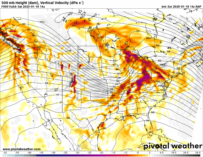
Wintry mix potential weekend of Jan 18-19, 2020
in New York City Metro
Posted
I'm close to 3". For the most part the storm behaved as expected. All snow here. Sleet line will come close with this next batch, but all snow up to now.