

NittanyWx
-
Posts
758 -
Joined
-
Last visited
Content Type
Profiles
Blogs
Forums
American Weather
Media Demo
Store
Gallery
Posts posted by NittanyWx
-
-
1 hour ago, CoastalWx said:
Yeah we need to sort of flush out the crap and cool it off a bit. That should happen late month. My guess is the pattern flip won’t necessarily be very cold, but offer more snow chances as a whole with an active look.
We're thinking alike
-
 1
1
-
-
1 hour ago, Allsnow said:
This needs to improve before anyone can start talking snow

All about source region.
-
1
-
-
14 minutes ago, CoastalWx said:
GEFS are definitely active, but marginal airmasses. Might be an in and up look.
There's a source region problem. Perhaps that Kara-Siberia ridge starts dislodging some cooler air towards AK/NW Canada that can be tapped into at a later date when +PNA base state returns.
-
1
-
-
By the way, the VP200 Hovmollers are already in 'favorable' territory inside the 15 day. So the models are already 'seeing' the MJO
-
1
-
-
I will continue to harp on about the source region until it's resolved. It's the biggest inhibitor to anything other than a transient cool period right now.
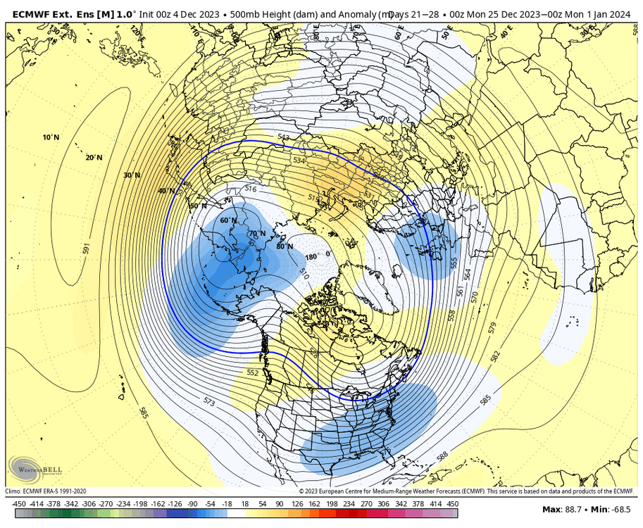
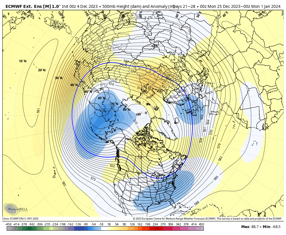
Kara Sea ridge developing 11-15 day should shunt some cooler air on this side of the pole, primarily focused over Alaska and hopefully some of NW Canada.
For significant storm odds to increase along with a helpful airmass with it, this period would hopefully include some cold air draining into W Canada. At that point you'd look for a baseline Nino +PNA to re emerge which would, in theory, be the timing when things would line up for something more significant.
-
7
-
-
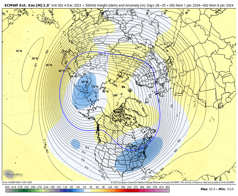
Thinking is for a transient few cooler days around mid month sandwiched around warmer ones. I still don't see permanent blowtorch, though I do think the post cool period could produce several much above normal days.
-
1
-
-
2 hours ago, EastonSN+ said:
It's more that I had a blanket thought that most El ninos are snowy here. Just like some la ninas are favorable, some El ninos are not.
CPC did/does some work on ENSO and snowfall. The problem is the composites haven't updated since 2010, so it's a bit outdated.
-
1
-
-
2 hours ago, Typhoon Tip said:
Exactly ...
In dailies/practical terms, there's nothing there to be either disappointed with, or happy about. It's really oblivious.
Agree, be it MJO ...or a Asian wave break in the flow ...something to impact enough forcing to synergy/constructively interfere.
One thing I am noticing is the WPO is ( numerically) negative, despite the EPO flatlined. If an MJO is destined to propagate out of the Marine region and comes into western Pac up underneath, the two could certainly do what we are asking above. If ( and hopefully when) that happens, we see a pattern change from this marching shit above into something more classical. It could do it pretty quickly too - we'll see.
Agree with this and was making a similar point yesterday. Lotta ways to skin a cat, tropical forcing being one of them, but would prefer it be some form of combination of influences to overcome background interference.
-
2
-
-
5 hours ago, MJO812 said:
Yep it will continue as it catches on to the MJO plots.
The model itself is forecasting the variables that are plotted into an MJO plot. Please explain how a model can catch up to its own forecast?
-
1
-
 1
1
-
-
31 minutes ago, donsutherland1 said:
Not necessarily. If we can more or less keep the blocking, there will be some opportunities (mostly January and perhaps February). Also, those are exceptional cases. They aren't the norm.
This is a good way to think about it. There's plenty of blocking right now over the pole and NAO regions, but the Pacific is very much non-cooperative. The net result is this pattern that isn't a prolonged torch, but any cold spell is pretty short lived and doesn't pack much of a punch here in early Dec. Week 2 trends look quite mild.
Now if you have a cooperative Pac, you're aided by this blocking. So I'm not by any means throwing in the towel on winter. But 10 year normal temps in Dec aren't doing much snow wise right now. The playbook is Pac improvement, whether that be through the RWT, wave breaking, some strato influence, the MJO assisting with these things or some combo of all of them. Then the blocking can really help.
And that's not to say Dec is a shutout, but I think the focus should be 90% Pacific right now
-
1
-
-
54 minutes ago, bluewave said:
The MJO has successfully been used as a forecast tool for a while now. But the rapid expansion of the WPAC pool has slowed and amplified it in the warmer phases in recent times. Numerous papers were published in the last 5 years on this topic. So you are hearing about it now more because of the warming influence for us plus more understanding how it’s altering our local climate. Everything from mountain torques to sudden stratospheric warming have there roots in the MJO dynamics. So it’s right up there in importance with El Niño and La Niña. The key is figuring out how the ENSO and MJO will interact and drive the Rossby wave pattern.
I'll go one further. Models have gotten a lot better at forecasting the MJO and subsequent RWT over the past 15 years. Part of the challenge is figuring out 'are you better than the model at forecasting the MJO?' And more importantly, are you better at diagnosing the downstream pattern than the model.
I think a lot of folks treat the MJO like it's still 2009 and you had clear skill advantages and especially so in certain patterns. Not sure that's the case as much anymore given the improvements in the NWP space.
It's a tricky game of when you're actually adding skill vs when you're actually taking decent modeling and making it worse with your own tinkering.
-
2
-
-
5 minutes ago, brooklynwx99 said:
idk, this develops a pretty nice source region as heights increase into AK and the NAO trends negative. this would be a cold pattern. nothing frigid, but cold given that we're into early Jan at this point. Christmas might be a tad too early... maybe a few days after before we start talking anything bigger
Well you were talking Holiday week in your post and my point is 'what air are you advecting'?
If you're saying more towards January, I think you'd have a better case for it since there's potential for retrograde into EPO regions if you take that model verbatim.
That Alaska look last week of December isn't what you want though.
-
4
-
-
2 hours ago, brooklynwx99 said:
the ENS and extended products look like that as they transition to a more favorable pattern during holiday week
If you're talking about the EC Weekly 500, it's missing any material source region and that trof is pretty empty. Essentially transporting mediocre Pacific air amid some storminess.
Again, for the purposes of this winter you're looking for a source region build with Nino tendency to ridge out west. So in those breaks synoptically between ridges (you almost always get them), gonna really look to see if anything decent drains into W Canada. That's 90% of my focus right now. I liked the trends today a bit towards the end of the run today for that happening. But I need to see more synoptically for me to believe in a loading pattern that could deliver anything Christmas week. I don't have enough of a feel for what any +PNA or whatever would be transporting. Risk is a +PNA is just bringing in some modulated weak air and any potential system wouldn't have much to work with.
My advice to this forum is focus on the source and less so the MJO. MJO 8 isn't the be all/end all for snow. Doesn't magically give you a source region.
-
3
-
-
4 hours ago, EastonSN+ said:
Montreal and eastern Canada were hit pretty hard last night. Is this a good source region or do we prefer Alaska and wester Canada epo/PNA reasons?
I'd prefer Canadian prairies and upper Midwest, personally. Now thats not to say it CAN'T snow without those areas, but more often than not your source region is north and west and gets modulated and weakened without snowcover.
More important to me is a loading pattern that at least brings in some cold into western Canada to tap into. We're lacking that currently.
Models today towards the end are starting to show some signs of that, but that's really step 1 in the process.
-
1
-
-
Also, for the life of me I don't understand all the fighting about which phase the MJO is in and how phase 8 fixes everything.
You need a loading pattern for a source, you need a source region regardless. That source region can come from wave breaking, stratospheric fluxes, etc etc. Feel like in winter everyone thinks the MJO is the solution to all problems and I don't think that's necessarily true.
December's are tough in Nino years as the continent is often flooded with Pac air. We're seeing that play out right now.
-
10
-
 3
3
-
-
I see a lot of Nino standing wave here. Which isn't terrible in most circumstances and you can get some Kelvin waves to leak east out of that.
But, and I'm gonna keep saying this, we need some help with source region and building some snow pack to the west still, in my view before I can start to take storm risk seriously.
It's not an all out torch, but it's still relatively mild.
-
7
-
-
18 hours ago, SnowGoose69 said:
Funny thing is 18Z Op GFS shows that crazy AK/W Canada ridge again that is too far west for us usually at D16.
It's gonna take several steps for this to improve enough where you'd trust a pattern to have any meaningful cold with it. That's the issue with these setups and its the issue with any coastal next week. You don't have much of a source to work with.
-
3
-
-
1 minute ago, vegan_edible said:
could you explain this idea to me like im a 7 year old
We're in an El Nino, a strong one.
-
1
-
-
2 hours ago, brooklynwx99 said:
do we need +4C anomalies over the Pacific in order for El Nino forcing to be felt? i truly do not see why there is so much discussion as if this Nino is failing and we're just stuck in a La Nina. it makes zero sense. this event is going to top out at like +1.8C
I've seen weather vendors amplify this idea on the energy side too and they're getting run over right now because they're all too cold. Some people live solely inside the VP space as if it's the god particle that solves all weather.
-
Sitting in some heavy subsidence. Very tiny dendrites. 18 and windy.
-
16 minutes ago, weatherpruf said:
In all fairness, even with a family of scientists, I could not possibly pass the classes needed for a met degree. But I could do the weather on TV....
I'll be sure to tell my cloud microphysics teacher.
Look, I'm kidding a little bit. I've basically gone 'this is a Hatteras to benchmark low, it's gonna be a sizable storm for many east of 287' since Wednesday. But the northwestern component is an absolute nightmare with this and the comms around that are super difficult.
I'm glad I don't do TV for events like this.
-
2
-
-
I have a stupid job. Do the weather they said!
-
3
-
15
-
-
I just want to caution folks on aiming too high on these ratios again. I think 12:1 is a solid middle ground and reasonable right now. Just too much wind.
That said, this is a clear warning criteria storm east of 287 and a monster for SNE, Suffolk and some of the jersey shore.
-
9
-
2
-
-
4 minutes ago, weatherpruf said:
Where are you expecting that gradient to set up? Warren or Sussex? Or even further south? Some maps show Somerset county....parts of it...
I dont know yet, but my instinct says I can't totally toss out a gradient line starting at just west of 287 in Jersey yet.
This is a very tough forecast.
-
1
-


December 2023
in New York City Metro
Posted
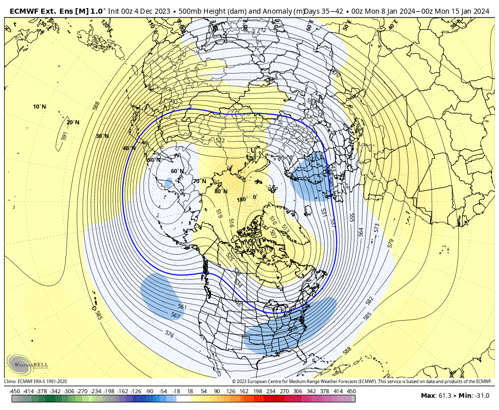
When I'm talking about source region, I'm not talking about extreme arctic air. One of the challenges with airmasses from the north and west is that these airmasses can weaken over time when there isn't sufficient snow-cover.
Looking at snow-cover anomalies and the Chinook showing up in the extended range...I'm struggling to find the snowpack build right now and a material change in that scenario. So that means any Continental polar airmass loses punch as it advects southeastward.
A +PNA with no snowcover and cP airmass that doesn't have much of a cold punch to begin with weakens chances for snow.
So what I'm looking for, and why I keep harping on the need for source, is to mitigate the risk of an empty trough and no real source for cold to accompany any coastal storm if and when El Nino forcing become a dominant driver again in the mid-lats and the seasonal +PNA trend re-establishes.