AstronomyEnjoyer
-
Posts
1,081 -
Joined
-
Last visited
Content Type
Profiles
Blogs
Forums
American Weather
Media Demo
Store
Gallery
Everything posted by AstronomyEnjoyer
-
With what's already on the roof and 1.5" of frozen QPF on the way, it might be time to dig out the roof rake.
-
18z HRRR is, uh, rather optimistic for CNE.
-
For this event I imagine much of the displayed accumulation on the pos depth change is from sleet that has been counted as snowfall. I don't think I should expect the 14" of snow it's showing for my location.
-
Not really in the HRRR's range, but the 12z run has a really solid initial thump for CNE.
-
Per Pivotal, copy and pasted below. Apparently the foreign models output directly usable data regarding p-type. "ECMWF, UKMET, and Environment Canada models keep track of precipitation type in a precise way as the model integrates, so we know how exactly much precipitation falls in the form of snow (at least, based on the model’s internal diagnostics). This eliminates any concern about including sleet, graupel, or rain when we compute snowfall for those models. For NCEP models, the bookkeeping for precipitation types is less precise, so mis-categorizing some of the precipitation that fell between data output times is always a risk during mixed precipitation or precipitation that is rapidly changing type. We have adopted an approach that usually avoids erroneously treating sleet as snow for NCEP models, so you should not see a shield of "fake snow" extending well equatorward of the actual snow-sleet line in a large mid-latitude cyclone, for example. Still, it is inevitable that we will sometimes overestimate the fraction of mixed precipitation falling as snow in borderline and transitional environments (usually small in area)."
-
24 hour Kuchie. Always room to adjust upwards if needed.
-
What a lovely little monster.
-
00z GFS says yes to the 20th.
-
The American models need to step up their game and actually assign p-types to QPF. The way vendors are forced to essentially guess what was falling based off of frames that are spaced 3 hours apart is silly. You get that ridiculous tiger striping artifact as a result.
-
Germans bringing the juice.
-
NWS 01z blend. Nice pack builder up here.
-
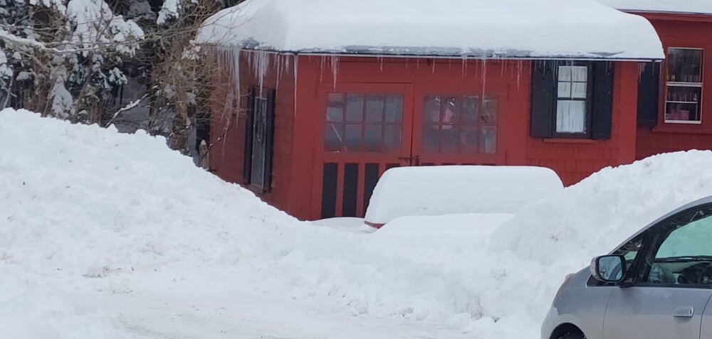
Pics from two days ago. Between 18"-20" in the yard, and as a bonus, my neighbor's mystical weenie picnic table that somehow holds snow better than anything else in existence. That thing might have 30" on it after this weekend.
-
28.4°, and sleeting here in Bradford.
-
For pictures I take on my phone, what I do is share them to my google drive. From there, I can download them onto my Windows desktop and use the resize function.
-
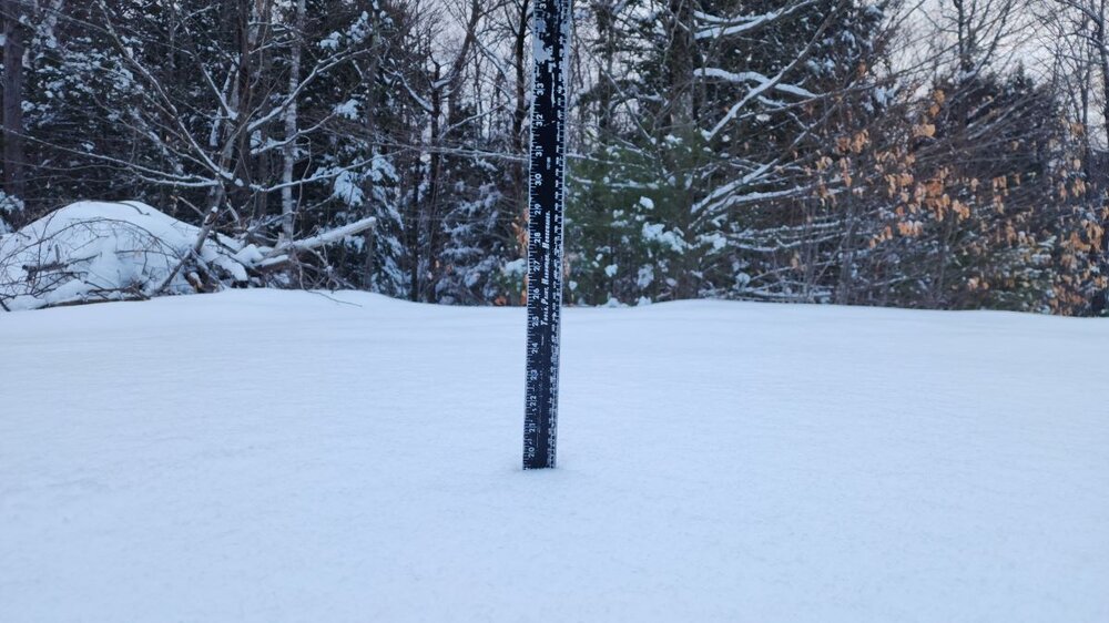
25.5°, light/moderate snow, crap growth. A little over 2.0" here. Had been sleet a couple hours ago.
-
Keep that ice crap to my south, ugh.
-
Better to have proximity to high terrain to your west than high terrain to your east?
-
I've looked before, but haven't had any success. Doesn't mean they don't exist though.
-
Here's Albany's map. Generated product though. Still hard to get an idea of snowfall totals.
-
I strongly suspect you do a little better than Keene.
-
Is your average really only around 57"? I feel like it should be a little higher than that.
-

Feb 8-9th Snow, Sleet, ZR OBS Thread
AstronomyEnjoyer replied to The 4 Seasons's topic in New England
Looks like 7.8" will just about do it here. Not too bad! -
Feb 8-9th Snow, Sleet, ZR OBS Thread
AstronomyEnjoyer replied to The 4 Seasons's topic in New England
Just hit 4.0" here in Bradford. If the HRRR has a clue, double digits are definitely within reach. -
Feb 8-9th Snow, Sleet, ZR OBS Thread
AstronomyEnjoyer replied to The 4 Seasons's topic in New England
Watching that band slowly lift north while I rub my hands together like a filthy little fly. -
Feb 8-9th Snow, Sleet, ZR OBS Thread
AstronomyEnjoyer replied to The 4 Seasons's topic in New England
21.7°, SN. Growth hasn't been the best, but closing in on 1.0".


