

AtlanticWx
-
Posts
643 -
Joined
-
Last visited
Content Type
Profiles
Blogs
Forums
American Weather
Media Demo
Store
Gallery
Posts posted by AtlanticWx
-
-
I honestly think we want the TPV lobe to hold back a little earlier instead of pushing east. The further west it is, the more interaction it'll have with the southern piece and capture it properly, just like we saw with the Euro solutions last night
-
 1
1
-
-
Just now, mitchnick said:
At 108hrs, definitely more amped than 6z.

yeah on the bright side, euro is one of the only models with the kicker literally starting to wrap around our system lmao
-
4 minutes ago, psuhoffman said:
I do find it a little odd that across the board the op runs are more amplified compared to their ensembles. It’s been that way for a few runs now also.
yeah i wonder why this is the case. is it because ensembles are more low res besides eps and eps is the most juiced out of them?
-
3 minutes ago, WEATHER53 said:
Nope
i mean it did, that's what caused it to be better further south and worse further north. good for us now, but we wouldn't want this to become a trend. idt it will tho so we'll see
-
euro made two negative shifts this run looking at it. by hour 84, there's less interaction between the two waves. additionally, the kicker is more destructive, stringing it out but stringing it out too late for it to affect us.
-
when are we getting a thread? after the gfs cave
-
 1
1
-
-
6z euro somehow looked even better with the capture of the southern piece holy shit
-
6
-
 3
3
-
-
4" here in south gtown, hit forecast with a few hours of snow left to go. let's get it
-
2.6 in GTown.
-
 1
1
-
-
Can a met explain why HRRR is so much warmer than every other model with sfc temps?
-
Honestly getting really excited for this. Didn't think we would score in February, let alone stare down a possible 6-8"+ storm area wide
-
2
-
-
qpf max went up, i like this run more than 6z. just went south due to noise with the confluence which doesn't get sampled till tomorrow anyways. i like this change
-
eyeballing more than just a dusting now, all surfaces caving in gtown. 33.2°
-
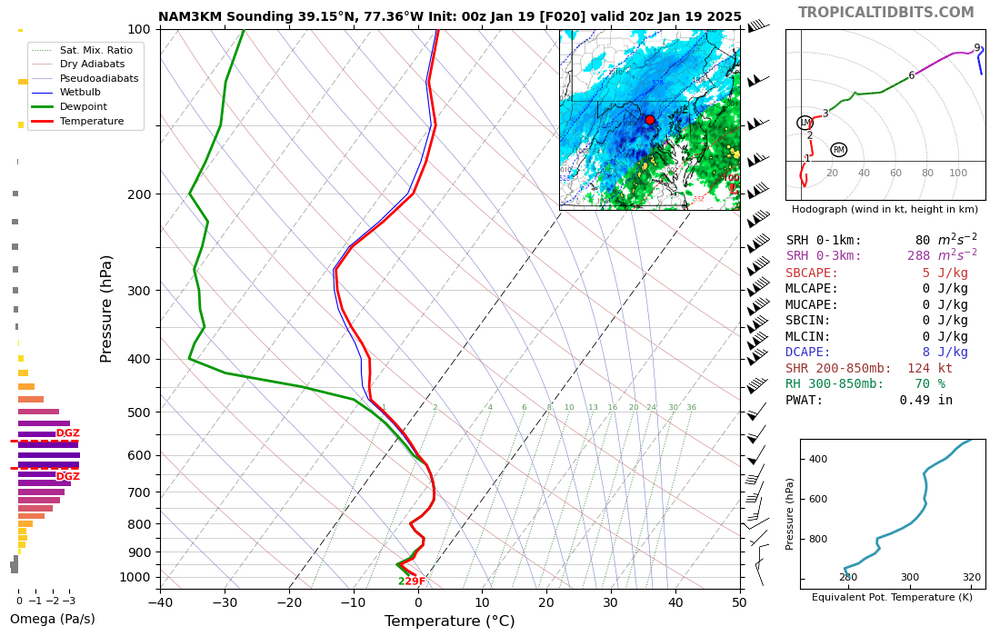
wtf i didn't realize soundings looked like this -
so excited to get a daytime snowstorm tomorrow. my sleep schedule has gotten so cooked by the late-night storms that peak at like 4 am. nice to see a snowstorm peaking at like 4 pm
-
1
-
-
hey yall, i've not been looking recently. how we looking for the storm and more specifically NW moco?
-
1 hour ago, Deck Pic said:
I like the trend of getting snow in early to mid January. We used to always punt the first two weeks
jan 6-7 is the new dec 5 of the 2020s
-
4
-
-
what are people's thoughts on ratios being overdone with kuchera for this event? soundings don't look impressive, with ripping winds and subpar lift in the DGZ just like on monday for the frontend thump
-
snowflakes look so much healthier now than they were in the first round. really seeing the impacts of better snow growth, accumulating nicely and efficiently
-
1
-
-
ripping fatties in germantown
-
3/8" of snow in the last 17 minutes, 1.3"/hr rates. Up to 4.7", but snow depth is around 4.3-4.4" due to compaction probably
-
1
-
-
.6" in the past 30 minutes, 1.2"/hr rates in gtown with radar only lighting up more. been sitting in greens and some yellows
-
Just now, MillvilleWx said:
It's been just pouring snow out our way. You can even see the flakes fall in the dark out the window it's coming down so steady. I measured 1.2" in a hour last ob. If this keeps up, we'll be over 10" by storms end, no question.
i think that initial thump that exceeded expectations really set us up well. now FGEN is coming in and much of the area is eyeing down 1.25-2"/hr rates. sleet line coming north should also give us some heavy snow with better flake size i imagine
-
1
-
-
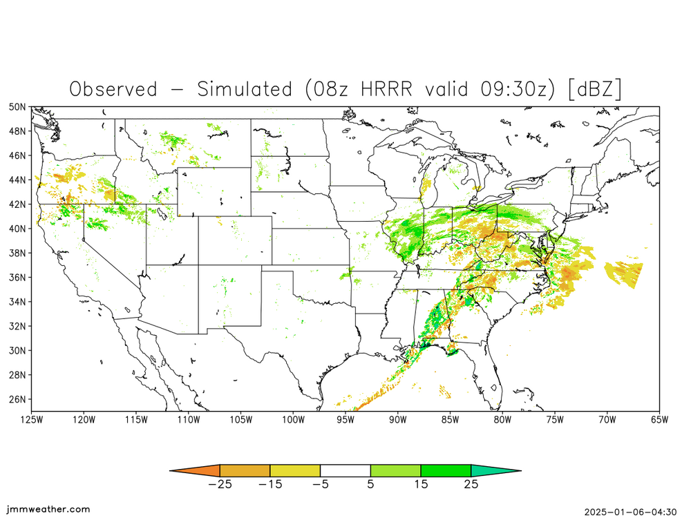
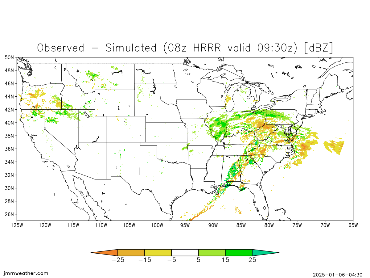
holy shit. look at the precip nw of the vort max, way overperforming compared to short res models. the dmv is in for a rude awakening tonight when everyone's gonna think the storm is over and then it comes back. getting jan 2019 vibes with this look tbh

February Medium/Long Range Thread
in Mid Atlantic
Posted
NAM had positive changes with our vort & confluence starting at hour 48. If this means anything for 0z runs, we're set. Confluence def lifted by 48 w/ trough buckling more -> more interaction by the period of interest