

Hurricane Agnes
-
Posts
8,579 -
Joined
Content Type
Profiles
Blogs
Forums
American Weather
Media Demo
Store
Gallery
Posts posted by Hurricane Agnes
-
-
Finally heard something akin to a gust front come through, but the rain has been pretty minimal. Before the latest round, I had 0.23" (+ 0.09" from yesterday for 2-day 0.32). Currently have 0.29" in the bucket for today with some light rain.
Temp is currently 53 with dp 50, so the colder air hasn't arrived yet.
-
Made it up to 60 for a high today and see the line approaching. Currently 59 with dp 57.
-
Made it up to 65 for a high yesterday and had a low of 53 this morning.
And for the first time in 65 days, my lightning detector picked up a strike this morning between 11 am and noon (didn't hear any thunder that I recall although one of my neighbors was moving so with that noise, I might have missed the sound).
So far have 0.18" in the bucket with the on and off rain (had 0.09" yesterday for a 2-day total at post time of 0.27").
Currently 57 and under moderate rain with dp 56.
And my crocuses are blooming! Plus I had a fly come in the front door but luckily flew back out.

-
Made it up to 57 as a high yesterday and had a low of 37 this morning.
Currently a mostly sunny 61, with cirrus starting to roll in, and a dp of 47
-
My low/high for yesterday was 31 & 41 but what was significant was that the dps had dropped into the upper single digits at one point before finally recover as the day went on.
My low this morning was a "warmer" 37 and it's currently a mostly sunny 53 with dp 37.
-
Ended up with 0.17" of rain this past Thursday and a low of high/low yesterday of 47/39.
This morning was a little chillier for a low at 37 but that plus 0.04" of rain and a high of 41 today once the sun came out, pretty much finished off what snow was left on the open N/NE-facing grassy areas.
It's currently partly cloudy and 37 with dp that has crashed down to 15.
-
Still have some persistent N/NE-facing grassy area snowpack that has helped in nighttime cooling. It has slowly eroded but is hanging in there. I expect the progged rain and warm up will do some damage to that.
Had a low of 24 yesterday and finally made it to a high of 41 at almost 4 pm.
Low (so far) this morning has been 25 and it's currently 26 with dp still in the teens at 19.
-
39 minutes ago, snowwors2 said:
That’s what’s so surprising about the coverage I have facing SW!
My front faces SW where my car is and there were a couple small lonely patches there in front of it where I dumped snow clearing it (it's a SUV), but agree... And am still surprised at what is still out there on grassy areas. I think that last snowfall was a fluffy water-laden layer that compacted and then became glacier the past couple nights so it would take much more energy to get rid of that. If it had been more powdery, it probably would have started to disappear faster.
-
 2
2
-
-
Made it up to 41 today with a 30 low. And yes I too see snowpack around (not including the plowed mounds) in any N/NE-facing grassy areas (S/SW-facing was long gone).
Currently mostly sunny behind a cirrus haze and 40 with dp 21.
-
1
-
-
7 hours ago, RedSky said:
Erie is the biggest red flag on the list indicating the lack of cold air flow from Canada.
All of the lake-hugging cities are well below their norms but agree that Erie being at just 1/4 of their average, is pretty telling. The Great Lakes ice coverage has been almost non-existent.
As some quick obs - I made it up to 42 yesterday after a cold 22 start and some dry arctic dps. This morning started out much milder although the temps are slowly dropping pre-dawn and am currently at my low of 30 this morning with dp 20.
-
Had a low of 30 this morning and made it up to 36 for a high before 2 pm. Was out in KOP at a birthday luncheon for a niece and saw where the powdery snow went. It was definitely blowing off the roofs (and even blowing across open fields on the way there and back).
Currently down to 31 with dp 22.
-
I just got in from a birthday celebration for one of my nieces at a restaurant out in KOP and I found the powder snow! The winds had kicked in around when we got out there at 12:30 pm and the stuff was continually blowing off the roofs of the buildings. Didn't have that IMBY - just a lot of splatting as the stuff fell off the trees, sloughing of snow sheets off the sides and hoods of cars, and lots of dripping.
-
The back edge of the last batch has passed me now and no accumulation from it (melted upon contact). Sun is trying again to come out.
Temp is 33 with dp 29.
-
32 minutes ago, Birds~69 said:
Snowing lightly....decent batch blew up to my W.
Yeah I just came in from clearing the car and was even considering looking for a "snowbow" in the west earlier when the sun was busting out in the east and the dryslot with open sky was visible to the west, but the west eventually filled in.
The snow wasn't powder nor was it the concrete like the last couple storms, but was fluffy (probably had lots of pancake flakes overnight).
The incoming band seems to be moving slower than the earlier bands and consolidated. The SN- with intermittent dropping to flurries, hasn't let up the whole time. It's not really accumulating anything but has been persistent.
ETA - temp is above freezing now and at 33 with dp 31. Melting is underway.
-
Still getting SN- with the back edge of that 2nd round moving through but the sky is brightening and the sun wants to bust through.
Still holding at 31/30 temp/dp.
-
Am under that 2nd round and am getting SN-. Not sure if it will accumulate anything but it is producing something.
Current temp is 31 with dp 30.
-
Looks like that other batch is intensifying a bit.
-
Interesting temp eval here where it was mostly mid-30s until the storm came in between 1 - 2 am and crashed the temp to right around or just below freezing and raised the dp.
I expected wet slop on the streets but although I expect they brined/salted, the areas on either side of my car have little or nothing.
-
1
-
-
7 minutes ago, Birds~69 said:
Not sure what to do? Clean off the car/shovel....or wait for the other thing-ma-jigger blob to roll through since I'm already up?

The low is still inland and south and it's like we are in a dry slot before a potential additional batch if that holds together. Not sure how strong it would be though.
-
1
-
-
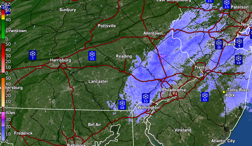
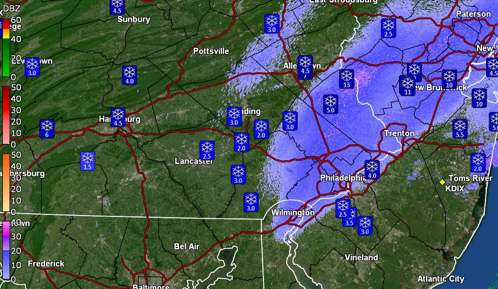
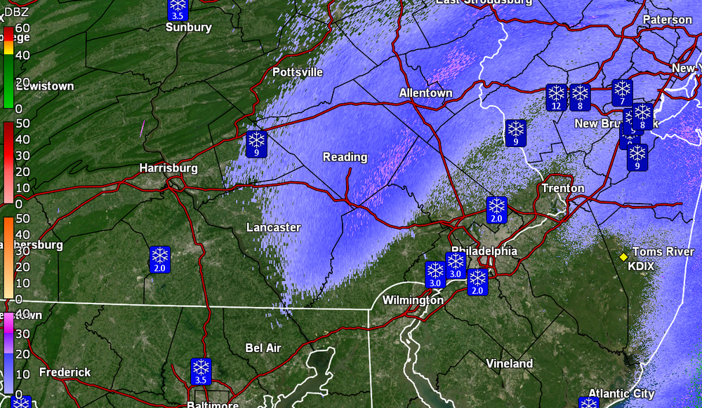
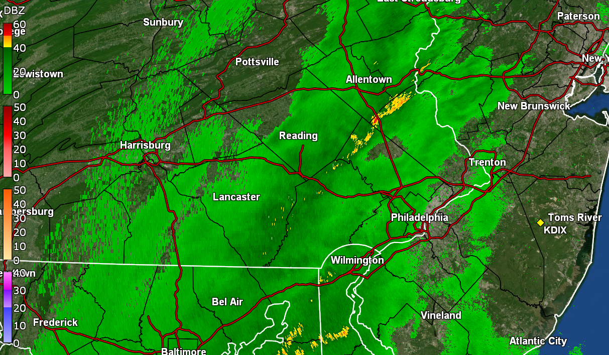
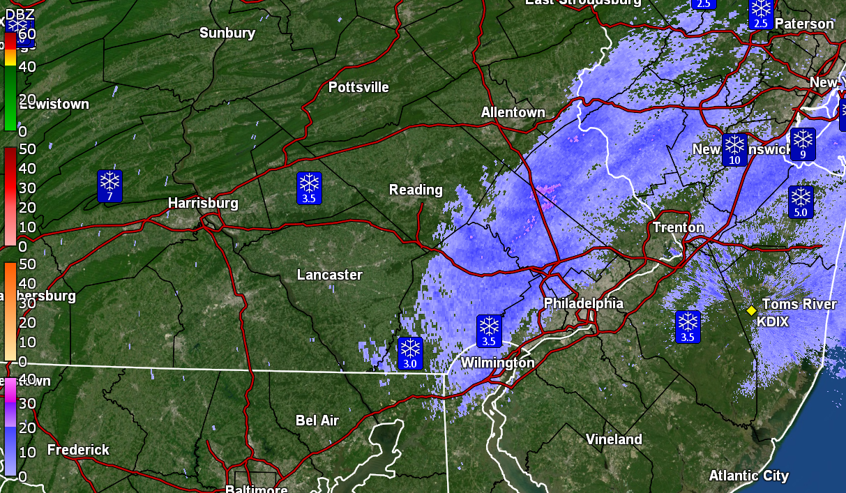
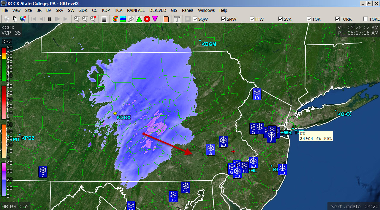
Down to flurries and measured 3.5" of wet snow that is sloughing off the cars and trees/shrubs. This came in "wetter" than I expected as there was all the talk about the high ratio snow ...
 48 minutes ago, RedSky said:
He must live on Macungie mountain too
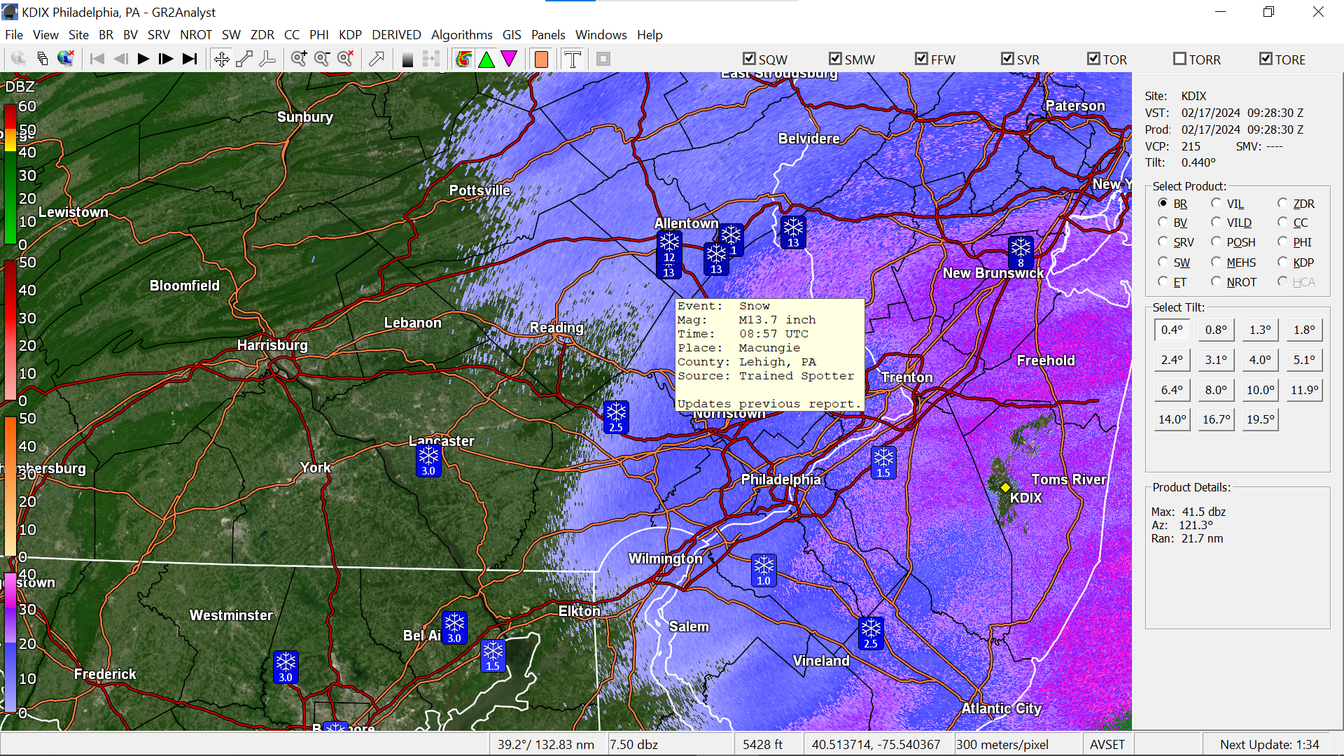
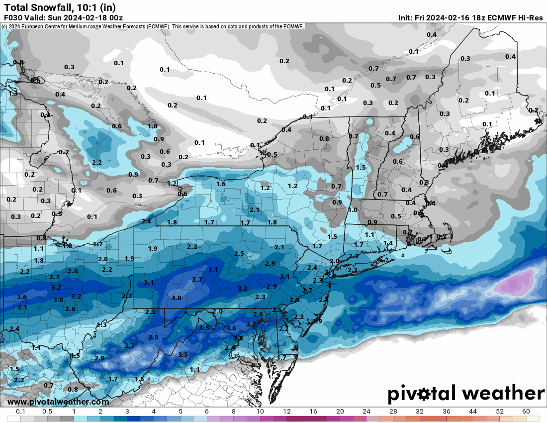
Seems this was a forecasting faux pas with respect to the areas north that got walloped.

Had grabbed a screen shot from about an hour ago that showed a 14" (13.7") total up in Macungie (and there are other 13" reports around the same area).
It's currently 30 IMBY with dp 30.

-
16 minutes ago, RedSky said:
The RAP looks like the hrrrr and anybody have the 18z euro? Not liking the dry frame I saw.

-
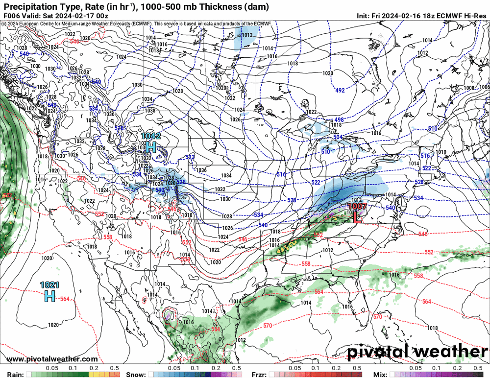
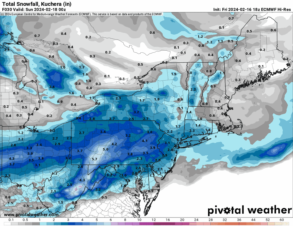
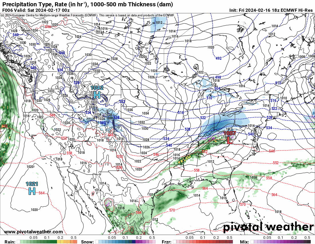
Although obviously not a good short range model, it ran so.... here's the 18z GFS -
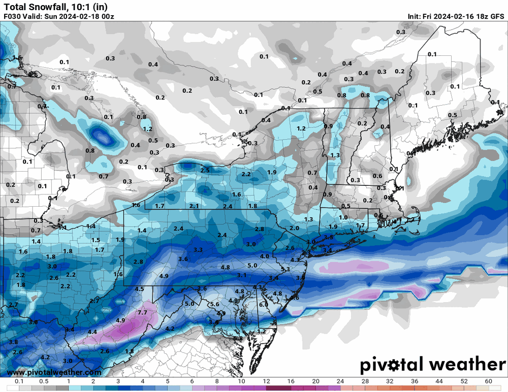
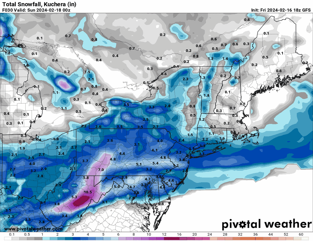
-
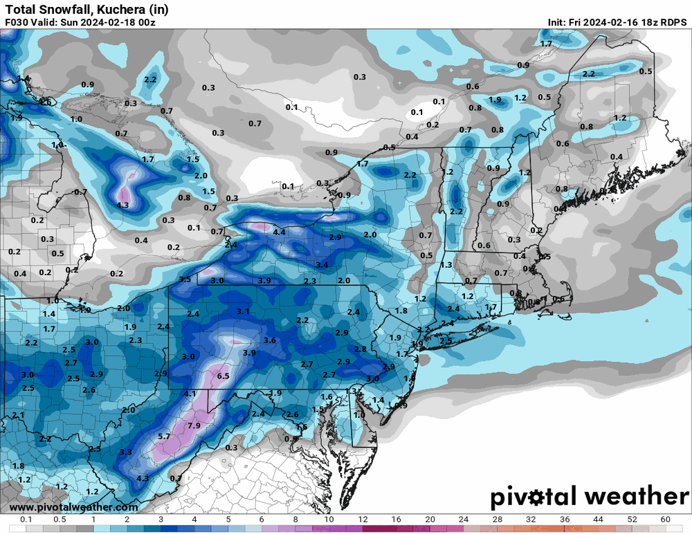
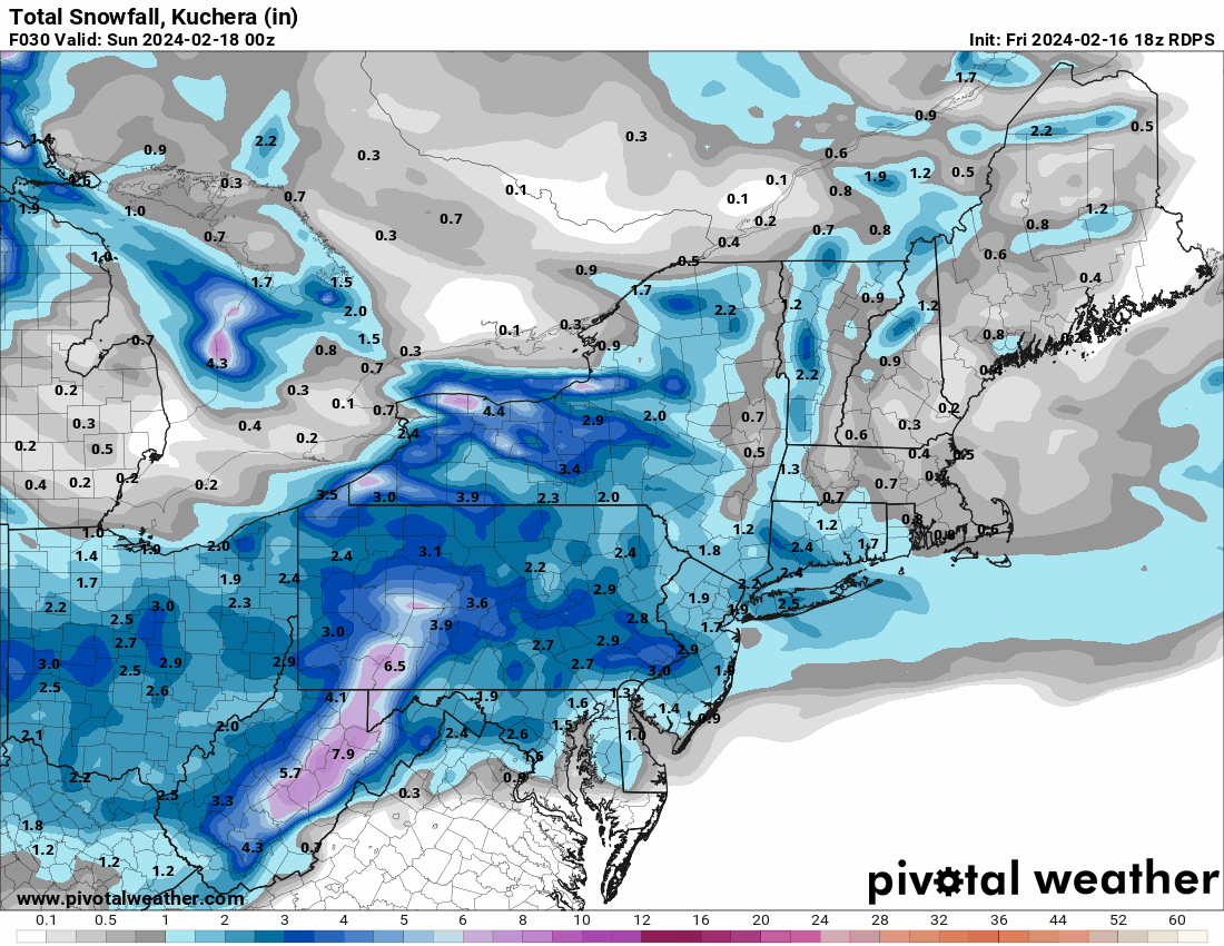
Throwing in the 18z Canadian.

-
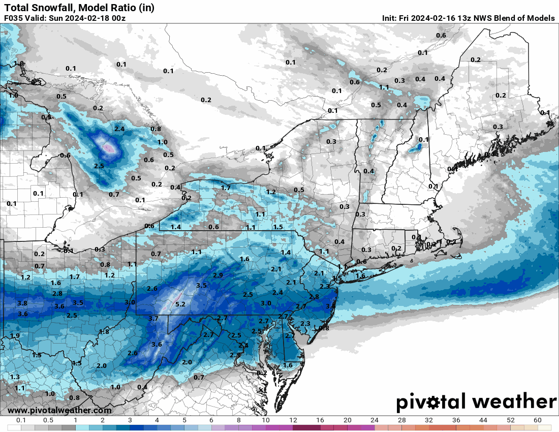
Throwing the 13z NBM in


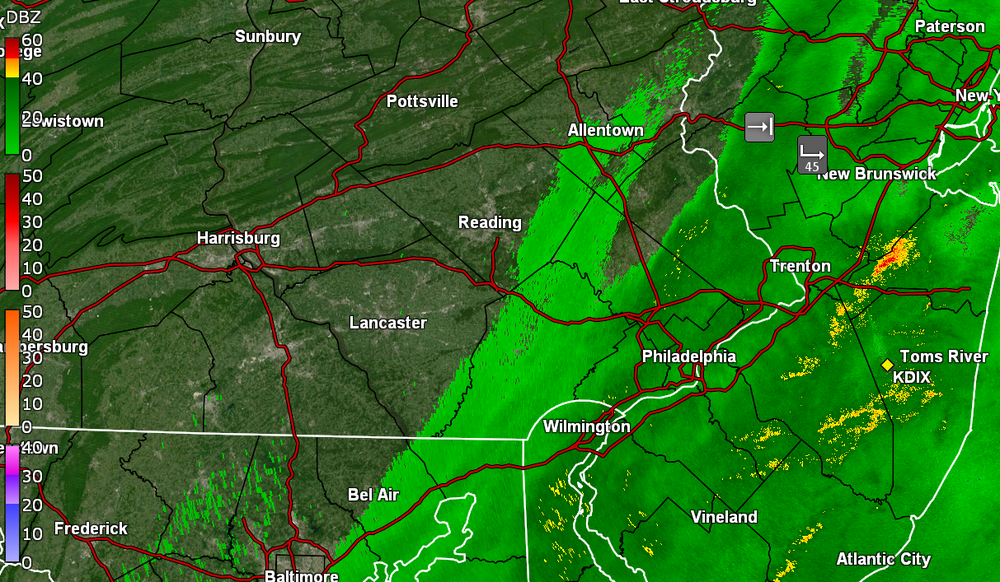
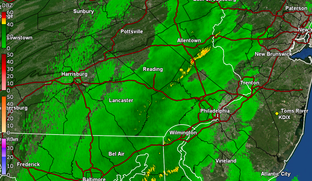
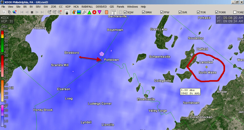
E PA/NJ/DE Winter 2023-2024 OBS/Discussion
in Philadelphia Region
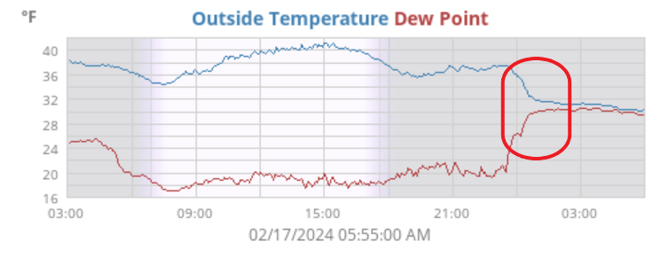
Posted
Cooler air now filtering in. Am down to 48 and falling. Have 0.31" in the bucket (0.40" 2-day), with some light rain and with some kite-flying winds!