Hurricane Agnes
-
Posts
9,261 -
Joined
Content Type
Profiles
Blogs
Forums
American Weather
Media Demo
Store
Gallery
Everything posted by Hurricane Agnes
-
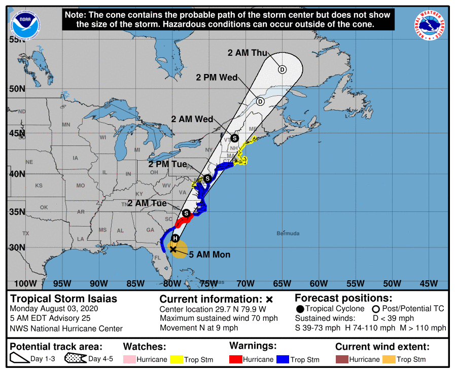
Didn't you guys just get nailed up there yesterday? My low finally settled on 75 before taking off again and am up to 79. Isaias path still holding as of 8 am.

-
Current Hurricane Local Statement - On another note, that cold front means some business believe or not (temps in the upper midwest are down into the 50s this morning) and my "low" for this morning has dropped another degree and is 76, with dp 64. EDIT - temp still dropping and am now down to 75 w/dp 63.
-
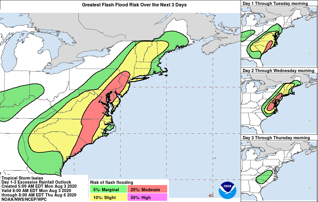
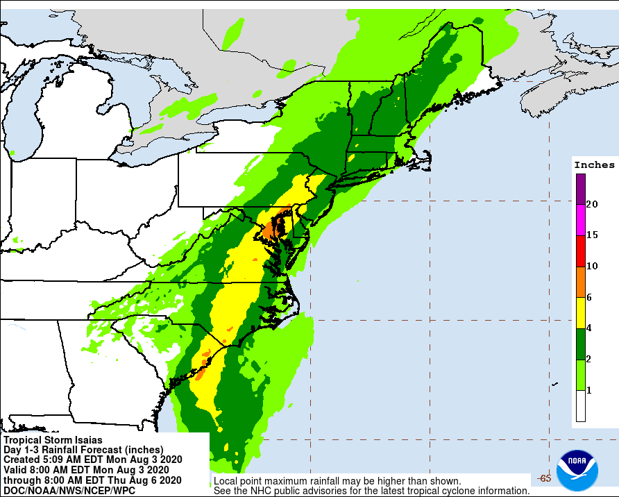
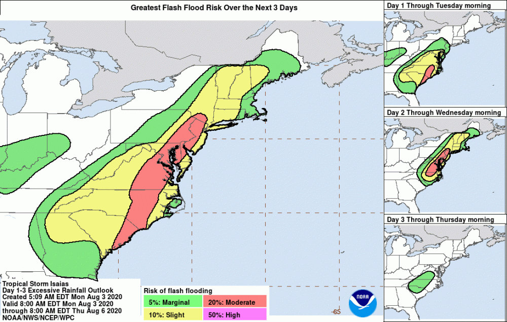
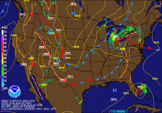
WPC forecast as of this morning (east of D.C. metro gets nailed).
-
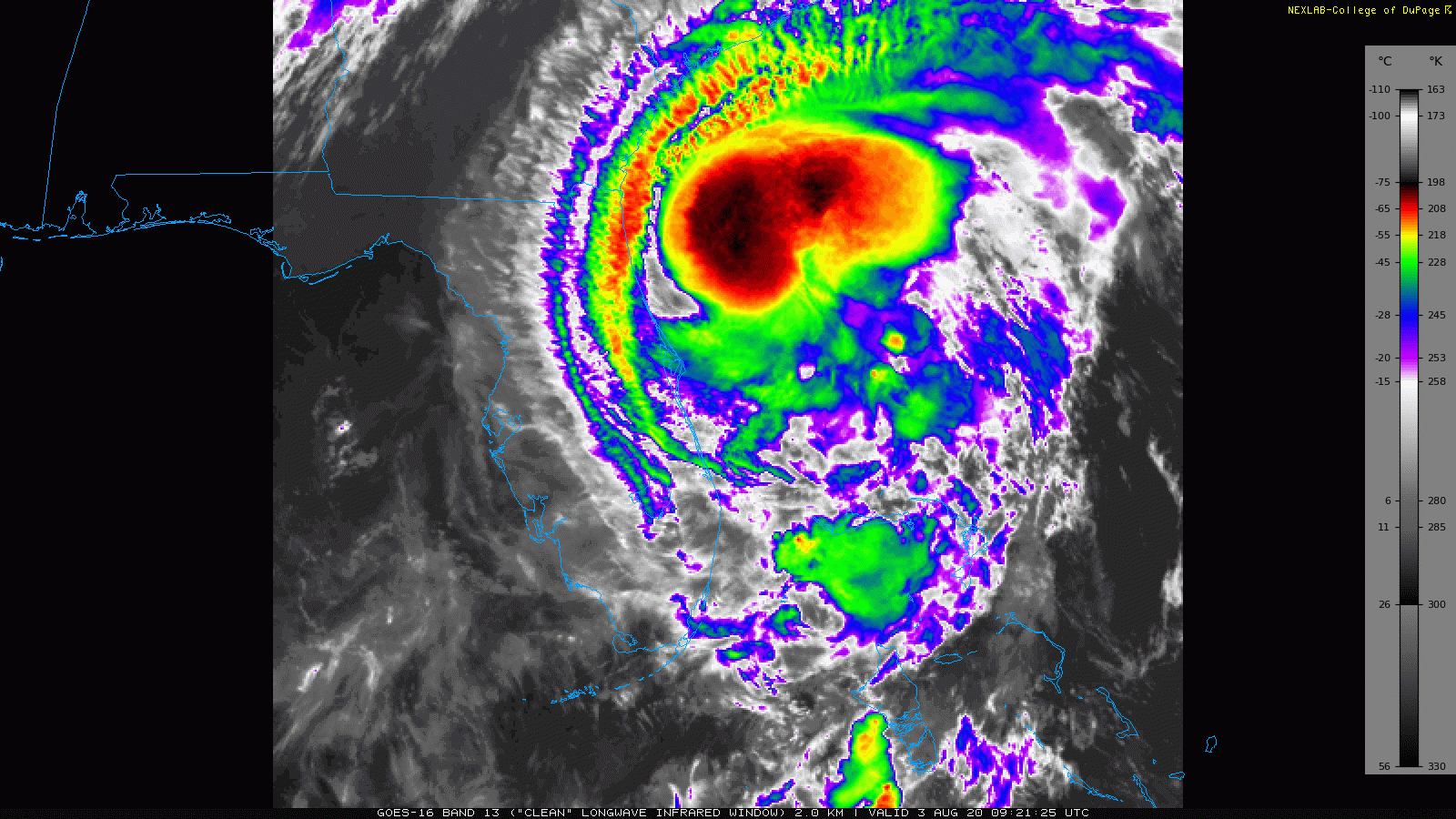
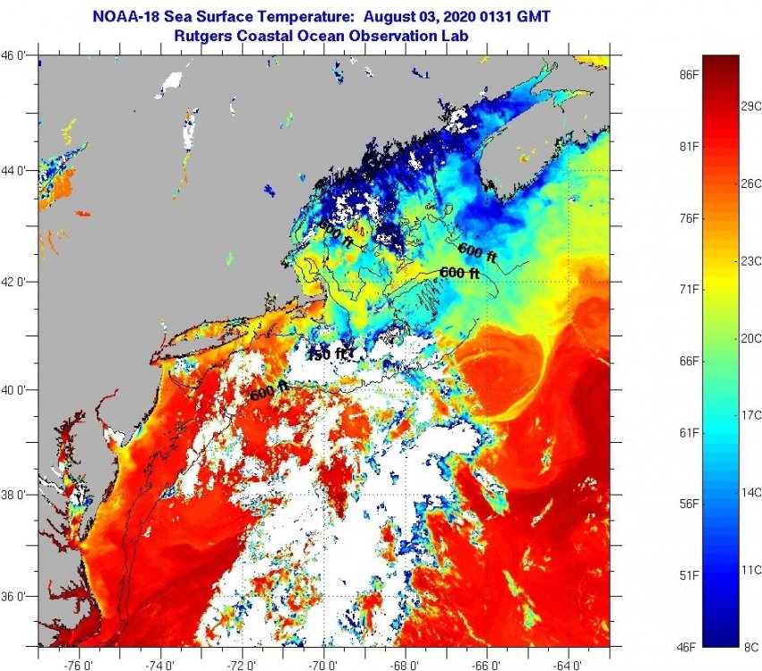
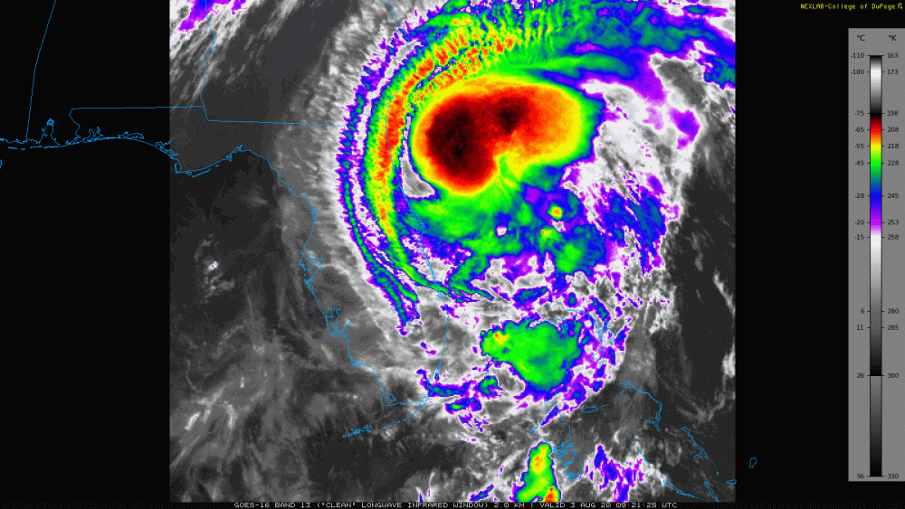
The blobs on the IR are large thunderstorm complexes that are just north of the CoC currently offshore from FL, but the whole thing will eventually go barreling into the Carolinas, and it will depend on whether the thunderstorm complexes hold together as the system moves over land, with respect to how much rain gets wrung out over us (particularly if the ocean fetch feeds it). The SSTs off the coast are back to bathwater levels.
-
Levi's commentary last night (note he had some audio issues so will have to max out your volume to hear him) -
-
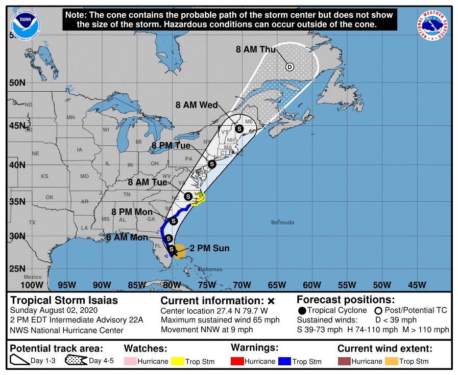
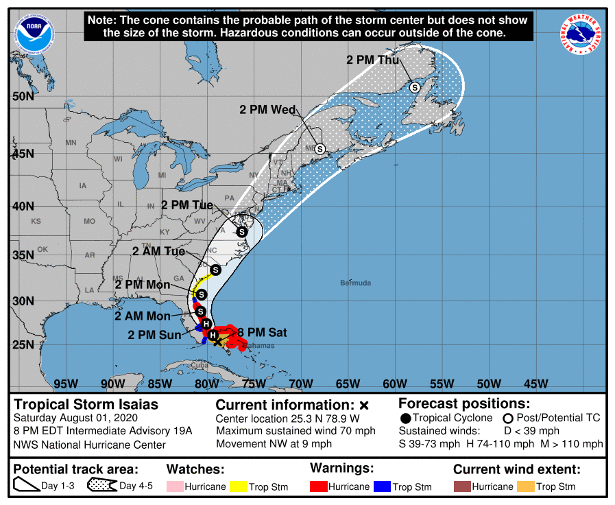
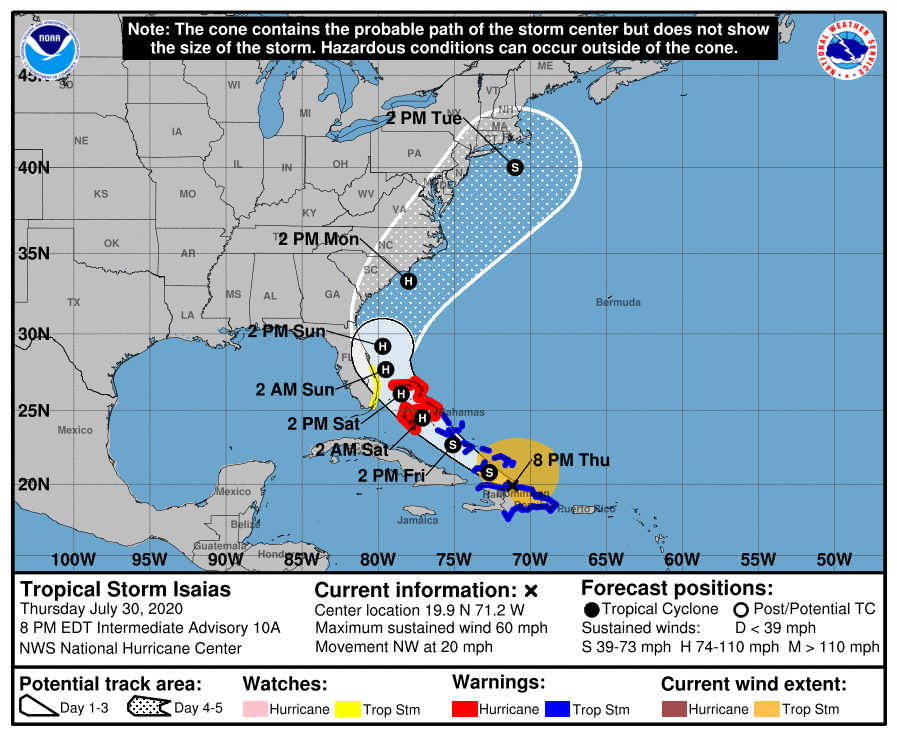
Looks like my low this morning may be 77 and the dp is literally some 10 degrees lower than yesterday, ahead of the cyclone. NHC now has Isaias progged to briefly become a hurricane again with the 5 am update, as it moves into more open water off the coast of Florida. It will depend on what happens to it when it hits the Carolinas regarding any intensity up here around 40 lat.
-
Great shot! You have to be in the right place/angle to get the "anvil" view.
-
Currently down to 86 here with dews still in the 70s, after a high of 93. Isaias still on track...

-
All kinds of stuff has been lofted now including a Tropical Storm Watch (and warning) for the area - Currently 89 and mostly sunny here with a dp of 74.
-
I used to have a half-barrel water garden with 2, 9" comets in it, and Floyd literally caused it to overflow and I had to run out there and keep bailing it out so the fish didn't go over the side! It was a nightmare to drive home from work for that too (let out early). Took several hours due to all the flooding, to do a normal 40 minute afternoon commute. Mt. Holly just hoisted a Flash Flood watch for a large area - Currently mostly sunny, 92 with dp 76. Isaias still on track to barrel through here.
-
Peeped outside and it is brutal. It finally hit 90 here and with a 77 dp, it's sauna.
-
It's been a steam bath this morning although without the sun beating down and temps still below 80, it's not too bad yet. Was just outside and am getting a bit of drizzle. Currently 78 with a dp of 75 and light drizzle. TS Isaias is looking more and more Fay-like and whatever is left is still being set to come through the CWA.
-
Warm front on the move!
-
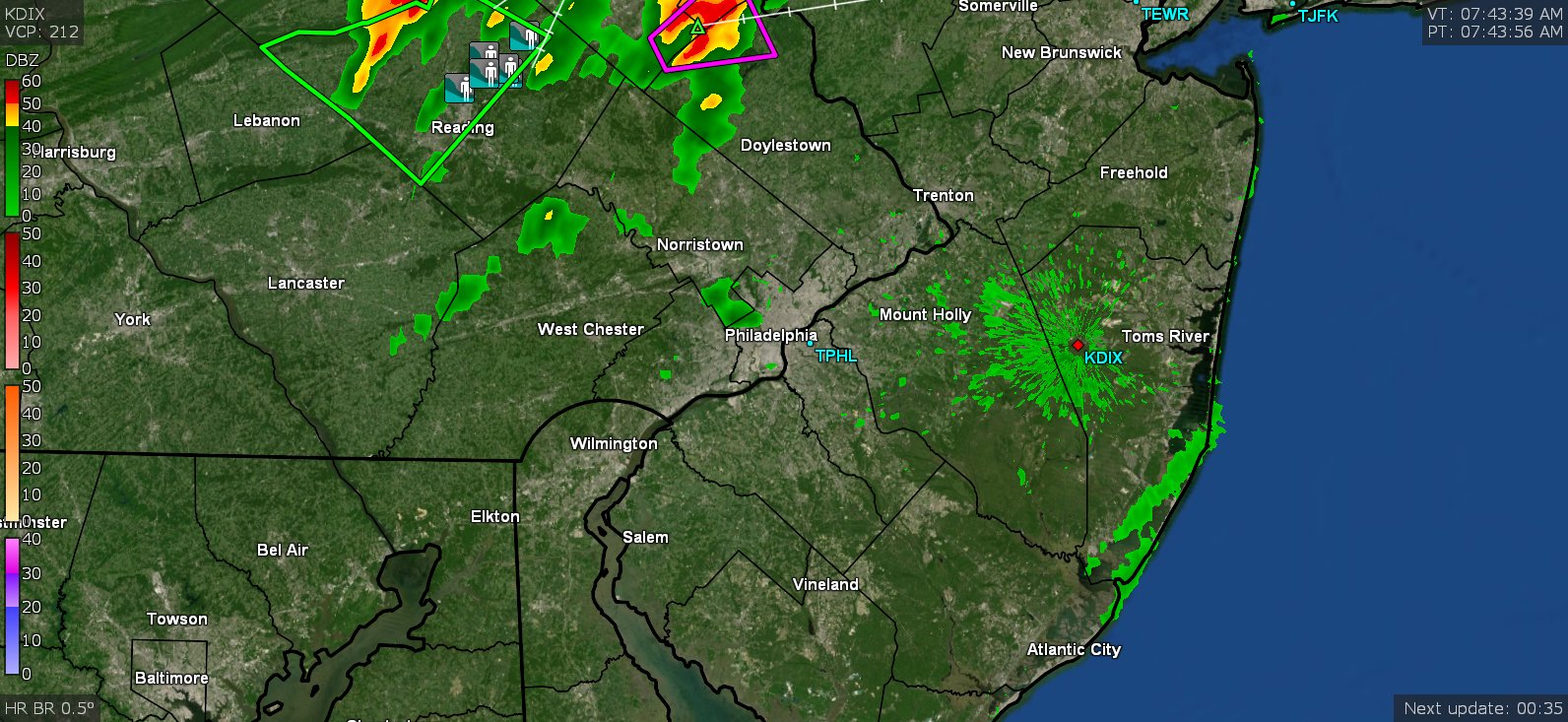
There was even a TOR up there for a bit about 45 minutes ago and a new one just issued. Numerous reports of flooding/water rescues in Berks. Creeks out of their banks.

-
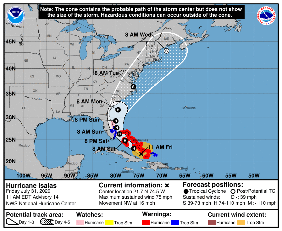
Made it up to 92 today and currently 84 and clouding over. Isaias has weakened to a 70 mph TS at the moment but the 8 pm update track appears to have us bullseyed at the moment.
-
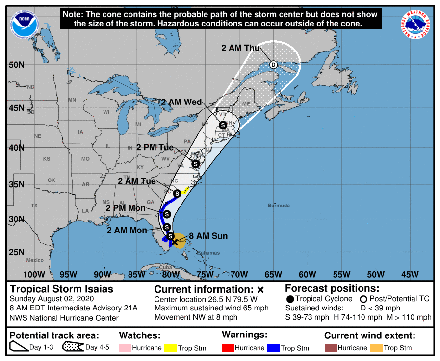
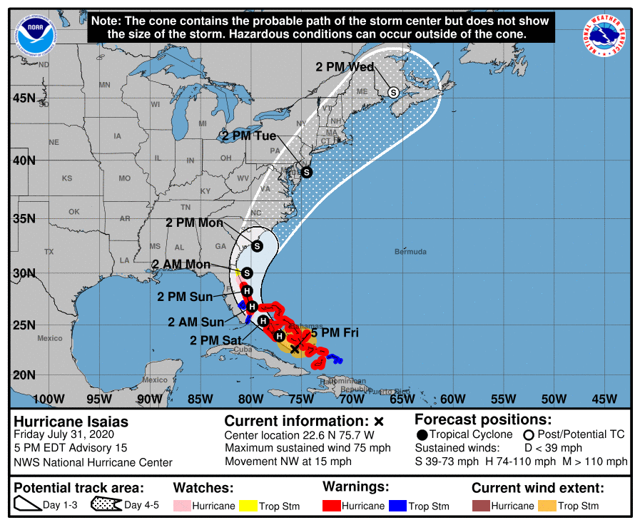
After a "cooler" low of 71 than recently, am edging up and currently at 72 but with dp 70. About 72 hours out, right off the coast of Jersey is bullseye so far for what would be TS Isaias' CoC once it gets up here, but I wouldn't be surprised if more track changes happen. The 8 am update should be in shortly.
-
The overcast cleared about an hour ago just as I was finishing using the oven and the temp outside has responded in kind. Didn't make it to 80 here until around 5 pm. Currently partly sunny and 81 with 69 dewpoint (it was pretty steamy this morning even with the temps in the 70s most of the day). I also noticed the cone is moving back west again too!
-
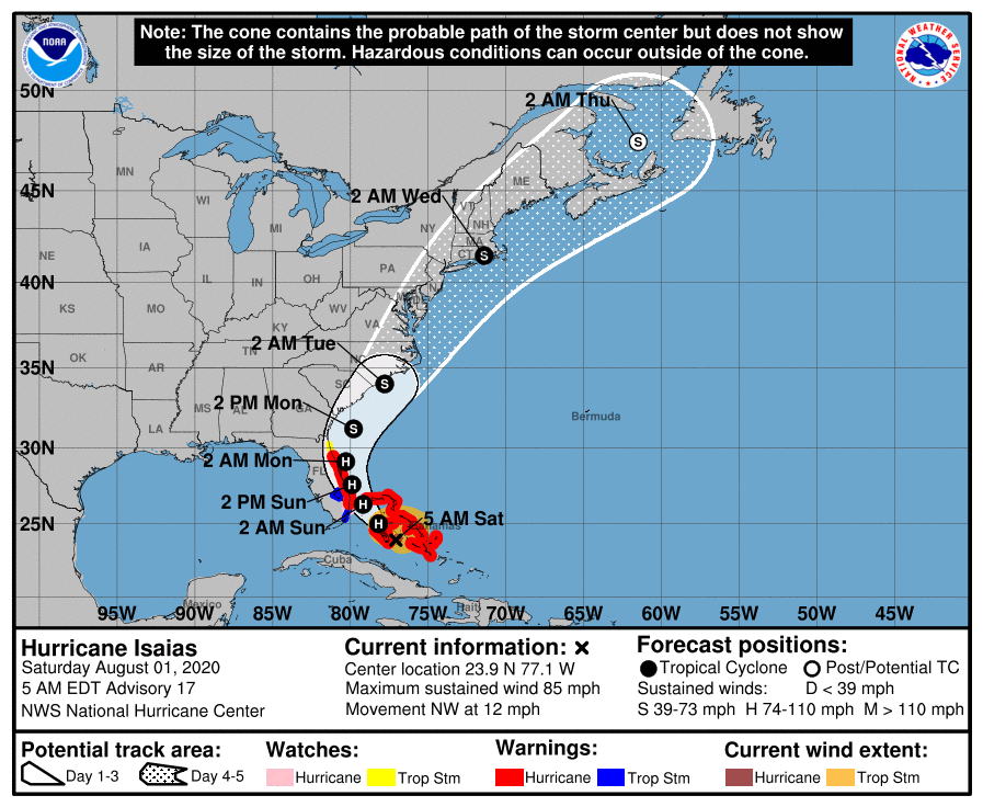
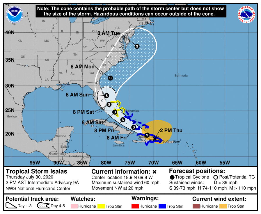
The warnings woke me up last night and there was a good amount of lightning but only 0.01" of rain before midnight here. Have had on and off light spatters later this morning that have amounted to 0.06" so far. After a low of 71, am currently at 75 and overcast. Looks like the models shifted Isaias a tick to the west with the 11 am update.
-
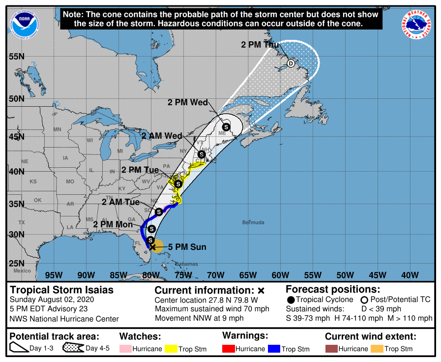
My high ended up edging up one more degree to 96 just after 3 pm and then it clouded over, dropping the temp a few degrees after that. It's currently 84 and overcast. NHC upgraded the forecast for TS Isaias at the 5 pm update, to reach hurricane status as it barrels through the Bahamas. The cone path has steadily moved to the east since the tracking started (maybe dependent on the strength of that Bermuda High and shear). Levi from Tropical Tidbits has an interesting take so far -
-
Just heard Hurricane Schwartz on KYW saying Philly tied the record for 21 days of 90+ temps (am guessing for this month). Here it is currently 95 (my high for the day so far), but at least the dp is 65 and not 75!
-
Have been a tad warmer this morning than yesterday for a low (74 vs 73) but today is expected to be the last day of 90s for a bit. But more interesting is this (will see how TS Isaias evolves over the next couple days) --
-
Made it up to 92 here today and it was somewhat shocking but not unexpected to have the lower dews (mostly in the upper 50s - low 60s today). Currently 85 and clear.
-
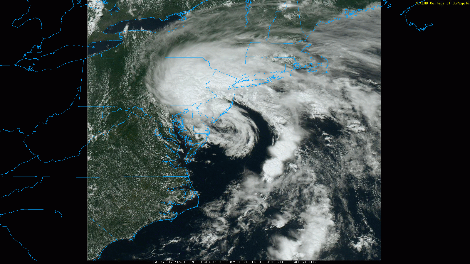
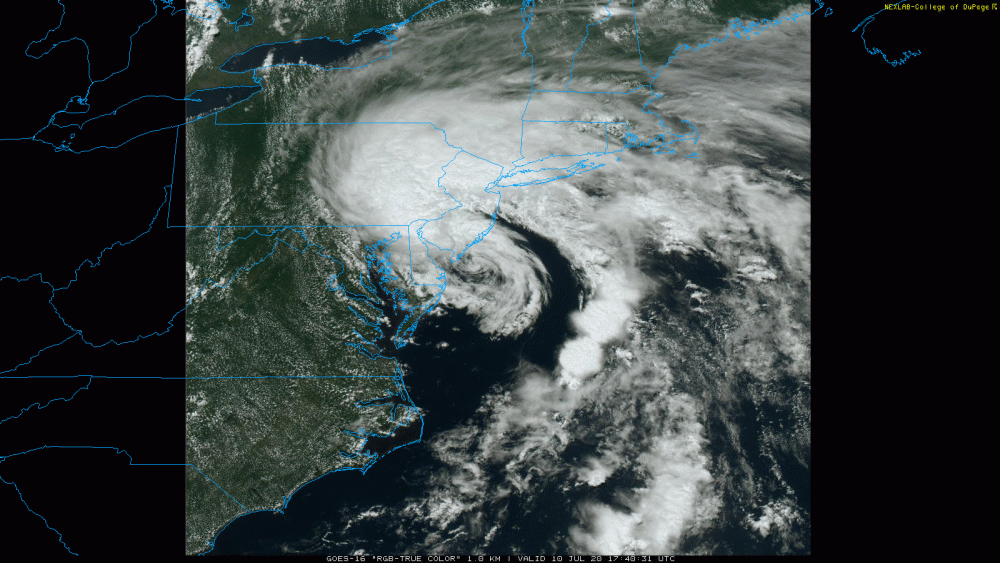
Okay cool. I know Fay was hugging the coast and I was grabbing some snapshots of true color vis. of TS Fay from COD's GOES-East site. This one was from around 1:40 pm as a position reference for you!
-
Nice job! Was that before or after Fay passed by there? I know the SSTs this summer have been pretty amazing although I expect Fay churned some colder water up at some point. As an obs, I did just make it to 94 today but the humidity wasn't as severe as it could have been. Currently 89 and partly cloudy.
-
Hale-Bopp was the be-all end-all because it was still visible for a long time and at some point, both during the day and at night! I still haven't been able to catch Neowise thanks to the damn continual streams of cirrus clouds (in addition to other days when it was rainy/overcast here). Currently at 91 with dp 72 with some fair weather cumulus dotted all around.