
Volcanic Winter
-
Posts
1,515 -
Joined
-
Last visited
Content Type
Profiles
Blogs
Forums
American Weather
Media Demo
Store
Gallery
Posts posted by Volcanic Winter
-
-

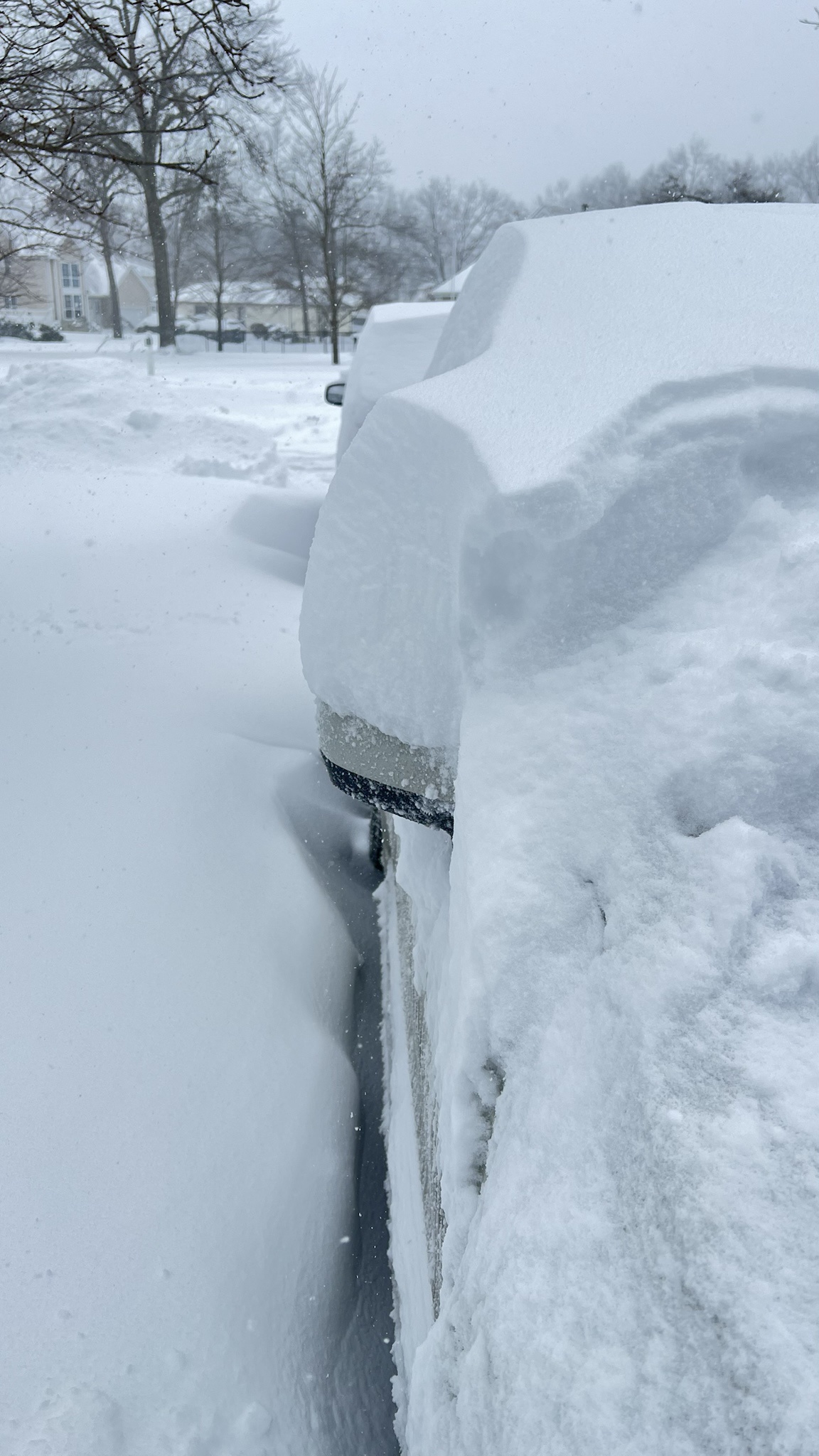
From my house this afternoon.
Absolutely insane.
-
 1
1
-
-
On 3/13/2025 at 6:03 PM, LibertyBell said:
Talk about records-- on this date in March 1990 it was 85 degrees, on this day in March 1888 it was only 6 degrees !
That 6 might be the March monthly record set right after the big blizzard.
The March 1990 temperature of 85 is close to the monthly record, I think it hit 88 the next day?
Continental climate exemplified, subject to the dominant airmass at the time and prone to extremes (I’m talking about NA overall, not Koppen climate zones). We’re lucky though, all things considered. The Chinese coast at our latitude hardly receives any snow, not because of temperature or anything but simply lack of moisture - and there’s no juicy Gulf Stream right offshore ready to amplify storms into bombs.
I know we often bemoan our deck of cards, but it’s really not bad relative to other comparable locations. We don’t have an enormous snowfall average, but we at least can expect snowfall every winter and have the chance at monstrously powerful cold hurricanes that many places will never experience.
I was thinking about this even before your post made me reflect on our climate, but we really do have it kinda cool here.
-
 1
1
-
-
1 hour ago, EastonSN+ said:
Amazing winter down there even if this does not come to fruition. We just have to break out of this 1980s weather pattern, hopefully next year we will see.
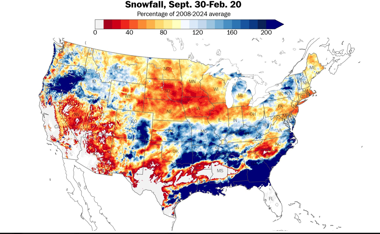
I thought only coastal sections / parts of the Delmarva and VA exceeded climo? I linked a chart from Feb 20th that showed many areas of the MA were still below average, and from reading the MA forum - many weren’t all that thrilled with the snowfall this year.
I mean for sure they appreciated the lasting snow in Jan, as did we - it certainly wasn’t a bad winter for most of them. But it seemed like the repeated snows were mostly odd coastal sections. I’d have to look again, but I certainly didn’t garner the impression it was some blockbuster winter for the broader MA.
-
2
-
-
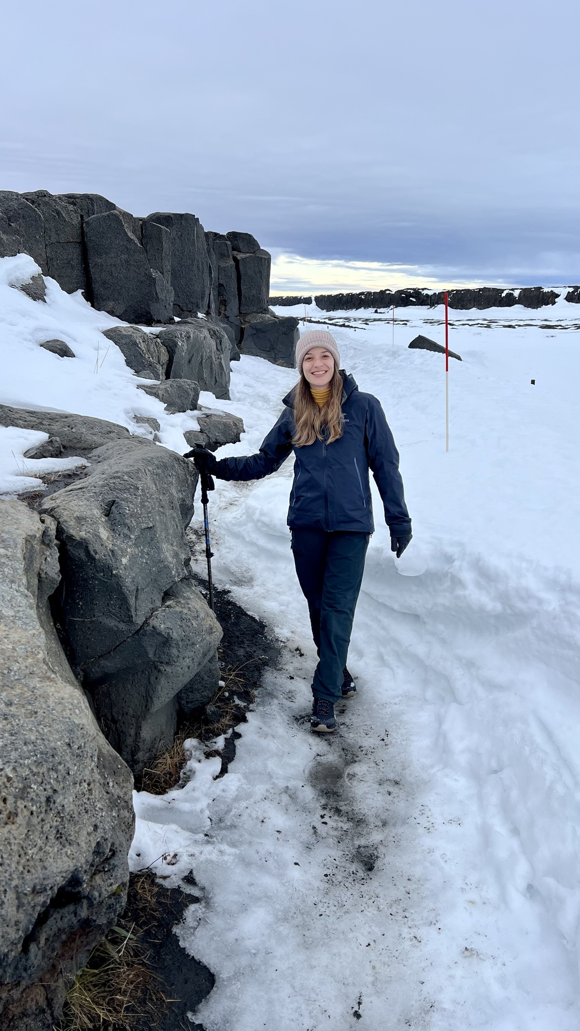
I honestly really enjoyed this winter, especially in relation to the past several. That said, I’m truly someone who loves cold weather - it makes me feel alive and invigorated. I’m an avid winter hiker and outdoor enthusiast, my wife and I mainly travel in the winter to go to snowy places and get outside (injury reasons for both of us sadly are why we don’t ski / snowboard).


That said, I’m really earnestly disappointed we couldn’t cash in on one big region wide storm. It did feel like it was our time, it felt like that last threat was the one, and I allowed myself to get invested even vividly recalling how many recent rug pulls we’ve endured.
It sucks. But at least we had a winter that felt like winter, and snowfall that stayed around and didn’t generally melt the day after in 60 degrees.
Hopefully it’s a sign of things to come going forward if the PDO begins to relax, but we still definitely need Pac help (that damn jet needs Xanax).
Was a pleasure.
-
6
-
 3
3
-
-
-
6
-
-
Down to 13 overnight, don’t think this was forecasted (I saw like 20-22). Good radiative conditions?
-
1
-
-
Northern Ocean Co was a screw zone this winter and a partial screw zone in 2022 in that the early Jan event that gave ACY like a foot down to Cape May gave us nothing but virga with a hard northern cutoff.
This year I have ten inches, storms missed south repeatedly and north.
Thankfully 1/29/22, I had the Jersey jackpot with 16 inches (I think our poster from Barnegat beat me at 18 though, still I’m not complaining). I would be much …pissy-er without that storm. Cold smoke, 22f, windy, … was a good one.
-
Not caught up in our thread yet so forgive me if this has been posted recently, but I saw this and found it interesting (in a painful sort of way
 ):
):
The Delmarva and VA/NC coasts on south really did unbelievably well, not so much inland or north of VA.
-
3
-
-
I now have 10 inches on the season, the upside here is it oddly fell across like 5-6 separate “events” so there were at least several ‘wintry’ days and melt happened way slower than the past few winters.
I’ll take it as someone who loves and appreciates cold weather, winter at least has felt like winter and that counts for something.
This works for me:
-
4
-
1
-
-
Got a nice .25+ so far, had to drive up to EWR to pick my parents up for the airport. Cold, wintry drive!
I’m at, let’s call it 10 inches on the season with today / tonight.
-
3
-
-
Flurries in TR, 26F.
-
1
-
-
4 hours ago, Stormlover74 said:
It's funny you mention that. I was just perusing the great gfs model comeback on Christmas eve morning before the boxing day blizzard of 2010. Everyone should go back and read for fun
Was one of the first old threads I went back and read through when I first signed up at American WX a few years ago. I really think Boxing Day was my favorite storm of all time despite living through multiple HECS. I lived in North Brunswick then which was near one of the maxes in NJ. Especially coming just after the holiday was the perfect chef’s kiss on the whole thing.
Sadly the only big storm I’ve been able to experience live here was 1/29/22 and that was only a real big one for like myself and LI, but was still exciting overall.
-
1
-
-
70ish mph gust went right over my house. Might have been the strongest wind I’ve personally been in my home for.

-
3
-
-
12 minutes ago, Brasiluvsnow said:
Well I just woke up and I am very pleasantly surprised as everything is white including the streets here in New City / Rockland County = I was not expecting anything here but my guess is we could have close to an inch,,,,,,,,If I was not so tired I would go for a walk,,,,,,flakes still coming down lightly but I think this is just about done,,,,congrats on your snow everyone especially South Jersey
So happy this gave many at least something. Do we know totals out of ACY - Cape May? They looked to have been in the heavier bands.
-
1
-
-
1 hour ago, TJW014 said:
Back home, calling it a night. Still a moderate rate of small flakes. Closing in on 5".

What’d you finish up with? I appear to be about 4.75 - 5. I don’t have a perfect measuring surface but that’s a good conservative measurement for me.
-
Just under 5 inches for 9-9.5 inches on the season. Needed this today.
Was a pleasantly steady light to moderate snowfall since 5-6pm last night.
-
3
-
-
11 minutes ago, nycsnow said:
Radar still looks good, and have a nice band over me now in southern Nassau
Yep, and here the WWA was lowered from 3-5 to 2-5, which lately made me think “expect 2 or less” - nah, this has performed nicely for me. In the 4-5 range with snow still to come as the radar still has decent returns for a bit yet.
If only this amplified just a bit more.
-
1
-
-
Around 3+ inches here in inland Toms River. 30F 28Dp.
As is gets me to about 8 on the season.
-
2
-
-
35 minutes ago, CPcantmeasuresnow said:
Just curious who you consider the northern folk to be? NYC?
Yeah, the metro is a large region. “Northern crew” I think Sussex -> east across the LHV and into NYC metro areas of CT. That map as depicted was an improvement for CNJ.
It doesn’t help that nobody can agree on what constitutes NNJ, CNJ, and SNJ either
 . Truly one of the great debates of our time.
-
3
-
-
1 hour ago, The 4 Seasons said:
is that on the map? probably just barely makes it toward the bottom there in Ocean right?
Yeah - Toms River is normally the furthest south marker for the NYC metro and is why Ocean county gets included in the metro maps (you usually see a Toms River marker on media maps but not Brick, Jackson, etc). I live a bit northeast of the marker you have in north / central ocean that’s by itself. Edit- I’m referring to your Feb 8-9th Snow to Mix Storm map.
-
2
-
-
This is amazing, thanks very much!
I’m at about 4.5 inches on the season, Toms River but away from the water & well inland. We’ve been a bit of a snow hole this winter with storms missing both north and south.
-
2
-
-
WSWatch here 4-6, up to 8. Mt Holly went fairly aggressive imo for me, was thinking this would be predominantly south of me but we’ll see.
I’m at 4.5 inches on the season, will this get me to double digits?
-
1
-
-
Very happy for the city, glad they picked up something tonight!
Will probably fare better here on Tues, maybe.
-
1
-
-
4 minutes ago, TJW014 said:
Crazy that I'm no more than 5 miles from you and we haven't had a lick of sleet yet. Sitting at 36.
Where in TR are you? I’m at the Manchester border, inland. Definitely a cold spot in TR and very slightly elevated relative to the rest of the town closer to the bay / river.
My grass is coated in mixy sleet / ice along with our cars, but p-type appears plain rain.

June 2025 discussion-obs: Summerlike
in New York City Metro
Posted
Is it winter yet?