-
Posts
76,099 -
Joined
-
Last visited
Content Type
Profiles
Blogs
Forums
American Weather
Media Demo
Store
Gallery
Posts posted by MJO812
-
-
-
Awful performance by the models even at 6z.
-
 1
1
-
-
Awful performance by the models even at 6z.
-
4 minutes ago, ag3 said:
Loud thunder. What a bust. Looks like rain for a couple hours.
Music to my ears
-
Showers here
-
This week is going to be awful. Good thing is that I will be in A.C on Tuesday working at a polling site.
The park should get to 100 on Tuesday
-
Its getting really dark here
-
Its already 85 degrees here in Brooklyn. Awful.
-
-
Im already sweating
Who the hell likes this crap?
-
 1
1
-
-
Im wearing a hoodie right now
Love this cool weather
-
 1
1
-
 1
1
-
 1
1
-
-
I hope it pours Saturday
-
 1
1
-
 1
1
-
-
-
13 minutes ago, nycwinter said:
time to take my walk wearing my hoodie nice and cool for the start of june..
Mittens ?
-
 1
1
-
-
53 here
Feels like autumn
-
4 minutes ago, Sundog said:
If this was winter the coast would have committed suicide.
That looks like some beautiful wraparound for the interior. Just a classic depiction.
Yep awful bust
Was looking forward to the rain today since I have to work later.
-
 1
1
-
-
-
1 hour ago, winterwarlock said:
Make this garbage weather end...the same week repeating four weeks in a row...we are almost in frickin June
I swear if next week promised sun and 80s gets muted somehow.....
Hope it does
-
 1
1
-
 1
1
-
 1
1
-
-
Any updates ?
Im counting down
-
 1
1
-
-
I want this weather all summer
-
 3
3
-
 2
2
-
-
This weather is awesome
Wish it was colder though
-
 1
1
-
-
This weather is awesome
Wish it was colder though
-
 1
1
-
 3
3
-
 2
2
-
 1
1
-
-
53 here
Wearing a hoodie.
-
 1
1
-
-
This is beautiful weather
-
 1
1
-
 1
1
-
 1
1
-


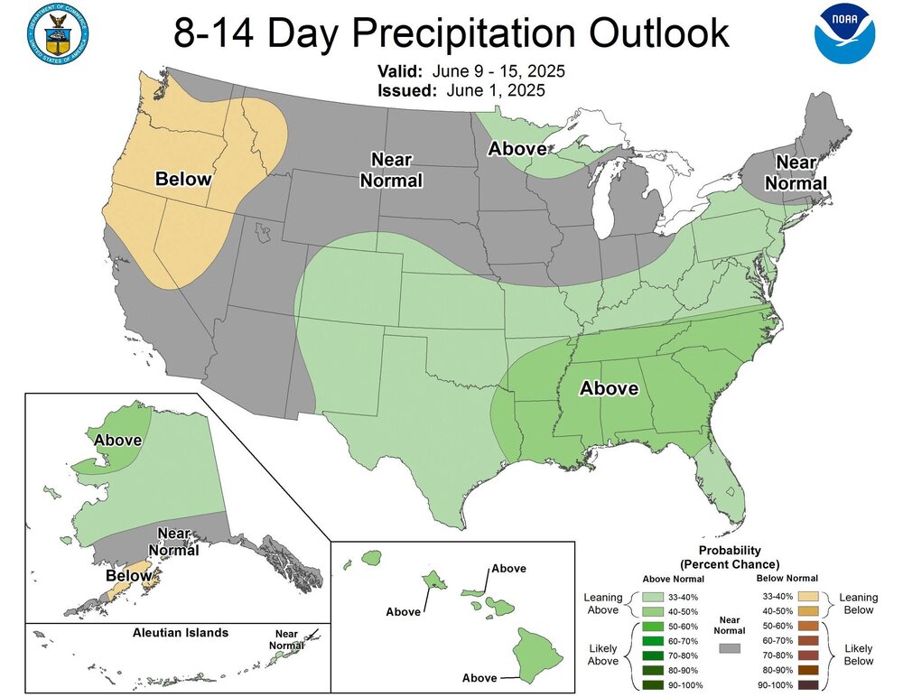
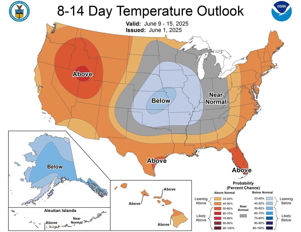
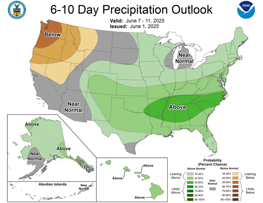
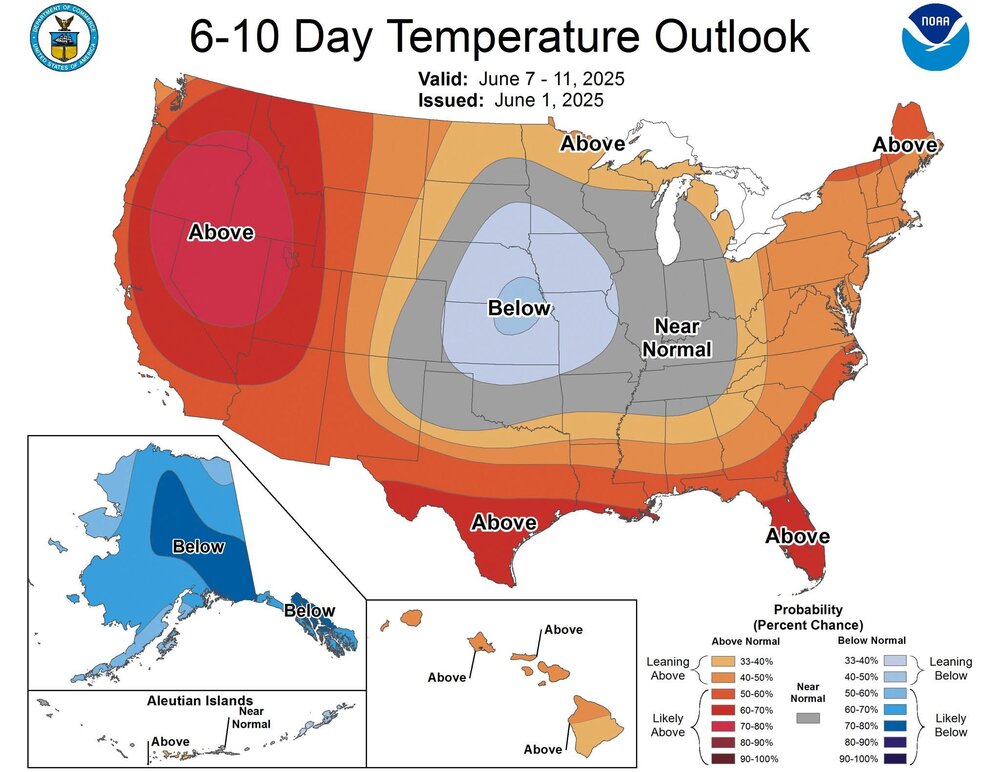
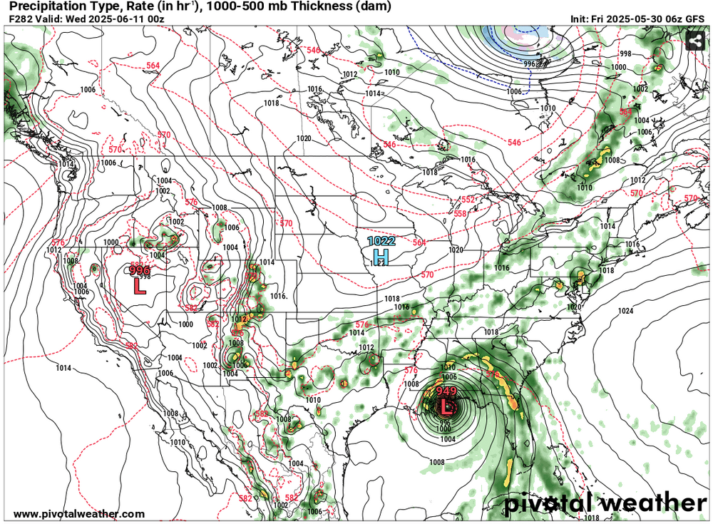
Newark (interiors of NJ/se NYS/CT) Sun-Wed June 22-25 possibly hottest 3-4 day period this year (2025) with 2-4 100F+ days, possibly hottest June daily. NYC probably one 100 deg. HI exceeds 105 interior M-T June 23-24.
in New York City Metro
Posted
95 here