
Beach Snow
-
Posts
219 -
Joined
-
Last visited
Content Type
Profiles
Blogs
Forums
American Weather
Media Demo
Store
Gallery
Everything posted by Beach Snow
-
Mid to Long Range Discussion ~ 2022
Beach Snow replied to buckeyefan1's topic in Southeastern States
Hopefully ensembles are further east…but that NW trend went a little too quick…oh well plenty of time still -
Dumb question but we want the energy to be ejected correct instead of held back?
-
Mid to Long Range Discussion ~ 2022
Beach Snow replied to buckeyefan1's topic in Southeastern States
No only thing is the western mountains range. From charlotte east it’s new -
Mid to Long Range Discussion ~ 2022
Beach Snow replied to buckeyefan1's topic in Southeastern States
Agree quite a few so the OP seems to Somewhat of an outlier -
Mid to Long Range Discussion ~ 2022
Beach Snow replied to buckeyefan1's topic in Southeastern States
Ensemble not terrible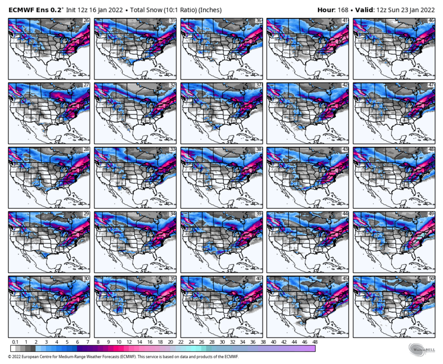

-
January 20-22 “bring the mojo” winter storm threat
Beach Snow replied to lilj4425's topic in Southeastern States
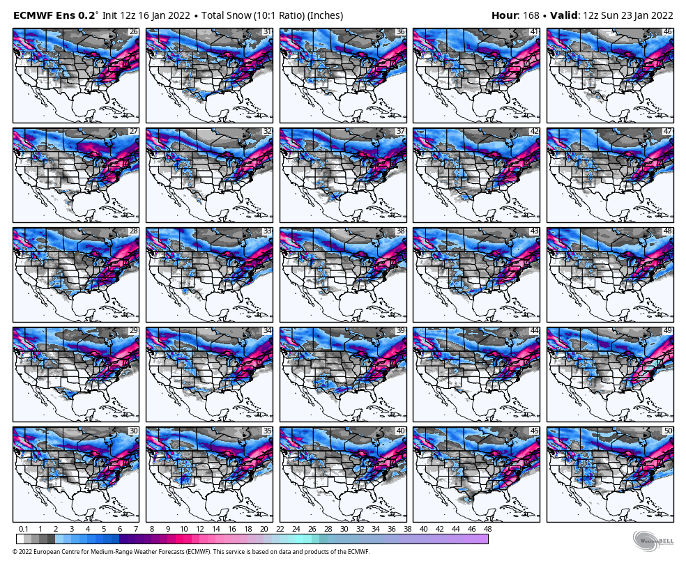
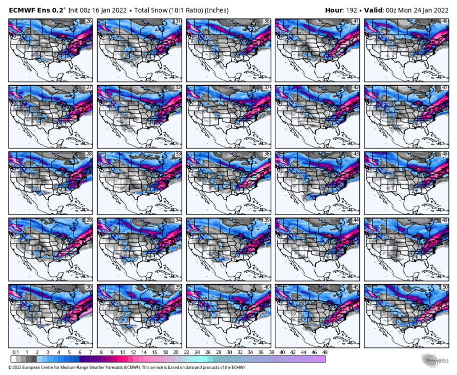
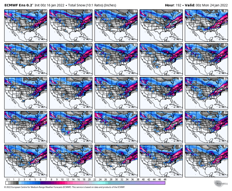
Individual members

-
January 20-22 “bring the mojo” winter storm threat
Beach Snow replied to lilj4425's topic in Southeastern States
Euro ensemble not terrible
-
January 20-22 “bring the mojo” winter storm threat
Beach Snow replied to lilj4425's topic in Southeastern States
Very little just on Obx like UK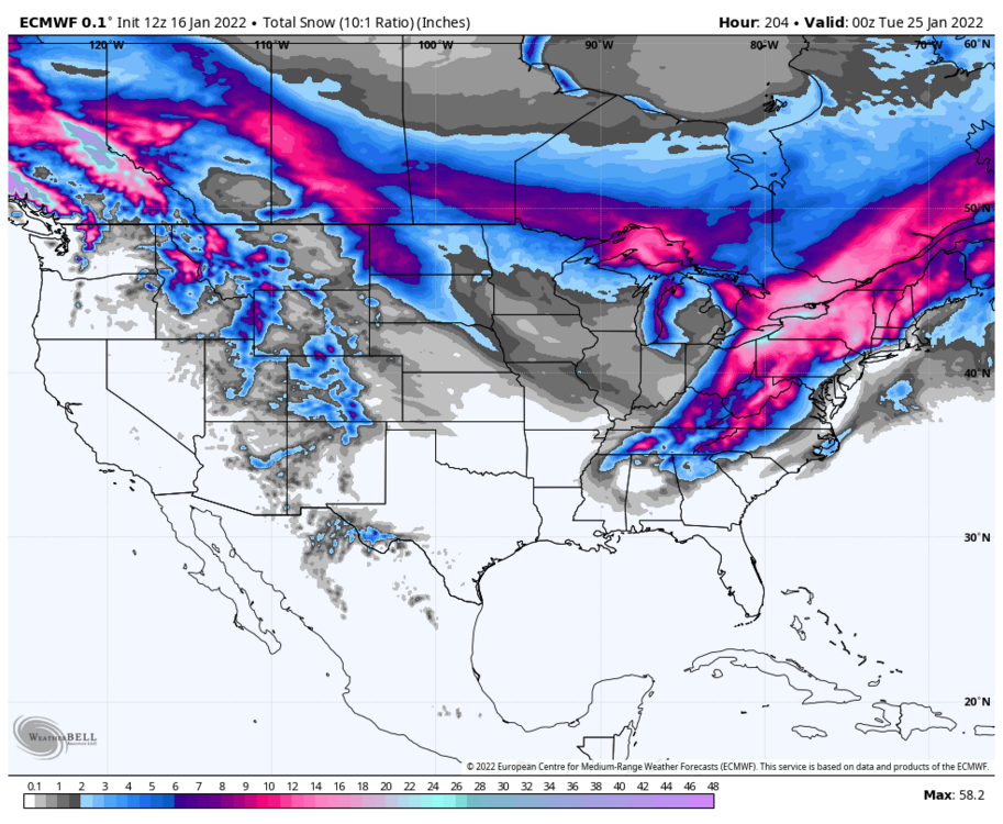
-
January 20-22 “bring the mojo” winter storm threat
Beach Snow replied to lilj4425's topic in Southeastern States
Agree, still promising the Canadian has the storm it didn’t too bad on todays storm. Would like to see GFS come back at 18z -
January 20-22 “bring the mojo” winter storm threat
Beach Snow replied to lilj4425's topic in Southeastern States
Out to 141 so far doesn’t look like it’s going to do it…. Comparing to 0z it’s very suppressed -
January 20-22 “bring the mojo” winter storm threat
Beach Snow replied to lilj4425's topic in Southeastern States
Tuesday 0z should be some good tracking and trends to watch if she holds. -
January 20-22 “bring the mojo” winter storm threat
Beach Snow replied to lilj4425's topic in Southeastern States
Excellent point we saw how much the current storm trended NW on the GFS. -
January 20-22 “bring the mojo” winter storm threat
Beach Snow replied to lilj4425's topic in Southeastern States
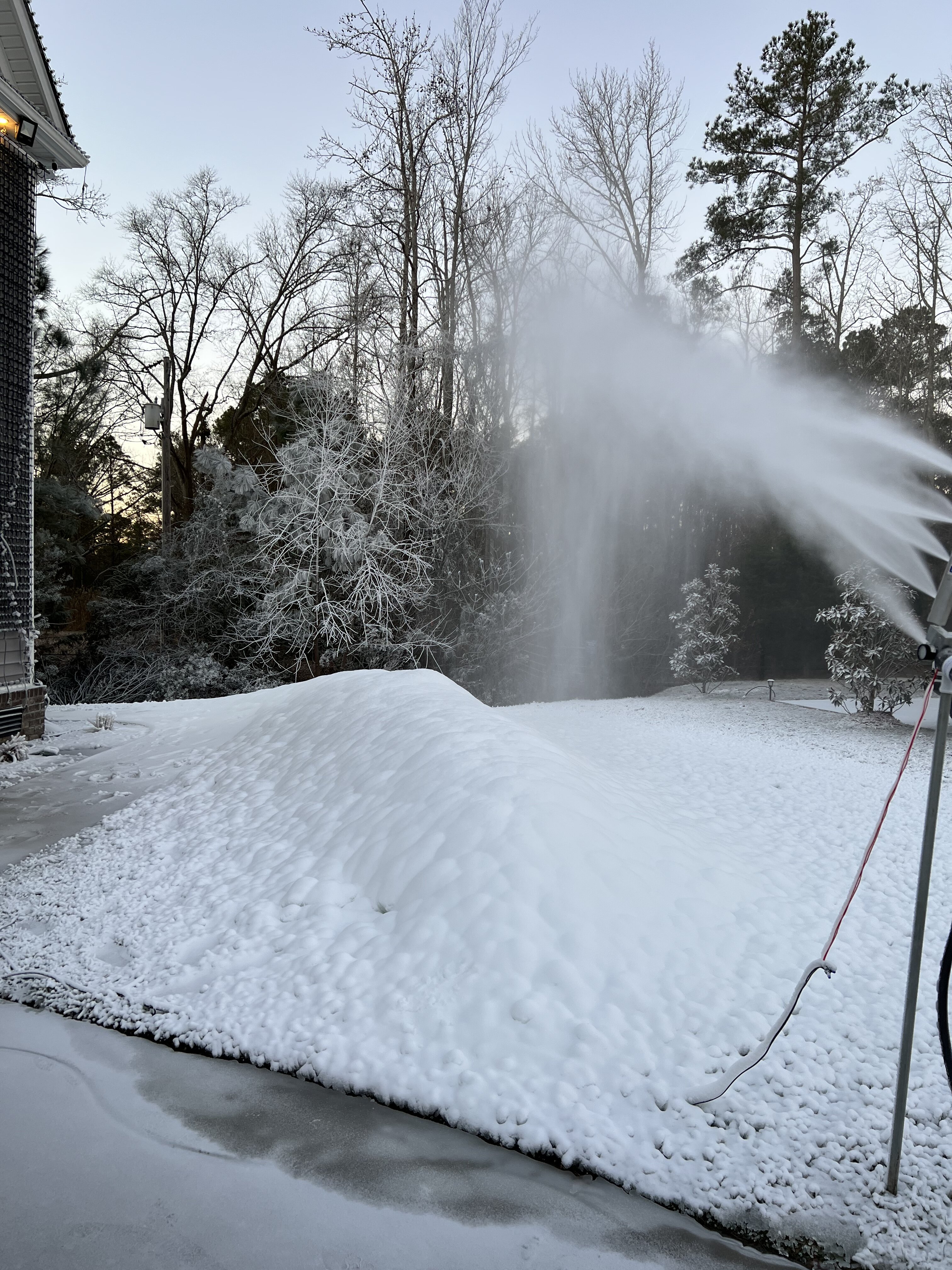
Canadian goes Boom!! Wow will post map in second -
Mid to Long Range Discussion ~ 2022
Beach Snow replied to buckeyefan1's topic in Southeastern States
Yup it’s Gone but sometimes they will loose the storm and bring them back within 4 days so really need to see the models pick the storm up again tomorrow and Tuesday or it may just have been a fantasy.. edit- looks like it’s delayed to Sunday/Monday vs Friday/ Saturday not a met so can’t tell -
Mid to Long Range Discussion ~ 2022
Beach Snow replied to buckeyefan1's topic in Southeastern States
Looking at GFS and EURO the consistency was there from about 120 hours from every model run forward with the current storm. Wouldn’t mind being in the bullseyes once we get in within 120 hours. Might be able to seriously track it after todays 12z or 0z tomorrow if they keep showing the signal for a storm. -
Mid to Long Range Discussion ~ 2022
Beach Snow replied to buckeyefan1's topic in Southeastern States
Only good thing so far is GFS and Euro are suppressed to the SE. gives some roof for the NW trend that we know will happen -
Mid to Long Range Discussion ~ 2022
Beach Snow replied to buckeyefan1's topic in Southeastern States
We already have a thread opened up -
Mid to Long Range Discussion ~ 2022
Beach Snow replied to buckeyefan1's topic in Southeastern States
-
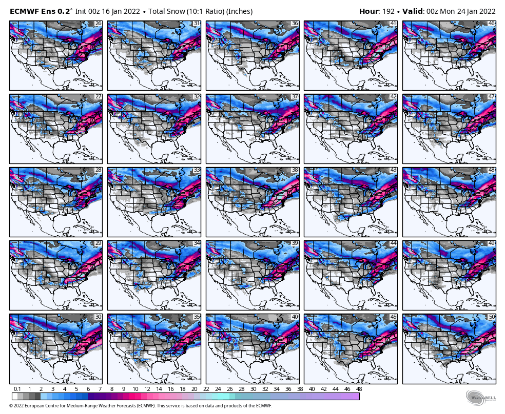
Mid to Long Range Discussion ~ 2022
Beach Snow replied to buckeyefan1's topic in Southeastern States
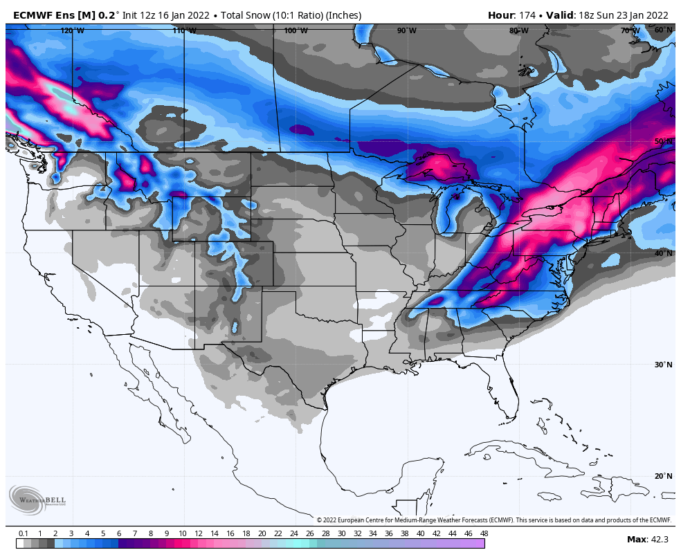
Compared to 12z it’s a large increase in snow on the mean -
Mid to Long Range Discussion ~ 2022
Beach Snow replied to buckeyefan1's topic in Southeastern States
-
Mid to Long Range Discussion ~ 2022
Beach Snow replied to buckeyefan1's topic in Southeastern States
So far ICON lost the storm and GFS is more south east but still has the storm and some snow in SC and NC but slides off the coast with little impact. This is good gives us room on inevitable NW trend. -
January 20-22 “bring the mojo” winter storm threat
Beach Snow replied to lilj4425's topic in Southeastern States
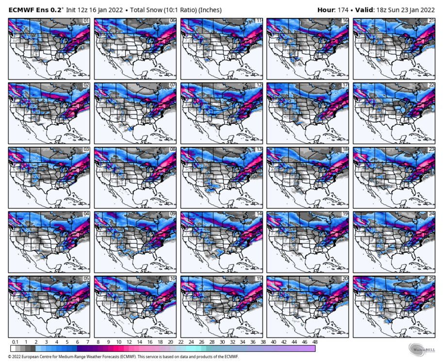
For what it’s worth 18z GFS came in with a monster snow storm. 12z nothing. Now the Euro, GEM, ICON and GFS showing same solution! -
January 20-22 “bring the mojo” winter storm threat
Beach Snow replied to lilj4425's topic in Southeastern States
I hope it’s the biggest snowstorm in history -
January 20-22 “bring the mojo” winter storm threat
Beach Snow replied to lilj4425's topic in Southeastern States
Hahaha me too! -
January 20-22 “bring the mojo” winter storm threat
Beach Snow replied to lilj4425's topic in Southeastern States
Too early for that or it’ll be a cutter up the Ohio valley