
Beach Snow
-
Posts
219 -
Joined
-
Last visited
Content Type
Profiles
Blogs
Forums
American Weather
Media Demo
Store
Gallery
Everything posted by Beach Snow
-
January 20-22 “bring the mojo” winter storm threat
Beach Snow replied to lilj4425's topic in Southeastern States
Icon shows a great storm and actually trended east from 18z a good bit -
January 20-22 “bring the mojo” winter storm threat
Beach Snow replied to lilj4425's topic in Southeastern States
Thank you for the disco! Super helpful for us map readers!! -
January 20-22 “bring the mojo” winter storm threat
Beach Snow replied to lilj4425's topic in Southeastern States
MA guys are probably going nuts. NAM drops 4-8” Thursday night before we even see the weekend storm…sheesh -
January 20-22 “bring the mojo” winter storm threat
Beach Snow replied to lilj4425's topic in Southeastern States
Can’t tell too much but definitely looks more like euro than GFS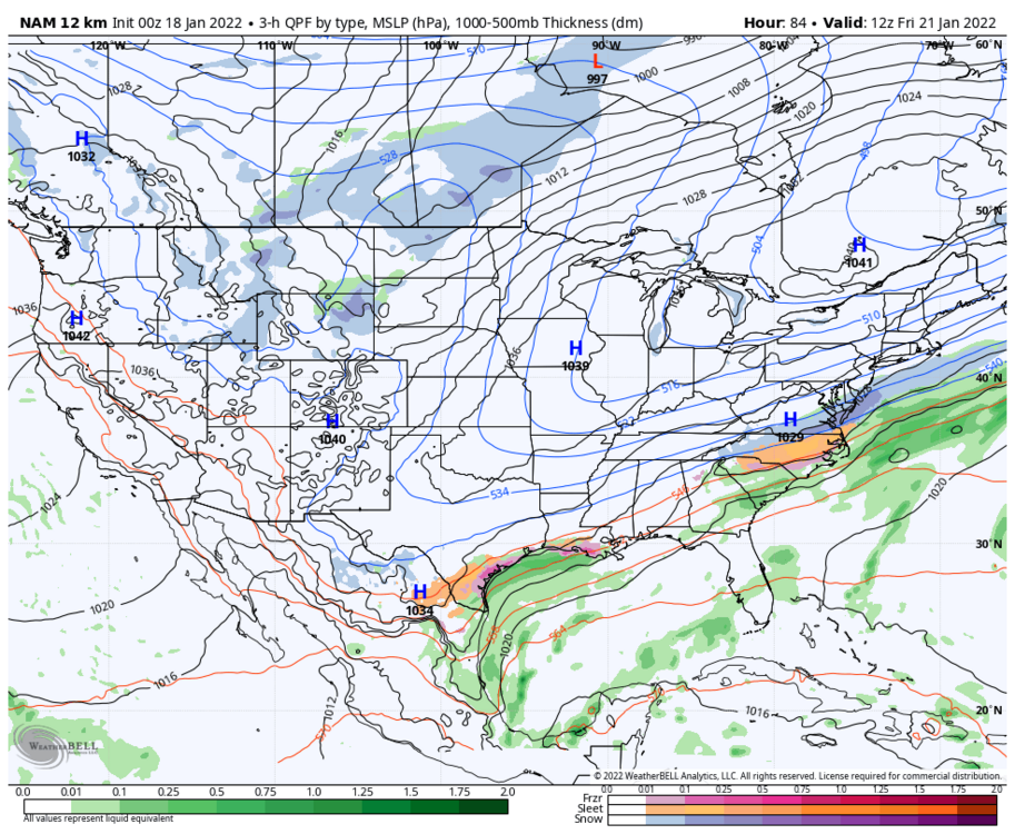
-
January 20-22 “bring the mojo” winter storm threat
Beach Snow replied to lilj4425's topic in Southeastern States
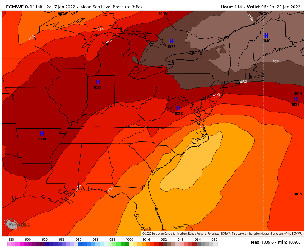
And the euro comes back south and east -
January 20-22 “bring the mojo” winter storm threat
Beach Snow replied to lilj4425's topic in Southeastern States
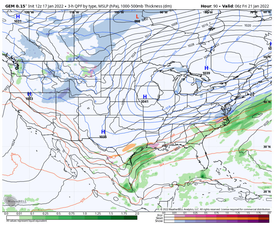
Only goes out to hr 90 for ice and sleet maps -
January 20-22 “bring the mojo” winter storm threat
Beach Snow replied to lilj4425's topic in Southeastern States
Still 20ish or so members showing a more southern solution…i think the NW solutions are such big hits is why the mean jumped so far NW. maybe i could be reading them wrong.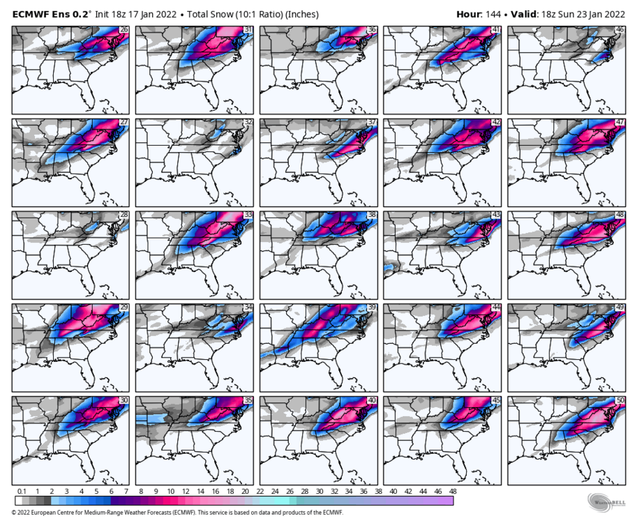
-
January 20-22 “bring the mojo” winter storm threat
Beach Snow replied to lilj4425's topic in Southeastern States
Not good trends at all, really need the Canadian to hold its ground or maybe we see a Euro GFS blend? Really hoping euro is too amped -
Yup, if 18z euro is right that was nail in the coffin…huge shift NW
-
January 20-22 “bring the mojo” winter storm threat
Beach Snow replied to lilj4425's topic in Southeastern States
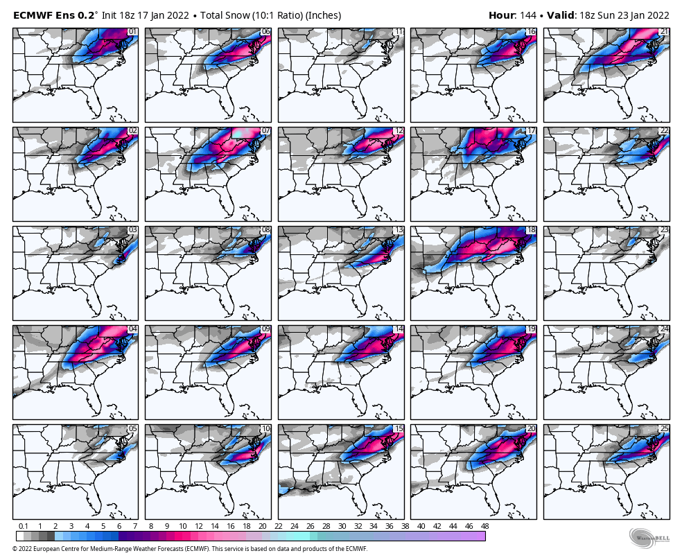
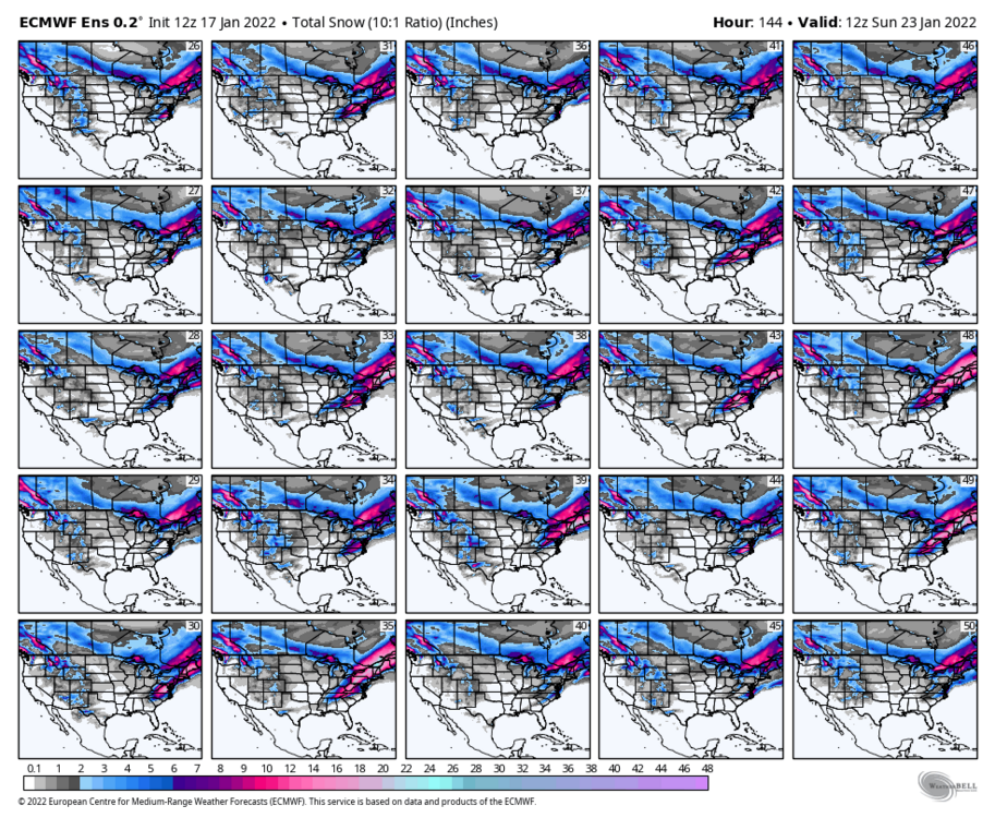
I’ll post ensemble snow maps when they roll out -
January 20-22 “bring the mojo” winter storm threat
Beach Snow replied to lilj4425's topic in Southeastern States
18Z GFS second wave for Sunday is SE of 12z -
January 20-22 “bring the mojo” winter storm threat
Beach Snow replied to lilj4425's topic in Southeastern States
18z GFS separating the 2 systems. -
January 20-22 “bring the mojo” winter storm threat
Beach Snow replied to lilj4425's topic in Southeastern States
Yea looks like it shifted access more NW similar to Euro, or maybe just expanded precipitation coverage -
January 20-22 “bring the mojo” winter storm threat
Beach Snow replied to lilj4425's topic in Southeastern States
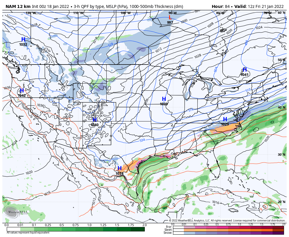
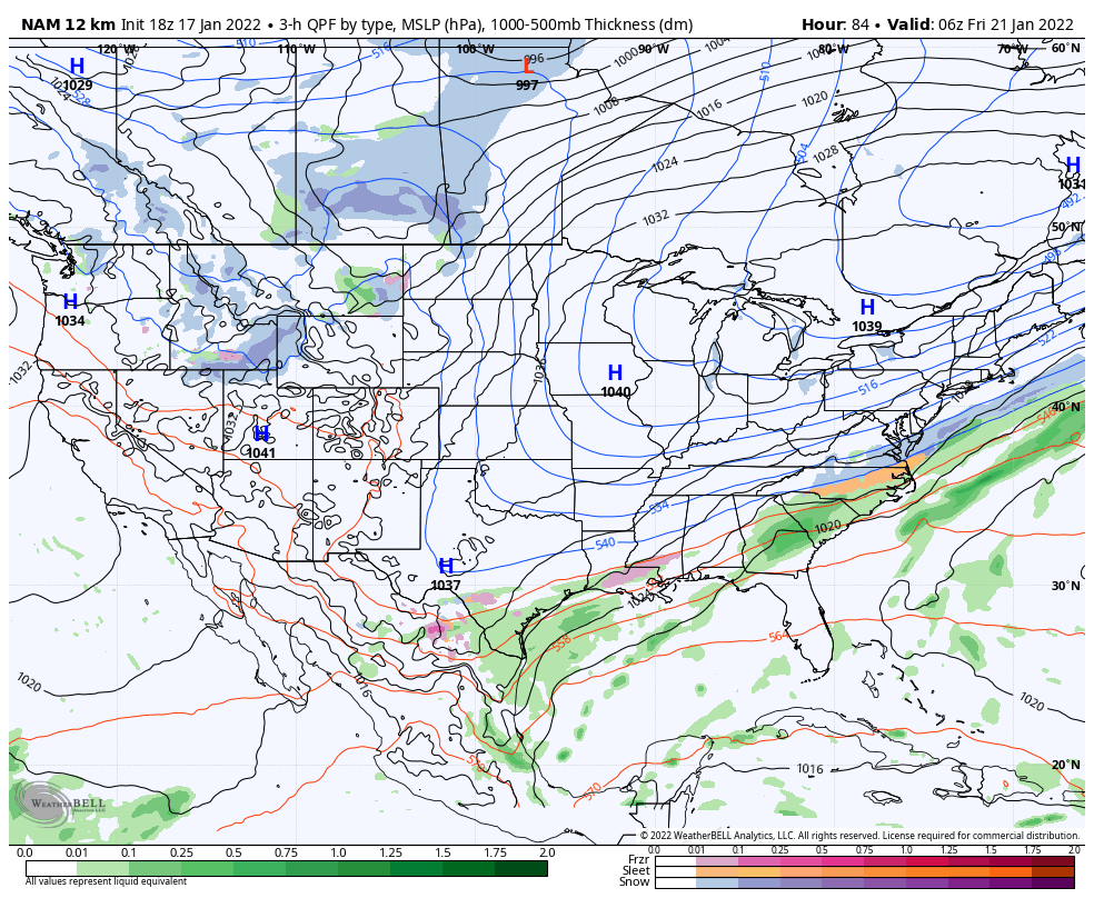
Fwiw the 18z NAM has almost the exact same surface map as the Canadian does at 84hrs….yes yes i know it’s the NAM
-
January 20-22 “bring the mojo” winter storm threat
Beach Snow replied to lilj4425's topic in Southeastern States
Agree, but the further east the low is less likely the 850s creep inland…i think.
-
January 20-22 “bring the mojo” winter storm threat
Beach Snow replied to lilj4425's topic in Southeastern States
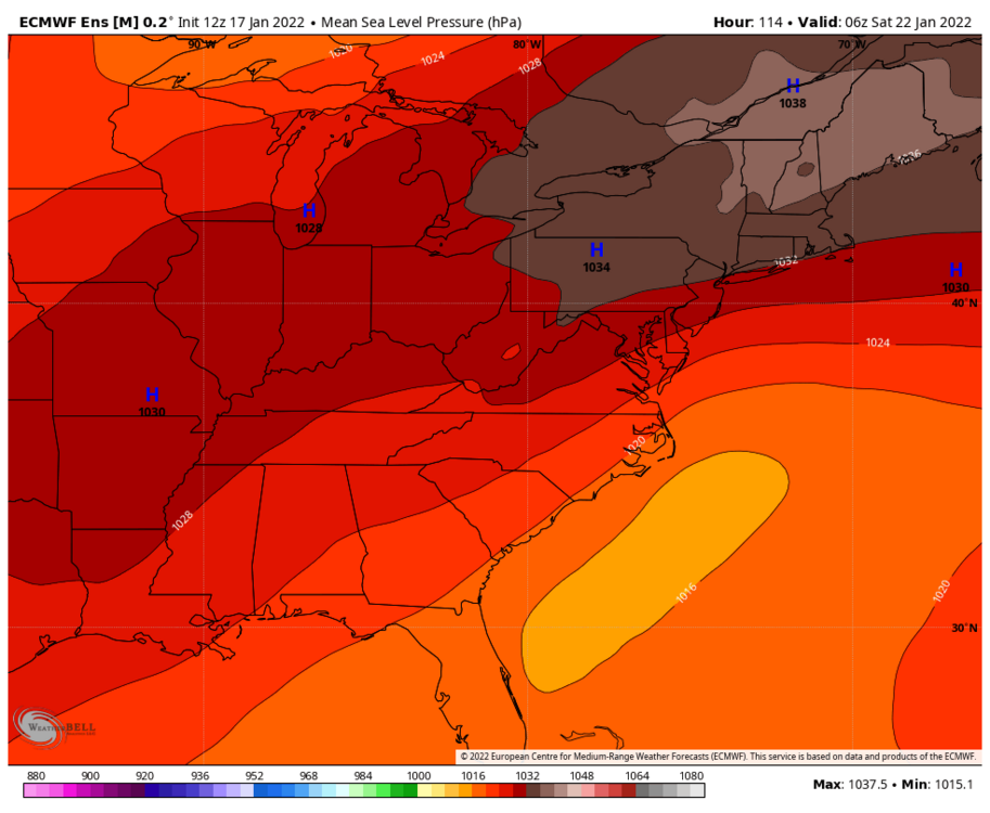
Most LP are well offshore compared to OP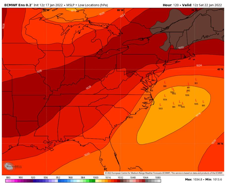
-
January 20-22 “bring the mojo” winter storm threat
Beach Snow replied to lilj4425's topic in Southeastern States
I truly believe the CMC is the most likely solution…it seems to be the middle ground. -
January 20-22 “bring the mojo” winter storm threat
Beach Snow replied to lilj4425's topic in Southeastern States
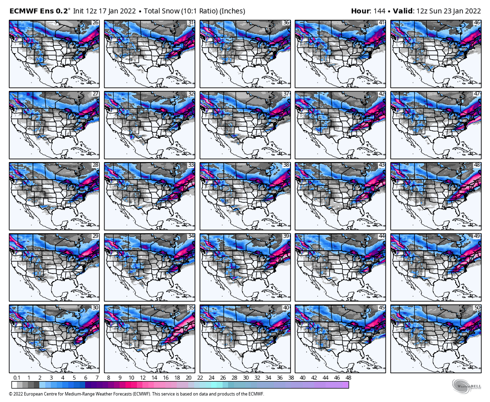
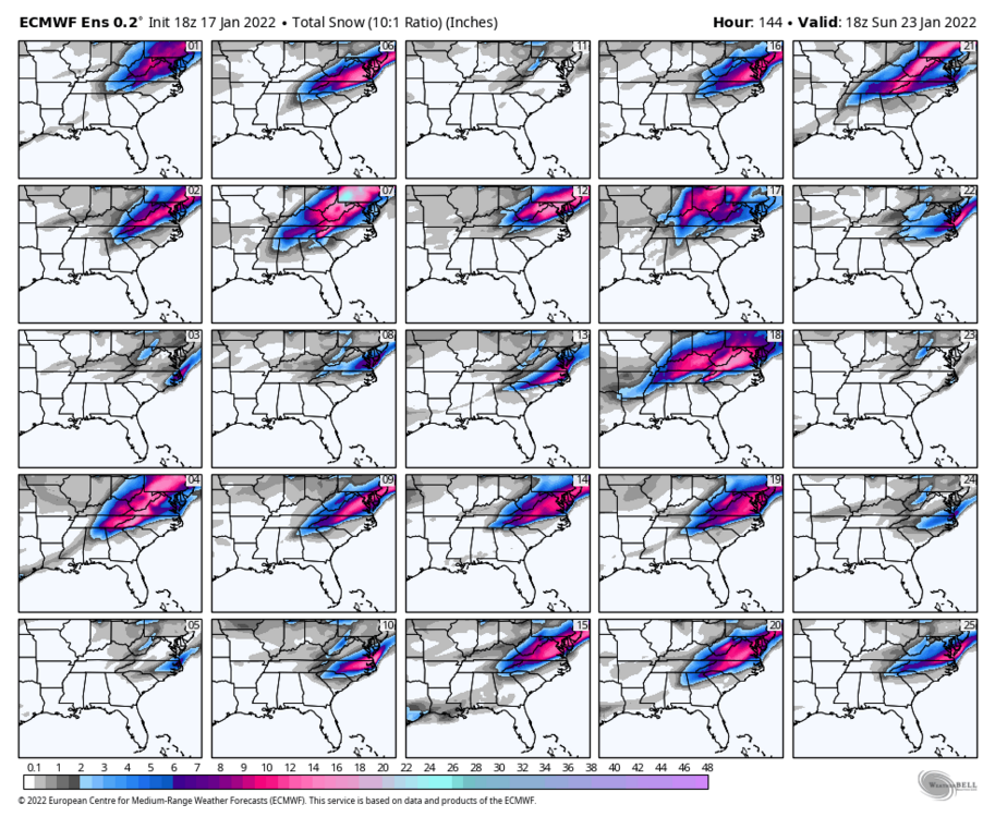
Individual members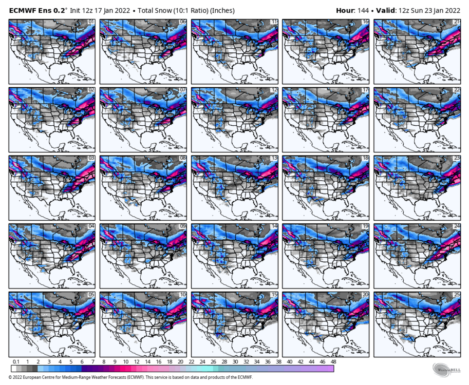
-
January 20-22 “bring the mojo” winter storm threat
Beach Snow replied to lilj4425's topic in Southeastern States
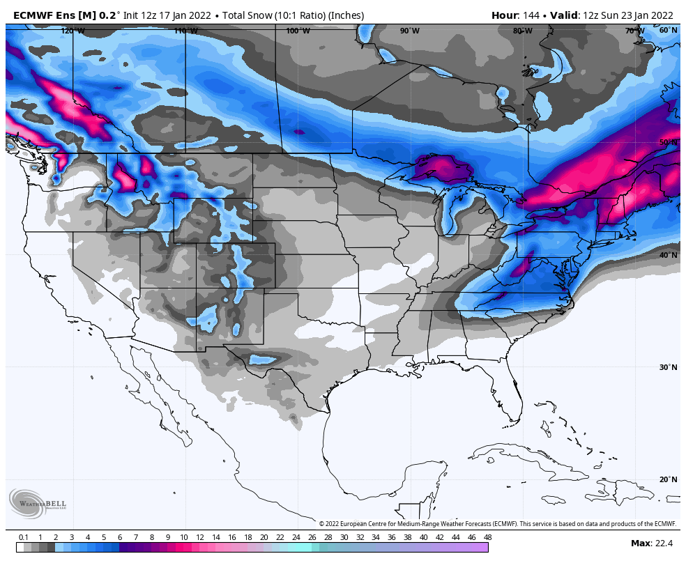
EPS looks great
-
January 20-22 “bring the mojo” winter storm threat
Beach Snow replied to lilj4425's topic in Southeastern States
Agree, but we are within 100 hours. With the recent storm there was tons of agreement between most models within this range. This storm has less agreement in closer range which is unfortunate -
January 20-22 “bring the mojo” winter storm threat
Beach Snow replied to lilj4425's topic in Southeastern States
This actually looks reasonable we have GFS Suppressed and euro amped. This looks more like CMC which could be the middle ground. EURO Ensembles will be interesting. -
January 20-22 “bring the mojo” winter storm threat
Beach Snow replied to lilj4425's topic in Southeastern States
Euro amped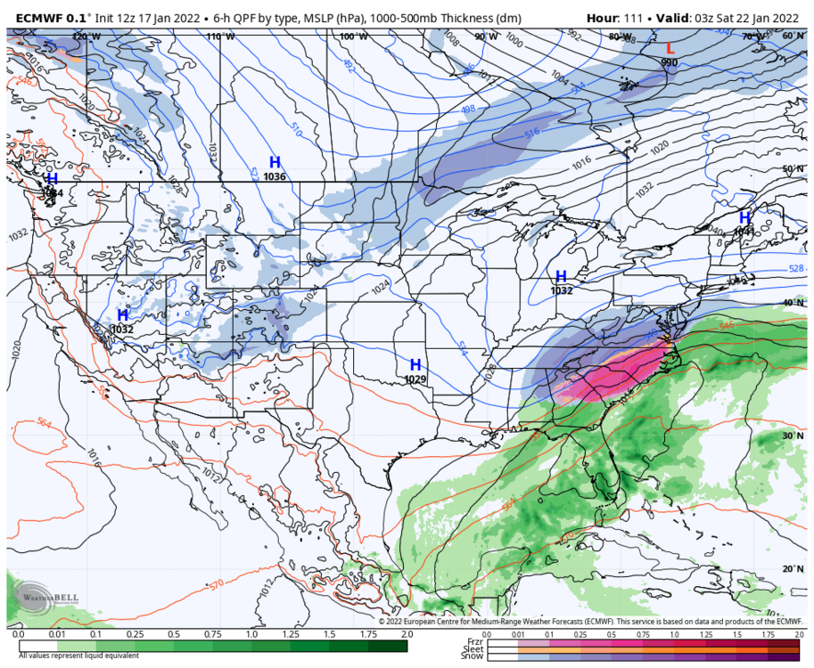
-
January 20-22 “bring the mojo” winter storm threat
Beach Snow replied to lilj4425's topic in Southeastern States
As soon as we get in range ill start posting surface maps -
January 20-22 “bring the mojo” winter storm threat
Beach Snow replied to lilj4425's topic in Southeastern States
GEFS does look good for 95 east -
January 20-22 “bring the mojo” winter storm threat
Beach Snow replied to lilj4425's topic in Southeastern States
Time will tell but we are literally only 4 days and i can’t see how the gfs is right this time when so far 3 including icon of 5 globals show a decent event