
Ephesians2
-
Posts
193 -
Joined
-
Last visited
Content Type
Profiles
Blogs
Forums
American Weather
Media Demo
Store
Gallery
Posts posted by Ephesians2
-
-
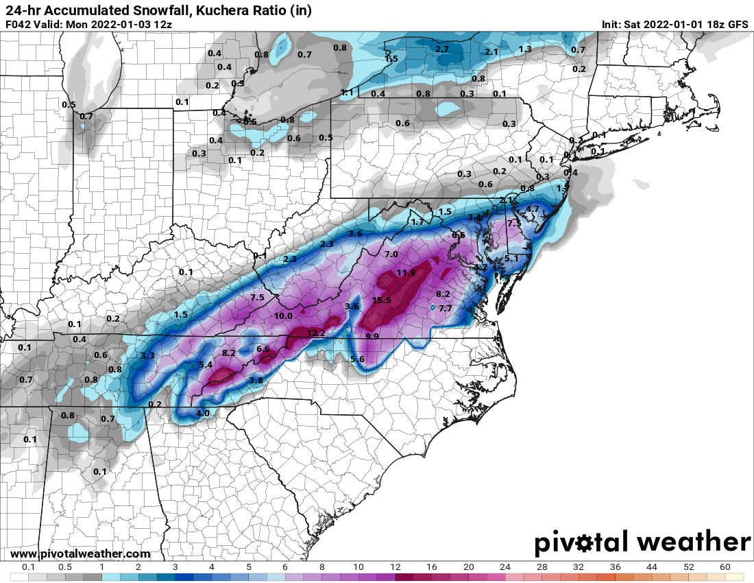
GFS looks like multiple days of subfreezing highs and single digit lows next week, especially south and west of DC. I'm sure lots of that depends on the 6-12" of snow it projects being on the ground as well
-
 1
1
-
-
1 minute ago, rjvanals said:
Like the NAM GFS is showing signs in soundings that we might have to contend w Sleet if we get precip up here
I'd take a mix with sleet over what I thought this morning... a few wet flakes that might accumulate on car tops for about 15 minutes, in the best case

-
Kuchera

-
 2
2
-
-
-
2
-
2
-
-
Cloudy and 66F
-
A little chilly this weekend... but otherwise perfect for this time of the year (of course, except for snow). 7 consecutive sunny days
 This AfternoonSunny, with a high near 62. Northwest wind around 15 mph, with gusts as high as 26 mph.TonightClear, with a low around 28. Northwest wind 6 to 9 mph.FridaySunny, with a high near 52. Northwest wind 7 to 13 mph, with gusts as high as 22 mph.Friday NightMostly clear, with a low around 25. West wind 6 to 8 mph.SaturdaySunny, with a high near 49. Northwest wind 6 to 10 mph.Saturday NightMostly clear, with a low around 26.SundaySunny, with a high near 50.Sunday NightClear, with a low around 26.MondaySunny, with a high near 55.Monday NightMostly clear, with a low around 32.TuesdaySunny, with a high near 63.Tuesday NightMostly clear, with a low around 38.WednesdaySunny, with a high near 67.
 -
62/38 under full sun
-
1
-
-
-
Just now, psuhoffman said:
Something just fell on my roof. Doesn’t seem to be any damage. But there are lots of not cool noises outside right now. I’m definitely not down with ice storms. Not worth it.
Yep. I would prefer rain over (damaging) ice.
-
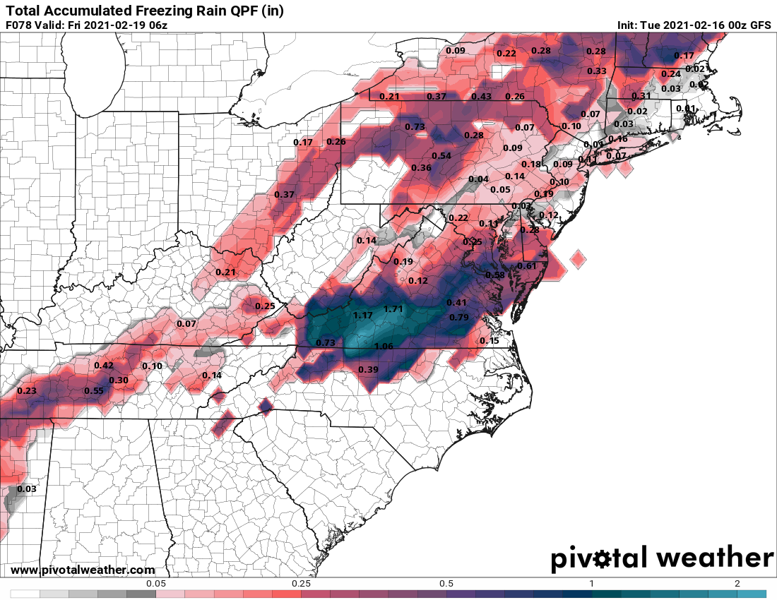
The most recent event brought over 1/2" ice to a lot of southern and central VA. There are trees and branches down here, but it's much worse with widespread power outages across South Central VA. I'm definitely hoping for a south trend, and if not, more sleet as opposed to ZR.
-
1
-
-
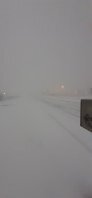
"Pingers" in Lynchburg. Seems like a rain/sleet mix, mostly sleet now.
-
3
-
-
0.75" in Lynchburg. Unfortunately snow is lightening up as the back edge of the band approaches. It is high ratio fluff.
-
2
-
-
Just now, NorthArlington101 said:
I’m guessing that this bit might actually be making it to the ground. Gives me time to take an hourlong cat nap.

Yep. It is beautiful in Lynchburg. Mod/heavy snow with large flakes, everything caving, and it appears to have put down close to an inch in an hour (need to go out and measure).
-
5
-
-
Moderate, borderline heavy in the city of Lynchburg. Large flakes, sticking everywhere.
-
3
-
-
The band moving through SW/Central VA is nice. Spent about 30 minutes sitting under virga, then light/moderate snow broke out with instant stickage outside of treated roads. This has to be more than 10:1 ratio and decent flake size.
-
1
-
-
34/17 in Lynchburg.
-
12 minutes ago, wasnow215 said:
0z 3k NAM isn’t bad
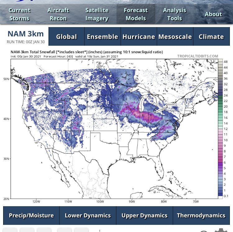
unfortunately, that counts a lot of sleet as snow at 10:1 ratios. NAM 3k isn't that much of a change from the last run, a pretty quick flip to sleet/ice.
-
1
-
-
From the main thread
-
2
-
-
5 minutes ago, RVASnowLover said:
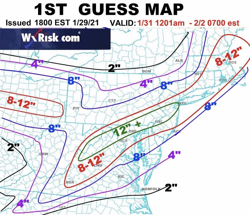
Nice. I think we could score big if we can get the rain line to stay near Petersburg
That model actually takes the rain line all the way up to EZF at one point. But there's enough heavy snow before the flip for decent totals in Central VA. Now if it stays frozen ...

-
1
-
-
-
41 minutes ago, wasnow215 said:
Here it is. Storm sets up just a tad more southeast and it’s beyond game on. But yeah 6-8” is excellent.

I like the "wiggle room" for central VA. Even if that shifted north it wouldn't be a total bust, more like a 2-4" deal. Which is not bad after the last couple of winters.
-
2
-
-
RGEM is pretty good for central VA.
So far NAM is the only model with a total shutout. Hopefully it stays that way.
-
1
-
-
Just now, Rhino16 said:
Which run? I don’t believe the new one has quite finished yet... so don’t freak out yet. Still some time anyway.
It's no big deal, it looks nice further north. Just not good for central VA.
.thumb.png.dad0f9769ce6507d65cb752ed3b4ad71.png)
-
The NAM took away virtually all of my snow
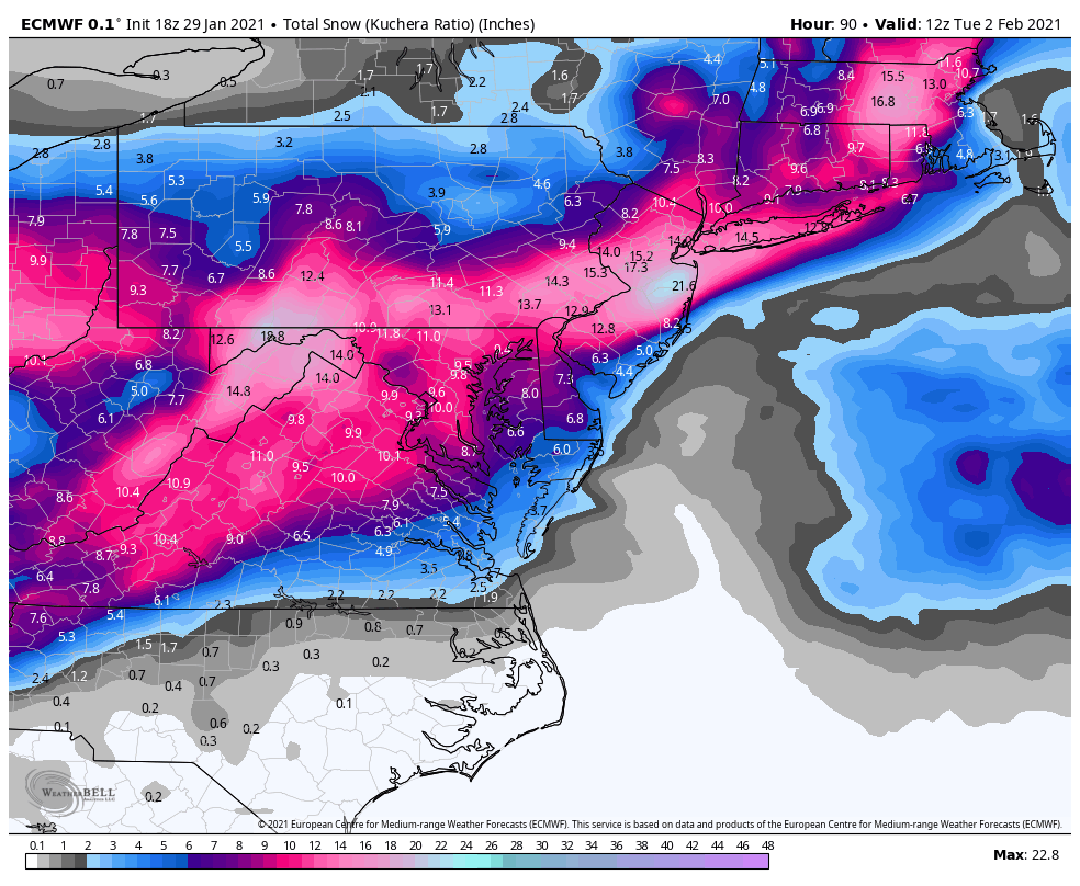
 Euro shows 6-12" for SW and parts of central VA while ... practically nothing on the NAM.
-
 1
1
-

.png.ec6feace2124149be47f37c2a3af5735.png)
.png.dc0d5d1e0a5439baa7f4fd7ca24c76f3.png)
January Medium/Long Range Discussion
in Mid Atlantic
Posted
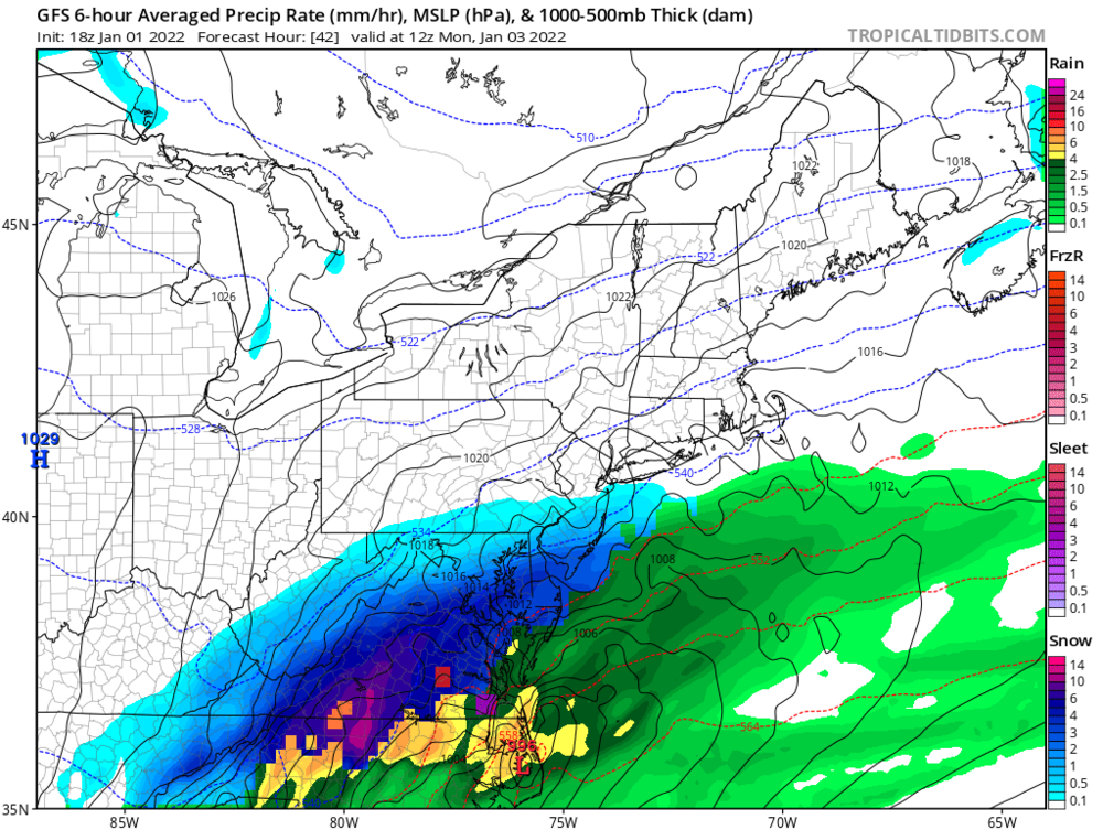
GFS for the late week potential