
stormdragonwx
-
Posts
512 -
Joined
-
Last visited
Content Type
Profiles
Blogs
Forums
American Weather
Media Demo
Store
Gallery
Everything posted by stormdragonwx
-

MO/KS/AR/OK 2020-2021 "Winter" Discussion
stormdragonwx replied to JoMo's topic in Central/Western States
Lol incredible. Fayetteville getting the stiff again. -
MO/KS/AR/OK 2020-2021 "Winter" Discussion
stormdragonwx replied to JoMo's topic in Central/Western States
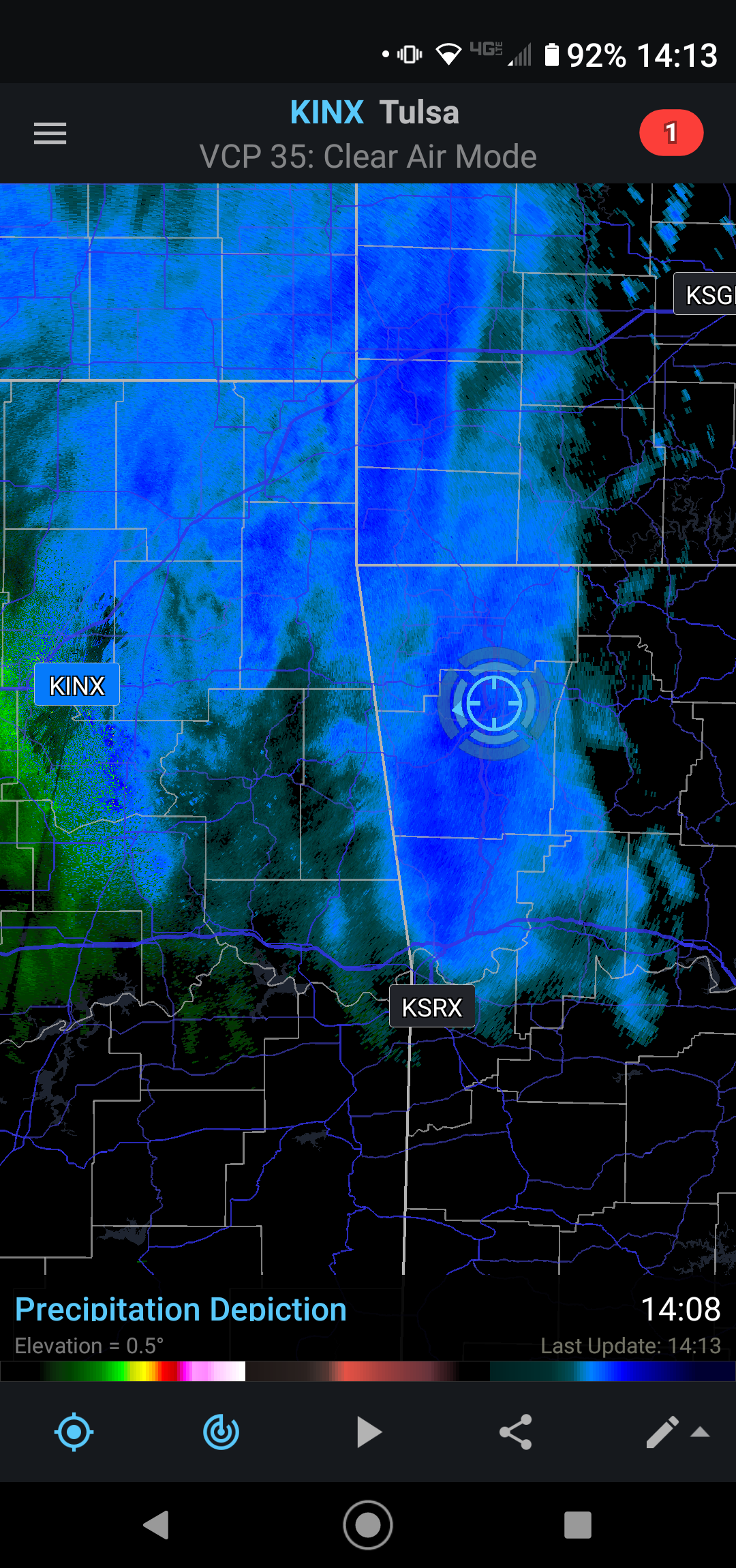
Must be having some dry air aloft. Radar showing a lot of snow over me but it's not coming down anymore.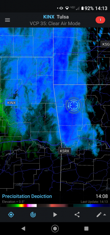
-
MO/KS/AR/OK 2020-2021 "Winter" Discussion
stormdragonwx replied to JoMo's topic in Central/Western States
Reporting snow here in SE Fayetteville too. -
MO/KS/AR/OK 2020-2021 "Winter" Discussion
stormdragonwx replied to JoMo's topic in Central/Western States
Yup typical 33 and rain again. -
MO/KS/AR/OK 2020-2021 "Winter" Discussion
stormdragonwx replied to JoMo's topic in Central/Western States
I was actually living in Tulsa for the 2009 one. I agree with what you said from what I saw and heard. The 2000 one that hit on Christmas Eve was pretty rough too. -
MO/KS/AR/OK 2020-2021 "Winter" Discussion
stormdragonwx replied to JoMo's topic in Central/Western States
Yeah I got a bad feeling this is gonna become a nasty Ice Storm for my neck of the woods. I remember the one in 2000 that hit around this time of the year. -
MO/KS/AR/OK 2020-2021 "Winter" Discussion
stormdragonwx replied to JoMo's topic in Central/Western States
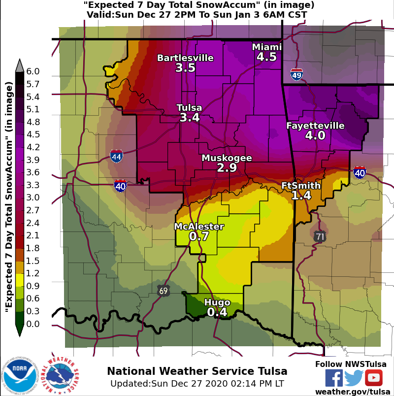
Still 4 days out and while I have observed TSA is usually pretty cautious and conservative, they already pulled the trigger upping the amounts on the DSP graphic. Personally, I hope this doesn't morph into a crippling ice storm like what some of the models were hinting at.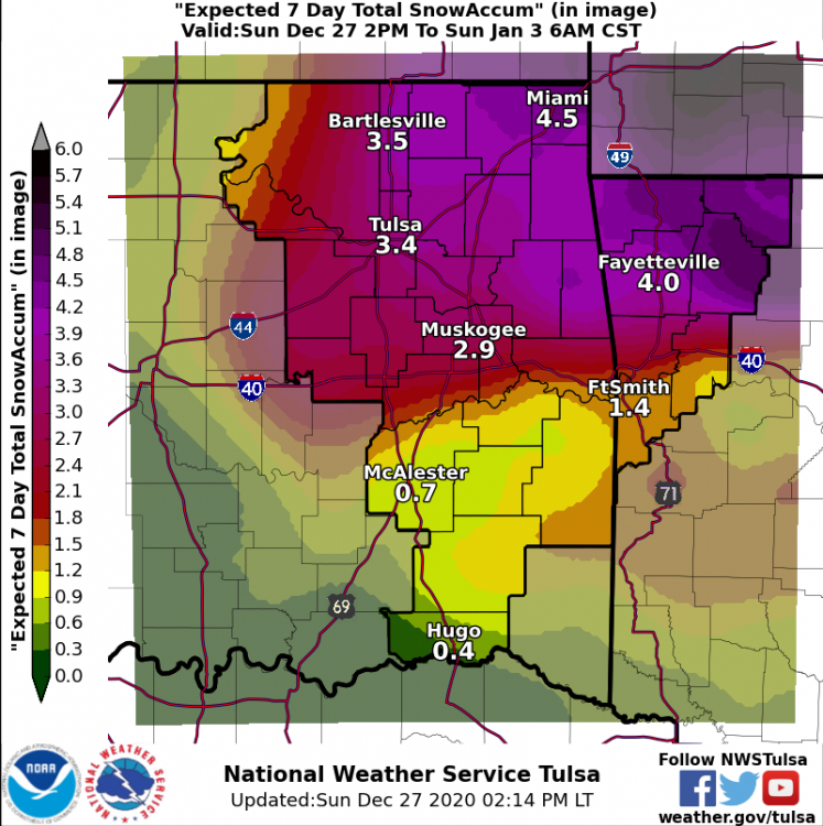
-
MO/KS/AR/OK 2020-2021 "Winter" Discussion
stormdragonwx replied to JoMo's topic in Central/Western States
Currently at work here in the Springdale, AR area. Approaching 2" now after finally changing over around 12pm. -
MO/KS/AR/OK 2020-2021 "Winter" Discussion
stormdragonwx replied to JoMo's topic in Central/Western States
Yeah Dan Skoff at KNWA is saying 8" in NW AR and that it might actually be conservative. All the models are showing at least 6" or more now too. That doesn't happen too often. -
MO/KS/AR/OK 2020-2021 "Winter" Discussion
stormdragonwx replied to JoMo's topic in Central/Western States
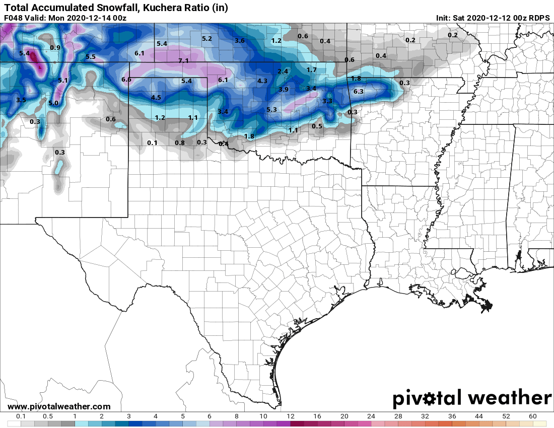
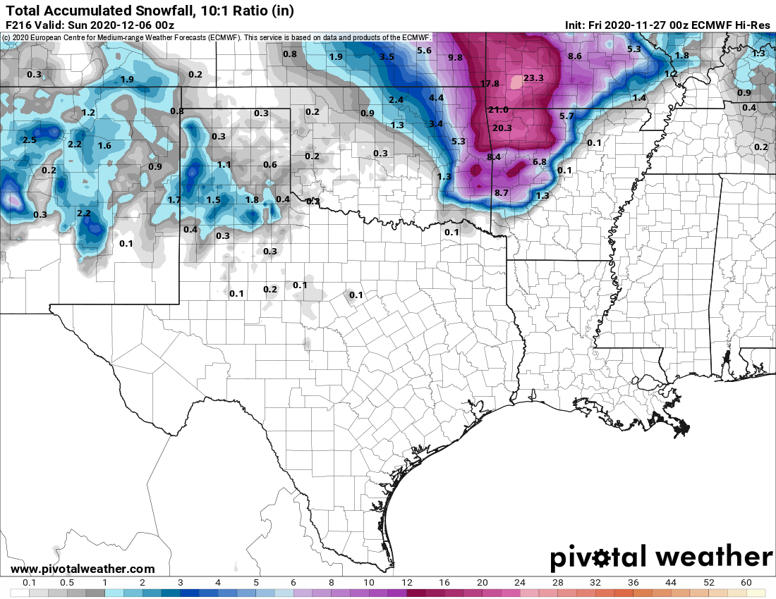
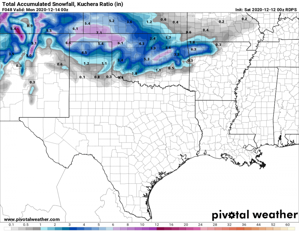
As I mentioned in my other post I think the best way to determine the precip accumulations taking into account for melting will be to take the 10:1 parameter and half it. The Kuchera Ratio also looks somewhat accurate to getting the real totals. Also regarding the thundersnow potential, I also do recall an event similar to this back on March 28th, 2009. I was living in Tulsa and we had a thundersnow event that day. It was just above freezing and had heavy wet flakes as a result. Got 9" in a few hours that melted to about 5" at sundown. -
MO/KS/AR/OK 2020-2021 "Winter" Discussion
stormdragonwx replied to JoMo's topic in Central/Western States
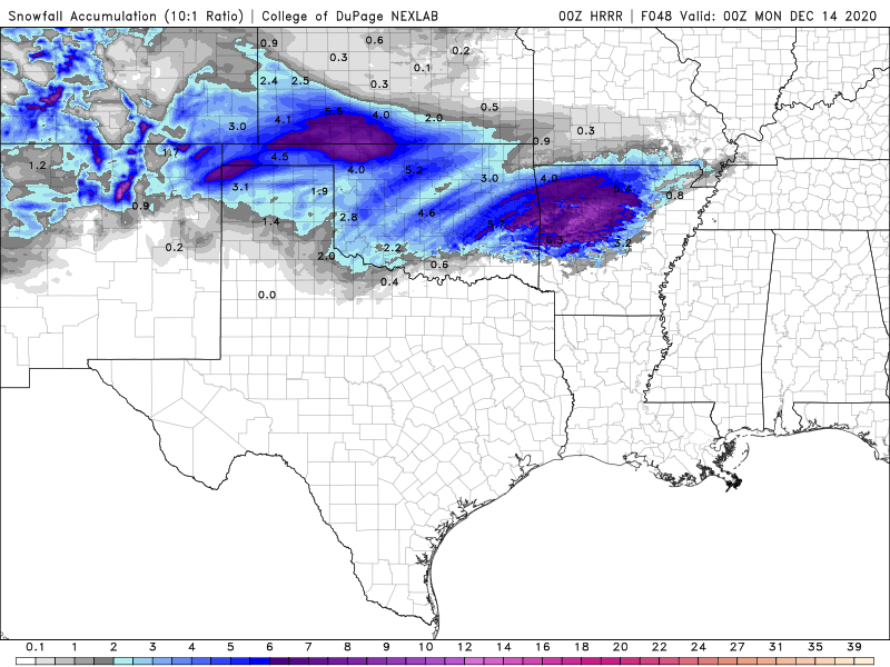
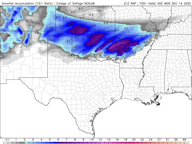
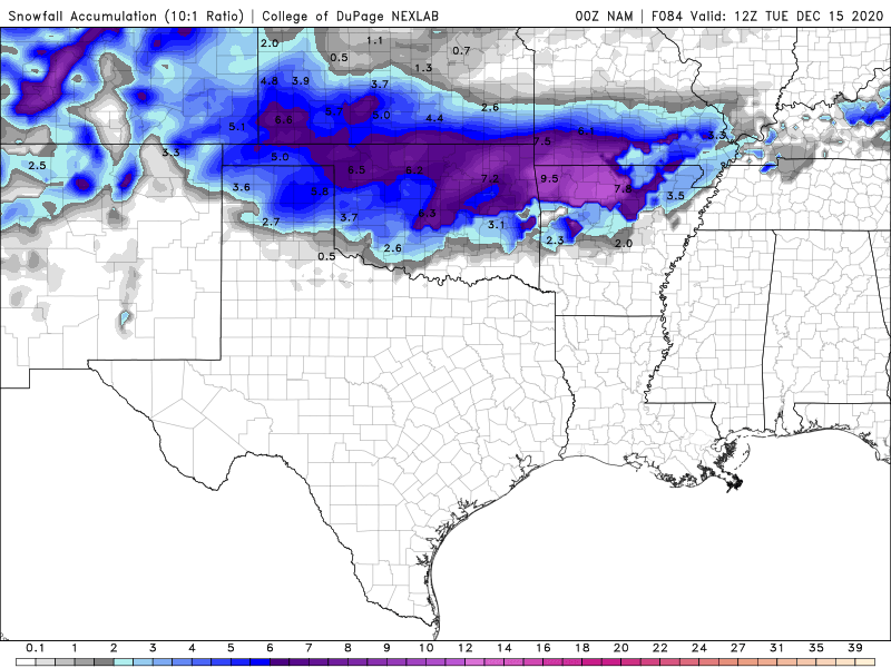
NAM, NAM 3k, RAP, HRRR and even the Canadian are saying its happening and upping totals/coverage overall. Might even be getting some convective thundersnow out of this. Temps are also trending colder. Though to be realistic I do think some of these totals seen here are overdoing it. Might cut the totals in half to get our real amounts due to the warm ground temps causing melting and compacting. EDIT: When you go back in and look at the Kuchera Ratio I think those will be closer to our actual amounts.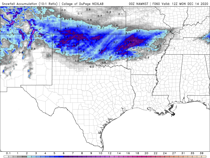
-
MO/KS/AR/OK 2020-2021 "Winter" Discussion
stormdragonwx replied to JoMo's topic in Central/Western States
00z GFS and Euro looking interesting. TV Meteorologists also taking note of it on their social media posts. -
MO/KS/AR/OK 2020-2021 "Winter" Discussion
stormdragonwx replied to JoMo's topic in Central/Western States
LOL yeah...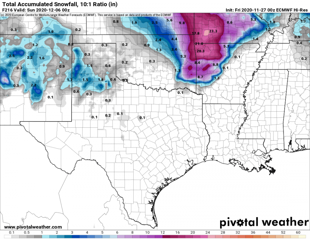
-
MO/KS/AR/OK 2020-2021 "Winter" Discussion
stormdragonwx replied to JoMo's topic in Central/Western States
After going on nearly 6 lackluster winters in a row, I am learning not to get my hopes up for an eventful winter around here. lol -
MO/KS/AR/OK 2020-2021 "Winter" Discussion
stormdragonwx replied to JoMo's topic in Central/Western States
Looks like the NAM pretty much nailed it. Just NW of OKC they have just shy of 2" of ice accumulation! Unbelievable... https://www.facebook.com/colt.forney/posts/10164673026050227 -
MO/KS/AR/OK 2020-2021 "Winter" Discussion
stormdragonwx replied to JoMo's topic in Central/Western States
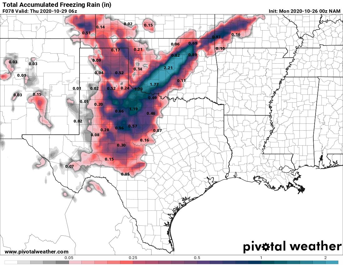
I joked a few days ago about a crippling Ice Storm because ya know... 2020 but now the 0z NAM has come into range with 2+ inches of ice. This along with leaves still being on most trees would be pretty devastating. I do think its being bullish jumping on board with that kind of outcome even though the GFS has been showing some kind of Ice Storm for several days now. Something will happen but 2+ inches of ice seems farfetched.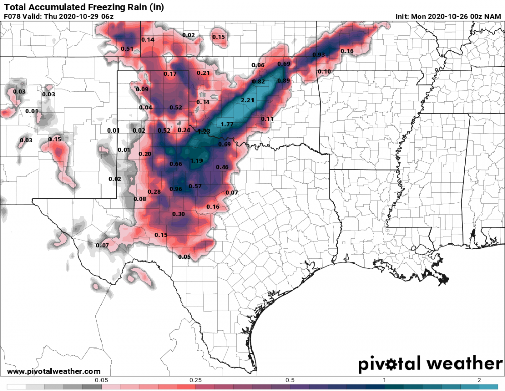
-
1411 Tornadoes First High Risk: May 5th