

Modfan2
-
Posts
2,951 -
Joined
-
Last visited
Content Type
Profiles
Blogs
Forums
American Weather
Media Demo
Store
Gallery
Posts posted by Modfan2
-
-
24 minutes ago, Damage In Tolland said:
1.47” from that beast last night and 4.58” MTD.
So far this month reminds of that summer 3 years ago where we had so many storms and dews
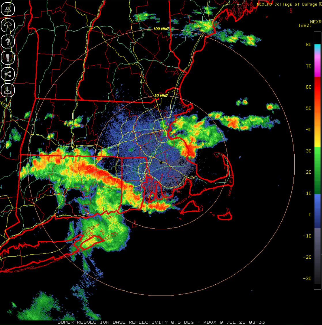
Looked like some decent rotation over your area for a bit as storms came through last night.
-
.64” overnight, just enough for the lawn and garden.
-
7 minutes ago, Damage In Tolland said:
Not like the other day . That was direct hit. But there were maybe 5 very close. Those ones that light up everything instant crash . Whole house was up. College girls frightened , dogs freaking, dad on porch not caring
Crazy light show here still as it pushes NE
-
12 minutes ago, metagraphica said:
NE CT and RI gettin' the goods now.

Crazy light show here
-
 1
1
-
-
26 minutes ago, CoastalWx said:
Still 90 here with the clouds.
Just hit 92 here in Steined E CT
-
Can see the sea breeze pushing north in RI and CT
-
 1
1
-
-
8 minutes ago, weatherwiz said:
Shear may be a bit too weak, however, I would not be surprised if we get some cells that drop 1" hail today.
All set with the hail in my hood after last Thursday: send that stuff to Damage Inc in Tolland
-
1
-
-
3 minutes ago, weatherwiz said:
Tomorrow should be interesting too. Again, not a tremendous amount of forcing but the NAM/GFS have a nice little speed max at 500 developing across the region which contributes to ~30 knots of bulk shear. Residual outflow boundaries from today could be a focus for tomorrow. May have to watch for convection to blossom overnight tomorrow with some better forcing approaching and adequate jet streak across the region.
What time do things get started today?
-
32 minutes ago, Damage In Tolland said:
87/72.4 here yields a HI of 94. That verifies for all intents
Or it yields a high of 87F
-
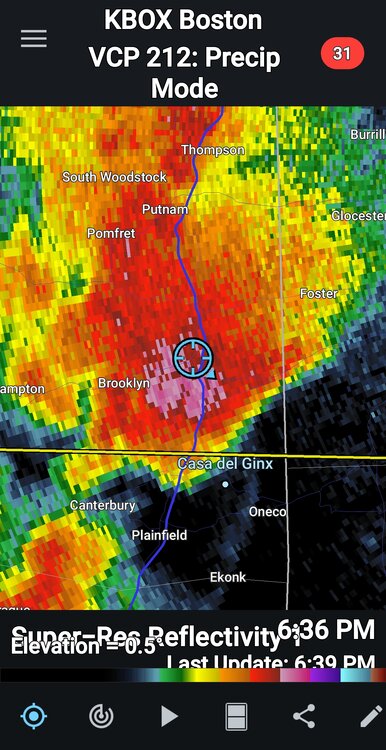
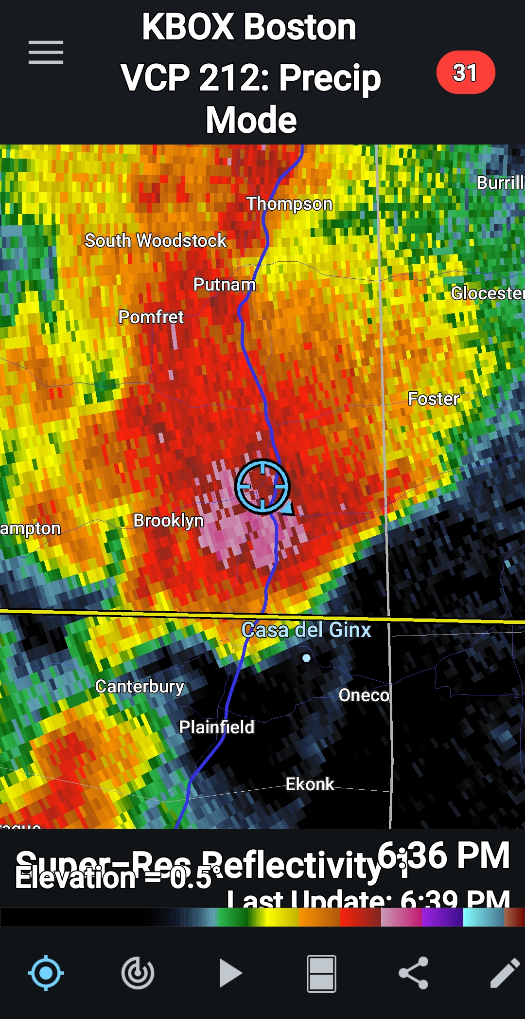
Not sure if someone can look at the radar loop of the storm that came through E CT, thinking ping ping size hail or greater came through here
-
1 minute ago, metagraphica said:
Very meh down here. A few rumbles and ~20 minutes of moderately heavy rain.
I’ve been through a number and of storms in FL and this might be the worst; thought for sure the front window would cave in
-
1
-
-
12 minutes ago, Ginx snewx said:
Right under the core. Danielson FD just pulled out
Multiple vehicle accident on RT 6 in Killingly near Westcott Rd do to the amount of ice on the road, serveral cars into the woods
-
 1
1
-
 1
1
-
-
Just now, Ginx snewx said:
Super intense storm at work in Danielson Ct
Getting destroyed here not too far from you
-
 1
1
-
-
Getting destroyed by hail here in Brooklyn CT!!!!
-
4
-
1
-
-
Looks like some decent hail in Hampton Ct
-
Nice line setting up from Manchester to Sterling/RI line
-
Have a lone cell approaching from IJD, wondering if this hinders later development?
-
38 minutes ago, weatherwiz said:
The HRRR is making my life very difficult. I would love for good storms to end up through BDL but I have to go from Branford to Costco in Enfield then to Springfield and then figure out from there. But with how slow people walk in Costco and the 8 million people there I'll be in there for 8 hours.
Could hit Costco in East Lyme and catch something on the way back in Hebron/Glastonbury area
-
1
-
1
-
-
Some hailers today; DIT with pics of hail mounds on the side of the driveway?
-
1
-
-
.53” since yesterday, storms died as the moved east of the Tolland mountain range
-
3 minutes ago, metagraphica said:
There is some kind of new bird flu or virus going around...saw an article about it a week or so ago.
79/72 Line kind of died, but at least we'll get some good rain.
Same here to your north, some gusty rain
-
90F here in E CT
-
1 hour ago, kdxken said:
Pretty nice day in Connecticut.
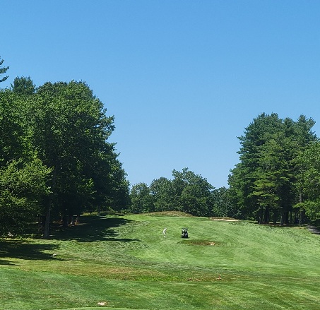
18th at CT National?
-
3 minutes ago, Damage In Tolland said:
It’s been raining all morning with not one blip on radar
Same, mucking up outdoor work plans for this morning
July 2025 Obs/Disco ... possible historic month for heat
in New England
Posted
Suns out in E CT, raced from 77F to 87F