nesussxwx1
-
Posts
170 -
Joined
-
Last visited
Content Type
Profiles
Blogs
Forums
American Weather
Media Demo
Store
Gallery
Everything posted by nesussxwx1
-
E PA/NJ/DE Summer 2026 Obs/Discussion
nesussxwx1 replied to PhiEaglesfan712's topic in Philadelphia Region
Great time lapse Basile! -
E PA/NJ/DE Summer 2026 Obs/Discussion
nesussxwx1 replied to PhiEaglesfan712's topic in Philadelphia Region
-
E PA/NJ/DE Summer 2026 Obs/Discussion
nesussxwx1 replied to PhiEaglesfan712's topic in Philadelphia Region
Was busy this weekend so wasn't able to send updates but the storm on Saturday was one of the worst I've seen in a long time. Was stranded on 295-S near Deptford, had to pull over. Hope everyone is safe. Best, -
E PA/NJ/DE Spring 2026 Obs/Discussion
nesussxwx1 replied to PhiEaglesfan712's topic in Philadelphia Region
Down to ~45F. About a ~17 degree drop in 45 minutes. -
E PA/NJ/DE Spring 2026 Obs/Discussion
nesussxwx1 replied to PhiEaglesfan712's topic in Philadelphia Region
Power flickering. Seeing temperatures down 20-25 degrees in some parts of SEPA. Impressive front. -
Damn, wonder how Sussex did then. It looks like the extreme NW edge of this storm underperformed.
-
Ocean County was dealing with tons of subsidence last night. Should make up for it this AM though.
-
Wow.
-
Just saw some lightning! 2-4"/hr rates.
-
Heaviest snow of the night currently falling.
-
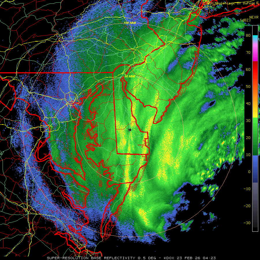
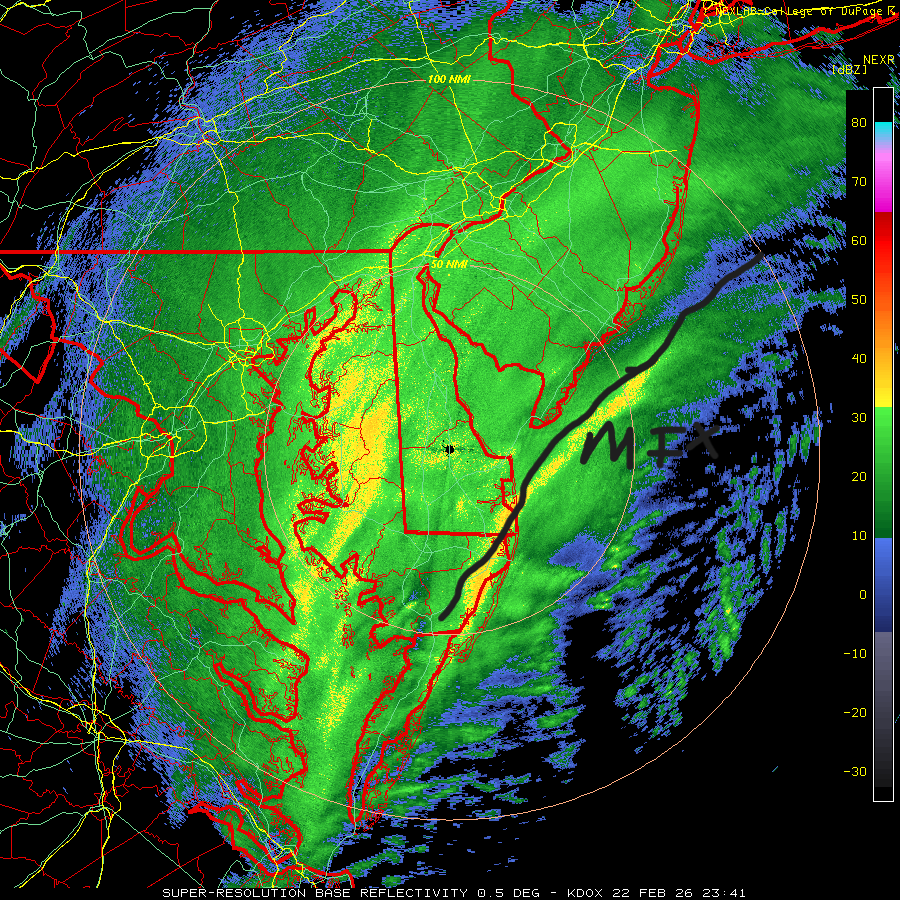
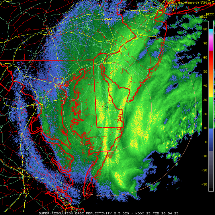
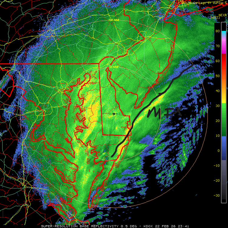
Radar just lit up over Philly. holy smokes.
-
S DE has been getting drilled the past 4-5 hours with the same band.
-
That death band might pivot over Philly. Would be insane.
-
Great shot!
-
haha, was wondering who was tailgating me . assumed it was another weather geek like myself.
-
I left ACY a while back. Heading home now, roads are treacherous.
-
It'll bust very low in SWNJ as well. Had me panicking for nothing.
-
Measured 6.1" in Atco. The last two hours or so have been insane.
-
2-3"/hr rates.
-
Making my way westward now. Snow intensity instantly picked up as soon as I entered Camden County. Seems like Atlantic County is in a bit of lull for now until later tonight.
-
Heavier echoes are having no issue pushing into western edge. I hope Reading can get into the action soon.
-
Cape May might briefly mix in the next hour or two. This bad boy is tucked.
-
Parts of CNJ have upwards of 5-6". Should be an all-timer for coastal central jersey.
-
Latest HRRR looks solid.
-
How do the roads look like out that way? Might decide to spend overnight in Atlantic County for safety reasons.