
ChasingFlakes
-
Posts
549 -
Joined
-
Last visited
Content Type
Profiles
Blogs
Forums
American Weather
Media Demo
Store
Gallery
Everything posted by ChasingFlakes
-
I'm not complaining, I went surfing in board shorts after class yesterday. Did have to drive through all that rain on the way home passing through your area. Like night and day between today and yesterday, today actually feels like fall.
-
Getting some pea sized hail and much needed rain here in phoenixville. Also a lot of lightning striking the ground nearby. Edit: here's the alert issued right around the time it was hailing here. : ...A STRONG THUNDERSTORM WILL AFFECT CENTRAL MONTGOMERY AND NORTHEASTERN CHESTER COUNTIES... At 932 PM EDT, a strong thunderstorm was located over Phoenixville, or 13 miles north of West Chester, moving east at 20 mph. Wind gusts up to 40 mph and pea size hail are possible with this storm. Locations impacted include... Norristown, Pottstown, Phoenixville, West Norriton, East Norriton, Conshohocken, Collegeville, Royersford, Trappe, Valley Forge, Chester Springs, King Of Prussia, Plymouth Meeting, Radnor Township, Skippack, Bridgeport, Spring City, North Wales, West Conshohocken and Evansburg. Torrential rainfall is also occurring with this storm, and may cause localized flooding. Do not drive your vehicle through flooded roadways.
-
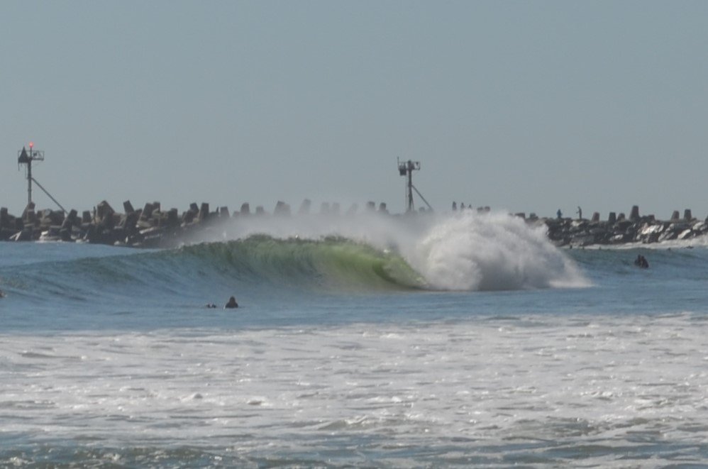
I actually did get down to Manasquan Inlet, NJ on saturday morning. I paddled out at 6:10am (30 mins before sunrise) and was greeted with warm water and big hollow barrels. Swell was variable with the largest sets around 6-8ft @ 13-15 seconds early in the morning with an average swell size closer to 5ft throughout the day. Really fun surf, hard to position yourself and easy to get caught inside with the variable swell size and direction. Also some big closeouts due to the long period, but really awesome surf overall.
-
Also the waves are going to be firing. Forecast as of now (for ocean city) is 11.5ft @ 15 seconds with offshore winds Fri morning. Remaining at 6-8ft @ 13+ seconds through sat evening. That means 12+ft faces at the right break.
-
Heavy rain and a really active storm lightning-wise above me right now.
-
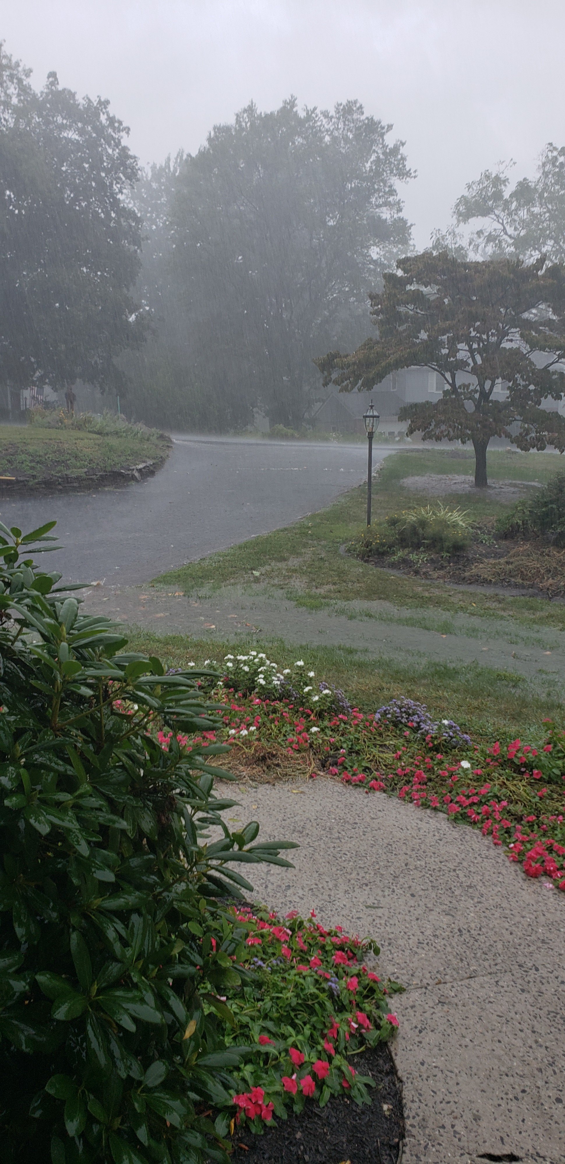
Holy crap that storm was no joke. Extremely heavy rain and strong wind. Gutter got knocked off the side of the house, whole yard is a river now. I took some video but I missed the gusts. Just lots of flooding in the front and back yard running down the hill. We have a storm drain on the upslope of our driveway, as well as a hump for water runoff. Clearly neither worked well enough..

-
Getting a full on downpour and some thunder out here. Keeping an eye on Dorian, surfs up for Jersey this week!