jaydreb
-
Posts
2,090 -
Joined
-
Last visited
Content Type
Profiles
Blogs
Forums
American Weather
Media Demo
Store
Gallery
Everything posted by jaydreb
-
Thanks for this PSU.
-
NAM calling for a foot of snow was laughed at but wasn’t far off. Even the Euro was underdoing the snow until the very end when Kuchera was giving us about 8-9”.
-
Measured about 10.5”. Didn’t use measuring board so it could have been more.
-
Could be. If you take a single measurement at the end of the storm it will be lower than the total accumulated snow. You’ll actually be measuring snow depth instead.
-
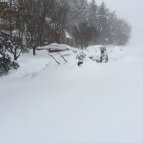
Dumping snow in N. Arlington. Accums are piling up.
-
My measurements aren’t official or anything. The 7” measurement was made by an 8 year old sticking a ruler in the ground.
-
Pretty amazing to see the DC snowhole getting filled in. It’s been 3 years in the making.
-
We measured 7” about an hour ago and it’s been ripping since. I bet we’re around 8” but haven’t measured.
-
Just came in from outside. These bands are delivering!
-
Nice band in N. Arlington. Just made an unofficial measurement of 7”.
-
Can you tell where the edge of the precip shield will be? Right now radar looks bare to SW of DC but I gather that will fill in?
-
Seems about right. We had 5” when I went out at 10 and we’ve probably picked up an inch since then. Nice moderate band moving through now. Great day!
-
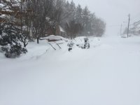
Moderate snow in N. Arlington. Nice fatties.
-
It’s picked up here in Arlington.
-
About 5” here in N. Arlington. Snow has picked up a bit in the last 30 mins.
-
Approaching 3” in N. Arlington. Heading out for a walk.
-
Remember when this was supposed to be a 2-4” event? We’ve already hit that!
-
1” here in N. Arlington.
-
We’ll be fine. Storm is barely an hour old.
-
Light snow in N. Arlington. Really enjoyed the chase with everyone!
-
Hope everyone enjoys! We’ve waited 3 years for this.
-
Best EURO run yet! Still snowing in DC at 6z Monday.
-
It’s fine if they show more snow!
-
-
GFS is the driest model and still shows 6” IMBY. LWX has bumped up totals for DC to 4-7.