Snowchaser
-
Posts
596 -
Joined
-
Last visited
Content Type
Profiles
Blogs
Forums
American Weather
Media Demo
Store
Gallery
Everything posted by Snowchaser
-
Ice blizzard
-
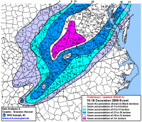
Eastern WV near Snowshoe gets buried .
-
Looked great for KCHO
-
3 would really suck for the PA peeps
-
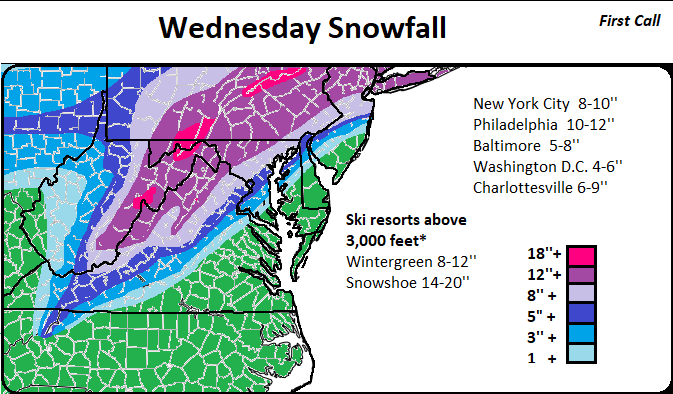
I was expecting to see more ice with the GFS.. I'm honestly shocked. I'm starting to believe this could be a 10''+ snowfall from Charlottesville, D.C., Baltimore, Philadelphia and maybe up to NYC.
-
-
some mixing in northern GA
-
Thunder snow watch

-
Weather Channel is showing 12+ just west of D.C.
-
This seems like a safe bet by Accuweather for Monday.
-
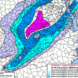
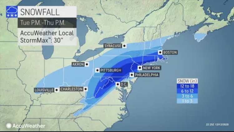
Accuweather out with their snowfall forecast. 6-12” blue ridge parkway points west. 12-18” over much of eastern PA. The map is low imo for Washington, Baltimore, Philadelphia, even Charlottesville to the south. We shall see where things go
-
i'll take 30-40% for 6+ Congrats PA!
-
I'm shocked Cville is in the Red. Clearly they know more than me lol.
-
It's been awhile. LEVEL 4 OUT 5 and five days out

-
The beast!

-
I'm not feeling good about cville snowfall with this one. Looks like a 3-6 snow event with ice ice ice. North west VA looks golden
-
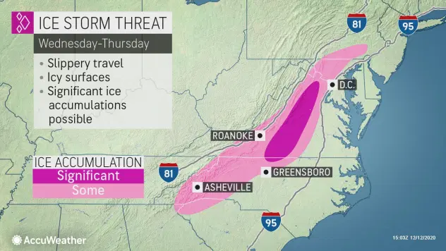
accuweather thinking possible MAJOR ice storm D.C points south.
-
Everyone shows 9''+ for my cabin in WV
-
If charlotte, NC can get 1-2'' of slushy snow we will all get 8"+.
-
Maybe even a mix in charlotte
-
I feel east of the parkway and south of D.C will see a MAJOR ice storm.
-
Only 12'' for me in Cville Dam it lol. Solid 30'' west of D.C
-
it's safe to say things are looking colder
-
Wow! Everyone gets deep snow with CMC
-
around D.C. looks to be Jackpot with this run