Snowchaser
-
Posts
596 -
Joined
-
Last visited
Content Type
Profiles
Blogs
Forums
American Weather
Media Demo
Store
Gallery
Everything posted by Snowchaser
-
Icon looking like snow to freezing rain or plain rain for most on Wednesday.
-
I’m going to my cabin near Snowshoe at 3,100 feet for this event. Everyone above 2,500-3,000 feet should do just fine Monday
-
Beautiful 10-12” for snowshoe
-
A thunder snow watch has been activated!
-
-
Nothing like a midweek ice storm
-
Updated*

-
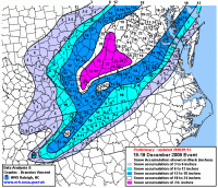
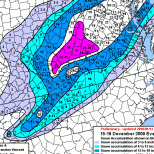
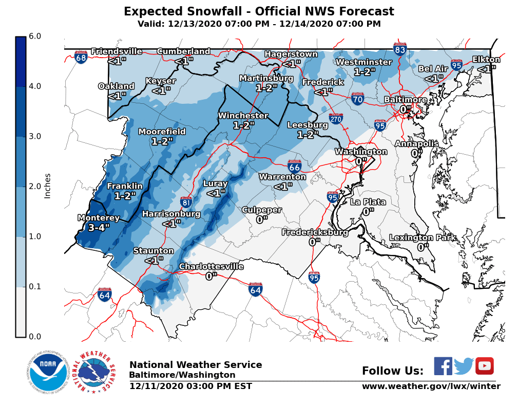
Monday’s snowfall from NOAA. 1-2” Leesburg and Winchester

-
I’m 99.9% sure it’s for Wednesday
-
DT BULLISH AF
-
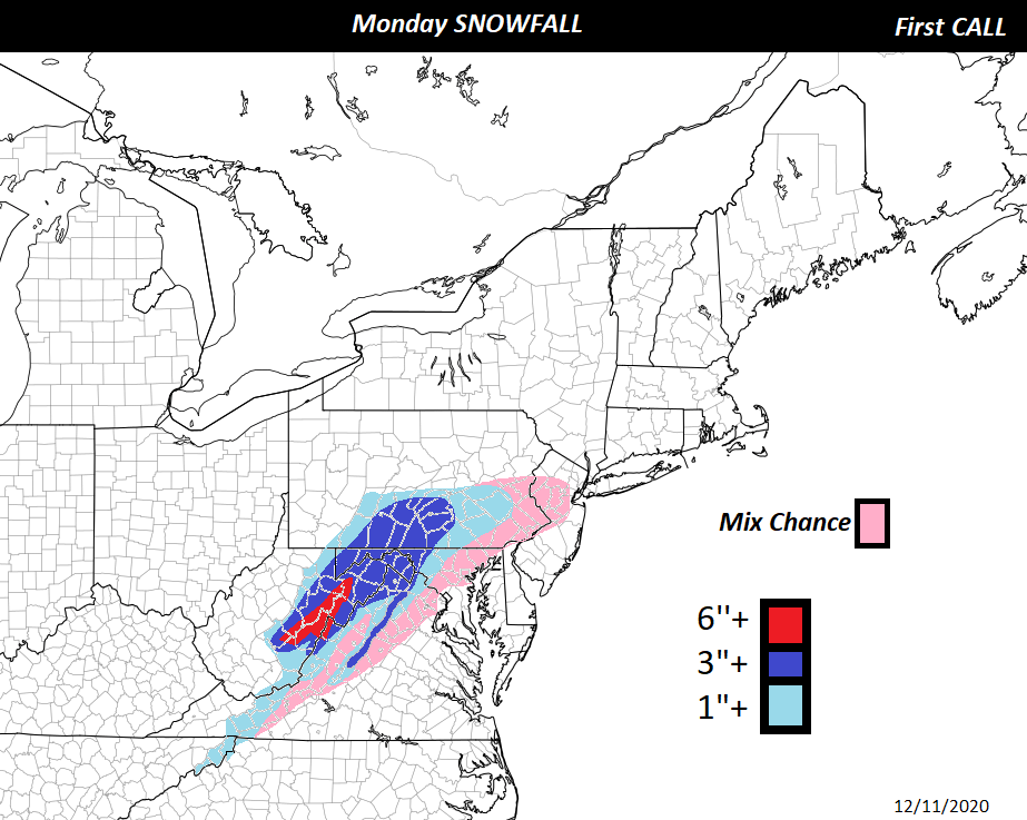
only places above 2,500 feet would those snowfall numbers be right imo.
-
The mix/snow line is a nail biter for many near D.C HEAVY+ SNOW west of D.C.
.thumb.png.da726578ffb006564718fd599824a777.png)
-
Looking good so far
-
This is great for Snowshoe.
-
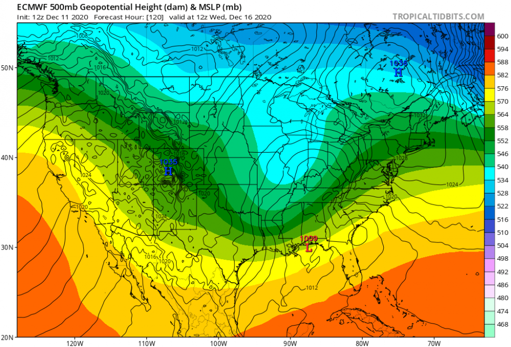
This storm looks to be more southern compared to the 2002 storm. We shall see
-
I saw that. Very interesting
-
HOLY SHIT!!!! CMC
-
Looks like heavy snow cville points north. Ice storm central/southern VA.
-
This could be an ice storm in the making for the peeps in Virginia.
-
ICON coming in shitting for the Wednesday event. No big snow
-
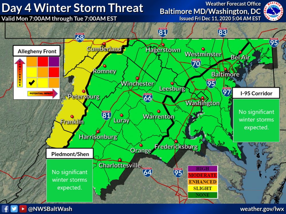
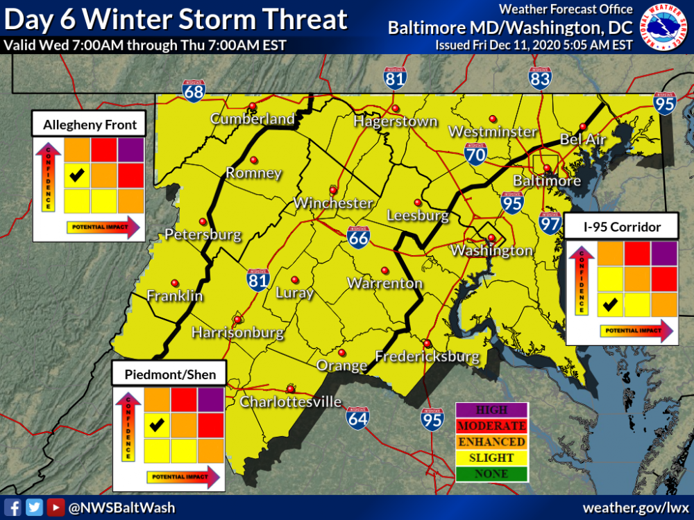
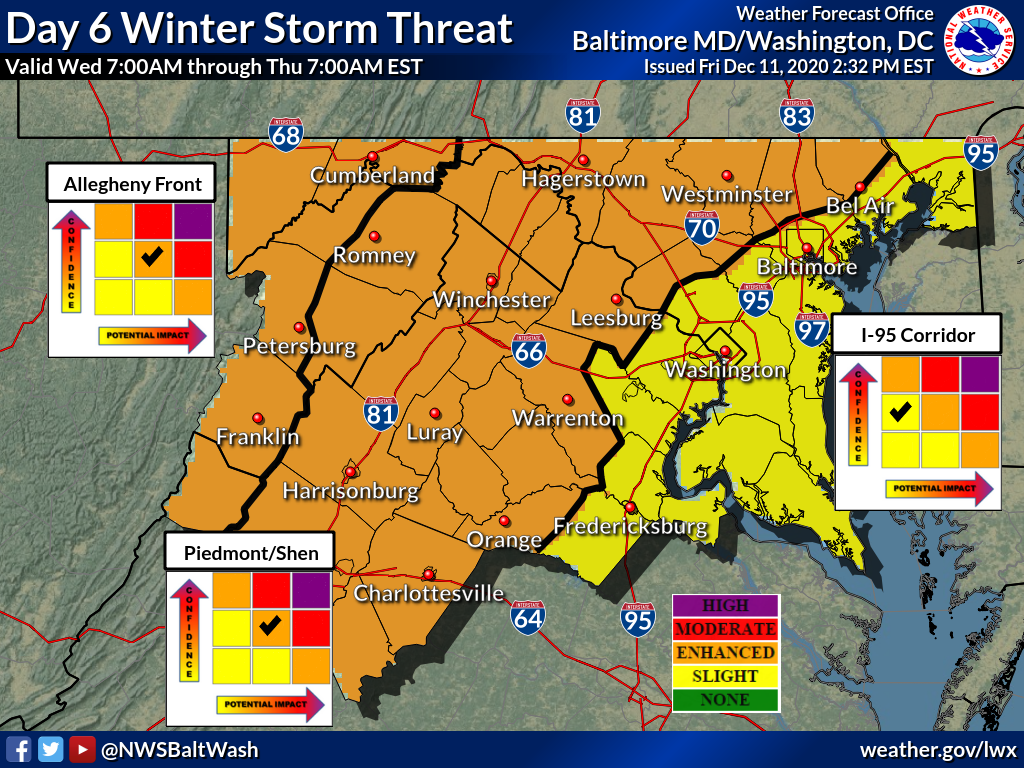
Updated threat maps for Monday and Wednesday from the Baltimore/Washington NOAA Weather Office.
-
Elevation will be key for Monday. Wintergreen, VA, Snowshoe, WV and places above 3,000 feet should do solid for Monday. It'll be hard for us east of parkway.
-
If this data continues, I’m going to head out to Snowshoe, WV Sunday night and stay there until Thursday.
-
I agree. It will be hard for snow in Virginia on Monday. But West Virginia near Snowshoe could see a nice snow event
-
I did. Above 3,000 feet in West Virginia looks pretty good for wet snow.


.png.27af66a7a2f15cbc5ff37530c9286305.png)


