GreensboroWx
-
Posts
342 -
Joined
-
Last visited
About GreensboroWx

-
December 8-10, 2018 Winter Storm
GreensboroWx replied to Orangeburgwx's topic in Southeastern States
Often, upper lows, which are cold aloft in nature, over perform and are not well handled by the models. See Lubbock, Tx..... I wouldn't discount the NAM 3K. -
December 8-10, 2018 Winter Storm
GreensboroWx replied to Orangeburgwx's topic in Southeastern States
Unfortunately, I DO think there is going to be some major icing, later Sunday after the brunt of the snow is over....I'm thinking in a line from CLT to RDU for the most icing. -
December 8-10, 2018 Winter Storm
GreensboroWx replied to Orangeburgwx's topic in Southeastern States
Yeah, the HRRR has been consistent showing strong CAD temps. Impressive, if correct, which I have not reason to doubt -
December 8-10, 2018 Winter Storm
GreensboroWx replied to Orangeburgwx's topic in Southeastern States
I know the storm is just arriving here in NC, but I've been impressed by the global models picking up on this event 7+ days. I'm not sure I've ever seen this. I'm trying to figure out why this storm is so well progged but others not so much. I'm thinking it may have to do to the strength of the waves, but that's just a guess. I'm thinking the locations right along the snow/sleet border is going to hit the jackpot of 16+" total which is insane for this area. Just think, we are only in early Dec and the way it's looking, Jan/Feb are going to be cold with plenty of blocking. I'm really thinking this is going to be a blockbuster winter for much of our region, esp the northern mountains of NC....wax those skis! -
December 8-10, 2018 Winter Storm
GreensboroWx replied to Orangeburgwx's topic in Southeastern States
Based on what I have seen with the overnight runs, I think it might be a bit conservative. -
December 8-10, 2018 Winter Storm
GreensboroWx replied to Orangeburgwx's topic in Southeastern States
Yes, great observation. 84 hrs only takes us to Sunday afternoon and this storm is going to persist through Monday morning, at least. -
December 8-10, 2018 Winter Storm
GreensboroWx replied to Orangeburgwx's topic in Southeastern States
Geez, check out the time on the map!! The NAM is slower and the bulk of the moisture is just really getting into the N parts of NC. What I'm saying is this is just the totals for the very beginning of the storm. Be patient! Yes, it's warmer aloft but we'll have to see what other model runs tell us. -
December 8-10, 2018 Winter Storm
GreensboroWx replied to Orangeburgwx's topic in Southeastern States
Yes, 850 low tracks from northern MS through AL, GA and off of ILM....pretty ideal for NC piedmont -
December 8-10, 2018 Winter Storm
GreensboroWx replied to Orangeburgwx's topic in Southeastern States
Nice 1040 high on NAM is good for PLENTY of cold air. -
December 8-10, 2018 Winter Storm
GreensboroWx replied to Orangeburgwx's topic in Southeastern States
Maybe a touch less QPF but I'm only seeing the maps through Monday at 12z....still have the upper low to go by on Monday -
December 8-10, 2018 Winter Storm
GreensboroWx replied to Orangeburgwx's topic in Southeastern States
As you well know, the NWS is going to be very conservative. Read their AFD...that's actually about as aggressive as you'll see several hours out. Anyway, why even look at their point forecast, you'll always be disappointed. All indicators point to a significant winter weather event for the Triad. -
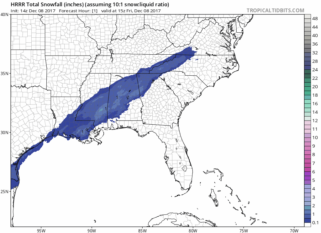
Latest HRR snowfall totals:

-
-
-
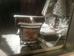
Summerfield, NC 1/17/2013
-