
Holston_River_Rambler
-
Posts
5,107 -
Joined
-
Last visited
Content Type
Profiles
Blogs
Forums
American Weather
Media Demo
Store
Gallery
Posts posted by Holston_River_Rambler
-
-
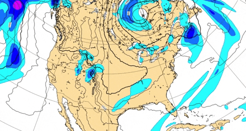
Nice satellite imagery this AM, good Gulf moisture fetch as teh cold from makes its way through TN and KY:

-
 1
1
-
-
If this works out Greyhound, you have to put that snowman jack-o-lantern thingy up every year.
-
1
-
-
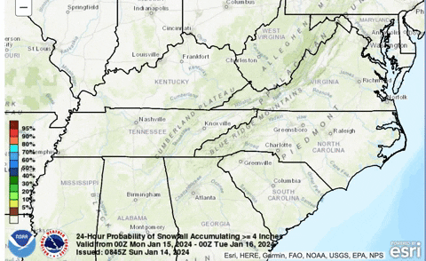
WPC probabilities of greater than 4"
-
 2
2
-
-
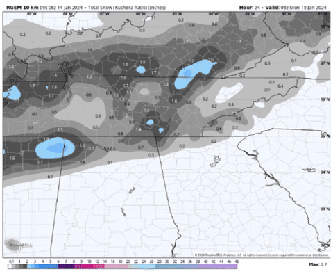
RGEM with special effects:
Thanks for all the updates overnight for my sleepy butt.
-
2
-
2
-
 6
6
-
-
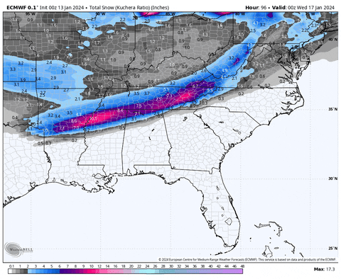
18z Euro:
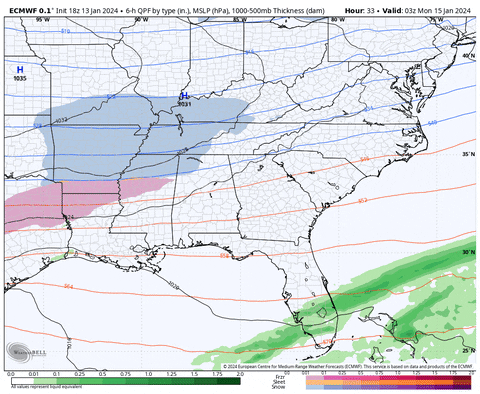

4 run snow Euro trend:
-
5
-
2
-
-
Maybe we need to consult @Greyhounds snowman jack-o-lantern model
-
2
-
-
NAM is so amped it is trying for a gulf low late in the run. Mini miller A
-
2 minutes ago, fountainguy97 said:
Big warm air push into ETN end of hrrr.
Bring back the low teens and snow haha
It's that Nina programming

-
But to be fair to Heather Haley, WPC seemed to like the NAMish solution as of 15z:

-
3
-
1
-
-
Well SREF plumes should be out. Any one want to venture a NAM guess based on those?
-
1 minute ago, PowellVolz said:
I don’t blame her at all. However one thing I believe that would help the local weather people in these situations is to show the viewers more than one solution and explain the difference. At this range they could show more than one accumulation map.
.It looked like earlier in the video she had some sort of a meteogram up with several model snowfall totals.
-
1
-
-
Look, I get it, I'm sorry for her. No matter what happens she is going to have a bunch of idiots messaging the WVLT studio, harassing her and her family. I suspect she is trying to temper expectations for viewers.
-
4
-
-
1 minute ago, weathertree4u2 said:
So are we saying her take on it is wrong?
If her only reasoning is diurnally driven temperatures.
-
1
-
-
8 minutes ago, PowellVolz said:
WVLT is riding with the NAM it looks like.


.She basically seems to be going with the NAM graphic and describing the snow to rain transition based on diurnal heating.
Time stamp is around 6 minutes in.
-
1
-
-
I thought Ninas normally favored suppression and out to sea, which to me would fit this trend. Aren't Ninas when places further to our south usualy get good snows?
Where's that juicy Nino STJ when you need it lol.
-
1
-
-
For those wanting the Euro output, here you go:

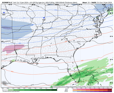
-
2
-
-
Here are the Euro Machine Learning models for those interested:
There are more than 2 ML models, but only 2 have precip panels available
-
2
-
-
3 minutes ago, John1122 said:
t's the NAM upgrade coming to full time use later this year.
Is that the RRFS?
-
It's the MSLP running into middle TN that makes me a little nervesome:
 A little more dig and we can get a clean Miller A, Mobile to Hatteras.
-
1
-
-
Maybe this is a situation where the boundary will end up a bit further north for the next system to ride, after the early week event rolls out.
-
I like the PNA ridge on the GFS, I just wish the wave could dig a little more.
-
Close to a big dog again on the 12z GFS for the late week system
-
1
-
 1
1
-
-
That is the NBM, just so there's no confusion with the previous posts
-
1
-
-
I don't know it didn't look too different to me between 9 and 12z
even has a Knoxville dollop
12z on left, 9z on right

-
1
-
January 15th-17th 2024 Arctic Blast/Snow Event
in Tennessee Valley
Posted
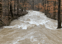
Twere a good un:
I trie to make a trend gif, but weatherbell doesn't go back to the 6z that ran out that far