

Holston_River_Rambler
-
Posts
5,560 -
Joined
-
Last visited
Content Type
Profiles
Blogs
Forums
American Weather
Media Demo
Store
Gallery
Posts posted by Holston_River_Rambler
-
-
FV3 FWIW coming in with very little ice
-
 1
1
-
-
4 minutes ago, fountainguy97 said:
Icing would be pretty devastating with ground temps like there are currently.
ice would accumulate even at air temp of 33-34 because the ground is mid 20s
I liked <sarcasm> this sounding from the NAM:

31 degrees, best guess: Rain
sounding from this frame in central TN

-
1
-
-
NAM is still trying to shove a lp up into the gut of middle TN
4 run trend:

-
 1
1
-
-
12z 12 km NAM sleet sounding, I will defer to Tellico:
location NE Alabama:


-
Healthy moisture transport:

-
1
-
 2
2
-
 1
1
-
-
2 minutes ago, housemtnTN said:
Wow! This might actually be a possibility? This is a higher resolution short range model, correct?
I think it's possible, but should be taken with a hunk of salt for now.
-
1
-
-
Just based on 500 mb trends at 15 hours out, I think the NAM will have more precip this run, mixing or not remains to be seen.
-
I wasn't sure what Tellico was talking about with SHARPY, so I looked it up and thought I would share:
https://sharppy.github.io/SHARPpy/
-
1
-
 1
1
-
-
Ron to run trend:
-
-
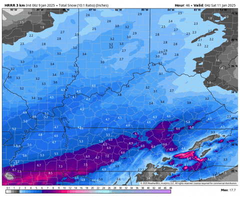
I don't know which is better on the HRRR, the Kuchera or 10:1 lol.
-
3 minutes ago, Carvers Gap said:
But at least the answer to that question is that today has promise in that it won't be boring.
Maybe Powell will ride in like Gandalf at Helm's Deep to usher in the 18z runs?
-
1
-
 5
5
-
1
-
-
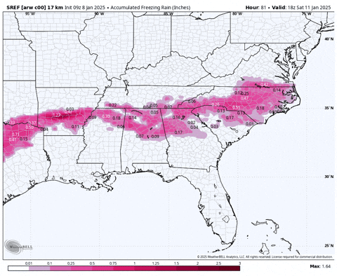
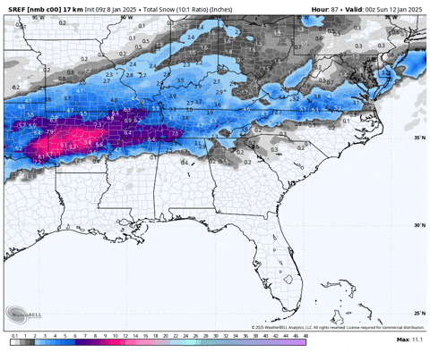
One thing I have noticed (now that I can look earlier than thought at the SREF thanks to fountain) is that he SREF cores seem to have been overestimating ZR over AR and TX:
5 run trend:
ARW core
NMB core:
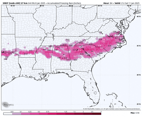
They are also too far north with the mixing line:
-
2
-
-
Past 3 EPS means:
-
1
-
-
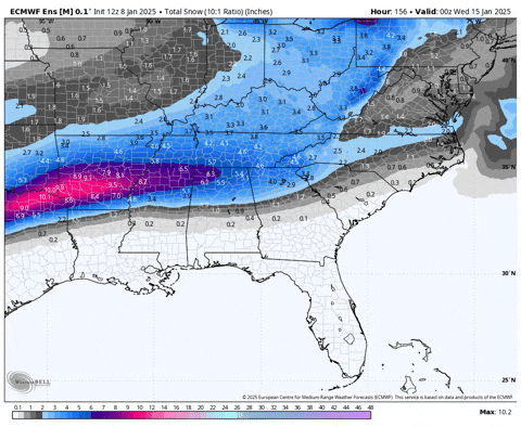
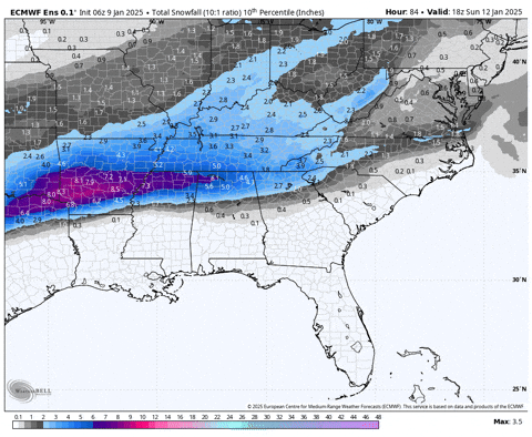
Welp, still over an hour for the SREF, so might as well look at the EPS:
10th through 90th percentile snowfall (this is NOT an increasing Mean)
-
3
-
-
1 minute ago, matt9697 said:
Here is the most recent statement on the Sumner County Facebook page.....


-
3
-
5
-
-
Local news (WBIR and WATE haven't had a chance to see WVLT yet) this AM seem to be leaning into the more snow than not, but I think they have the problem of the MRX graphics totals cut in southern and eastern areas of east TN. Also a lot of times the in house models they show on TV are Hi res CAMs that show some of the mixing potential.
-
1
-
-
17 minutes ago, tnweathernut said:
The next slide is even better. Just don’t look at it on a full stomach.

-
5
-
1
-
-
-
NAM is nailing its colors to the mast of its algorithm.

-
3
-
-
Wild that we were worried about suppression just 22 hours ago, lol.
-
5
-
 1
1
-
-
WPC probabilities as of 21z:
at least 2":

at least 4"

at least 6"

-
8
-
-
RGEM has only a small amount of sleet near the GA border and has upped .qpf a small amount.
-
2
-
-
Hey I almost nailed the WPC disco release time lol. Nice that they want to keep mention of mixing around and south of I 20
-
1
-
1
-


1/10-1/12 Southern Slider
in Tennessee Valley
Posted
Anyone have any thoughts on why the NAM is doing this? I guess I'm asking what process does it see that shoots the 850 winds and WAA so far north? Superficially (i.e me remembering all the runs I've looked at in the past few hours) nothing seems even close to it.
Is it a convection issue? Is it how its handling a shortwave? I'm not saying its wrong, but I'd like to know what it is seeing.