

Save the itchy algae!
-
Posts
132 -
Joined
-
Last visited
Content Type
Profiles
Blogs
Forums
American Weather
Media Demo
Store
Gallery
Posts posted by Save the itchy algae!
-
-
Has Dr. No come in with the 12z yet? If the trend shows up there in some form then I will start getting excited
-
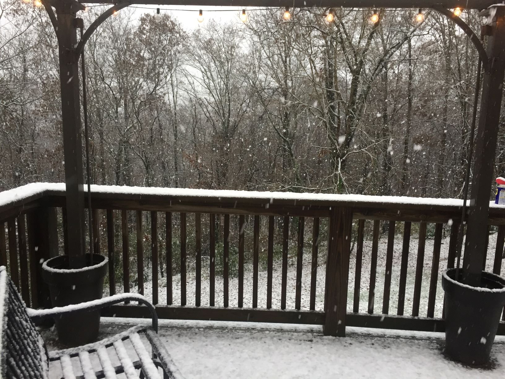
2” in Farragut
-
 5
5
-
-
Ground turning white in Farragut.
-
2
-
-
Some snowflakes mixing in with rain here in Farragut. Heard it is all snow on western avenue near the city
-
2
-
 1
1
-
-
Their pm update is coming in about an hour, hopefully they drop the hammer and everything keeps trending nicely.
all precip has stopped in Farragut but temperature is dropping more steadily now.
-
7 minutes ago, PowellVolz said:
Bright bandingI saw the banding but when it went through the precip at the surface got lighter not heavier. Just a mist here with temp at 39. Hopefully it does more up your way. Reports of some sleet mixed in with mostly rain off western avenue.
-
I’m in Farragut under those high returns. It’s barely doing anything here. Must be higher level reflectivity
-
I feel like cold air moving at 110mph is something you’d see in the Day After Tomorrow movie
-
 3
3
-
 1
1
-
-
1 minute ago, jaxjagman said:
This work for anyone?
I’ve only tried on my phone and it hasnt worked yet, but I’m also a bad millennial-I’m not savvy with this stuff. I’ll try on my computer in a bit to see if that’s better for me.
-
Can you describe what you saw in your link? It doesn’t work for me lol.
-
It's coming down here pretty hard, though it must've just started not too long ago because the road/sidewalks are just wet and the ground barely white. At the rate its falling coupled with the wind I would expect blowing snow before long. The wind is howling.
-
12 minutes ago, John1122 said:
The snow line looks like it's moving at about 25 mph. Its about 75 miles WNW of me.
It looks like it's either accelerating or jumping down the plateau on my map. May not take 3 hours!
-
1
-
-
Rain picking up in Farragut. Not much of a temp change the last few hours.
-
2 minutes ago, janetjanet998 said:
no there was only an advisory ....
usually there is a flood warning issued ...then when things get extreme a "Flash flood emergency"
Not correct. Maybe you should stick to your area. Things are 'extreme' by the way.
Flood Warning
National Weather Service Morristown TN
718 AM EST SAT FEB 23 2019

TNC001-009-057-089-093-105-129-145-155-231815-
/O.NEW.KMRX.FA.W.0014.190223T1218Z-190223T1815Z/
/00000.0.ER.000000T0000Z.000000T0000Z.000000T0000Z.OO/
Morgan TN-Loudon TN-Knox TN-Anderson TN-Blount TN-Jefferson TN-
Grainger TN-Sevier TN-Roane TN-
718 AM EST SAT FEB 23 2019

The National Weather Service in Morristown has issued a

* Flood Warning for...
  Southeastern Morgan County in east Tennessee...
  Loudon County in east Tennessee...
  Knox County in east Tennessee...
  Southern Anderson County in east Tennessee...
  Northern Blount County in east Tennessee...
  Jefferson County in east Tennessee...
  Southwestern Grainger County in east Tennessee...
  Northwestern Sevier County in east Tennessee...
  Roane County in east Tennessee...

* Until 115 PM EST.

* At 717 AM EST, Doppler radar indicated heavy rain that will cause
  flooding. Up to three inches of rain has already fallen.

* Some locations that will experience flooding include...
  Knoxville, Oak Ridge, Maryville, Sevierville, Clinton, Lenoir City,
  Alcoa, Jefferson City, Kingston, Rockwood, Loudon, Dandridge,
  Rutledge, Farragut, Fairview, Oliver Springs, Louisville, White
  Pine, Plainview and New Market.
-
18 minutes ago, janetjanet998 said:
a flash flood warning should have been issued long ago
FFW and Emergency are different things. The warning has been in place officially since 7:16 this morning.
I have some videos, will post later when they've downloaded. It's getting worse so these may be tame by the time they upload. Turkey Creek has breached the bridge at Kingston Pike. The road is impassable as it is a river
-
It's a small sample size, but in the 4 years I've lived here this is the rainiest day I've seen and it's only 9:30
-
I have to head out in a couple hours, will take some pictures if I can.
-
44 minutes ago, janetjanet998 said:
Heavy steady (not not excessive rates yet) rains the past 6 hours. 2.17 inc
time and per hr rainfall
23 07:53 0.42
23 06:53 0.38
23 05:53 0.40
23 04:53 0.27
23 03:53 0.33
23 02:53 0.26
23 01:53 0.11The airport has been just east of the heaviest axis of precipitation, though it's catching up now. In west Knox I've past 4 inches in the rain gauge this morning alone. It's excessive. For locals:
The entrance and exit to I-40/75 @ Campbell Station rd is underwater and impassible. Lovell Road is still passable.
I-40/75 itself has standing water on the left lane, there are many emergency vehicles out
Turkey Creek has flooded its banks along Campbell Station rd, the bridge at Turkey Creek rd is almost breached as well as the bridge at Kingston Pike.
-
1
-
-
Actually it's an inch here now, very quick accumulation!
-
1
-
-
A solid 1/2" here in Farragut, it's beautiful!

-
4
-
-
The temps have been stubborn over in my parts, I'm starting to get a little worried...the latest trends got my hopes up.
-
After all these years of tracking weather, I have really come to hate the GFS with this event. If it ends up being right I don't know what I am going to do with myself.
-
I'm just going to bed tonight pretending that the GFS isn't a thing, and that the overnight Euro will take care of us all...
-
1
-
-
The 00Z GFS looks like rain for most in TN.
February/March 2020 Winter's Last Chance Thread
in Tennessee Valley
Posted
Well Morristown originally thought I wouldn’t get any snow two weekends ago and I ended up with over two inches. By linear thought progression that means I should get over 4” this time in Farragut.