Sw NC weather
-
Posts
523 -
Joined
-
Last visited
Content Type
Profiles
Blogs
Forums
American Weather
Media Demo
Store
Gallery
Posts posted by Sw NC weather
-
-
30 minutes ago, franklin NCwx said:
About two inches at 4000ft in alarka. Soco gap has about 3 inches
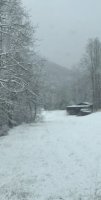
Pretty much a bust below 3000ft. Rode up to about 3800ft. There was a couple inches and coming down good I’ll post pics later
-
 1
1
-
-
Starting to mix 33.8 hope we can still squeeze out a inch or two
-
Sitting at 34.4 here with a drizzle hopefully can get get in some better rates
-
1
-
-
Maybe just wish casting but the radar in north Alabama and Mississippi don’t look half bad. Sitting at 38.4 F
-
8 minutes ago, Silas Lang said:
Next Tuesday-Wednessay looked great on the Euro for the mountains. 6 plus inches of snow with temps falling in the teens and wind gusts in the 30 mph range.
Couldn’t agree more it’s looking great for snow to stick around for a while also
-
Got a 1/2 inch here with fine snow falling
-
1
-
-
Came through winding stairs gap 3600’ and the ground was getting white with mod snow and even down in franklin mostly sleet
-
Looks like we might have a few flakes fly tomorrow with light Accums above 3000’
-
Just had a few snow flakes fly by with a temp of 34.7
-
1 hour ago, Tacoma said:
Well Jason Boyer on WLOS said this will be a nuisance event, I still thought we were far enough away from the event to where things could change overnight. I don't think I would have said one way or the other right now since there is plenty of time for the models to change. I remember last year when Jason said we would probably only see an inch and we got a foot in Candler and the Asheville area.

I agree, this thing still has 72 hours or so to change a lot. It’s hard for me to believe with a 1040 high could not push this thing a little further south
-
Flipping through the eps members looks promising. Pretty much every member gives something though most are 1-4 inch’s for most they are 5 or 6 at 6+
-
Next weekend definitely has some potential for a mod. Event
-
1
-
-
Ended with 90.7” north of franklin
-
1
-
-
Just crossed the 4 inch mark here which puts me over 90 inches for the year
-
1
-
-
Merry Christmas guys. Hope everyone’s had a blessed day.
On a side note both GFS throw us some New Year’s Day snow!
-
2
-
-
Talked to a guy that made it up to cowee bald and he said there was roughly 19 inches and he measured a 33 inch drift
-
1
-
-
The wwa was expanded

...SNOW ACCUMULATIONS AND WINDY CONDITIONS THROUGH SATURDAY
MORNINNG ABOVE 3500 FT...

.As a low pressure system tracks northeast of the area,
precipitation will linger across the mountains this afternoon and
evening as cold air moves in from the northwest. Snow levels will
gradually fall through the early evening, reaching the valley
floors by nightfall. Snow showers will gradually taper off
Saturday morning.

GAZ010-NCZ062-063-220400-
/O.EXA.KGSP.WW.Y.0020.000000T0000Z-181222T1700Z/
Rabun-Macon-Southern Jackson-
Including the cities of Clayton, Pine Mountain, Mountain City,
Franklin, Rainbow Springs, Kyle, Highlands, Wolf Mountain,
and Cashiers
256 PM EST Fri Dec 21 2018

...WINTER WEATHER ADVISORY IN EFFECT UNTIL NOON EST SATURDAY...

* WHAT...Snow expected. Snow accumulations of up to one inch,
  mainly at elevations above 2500 feet. Winds gusting as high as
  40 mph. Areas of black ice Saturday morning.
-
Starting to get some mixing here about 2500 feet rode up the mnt a ways to 3000 feet and there was a good inch on the ground. crazy elevation gradient
-
1 minute ago, AirNelson39 said:
Could you post it?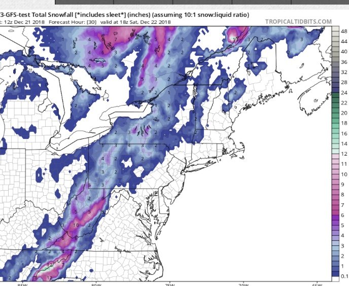
-
1
-
-
8 minutes ago, AsheCounty48 said:
3k NAM is juicy, more so than the 12k.
Talking about juicy check out the fv3 gfs for a good laugh
-
0z Nam upping the ante yet again even juicer then the 18z
-
1
-
-
The new GFS drops the hammer on wnc don’t no how much stock I would put in it but fun to look at
-
Looks like we have a good chance of snow 12/21-12/22 on the backside of a apps runner low
-
2 hours ago, NavarreDon said:
Did any of you feel this? Around 4:15 am EST.
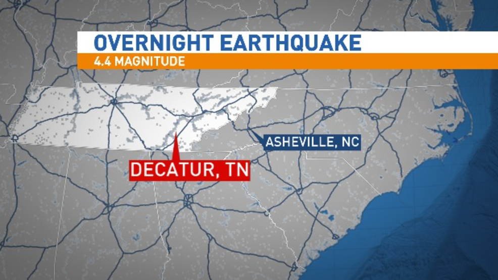
Woke me up too
-
1
-
2018/2019 Mountains and Foothills Fall/Winter Thread
in Southeastern States
Posted
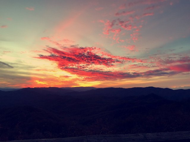
Took around 3800ft