SRRTA22
-
Posts
1,857 -
Joined
-
Last visited
Content Type
Profiles
Blogs
Forums
American Weather
Media Demo
Store
Gallery
Everything posted by SRRTA22
-

August 2019 General Discussions & Observations Thread
SRRTA22 replied to bluewave's topic in New York City Metro
I'm in south Jersey City , and those storms look very intense . Somewhat of a wall loud looking feature to my west. Probably scud but looks very ominous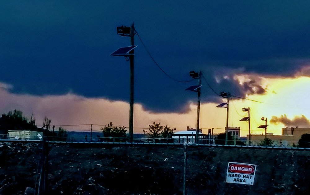
-
August 2019 General Discussions & Observations Thread
SRRTA22 replied to bluewave's topic in New York City Metro
I'll trade the next few winter's for summers just like this please. -
August 2019 General Discussions & Observations Thread
SRRTA22 replied to bluewave's topic in New York City Metro
Be careful guys, even though the main line has moved through, theres some very intense CTG behind it. -
August 2019 General Discussions & Observations Thread
SRRTA22 replied to bluewave's topic in New York City Metro
Radar just exploded. Wow -
August 2019 General Discussions & Observations Thread
SRRTA22 replied to bluewave's topic in New York City Metro
In your hood @forkyfork -
August 2019 General Discussions & Observations Thread
SRRTA22 replied to bluewave's topic in New York City Metro
Just like that, suns back out. Not gonna last long though as more storms continue to fire to the SW -
August 2019 General Discussions & Observations Thread
SRRTA22 replied to bluewave's topic in New York City Metro
Theres going to be major, major flooding issues in my area. Radar indicating 2" in just the last hour juuuust to my west, with plenty of more storms to come. Not good. -
August 2019 General Discussions & Observations Thread
SRRTA22 replied to bluewave's topic in New York City Metro
Crazy CTGs here. Gunshot thunder. -
August 2019 General Discussions & Observations Thread
SRRTA22 replied to bluewave's topic in New York City Metro
Although unlikely, wondering(and by wondering, I mean hoping lol) if that storm can maintain intensity into the NY metro area -
August 2019 General Discussions & Observations Thread
SRRTA22 replied to bluewave's topic in New York City Metro
We've definitely been getting lucky this year! -
August 2019 General Discussions & Observations Thread
SRRTA22 replied to bluewave's topic in New York City Metro
35+mph gusts here that lasted seconds with this second storm. Torrential downpour, no lightning Edit: Looking at radar and eyewitness visual of a heavy rain shaft that approached quickly, likely experienced a weak wet microburst. -
August 2019 General Discussions & Observations Thread
SRRTA22 replied to bluewave's topic in New York City Metro
Another cell in the same area as the last one. Around Orange,NJ (Essex County) -
August 2019 General Discussions & Observations Thread
SRRTA22 replied to bluewave's topic in New York City Metro
Yes sir. Didn't rain nearly as heavy here but had decently strong outflow winds from it. I'd guestimate around 30mph -
August 2019 General Discussions & Observations Thread
SRRTA22 replied to bluewave's topic in New York City Metro
South JC, near Bayonne. -
August 2019 General Discussions & Observations Thread
SRRTA22 replied to bluewave's topic in New York City Metro
I have a great view of a developing cell just to my west -
August 2019 General Discussions & Observations Thread
SRRTA22 replied to bluewave's topic in New York City Metro
Monsoon here -
August 2019 General Discussions & Observations Thread
SRRTA22 replied to bluewave's topic in New York City Metro
Counted 27 flashes in 1min. Amazing lightning show -
August 2019 General Discussions & Observations Thread
SRRTA22 replied to bluewave's topic in New York City Metro
Continuous lightning -
August 2019 General Discussions & Observations Thread
SRRTA22 replied to bluewave's topic in New York City Metro
They will. There's more then enough elevated instability left, non existent Marine influence..I think theyll hold. We usually all do well with storms that are moving SEish. Obviously folks will miss out as this isn't a 100 mi squall -
August 2019 General Discussions & Observations Thread
SRRTA22 replied to bluewave's topic in New York City Metro
They're only about 35 mi to the north of the city. Not that far away -
August 2019 General Discussions & Observations Thread
SRRTA22 replied to bluewave's topic in New York City Metro
Nice light show to the north. -
It happens. It's just that people have easy access to share that information these days.
-
That wasn't five feet of hail. From the video I saw , flash flooding caused hail to pile up in certain spots. Still though a crazy amount of hail did fall.
-
at the 6z FV3 from this morning. Such trash