bjc0303
-
Posts
291 -
Joined
-
Last visited
Content Type
Profiles
Blogs
Forums
American Weather
Media Demo
Store
Gallery
Everything posted by bjc0303
-
Central/Western Medium-Long Range Discussion
bjc0303 replied to andyhb's topic in Central/Western States
Great example... last 4-6 runs of the GFS (maybe more) wiped out e gulf in the wake of the thurs/Fri system. now the frontal push stalls out around gulf Coast. -
Central/Western Medium-Long Range Discussion
bjc0303 replied to andyhb's topic in Central/Western States
Well it's not like climo favors anything nice terrain wise. we'll get there. Besides deterministic models, as you know, change pretty quickly. I'm not really holding out for anything big until farther down the line...maybe very end of March or early April. I think many expect an average-slightly AA season. -
Central/Western Medium-Long Range Discussion
bjc0303 replied to andyhb's topic in Central/Western States
EPS shows some promise of perhaps something with better moisture return from a large scale perspective laaaaatee in the forecast cycle... but even tho it's an ensemble mean, being so far out there (300+) it could vanish on any run. -
Central/Western Medium-Long Range Discussion
bjc0303 replied to andyhb's topic in Central/Western States
Likely to see a pretty active pattern indeed. we will see how it pans out. The pattern overall will be active but strong frontal intrusions in the wake of these high amplitude systems is going to be an issue. I like what the euro is showing however.. esp Friday and into the weekend -
Central/Western Medium-Long Range Discussion
bjc0303 replied to andyhb's topic in Central/Western States
I've honestly already lost interest in this upcoming week's days of potential. Wednesday would be ideal for me but moisture doesn't look like it will happen. Thursday is too far east and my schedule doesn't allow for a Thursday chase anyway. There may be bigger things in store the week after, however. -
Central/Western Medium-Long Range Discussion
bjc0303 replied to andyhb's topic in Central/Western States
Strong capping -
Central/Western Medium-Long Range Discussion
bjc0303 replied to andyhb's topic in Central/Western States
2017031300 euro weeklies are.... let me say... very exciting -
Central/Western Medium-Long Range Discussion
bjc0303 replied to andyhb's topic in Central/Western States
Feeling pretty confident we are going to see a few severe events evolve over the next several weeks, starting somewhere around mid/late next week. Certainly next week could get interesting. -
Central/Western Medium-Long Range Discussion
bjc0303 replied to andyhb's topic in Central/Western States
Timing looks okay, but timing and any early shower/elevated convection concerns aren't even worth addressing right now. -
Central/Western Medium-Long Range Discussion
bjc0303 replied to andyhb's topic in Central/Western States
Wish I could post latest ECMWF ensemble run. Shows mean west troughing evolving around 22nd or so. We will see. -
Central/Western Medium-Long Range Discussion
bjc0303 replied to andyhb's topic in Central/Western States
Indeed; I would agree. Accounts for MJO and other influences as he mentioned. I recall seeing forecasts of GWO entering the phase 1/2 space about 14 days or more before the big outbreak Feb 28, of course there are gonna be pitfalls since severe weather events depend heavily on mesoscale factors that this method cannot account for (large MCS wiping out a warm sector, for example)... But it at least gives clues into the large scale pattern/base state for severe weather. Even now, if you look at the deterministic GFS, there are hints that an extension of the NP jet will make its way to the west coast, and the ridge breaking down in response. Also, Gensini and others produce 2 and 3 week outlooks/forecasts for enhanced tornado activity (link: http://weather.cod.edu/~vgensini/ertaf/) Not sure what they look at in total when making their forecasts, but they agree: "Dynamic models show large amounts of noise for the week 3 period. The current thinking is that a more coherent signal may emerge by week 3 that features a NPJ extension that will need to be monitored. When/if this process occurs, it should lead to a favorable pattern for severe convective storms. This could happen as early as the end of week 3, but likely beyond. Many seasonal climate signals continue to point toward an active base state for severe convective storms. " Next week looks pretty dormant severe weather wise with a western ridge in place, but that looks like it will break down around the 21st or so. Obviously the operational models are inherently super inaccurate this far out but the GFS continues to advertise the breakdown of the ridge and even shows the extension of the mentioned jet into the west coast. We will see. Ensembles have yet to totally show any significant changes/signals for western US troughing. -
Central/Western Medium-Long Range Discussion
bjc0303 replied to andyhb's topic in Central/Western States
https://ams.confex.com/ams/28SLS/webprogram/meeting.html#Friday1 Look for "tornado frequency in the US related to the Global Wind Oscillation" and watch Gensini's recorded presentation for more information. -
Central/Western Medium-Long Range Discussion
bjc0303 replied to andyhb's topic in Central/Western States
Looks like for the most part the next 10-14 days are going to be pretty darn quiet over the southern and central plains, given large scale ridging over west/central states. A return to a more favorable pattern for severe weather seems more likely after that, with some signal of a pattern change. AAM will remain low, but will build up magnitude into the 1 and 2 phase spaces, associated with enhanced potential for tornado days. Ensembles do not show a strong signal yeto, although operational models do show breakdown of the ridging, even though it means nearly nothing at its current range. GEFS forecast of AAM: -
Central/Western Medium-Long Range Discussion
bjc0303 replied to andyhb's topic in Central/Western States
Yeah, GFS has trended some better on instability into east OK with 1000 mlcape. Still considerable spread among SREF members, as well as deterministic guidance. Looking past Monday, still looks like potential uptick in severe next weekend/early next week. -
Central/Western Medium-Long Range Discussion
bjc0303 replied to andyhb's topic in Central/Western States
Looking past Monday, GEFS continues to suggest increased severe potential late next week... somewhere around Sat or Sunday -
Central/Western Medium-Long Range Discussion
bjc0303 replied to andyhb's topic in Central/Western States
Agreed. Storm mode will also probably preclude sig tor potential, unless open warm sector development is to occur. Not sure this will be the case. -
Central/Western Medium-Long Range Discussion
bjc0303 replied to andyhb's topic in Central/Western States
Looks like more than a localized wind/hail threat. Assuming initiation does happen and that the NAM isn't grossly overdoing moisture... Looks like a nocturnal tornado threat into east OK Monday eve/night. -
Central/Western Medium-Long Range Discussion
bjc0303 replied to andyhb's topic in Central/Western States
Saw that too. ECMWF is harsher. It basically pushes a high amplitude Ridge over the west/central states. I haven't looked into the ECMWF ensemble, but the GFS ensemble shows support for a multi day severe weather threat next week. interestingly enough the GFS started showing this about when the euro stopped doing so. Looks more like Thursday and/or Friday but I could be mistaken. Edit: 18z GEFS continues to suggest increased severe potential late this upcoming week (most likely Fri-Sat-Sun). -
Central/Western Medium-Long Range Discussion
bjc0303 replied to andyhb's topic in Central/Western States
Too early to tell. The operational 12z GFS looks awful... but I am more interested in the ensemble forecast, the 12z operational ECMWF, and SREF forecasts. latest SREF doesn't look awful across OK/SE KS -
Central/Western Medium-Long Range Discussion
bjc0303 replied to andyhb's topic in Central/Western States
Although currently an outlier the NAM looks pretty potent for Monday evening across OK and central KS -
Central/Western Medium-Long Range Discussion
bjc0303 replied to andyhb's topic in Central/Western States
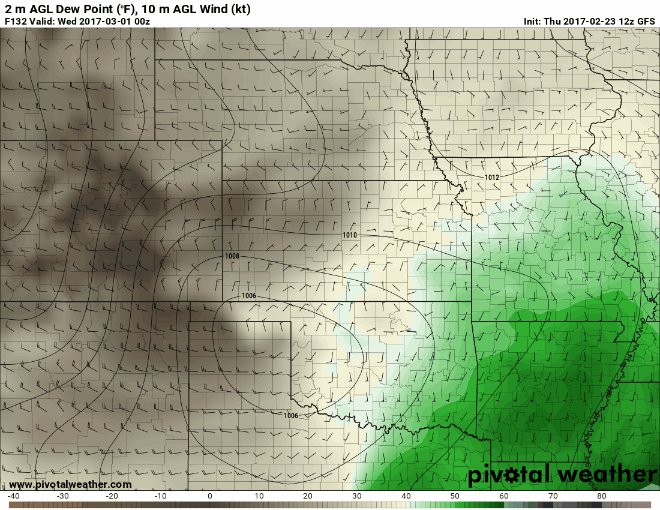
Hard to tell. I'm not sold yet that moisture return will be sufficient, but it could be. The gulf of mexico made it through the brunt of the cold season without any harsh intrusions. In fact it was one of the warmest seasons for the gulf ever I think... I saw an article about the GOMEX temperatures not dropping below a certain value thru winter since some time in the 60s or something...anyway... The NAM and GFS show quite the deep upper level low approaching the west coast by hour 84. The trend with the GFS has been to deepen and amplify the system with each run. the ECMWF 12z deterministic and ensembles did the same, though to a lesser degree. Personally, there probably will be, somewhere, a marginal supercell environment somewhere, probably farther north where colder Temps aloft will reside over modest moisture. If moisture return is sufficient, which would require stronger return flow/longer or weaker frontal passage than currently depicted, then I could see a pretty widespread severe risk over a large portion of the plains. Finally the GFS for now indicates potential for widespread cloud cover, which would probably kill any potential even with stronger return flow. Next few days will provide more clarity. The shear and dynamics of the system do look impressive. It would help if the system continued its trend to be more amplified with each run. -
Central/Western Medium-Long Range Discussion
bjc0303 replied to andyhb's topic in Central/Western States
On the other hand if we get forecast sfc lows closer to 1000 mb the flow will be largely veered and the warm sector will be more in line with what is currently depicted in the day 4-8 outlook. -
Central/Western Medium-Long Range Discussion
bjc0303 replied to andyhb's topic in Central/Western States
Key point here is with the jet stream overhead small fluctuations in amplitude, strength, etc make a huge difference, hence varying strength and positioning of key features. Likewise bulk shear will be high given strong flow aloft. if stronger sfc low becomes forecast or evident... could be in for a show given MLCAPE 1000-2000 likely -
Central/Western Medium-Long Range Discussion
bjc0303 replied to andyhb's topic in Central/Western States
Not sure it is ever that extreme. I would bet on a dry line no father east than I 35 unless flow becomes veered overall like previous model runs suggested -
Central/Western Medium-Long Range Discussion
bjc0303 replied to andyhb's topic in Central/Western States
Idk if it's completely dead in the water. 00z ECMWF pulled the dry line back closer to i-35 again. So did the GFS. here is dprog/dt for GFS.