ajr
-
Posts
379 -
Joined
-
Last visited
Content Type
Profiles
Blogs
Forums
American Weather
Media Demo
Store
Gallery
Everything posted by ajr
-
The southeast trend is real folks - you heard it here first
-
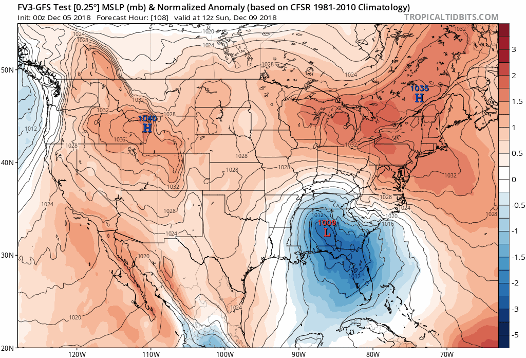
The overall pressure fields look fairly similar — a little weaker up north and maybe a tad slower with the low.
-
Just because it's an important feature with this storm I wanted to look at data supporting some of the things we talk about... turns out there is actual data supporting under modeling of CAD, both in onset and erosion (the latter appears mainly with forecasting low temperatures, i.e. prematurely cutting off the CAD at night). https://vtechworks.lib.vt.edu/bitstream/handle/10919/83476/Lindeman_SA_T_2018.pdf?sequence=1&isAllowed=y
-
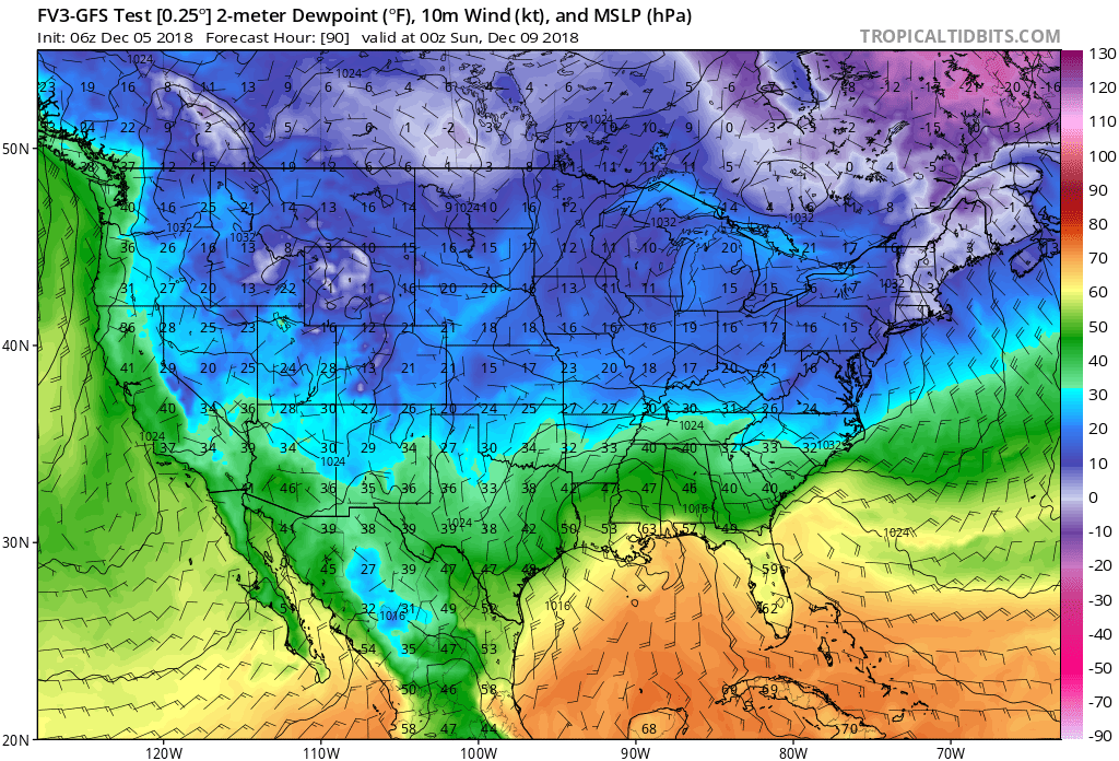
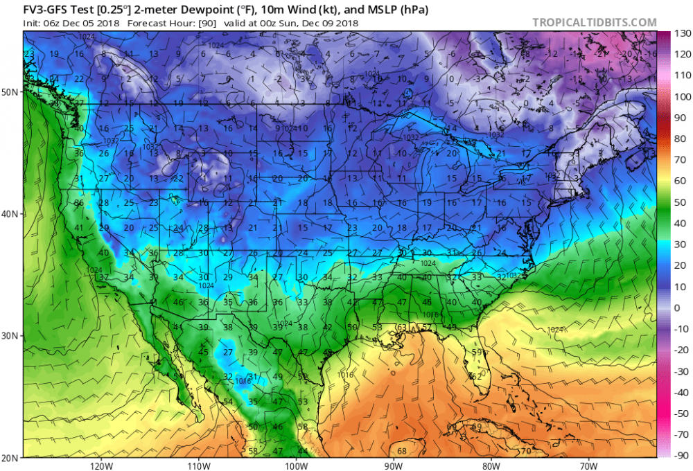
Yep.. pretty big (and nice) differences with DPs compared to the FV3
-
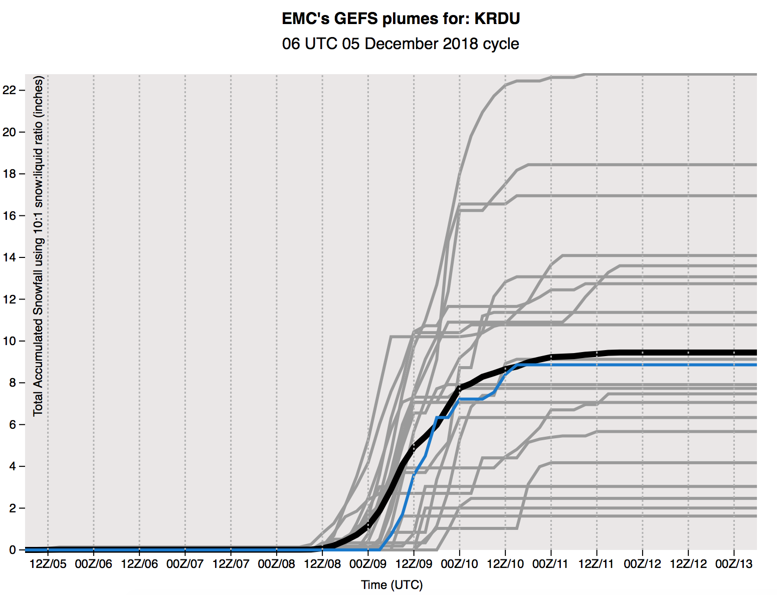
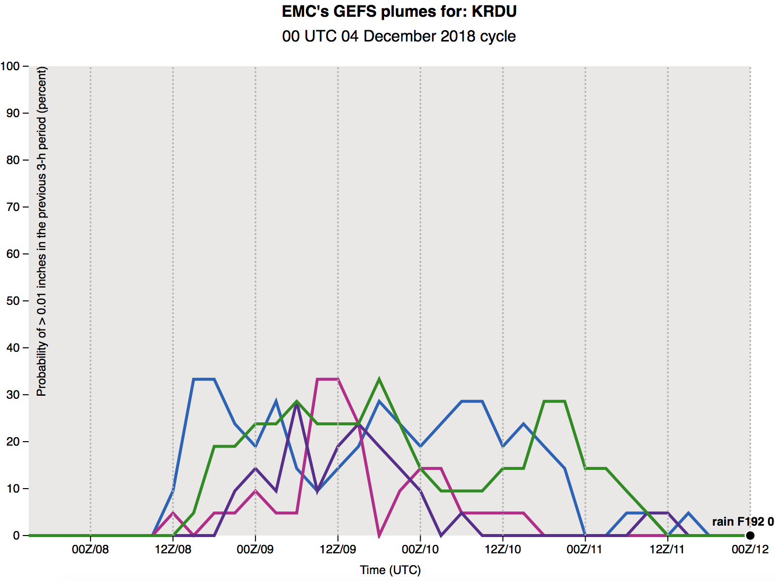
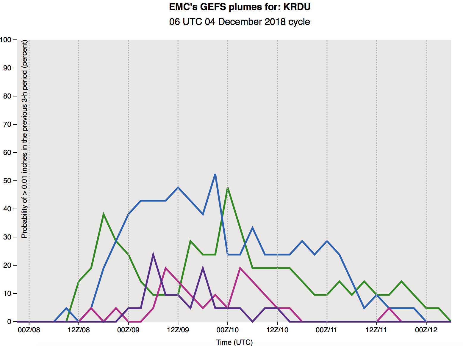
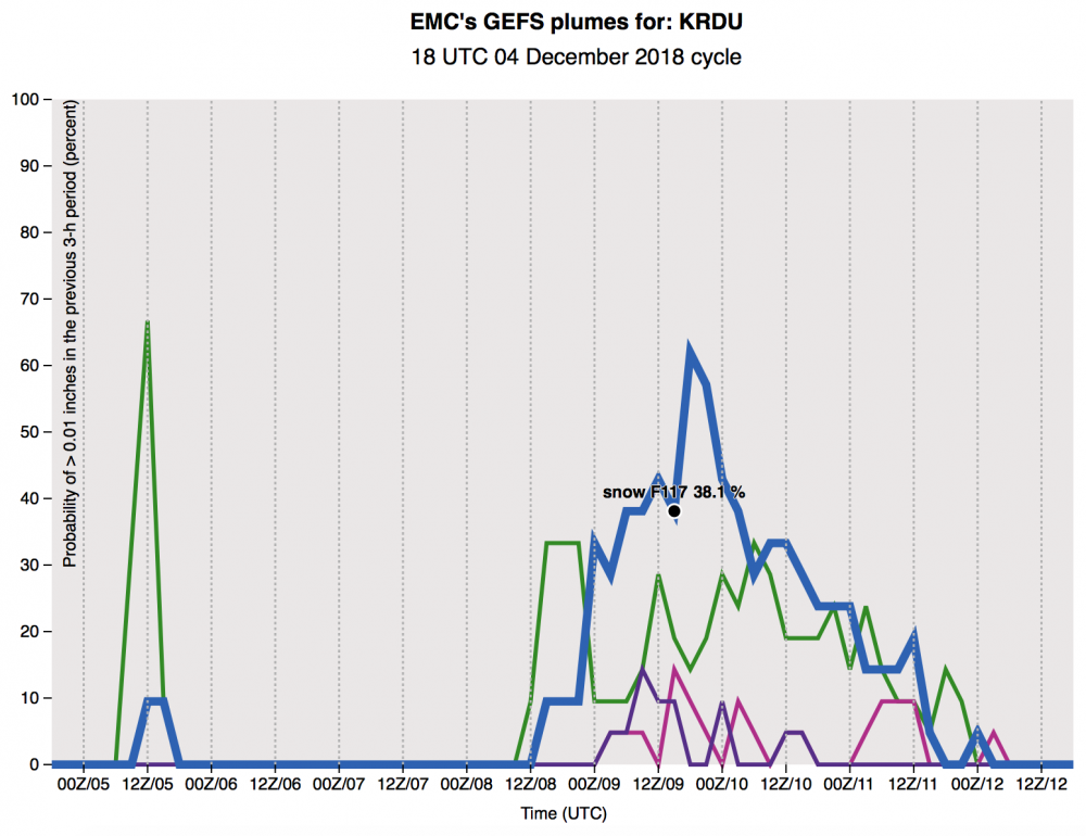
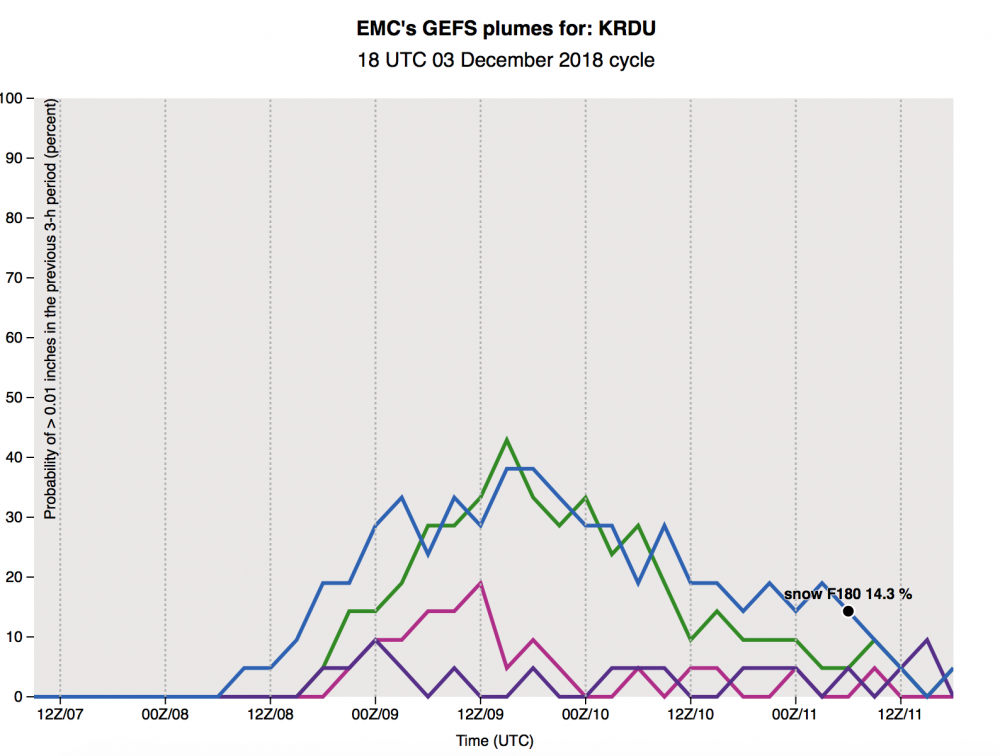
Haven't seen this posted yet... here are 6z GEFS plumes for KRDU.. trended up overall with some impressive outliers

-
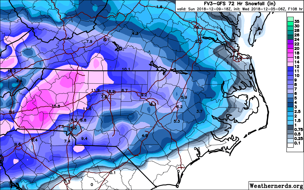
6z FV3 holding steady

-
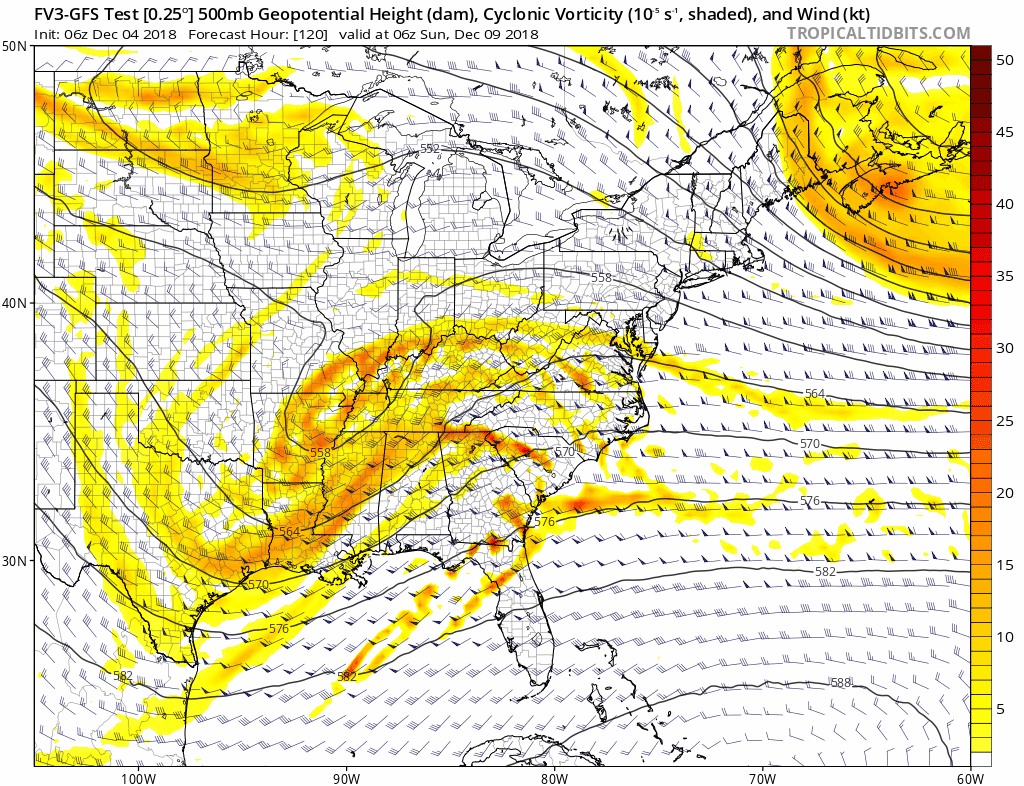
Holding steady-ish on the phasing front (can’t see any bad signals here yet)
-
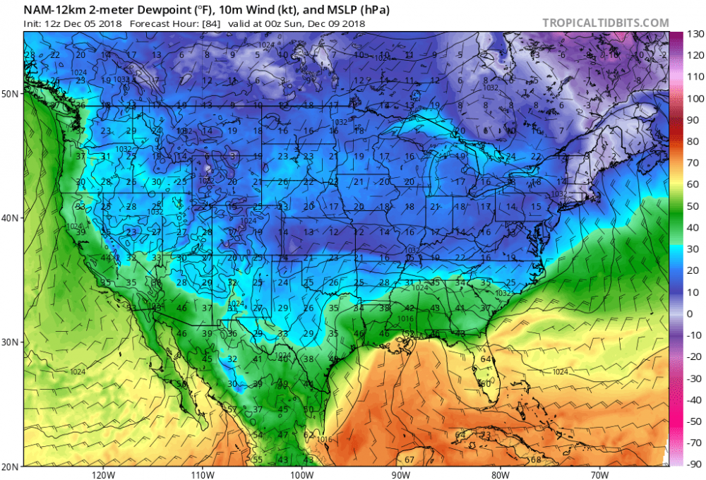
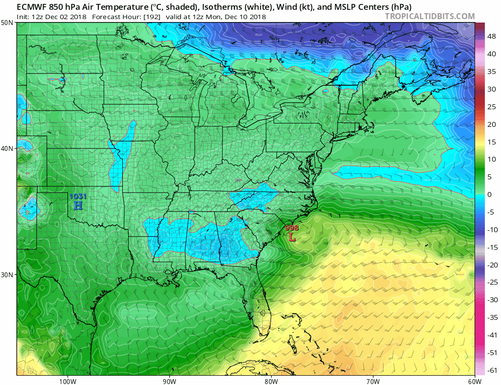
FV3 is colder with a more stout wedge - LP location good at hr 96 over Pensacola with snow throughout NC and upstate SC
-
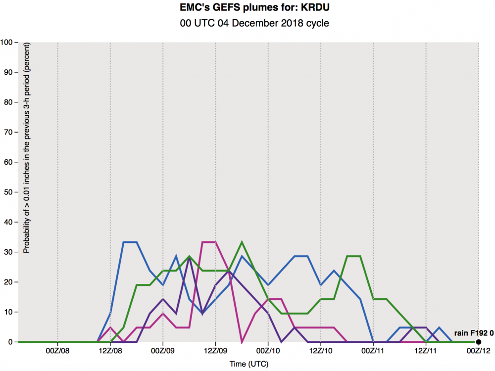
GEFS plumes with a big jump in snow % for RDU
-
The FV3 has this system continuing into Monday night, Tuesday AM with snow showers
-
Can you post maps?
-
Really threading the needle here..
-
Slowed down a bit through 84
-
18z GFS further south through 72
-
Can you post?
-
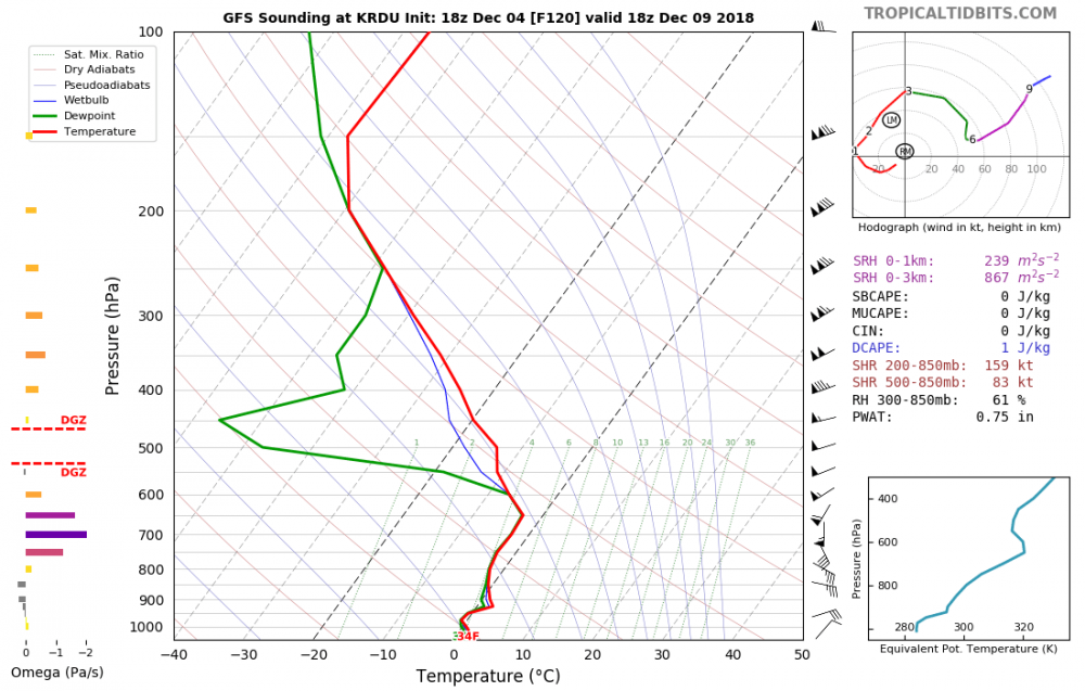
The trend at the 850 level that past few runs has been nice
-
That still looks like a foot of snow in Chapel Hill... unreal
-
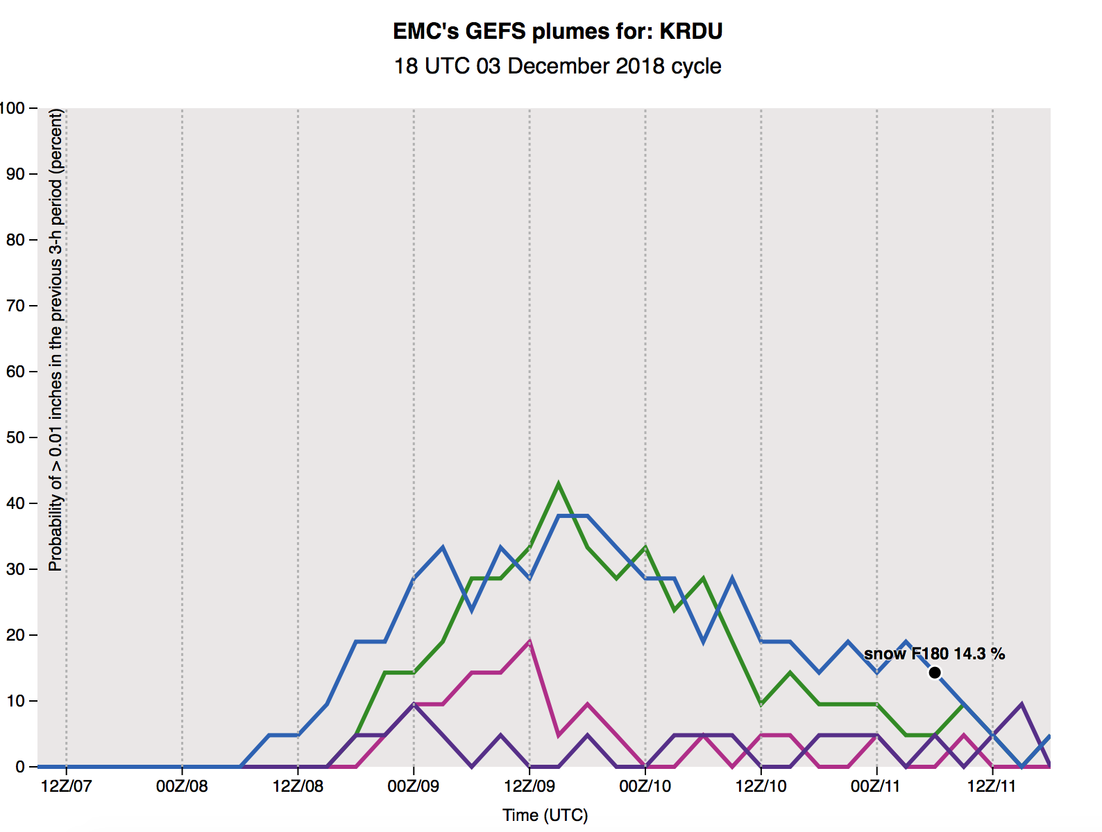
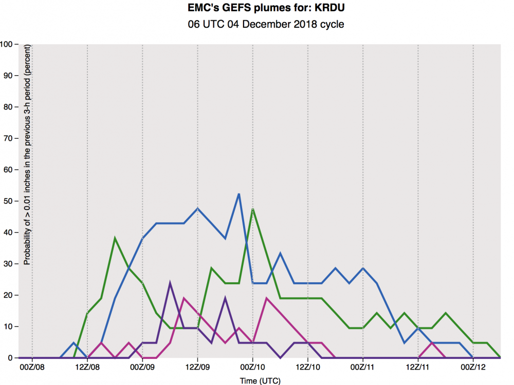
To support this idea, this is exactly what is showing in p-type breakdowns on the GEFS - while still a mixed bag, the 6z has higher prob of snow (30-40% vs 20-30%)
-
That's what I remember as well (in particular to Jan 2017 also)
-
I’m used to seeing a snow map like that on just ONE ensemble member and us hoping for that... never the mean. Have we ever had a GEFS mean that nice 5 days out?
-
Slightly faster but weaker low.. slightly colder at the 850 level through hr 90
-
Slightly weaker southern wave, slightly colder through hr 66 on the 6z FV3
-
That’s good to hear - in the past few years the NAM has handled temps better than globals (Jan 2017 comes to mind)