ajr
-
Posts
379 -
Joined
-
Last visited
Content Type
Profiles
Blogs
Forums
American Weather
Media Demo
Store
Gallery
Everything posted by ajr
-
The trend in temps on the Euro is worrying... our cold air is moving out before the storm hits
-
Unreal that the EPS mean is 10 inches for parts of central NC more than a few days out from the system
-
18z FV3 looks about the same through hr 90
-
Might be premature, but just ordered a sled for my son
-
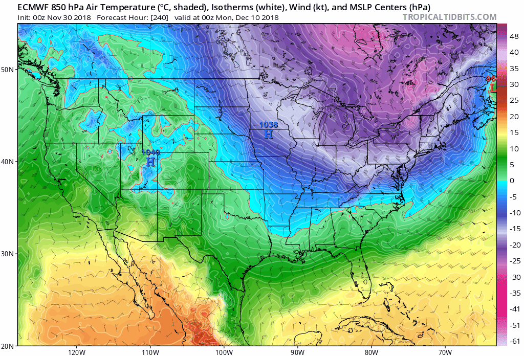
Not just you - you can see the cold air from Canada slowly making it further into CONUS at the 850 level
-
Sounds like perfect timing
-
18z GEFS is going to be more surpressed it looks
-
All caveats aside, when is the last time we’ve seen such a consistently modeled powerful winter storm modeled this far out?
-
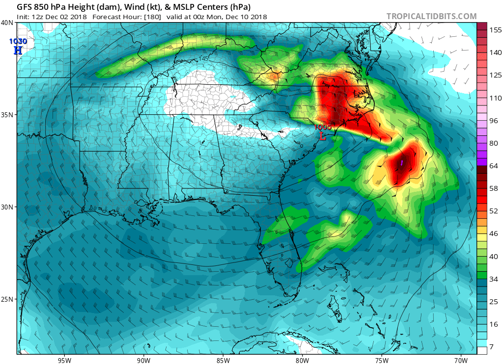
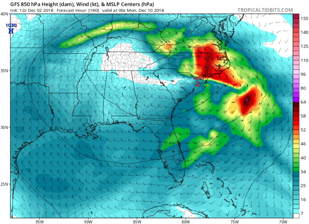
the 12z EURO is taking the low off the GA coast with plenty of cold air above
-
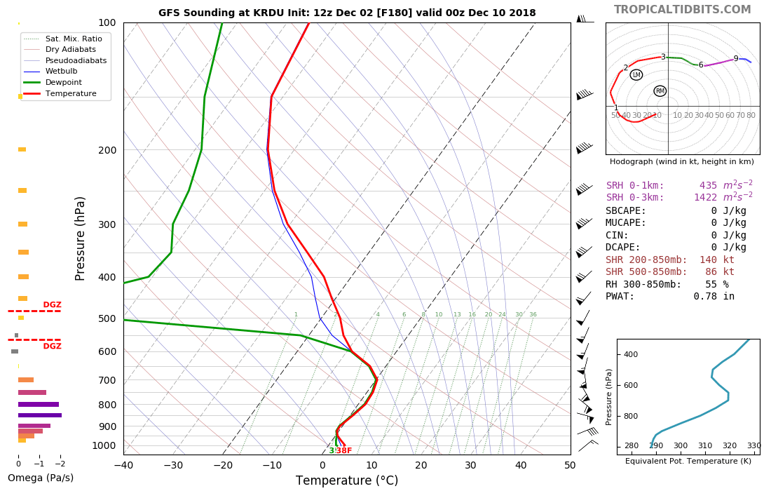
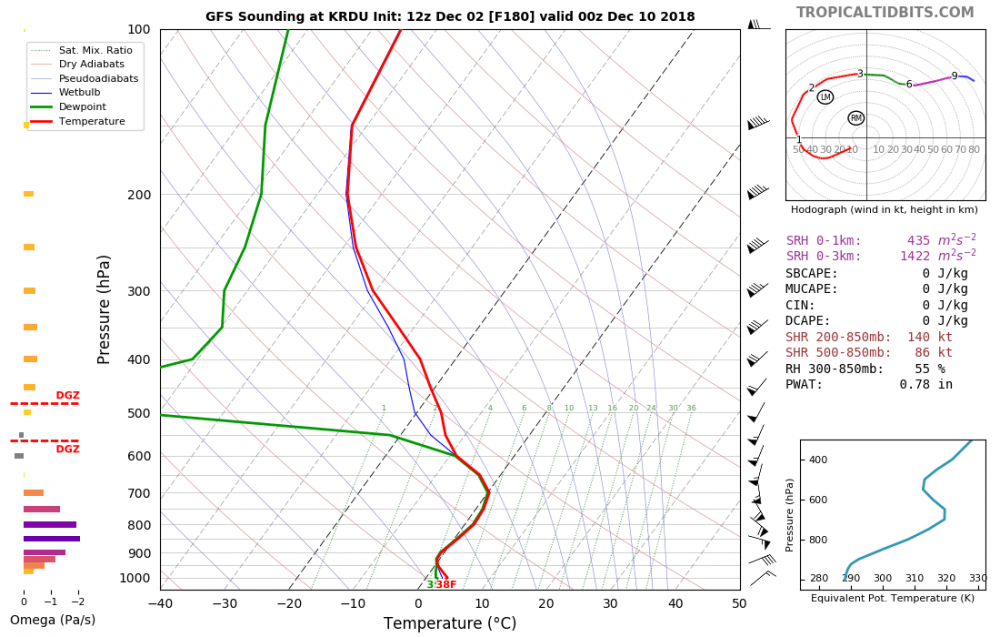
Agree.. looking at sounding at hr 180 verbatim when the low is approaching KILM, you can see the warm nose clearly.. then looking at the winds at the 850mb level, you can see the SE flow we don't want.
-
I think it's way too early to draw up the freezing lines - certainly we're not favored here, but it's not a bad look yet
-
The December to Remember 7th-8th blue turd winter threat thread.
ajr replied to lilj4425's topic in Southeastern States
Meanwhile HRRR is making things interesting for RDU... -
The December to Remember 7th-8th blue turd winter threat thread.
ajr replied to lilj4425's topic in Southeastern States
I just don’t see how Raleigh’s temp profile supports anything the models are spitting out -
The December to Remember 7th-8th blue turd winter threat thread.
ajr replied to lilj4425's topic in Southeastern States
I remember that tool (among others) being an epic bust last January.