

SENC
-
Posts
892 -
Joined
-
Last visited
Content Type
Profiles
Blogs
Forums
American Weather
Media Demo
Store
Gallery
Posts posted by SENC
-
-
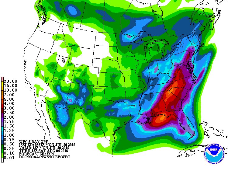
Ya''ll are "crying" over rain? you should check the stats for WILM,N.C. for the past month!
-
Monsoon continues..
That is all
-
 1
1
-
-
11 hours ago, Solak said:
Been Huffin & puffin to blow some of this off the Coast up ya'lls way!
") J/K..
J/K..
-
2 hours ago, Queencitywx said:
Now that I'm living in Duke Forest, I have no idea what to expect.
Mini Ice Age? You brought this with you correct?
-
SHILOH, N.C. (AP) — Heavy rainfall in North Carolina has diversified the farm of one family, who found fish flopping in between their rows of soybeans.The Observer reports a video posted on Facebook by Pasquotank County officials shows foot-long fish swimming through the rows of soybeans. The video was filmed by Carolyn Jennings on Tuesday afternoon, and has been viewed around 76,000 times.
The state has seen record-breaking rain in July, particularly around coastal areas that measured nearly a foot of rain since July 20. More than 16 inches of rain have been recorded this month at Cape Hatteras by the National Weather Service, breaking a 1949 record. Flooding from runoff has enabled fish to leave their native creeks and lakes. One family caught several off their back porch in Manteo. **Tailing Red Drum Folks! **
-
So ,, Monsoon Season thus continues?
Synopsis...
a front will remain west of the area through the weekend into early
next week. As a result, humid and unstable conditions will continue
with a chance of showers and thunderstorms each day. The coverage of
storms will likely increase the first part of next week as upper
level impulses move across the area.Flow through much of the column is from the
SW, which is keeping pwats over 2 inches, highest near the coast,
which combined with latest rap analyzed MLCAPE of 2500-3000 j/kg has
allowed scattered tstms to develop across the area well into next week.Welcome to the SouthEastern States Rainy Season

-
1 hour ago, downeastnc said:
Its nuts out there with the south flow the south facing beaches are deadly.......another guy drowned yesterday....10 others went to the hospital.
LifeGuards have "shutdown" Our beaches down south here also,,, DownEast..
We've had numerous WaterSpouts also spin up down this way too!
(I'm sure ya'll have had your share up that way to!)
-
6 hours ago, Brick Tamland said:
I see tumbleweeds here.
My "Rice Paddy" is doing great here on the Coast..
-
28? Tornado Reports? #Outbreak?
Wow..
I read somewhere there was just a SLIGHT chance for #severe WX in those areas today?
-
12 hours ago, No snow for you said:
For a cold rain?
NChailstorm says
QuoteSolar wind coming down the last 3 or 4 weeks after spiking up around 700 a few times in April and May, running around 280-450 or so lately. ig drop in the EEP levels too in the same time frame going from 9 to about 5 now.
QBO still ticking negative at -28.45
Just some observations I'm watching but carry on.
Your on too it I see NChailstorm..
(Why We've had a fairly cool Spring & decent (NOT BROILING) July..)
Yotaman asks:
And what exactly does that mean to the layman?I don't wanna to play into the Climate Change debate,, Please here...
Look up Grand Solar Minimum ..
In other words..
It's going to get COLD as _____________________
AND possibly
Lotsa record SNOW! This coming up,, gasp Winter! Like that October Dump from last year X2?

-
 1
1
-
-
-
-
-
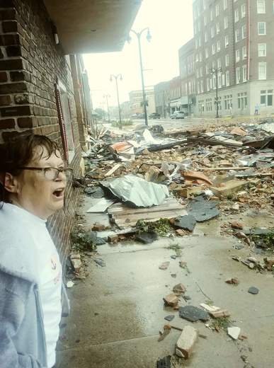
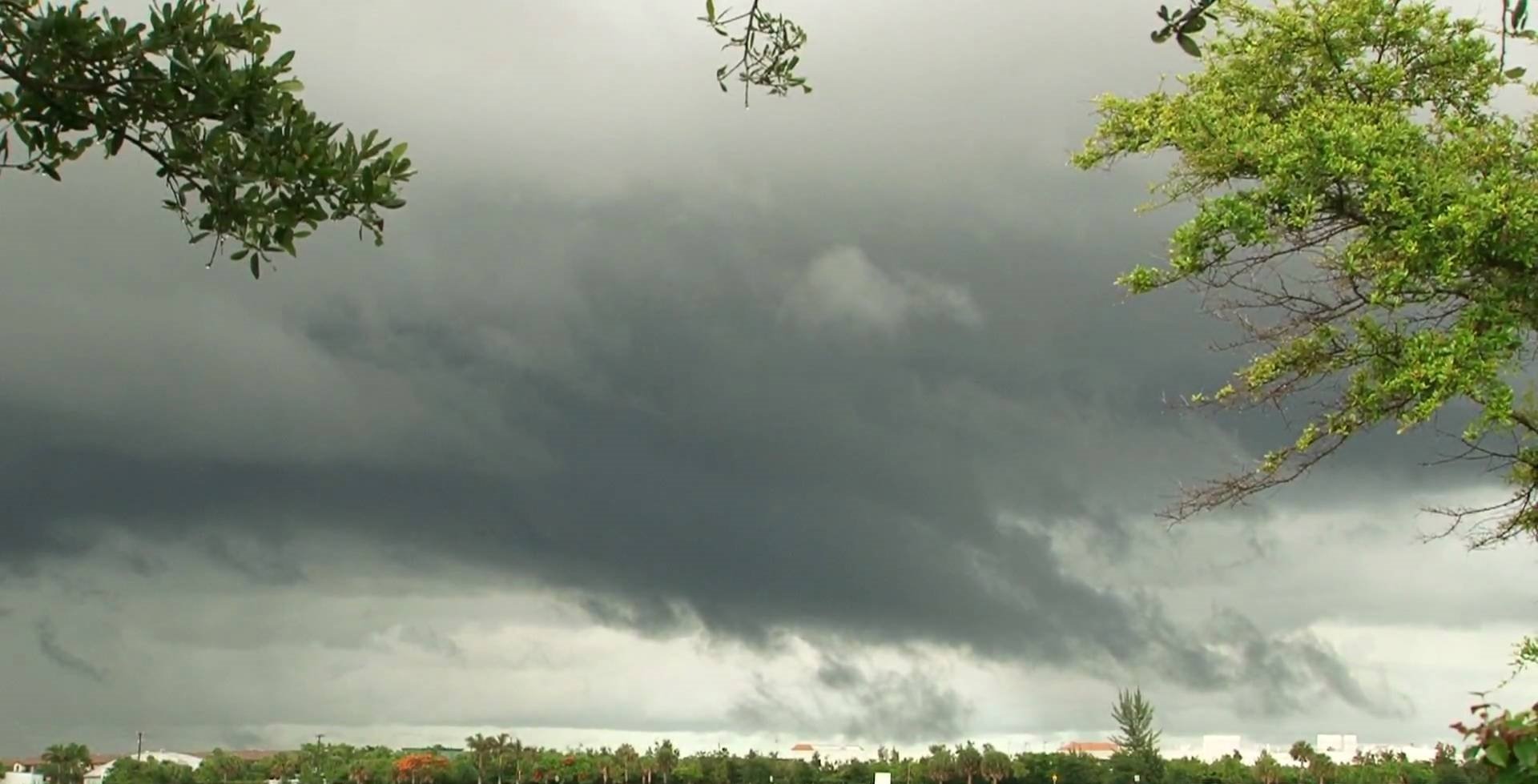
Pics & video coming out now..
-
1 hour ago, downeastnc said:
Not a single day with a high of 90 or higher IMBY on the 06Z GFS, many days where upper 70's low 80's.....thats pretty crazy for mid to late July average high is 90/91 here this time of year.
@DownEastnc, I watched a video that says in essence, We are entering "Phase #6" and Well be in a "cool period"? for the next 60 Days or so? Thoughts?
-
Well this is Interesting...
Moreover, Arctic mid-summer temperatures, north of 80°N latitude, have dipped to near freezing over the past days. This is likely in large part linked to the cold North Atlantic sea surface temperatures we’ve been witnessing. All this suggests ocean cycles, and not CO2, are the real Arctic drivers.
Snow and ice climbing past decade
The cold polar temperatures are naturally having an impact on Arctic snow and ice.
Japanese blogger Kirye tweeted here that Arctic sea ice volume is currently at the 4th highest level since 2003, thus defying the dire alarmist predictions of Arctic sea ice disappearing by now.
-------------------------
40-year veteran meteorologist Joe Bastardi at WeatherBell’s Saturday Summary shows how the Earth’s surface has cooled dramatically over the past three years and that Arctic sea ice is piling up.
-
15 hours ago, SN_Lover said:
It's really not that bad, i'm in Wilmington and barely had any wind or rain. There are plenty of visitors walking on the beaches and swimming.
models like this one are trolling my emotions though...pretty sure it is not going to verify.
WUT? You musta posted before the "White-out" rain(s) & Storms yesterday afternoon...
15 hours ago, SN_Lover said: -
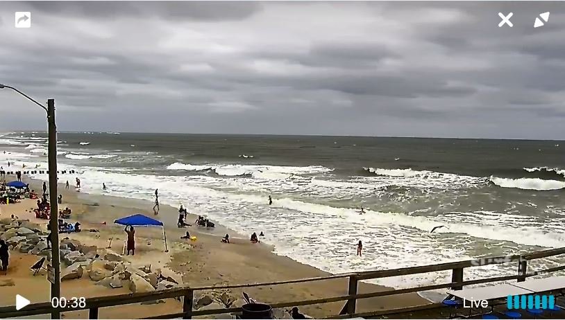
Current "Sea~State" on the Beaches..
Rip current advisories are up..
Careful, IF you plan on coming down in the next few Days, (Especially OBX beaches)
-
I DO NOT buy your "forecast".. not when this happens in JUNE..
WINTER STORM IN JUNE: Special weather alert issued for East Idaho calling for cold temps, frost and mountain snow https://idahostatejournal.com/news/local/winter-storm-in-june-special-weather-alert-issued-for-east/article_dc54e8ba-6b70-56ae-897d-88463857d5e3.html
-
KILM...
Short term /Monday through Monday night/...
as of 400 am Sunday...the time frame extending from the start
of this period, 6am Mon, through Tuesday daylight morning, the
local forecast area will see nearly a continuous shield of light to
moderate stratiform type rains. Embedded in this shield of
rainfall, will be a few thunderstorms. For the most part, the
tstorm activity will occur over the Atlantic waters and given
the trajectory of the swath of pcpn moving onshore, the coastal
counties will be the 1st in line to experience a few of these
storms. As the pcpn moves further inland, the lack of
instability will keep tstorms from further developing or in this
case, from progressing too far inland before it's demise.
Models indicate an expansive area of strong uvvs across the forecast area
and surroundings for a good 24 to 36 hrs. This a result of
synoptic difluence aloft due to the positioning of the upper
closed low as it moves from the lower Mississippi Valley Monday
morning, to eastern Tennessee late Tue night before finally
opening up to a S/W trof by Wed. Model soundings indicate 50+
kt east to southeast winds pumping in low level Atlantic
moisture across the Carolinas. Gulf of Mexico moisture will have
already been and continue to be tapped but by this time the main
source will be Atlantic moisture.
Forecast rainfall amounts during this 2 day period will range
from 2 to 4 inches. Isolated higher amounts are possible mainly
along the immediate coast due to the onshore movement of any
convection before dying out as it pushes further inland into a
more stable atm in the low levels. This modest rainfall amounts
over a 2 day period will be extremely beneficial to farmers and
local growers. Crops, plants, trees and etc, will literally act
like sponges and absorb this water. And given the 2 day period
of these rains, we do not expect high runoff problems.
-
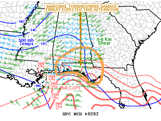
SUMMARY...A marginal tornado/wind damage threat is expected across
parts of southern Alabama, the Florida Panhandle and far
southwestern Georgia this afternoon. The threats are not currently
expected to be great enough to warrant watch issuance.
DISCUSSION...Latest surface analysis shows a 1010 mb low across
southern Mississippi with backed southeast flow across much of
southern Alabama, southwestern Georgia and the Florida Panhandle.
Surface dewpoints in these areas are in the mid to upper 60s F and
the RAP is estimating SBCAPE values in the 750 to 1500 J/kg range.
In addition, the Fort Rucker, Alabama WSR-88D VWP shows a curved
hodograph with 0-3 km storm relative helicity around 300 m2/s2. This
suggests that the stronger discrete cells will rotate and could have
a marginal tornado and/or wind damage threat. In spite of this, a
large area of cloudiness and rainfall is present from the Florida
Panhandle northward across much of Alabama. This should limit any
further destabilization and should keep any severe threat marginal
this afternoon. Nevertheless, we will continue to closely monitor
the situation.
-
Decided to put this in Banter, instead of the Long Term Disco..
Does this bear Watching & recording?
Year without a summer? Per Se??????
Well; I actually mean, a COOL summer? at least until Mid~Late June?
In science terms... Are we entering, a Maunder Minimum? Re: Low to No Sunspots, & Solar Minimum(s)???
Since the Topic: is Long range/Term Discussion...
WHAT IF: We are entering a period of a "Solar Minimum"?
I'm asking a very HONEST & Valid question...
In all my 55 years on this Rocky Ball, I cannot remember *EVER* cool temps like this.. This Late for SouthEastern N.C.
ALWAYS,,,,, BY THIS date, APRIL 20TH, I'm FISHING,, OCEAN CREST PIER , (Oak Island) and We are catching KING Mackerel & Spanish.(On or about this Date for years!, ).. (Since I stared King fishing in the Early-Mid70's),,, Yet the water temp, (even there)is 58~59 today.. Kings & Spanish preferred temps are 68 & above..
So a HONEST question..
What does the Long Term look like beyond 10 days? We have temps forecasted here in SENC, not even breaking 70 till next Sunday.. (10 Day) forecast.
Are We entering a Solar Minimum? I ask because there are "numerous" Science articles out there like this one from 2017..
Solar Minimum is coming.. https://science.nasa.gov/science-news/news-articles/solar-minimum-is-coming
How would/Will this affect OUR Long Term Weather outlook this Summer/Year?
Sorry Mods.. I'm HONESTLY asking for a reasonable answer/discussion..
-
1
-
-
31 minutes ago, Moonhowl said:
It is remarkable and looking at the long range the pattern seems to show no sign of changing. Since it looks like it is going to hold until next winter; we should be in for some epic snow.
Solar Minimum?
-
^^^ As in Calm Days, fair Skies & cool temps? (all summer)?
August Discobs Thread
in Mid Atlantic
Posted
LOL WE said that in the first of JULY!