

SENC
-
Posts
892 -
Joined
-
Last visited
Content Type
Profiles
Blogs
Forums
American Weather
Media Demo
Store
Gallery
Posts posted by SENC
-
-
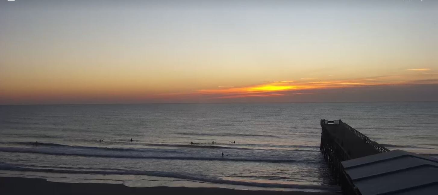
Lovin it..
On the Coast!
Current Temps 63F
Pressure 29.91 in
Visibility 8 miles
Clouds Partly Cloudy
Dew Point 60 F
Humidity 90 %
-
11 hours ago, Scorpion said:
I’d love to experience a hurricane up there sometime. Beautiful northern forest and hurricane force winds. Would just set myself up on an exposed ridge on an observation tower. Probably be hard to stay warm though.
No you don't trust me..
-
What a NICE DAY on the Beaches..High79ºLow69ºHumidity71%inchDew Point65.8ºinchRainfall 0.02 inchPressure29.82 inchWinds.. NNE @ 11mph
-
AF Recon Teal73 almost on the scene..
-
 2
2
-
-
NOAA43 departed Lakeland, now just leaving Fl. coastline
-
1
-
-
18 minutes ago, Rjay said:
Michael was a Cat 1
Ya got that right..
-
35 minutes ago, sojitodd said:
*If the levees fail it is gonna be partly YOUR FAULT!!-you admitted it! You admitted you were part of the whole sh**ty job of it! j/k of course...kinda.
I thought it would be someone elses fault? isn't that how it ends? Asking for a friend..
") Wishcasting a Cat 5 on Top on #NOLA,, complete Leeve Failures,, I jest..
Wishcasting a Cat 5 on Top on #NOLA,, complete Leeve Failures,, I jest..
-
[quote]Ok, so my post responding to the crazy person ranting about climate change and the left was deleted, but that stays up. Nice storm mode.[/quote]
I rather enjoyed His *RANT* coming from a retired COE,, It's called "Truth telling" & He's probably right..

-
2 minutes ago, RUNNAWAYICEBERG said:
Doctors appointments are not memorable unless it’s a colonoscopy.
Not unless it's snake bites, gator attacks, Bull sharks , We just deal with it..
-
41 minutes ago, Baroclinic Zone said:
I feel CT would be sent back to the dark ages if a real hurricane hit. It’s bad enough when you’re getting a minor storm and it’s gonna knock a million people out for a week plus
Need to come to SENC after a cane... Ya'll are WEAK.. 2 weeks the NORM.. Country folks can survive & all that..
-
 2
2
-
-
4 hours ago, ncforecaster89 said:
Me neither! Must be a new type of differential equation. After all, it was the least favorite course I took towards obtaining my meteorological degree...aside from Calc II. Then again, I’m not sure anyone could decipher it.
I believe it's that New alien, Common Core Maff I've been hearing about? Anyhoo BOT.. Interesting Analyses, We here in SENC up too OBX Coast(s) have had, about our wettest Summer eva, and Lotsa QPF could be our demise,, Dennis/Floyd esq, type stuff,, In other words extreme flooding very possible.. If some of those Forecast tracks, come to pass..
-
2
-
-
1 minute ago, AmpedVort said:
Cannot believe this has a chance to get a name - Fred

Can You pass My way, What your Smoking?


-
1
-
2
-
-
On 6/29/2021 at 9:46 PM, jburns said:
If the water is low enough just reach under the rocks and pull them out by hand.
Best bait too use catching trout.. It's going to be My first try this weekend.. (Gatlinburg,tenn areas)..
-
Current Obs, just alil warm out..
-
1
-
-
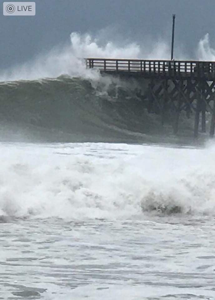
Roughly 2.0" of precip here in the ILM FA.. SENC/carolinas region..
74/85.. light rain currently
drought canceled.. -
Most *Notable*, (In My book)..
Hi! I’m so sorry to hear that he and his family endured such a horrible loss. I was born thirty years (1970) after your neighbor, in Wilmington, and have been a hurricane researcher from the time I experienced my very first hurricane eyewall in 1984 (Diana).
Here’s a list of all known TS’ and H’s that have made a direct hit on Wilmington, NC (1940-2020):
Dennis (1981) TS
Storm 2 (1982) STS (offshore)
Diana (1984) Cat 2 (eyewall)
Gloria (1985) TS winds (H-offshore)
Kate (1985) TS
Hugo (1989) TS winds (H-SC landfall)
Gordon (1994) TS winds (H-offshore)
Opal (1995) TS winds (TS-west)
Bertha (1996) Cat 2 (eye).. (I rode that one out on **Sheep Island** on the Lockwood Folly River..)
Fran (1996) Cat 3 (eye) (I got "smart" & bought a generator)..
Bonnie (1998) Cat 2 (eye)
Floyd (1999) Cat 2 (eye)
Charley (2004) Cat 1 (eye)
Ophelia (2005) Cat 1 (eyewall)
Ernesto (2006) TS/Cat 1 (eye)
Matthew (2016) Cat 1 (eyewall)
Florence (2018) Cat 1 (eye)
Isaias (2020) Cat 1 (eye)
-
Yes I've resided in Wilmington, since (forever),, anything after 1969.. My earliest memories, dob in the early 60's..
-
56/48
Light rain..
here on the beach's
wonderful!
BTW NO GAS down here!
-
-
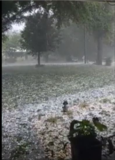
Rain/Hail & Thunder..
My Mater plants/ beans got the Smack down today, May no survive Round #2.. (currently)..
Not very often you experience HAIL here, Pea & ping pong sized, on/in SENC on the beaches..
At least the Pollen has been "cleaned" somewhat..
-
Second Round of Rain/Thunder/Lighting & Hail, today.. I assume things broke the "Cap" quickly after this mornings storms..
Currently 63f
Pressure29.85 inVisibility7 milesT~storm / lighting thunder & hail.. (again)..Special Marine Warning IssuedDew Point51 FHumidity61 %for the sportsmen here the First King was decked on Johnny Mercers pier.. this morningA 40 pound brute..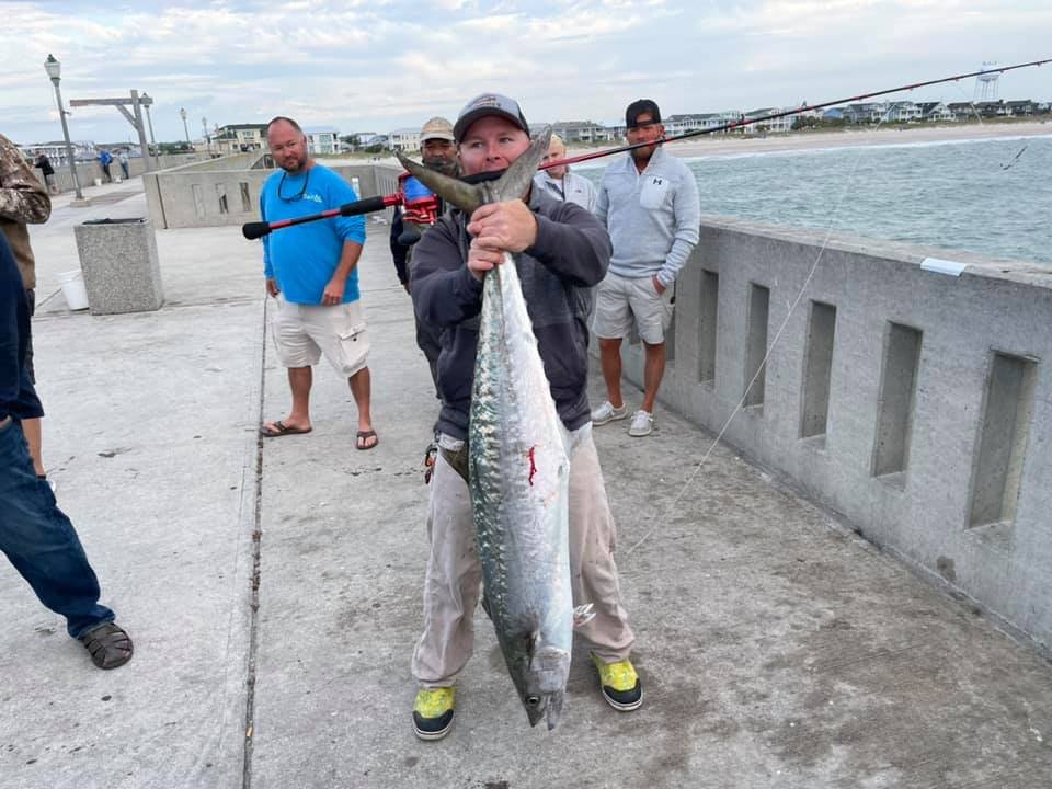
-
1
-
-
65/48
Thunder/lighting Rain & Hail..
-
49/74 here in Surf City..
Currently 69F
Pressure 29.81 inVisibility 10 milesClouds Partly CloudyDew Point 59 FHumidity 74 %Need alil rain to beat back the pollen..
-
2 hours ago, WinstonSalemArlington said:
Snow reported in the Triad
My STEP~Daughters (girlfriend ) reports Flakes/Flizzard down around "Pine Level?" area's ,, In the Johnston/S.Wake,, County.. Just a few, not enough too really even report?

Jan 15-16 Winter Storm
in Southeastern States
Posted
Great PHB Folks..
From KILM here on the Coast..