

Chicago Storm
-
Posts
19,046 -
Joined
-
Last visited
Content Type
Profiles
Blogs
Forums
American Weather
Media Demo
Store
Gallery
Everything posted by Chicago Storm
-
Fairly noticeable height rises this run across the board. Should allow the overrunning event to bump north in some areas and the main system to end up north as well.
-
ancient eons ago.
-
0z NAM is going to change the orientation of the overrunning event again it looks like.
-
OP 18z Euro only goes out to 90hrs.
-
18z EPS mean
-
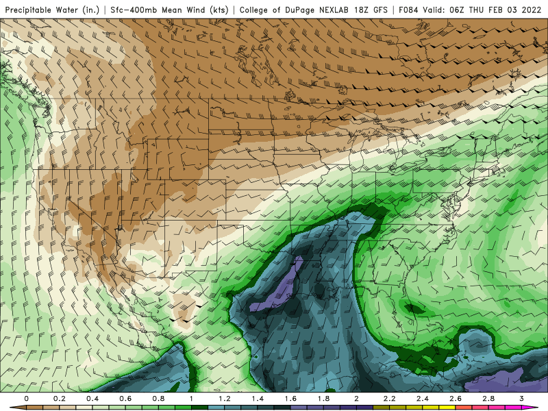
Moisture laden for sure, with both a Pac and Gulf connection.
-
18z Euro thru 12z Thur...
-
18z GEM was about the same with overrunning, but was definitely going to be north with the main storm system.
-
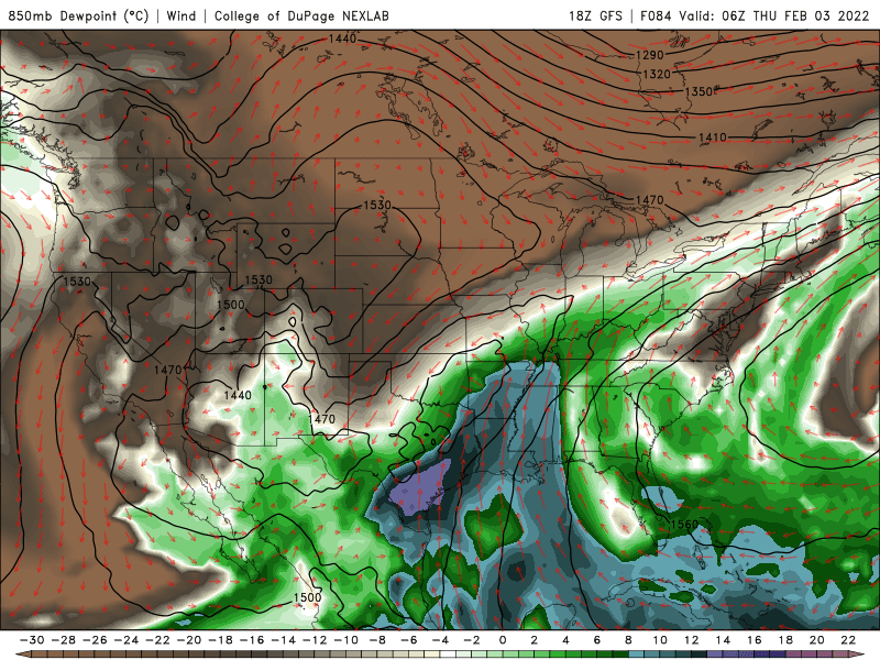
Definitely higher for the main storm system. Several posts back I posted a Chicago metro sounding from during the heart of the storm on Thursday, showing a deep DGZ.
-
A few appear to be near ~40” based on WxBell maps color scale. Obviously at 10:1 ratio. .
-
Sounding from the Chicago metro on Thursday, during the heart of the main storm system. Deep DGZ is deep.
-
There might have been some potential still left on the table with that trough evolution in the Southwest/Plains. .
-
18z GFS is coming north with everything... Overrunning event and the main storm system.
-
all of the OG regulars are back. need an amped NAM run to bring the WI folks out of hiding. .
-
just keep it easy as GHD III
-
12z Euro is going to be wayyy north with the main storm. Significant changes aloft in terms of trough organization/quality, ejection timing and ridging ahead of it.
-
Main storm should be north... Far less positive tilt and a bit faster as well.
-
In the end, yea it does look like that. Seems like most 12z guidance made that transition to different degrees.
-
12z Euro is going to bump the overrunning event south.
-
12z GEPS .
-
12z GEM .
-
12z GEM is a bit south with the overrunning event and is well south/weaker with the main storm (Ejecting trough is much more positive tilt/strung out/further south).
-
Main storm is a bit north of previous run. More ridging ahead of the ejecting trough, however it was slower.
-
We have a few STL area posters in here.
-
12z GFS coming in with a slightly different orientation for the overrunning event...It's a bit south for eastern areas and a bit north for western areas.


