weatherextreme
-
Posts
540 -
Joined
-
Last visited
Content Type
Profiles
Blogs
Forums
American Weather
Media Demo
Store
Gallery
Posts posted by weatherextreme
-
-
-
Thinking we could possibly see a hatched for tornadoes tomorrow.
From the SPC
Farther south along the front into central/eastern TX, the front
   will continue to push rapidly south overnight, with increasing storm
   coverage. Ample instability will interact with the front, with
   parallel deep-layer shear vectors and weakening winds in the low
   levels. Hail appears to be the main threat as the storms become
   undercut by the cold air, but a narrow zone of damaging wind
   potential could materialize should storms propagate fast enough to
   keep up with the front. The cells over southern OK and North TX
   prior to 00Z in particularly may produce damaging hail and a tornado
   or two before the front undercuts the activity. Any cells or bows
   that can propagate with a strong eastward component may reside along
   the boundary longer, enhancing both severe wind and tornado threat.
-
23 minutes ago, Ed, snow and hurricane fan said:
GFS shows a cap that never really breaks. There are Thursday afternoon/evening storms, especially E Texas and N. Louisiana, but there is only skinny CAPE above the weak cap ahead of them. Front maybe stalling somewhere near I-10 and PWs around 1.6, rain Thursday-Friday might be bigger issue.
Edit to add- if instability were higher in N. Louisiana, which could happen, dynamics are there for sig severe.
I could see this outlook possibly upgrading to at least enhanced by Thursday.
-
Dallas with the weather tonight is trending
https://twitter.com/search?q=%23Dallas&src=trend_click&vertical=trends
-
-
From Little Rock NWS
Thursday...

Will opt to recycle the discussion for Thursday from the mid-shift
as nothing the dayshift did could really improve upon their work.
Main talking points for Thursday will still be the uncertainty
regarding the northward extent of the wrm frnt, which could greatly
limit the extent of severe weather potential Thursday night...

Despite the exit of upper shortwave troughing Wed night, lingering
instability and ongoing WAA aloft will support at least some
convective potential overnight into Thurs morning, some of which may
be severe. This will also be a crucial trend to monitor thru
today/tonight as this area of convection may alter the warm sector,
potentially reconfiguring the greatest severe threat area later in
the day.

Additionally, guidance remains persistent in its depiction of
showers with embedded thunder lingering over portions of central/Nrn
AR during the morning and afternoon. Deep moisture, including very
moist low-levels, suggests the development of a strong Swrd moving
cold pool is unlikely, although even modestly rain-cooled air will
have the potential to push the warm front Swrd. As mentioned above,
model variability remains regarding this particular evolution with
lingering questions about the northward extent of the best BL air
and warm sector.

A Swrd trend is noted based on consecutive model runs, but to what
degree this will occur remains unclear. Locations along/south of the
boundary will see instability on the order of 2000 to 2500
SBCAPE/MLCAPE as well as strong moisture convergence along the
boundary. As of this writing, this boundary appears most likely to
set up from near Mena to Hot Springs to Stuttgart to near Holly
Springs, MS, but again, this will likely change in future cycles. A
more Srn shift would push us towards a best case scenario for AR,
but a more Nrn shift will push us towards a more worst case scenario
with more of AR in the volatile warm sector.

Further complicating the Thurs severe threat are progged phasing
issues between the warm sector and more robust forcing for ascent.
The incoming upper trough/cyclone will assume a negative tilt as it
approaches AR, but only neutral to weak height falls are expected
thru much of the day. After 03/00Z, more impressive height falls
begin to overspread the warm sector, thus supporting an increase in
more intense convection. This will occur in tandem with a rapid
increase in tropospheric flow as a 160 to 180 kt upper jet impinges
on the area and a very intense 70 to 80 kt LLJ develops by evening.

Storm modes and timing also remain nebulous, partly due to the lack
of more robust synoptic forcing during the day and the yet-to-be-
determined ability for moisture convergence along the boundary, or
free convection within the somewhat capped warm sector, to generate
storms. BRN values exceeding 10 indicate enough shear/instability
balance for organized modes once initiation occurs with multiple
modes likely, including strong supercells and clusters/segments.
Upscale growth along an Ewrd-racing cold front Thurs night will
support an intense squall line during the overnight hours.

Enough shear/curvature/instability will exist such that all severe
hazards will be possible anytime Thurs, but the developing LLJ
during the evening will significantly enlarge hodographs with SRH
values jumping to between 400 to 600+ m^2/s^2 within the warm
sector, and especially near the boundary. This presents a concerning
scenario regarding tornado potential with the parameter space more
than adequate for several strong/violent tornadoes along/S of the
boundary.

The ejecting cyclone late Thurs will cause the warm sector to
quickly surge Nwrd immediately ahead of a NEwrd moving sfc cyclone,
progged to move across NWrn AR during the overnight. This may offer
some window for pre-squall-line convection over central/Ern AR
before widespread damaging winds and embedded tornadic circulations
within the squall line sweep W to E across the Srn half of the area
Thurs night. Convection will end by dawn with lingering wrap around
moisture supporting rainfall across Nrn AR during the day Fri,
although this will be much more benign with the severe threat ending
by 03/12Z.

Bottom line: an outbreak of severe weather is still likely
Thurs/Thurs night, but the highest threat will reside along and S of
the warm front, the placement of which remains unclear and may
continue to present high uncertainty thru the event.

Flooding will also be likely thru Fri morning as moisture parameters
remain very high thanks to continued strong moisture advection.
Training storms are likely along/north of the front. This area was
recently inundated with several inches of rain with NASA SPoRT-LIS
data showing a swath of soil moisture values near the 95th
percentile stretching from near DEQ to near MEM. Given moisture
parameters and the potential for a few to several inches or more of
QPF, flash flooding will be likely, some of which could be
significant. The White River Basin has several points still in flood
as of this morning with worsening hydrologic conditions expected
within that basin and new flooding possible in other basins. There
is some lingering uncertainty with the QPF footprint with the latest
guidance hinting at a NWwrd shift in max amounts, so further
adjustments one way or another are possible.
-
-
Reed also mentioned that his you tube account was hacked
-
-
Looks like the 15% hatched tornado was moved a tad bit west and closer to DFW.
-
9 minutes ago, yoda said:

Very strong wording from the local Little Rock NWS. Don't see that very often
-
We might want to add Wednesday March 1st to this thread as well. Been seeing where this could possibly go enhanced.


-
 1
1
-
-
15 minutes ago, CheeselandSkies said:
It's moving west (as per the NAM, at least). Originally looked exclusively like another lower MS Valley-Dixie event.
How far west is the NAM showing
-
Early heads up - strong to severe storms will be possible Thursday. Areas most likely to see the strong storms will be east of I-35 during the afternoon Thursday. Timing/impacts will likely be adjusted in the days to come. Keep checking back in with us!
#wfaaweather
-
There has been plenty of chatter going on about this system, but this board seems to be very quite so far. I'm very surprised.
-
 3
3
-
-
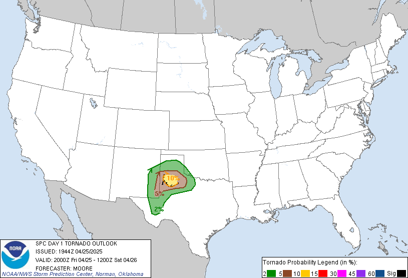
Hatched tornado stays at 10%, but the location has expanded into a more larger area over the past couple of update.

-
 2
2
-
-
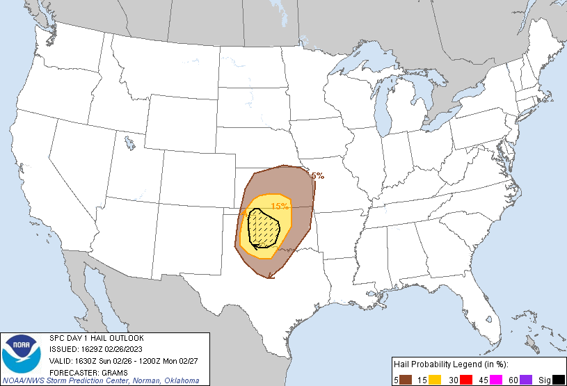
Hatched hail added in the latest update

-
 1
1
-
-
34 minutes ago, Quincy said:
Have had some time to take a deeper look at the setup. Seems like damaging winds will be the main threat and despite substantial surface-based convective inhibition, QLCS spin ups seem inevitable.
100 knot 0-6km shear? 75 knot LLJ? 500mb jet streak of 125 knots?
Pretty wacky wind fields, bordering on historic. I think it leads to complex storm modes with embedded, hybrid supercells possible.
Not favorable for storm chasing, but favorable to produce damage. Whether it’s 70 mph straight line winds or brief tornadoes, it almost doesn’t make a difference with it happening at night. Hopefully the threat wanes before reaching the more populated areas along I-44 and I-35 in Oklahoma.
Is there a possibility where this changes and we see a high risk issued? If I remember correct there would only need to be a 10% hatched for tornadoes and or hail for this to go high risk?
-

Mesoscale Discussion 0150
   NWS Storm Prediction Center Norman OK
   0320 PM CST Wed Feb 15 2023

   Areas affected...central North Texas into the south-central and
   southeastern Oklahoma vicinity

   Concerning...Severe potential...Watch possible

   Valid 152120Z - 152215Z

   Probability of Watch Issuance...60 percent

   SUMMARY...Risk for severe storms -- including potential for a a
   tornado or two -- is forecast to steadily increase over the next few
   hours as the atmosphere destabilizes.  WW issuance will likely be
   required in the next one to two hours.

   DISCUSSION...Latest surface analysis shows shallow low-level
   moisture continuing to stream north-northwestward across central and
   southeastern Texas toward North Texas.  Dewpoints are now into the
   mid 50s at the Red River, and near 60 into the Metroplex, but with a
   fairly substantial cap still evident in a recent (21Z) FWD (Fort
   Worth) RAOB.

   Still, as the upper system now centered near the Four Corners (per
   WV imagery) continues moving eastward, increasing ascent (hinted at
   by high-based CU developing over western North Texas) should
   continue to erode the cap, eventually resulting in surface-based
   storm development.

   With steep lapse rates evident aloft, and a kinematic environment
   featuring flow that veers from south-southeasterly to southwesterly
   through 6km, and increases substantially in magnitude through this
   layer, potential for supercells -- particularly with initial storm
   development -- and an attendant risk for large hail is evident.
   Where truly surface-based storms may develop -- i.e. mainly from the
   Red River vicinity southward, a tornado or two will also be
   possible.
-
8 hours ago, Powerball said:
A hatched hail area has been added to the day 2 outlook for DFW. Otherwise the probs are 15% Hail / 15% wind / 5% tornado.
Surprising enough, getting a bit of an appetizer right now with quite a bit of lightning.
Now it's gone. From the new day 2 update
-
 3
3
-
-
Update from the NWS FWD
National Weather Service Fort Worth TX
104 PM CST Wed Feb 1 2023
...New Short Term...
.SHORT TERM... /NEW/
/This Afternoon through Thursday Night/
Widespread freezing rain continues this afternoon across much of
North Texas and is largely tied to increasing warm advection
around 700 mb. Most of this activity is falling out of clouds
based around 8000 ft. Beneath all of this, incoming solar
radiation and a lack of cold advection is working on some of the
ice pack on area roads and we are seeing melting despite air
temperatures in the upper 20s. While this may lead to a false
sense of relief, there is still a substantial threat for
considerable icing, especially as we head into the evening hours.
High resolution guidance and current radar trends show a large
area of precipitation extending well back to the southwest of San
Angelo. This activity will increase in coverage through the
evening and as we do lose incoming solar radiation, additional icing
will commence on trees and roads/bridges. So, we`re not done with
the ice storm just yet and we`ll leave the current warning
configuration unchanged with the greatest impacts still expected
west of I-35. We launched a balloon just a little bit ago, and
the dry layer beneath this cloud deck is in the process of
saturating and will continue to support freezing rain, especially
into the late evening hours. As the upper trough approaches later
tonight, widespread precip will begin to spread south and east as
temperatures steadily creep up to or slightly above freezing. Rain
will generally prevail across the southeast counties while some
freezing rain will continue across the northwest into early
Thursday morning. We`ll continue to go slightly cooler than
guidance for highs on Thursday as abundant cloud cover will
persist. The core of the upper trough will track right across
North Texas during the afternoon. Strong dynamic forcing and
cooling aloft will likely lead to additional precipitation,
primarily rain, although some wet slushy snow may mix in across
the northern half of the CWA.
Dunn-
 1
1
-
-
2 minutes ago, Powerball said:
TxDOT, NTTA and local municipalities have been doing some treatment on the highways and main thoroughfares.
The secondary roads and side streets are still skating rinks.
Pete mentioned this from his facebook in response to the melting
40m ·READ CLOSELY:Yes, some melting is happening due to "warm" rain in places and limiting ice amounts. However, temps are below freezing and will stay below freezing as widespread rain continues to fall. Threat for re-freezing and icing continues, especially this evening- tonight. -
8 minutes ago, Powerball said:
That has to be off, or it could be a measurement over one of the lakes (I.E. Grapevine or Lewisville), which always run warmer.
Official observations from NWS sites show everyone is still in the upper 20s as of 1pm.
It's the Josey and Rosemead station from weather underground. It has fluctuated from 27-34 on and off.
-
Big blob showing up on radar out in West Texas. If that is heading to DFW that could be some bad news later on.
-
 1
1
-


Severe Weather 3-23-23 through 3-26-23
in Central/Western States
Posted
New Day `1
New Day 2