Runman292
-
Posts
757 -
Joined
-
Last visited
Content Type
Profiles
Blogs
Forums
American Weather
Media Demo
Store
Gallery
Everything posted by Runman292
-
SPC has extended the enhanced risk to western parts of east TN.
-
I think they underestimated yesterday's system in regards to the Southern Valley. No watches were issued south of Loudon county and that part of TN seemed to get hit the worst.
-
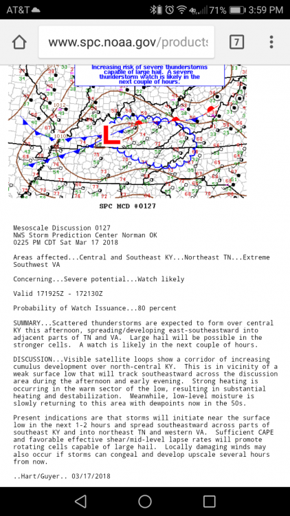
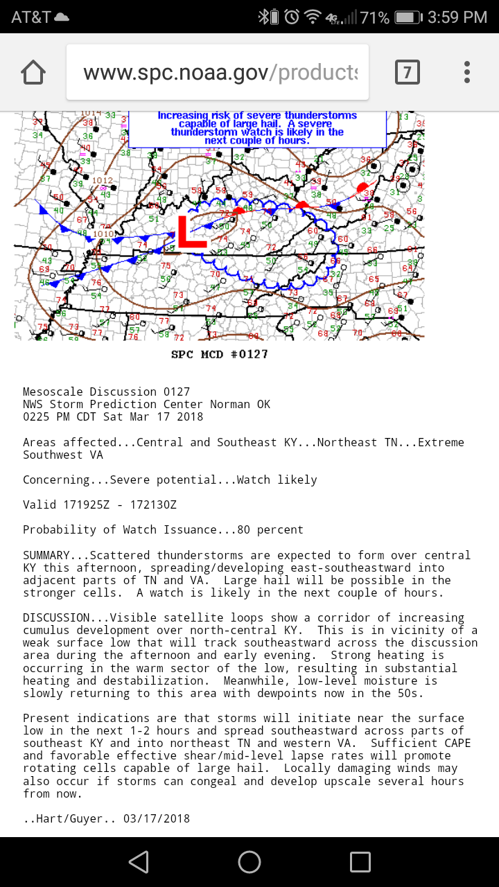
From the NWS SPC: