southbuffalowx
-
Posts
206 -
Joined
-
Last visited
Content Type
Profiles
Blogs
Forums
American Weather
Media Demo
Store
Gallery
Everything posted by southbuffalowx
-
Upstate/Eastern New York
southbuffalowx replied to BuffaloWeather's topic in Upstate New York/Pennsylvania
And more importantly, it seems to be trending north! Still going to remain skeptical, but hopeful -
Upstate/Eastern New York
southbuffalowx replied to BuffaloWeather's topic in Upstate New York/Pennsylvania
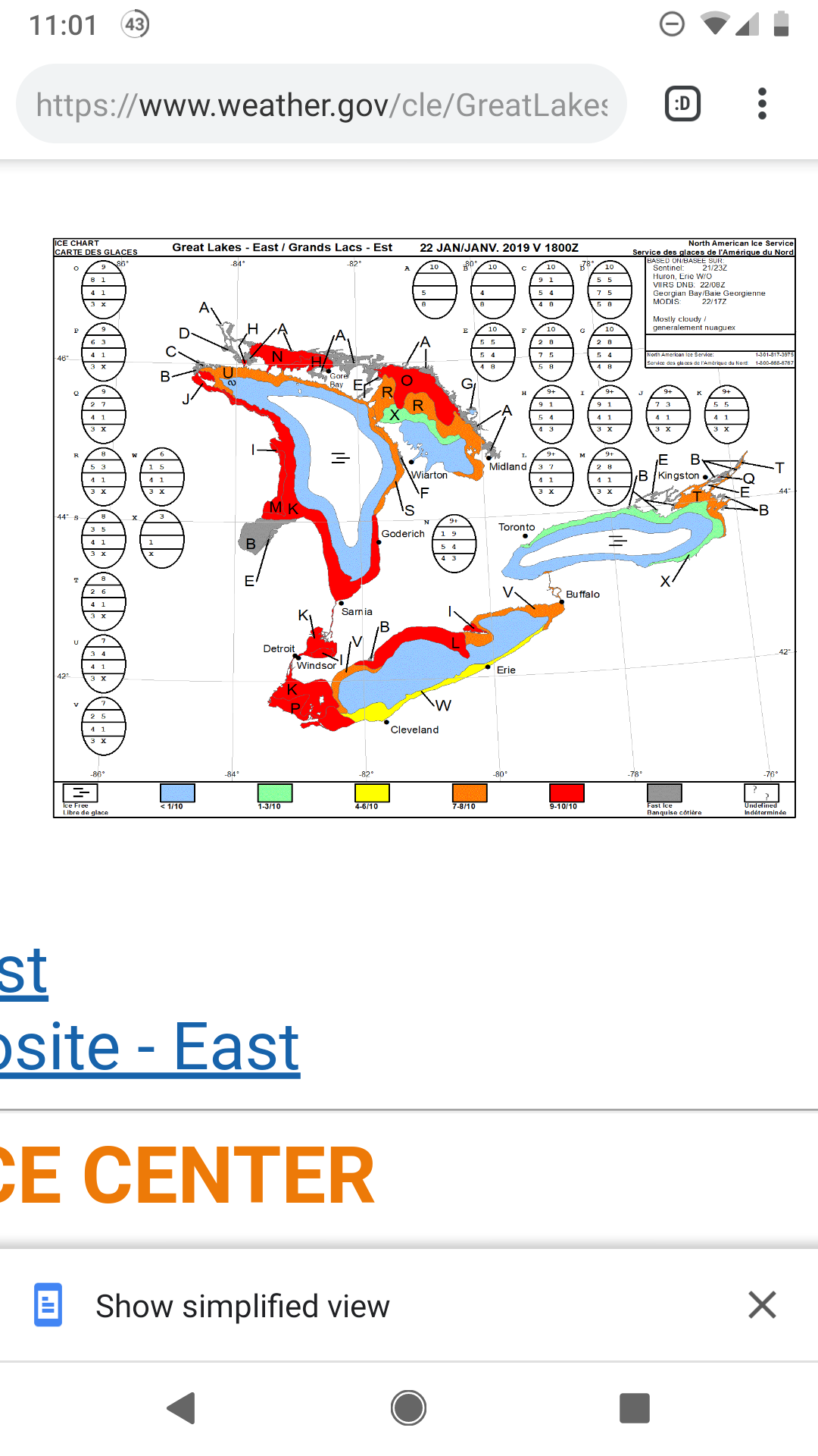
Unfortunately it looks like by next week lake Erie will probably be mostly frozen over. Maybe it can hold out just enough for a decent event on the first day, but I'm not getting my hopes up. Definitely sucks because I move on the 1st and probably won't get to experience decent lake effect storms for a while, unless I book snow vacations to the tug like I read some people on here do.
-
Upstate/Eastern New York
southbuffalowx replied to BuffaloWeather's topic in Upstate New York/Pennsylvania
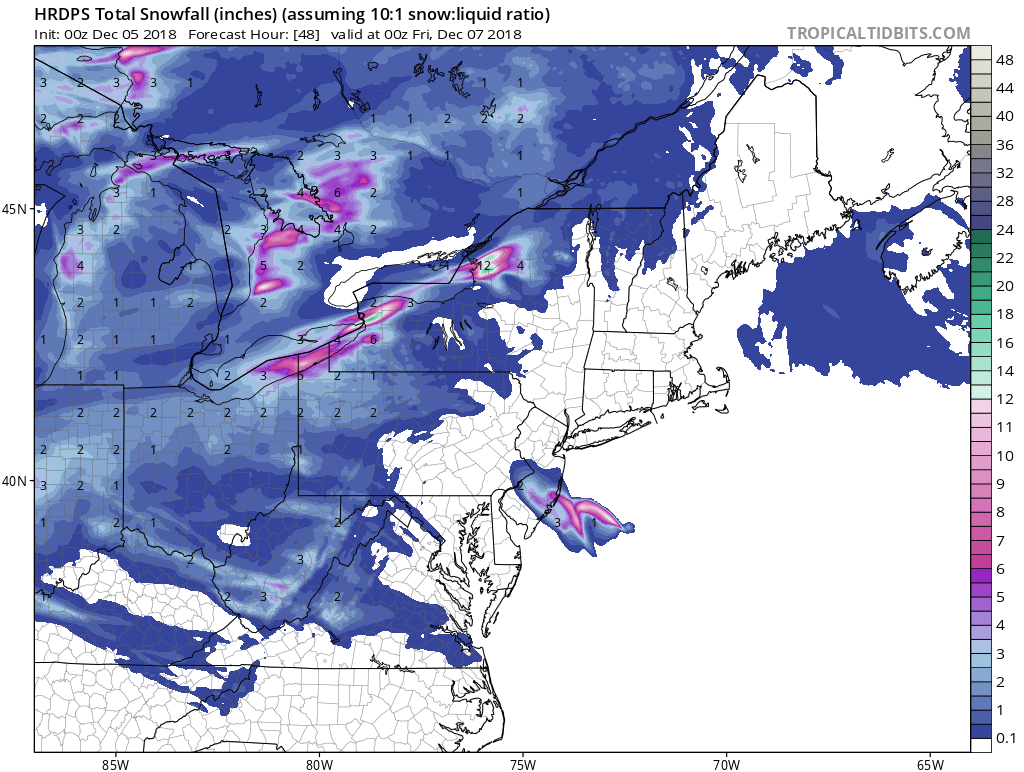
So did this storm build a lot of cred for the FV3? Because it didn't waver for days, showing the heaviest snows from Western-Central NY, even when other models trended south for a time. -
Upstate/Eastern New York
southbuffalowx replied to BuffaloWeather's topic in Upstate New York/Pennsylvania
Yeah, it definitely seems like the ideal place. Close to the city, but far enough south to get better lake effect events! Hopefully, I find myself moving back to Buffalo in 10 years or so and can get a place in the Southtowns -
Upstate/Eastern New York
southbuffalowx replied to BuffaloWeather's topic in Upstate New York/Pennsylvania
Congrats! Where are you gonna be located now? -
Upstate/Eastern New York
southbuffalowx replied to BuffaloWeather's topic in Upstate New York/Pennsylvania
Yeah, it already died off here... I'll be happy if we get enough snow to completely cover the grass for a couple of days. I might try to head to holiday valley tomorrow and take advantage of the good conditions while it lasts -
Upstate/Eastern New York
southbuffalowx replied to BuffaloWeather's topic in Upstate New York/Pennsylvania
Really coming down in South Buffalo right now. If only we could get snow like this to last for a few hours! -
Upstate/Eastern New York
southbuffalowx replied to BuffaloWeather's topic in Upstate New York/Pennsylvania
I believe that's more due to the lake freezing over around that time, and not due to the weather pattern being less conducive for lake effect in the metro. As long as the lake remains open, lake-effect storms are fair game for the metro. -
Upstate/Eastern New York
southbuffalowx replied to BuffaloWeather's topic in Upstate New York/Pennsylvania
I definitely will! Hopefully the El nino winter brings a few nice February storms. And engineering at a large manufacturing plant -
Upstate/Eastern New York
southbuffalowx replied to BuffaloWeather's topic in Upstate New York/Pennsylvania
Accepted an offer for my first job out of school! It's about 60 miles north of NYC, so hopefully Lake Erie gives me one last good lake effect event before I move down in less than a month. At least this winter is preparing me for what every winter is probably like down there lol -
Upstate/Eastern New York
southbuffalowx replied to BuffaloWeather's topic in Upstate New York/Pennsylvania
Haha I definitely considered it! I ended up taking the bus as far as it could take me after the first event, and then walked to my sister's apartment in West Seneca. The second event didn't hit them too much, but I at least got the satisfaction of helping her shovel the driveway. I got to experience 40" from the Dec 2010 event, so I'm happy with that at least. -
Upstate/Eastern New York
southbuffalowx replied to BuffaloWeather's topic in Upstate New York/Pennsylvania
I was stuck at school in the northern still during the Nov 14 storm, with my house in South Buffalo. I'm still bitter about staying at school because I didn't want to miss work lol -
Upstate/Eastern New York
southbuffalowx replied to BuffaloWeather's topic in Upstate New York/Pennsylvania
Precip lightened and turned back to rain but the cold air is there! -
Upstate/Eastern New York
southbuffalowx replied to BuffaloWeather's topic in Upstate New York/Pennsylvania
Out doing some Christmas shopping, and it's starting to snow here in Niagara Falls. -
Upstate/Eastern New York
southbuffalowx replied to BuffaloWeather's topic in Upstate New York/Pennsylvania
Seems like there's a pretty significant discrepancy in the models timing the frontal passage. I have to drive to Albany on Thursday afternoon, so as much as I'd love for the snow to park over the metro for a few extra hours, I'm hoping it pushes south by 2pm. -
Upstate/Eastern New York
southbuffalowx replied to BuffaloWeather's topic in Upstate New York/Pennsylvania
The Hi-Res Canadian drops up to 18" across the Northtowns.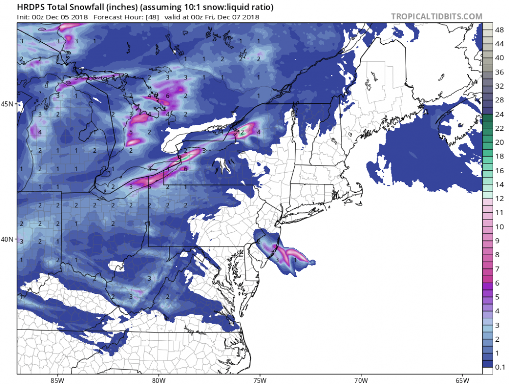
-
Upstate/Eastern New York
southbuffalowx replied to BuffaloWeather's topic in Upstate New York/Pennsylvania
About 3.5-4" here, which is better than I was expecting given my location in South Buffalo near the lake. Even though the Buffalo Metro hasn't gotten nearly as much snow as most other areas, it's hard to believe that it's still November, given that it feels like we've been tracking snow for a while now. Hopefully this is a sign of things to come for the rest of Winter. -
Upstate/Eastern New York
southbuffalowx replied to BuffaloWeather's topic in Upstate New York/Pennsylvania
Flipping back and forth between rain and snow in South Buffalo near the lake, even under the heaviest returns. 2 degrees colder and we'd probably have something interesting. -
Upstate/Eastern New York
southbuffalowx replied to BuffaloWeather's topic in Upstate New York/Pennsylvania
-
Upstate/Eastern New York
southbuffalowx replied to BuffaloWeather's topic in Upstate New York/Pennsylvania
I'm not sure if you could consider that a true synoptic event. If it wasn't for the lakes, there would not have been much of a storm. Here's the event synopsis from the 2016 winter summary. A deep area of low pressure slowly traveled across southern Quebec over the weekend of the 19th and 20th. This system transported Atlantic moisture over the Eastern Great Lakes that fed abundant moisture into bands of lake effect snow that fell southeast of the Lower Great Lakes on a cold northwest flow. Nearly a foot of snow fell in spots southeast of Lake Erie, while more widespread amounts of a foot to a foot and a half fell from the Genesee Valley to the Northern Finger Lakes region. Across the southern Tug Hill region upwards to two feet of snow fell from this system. Here is the summary for the 2013 synoptic event I just mentioned. A synoptic low brought widespread snow late on the 26th and through Wednesday the 27th. This storm brought several inches of snow, with upwards of a half a foot of snow found across the Genesee Valley and Eastern Lake Ontario region, and near a foot across the hills well south of Buffalo. -
Upstate/Eastern New York
southbuffalowx replied to BuffaloWeather's topic in Upstate New York/Pennsylvania
I remember we got like 5-6" around Buffalo just prior to Thanksgiving in 2013 from a synoptic event. Nothing crazy, but I think that qualifies. -
Upstate/Eastern New York
southbuffalowx replied to BuffaloWeather's topic in Upstate New York/Pennsylvania
https://buffalonews.com/2018/10/24/buffalos-new-radar-angle-will-help-get-better-weather-data-for-erie-pa/ Be interesting to see this in action this winter -
Upstate/Eastern New York
southbuffalowx replied to BuffaloWeather's topic in Upstate New York/Pennsylvania
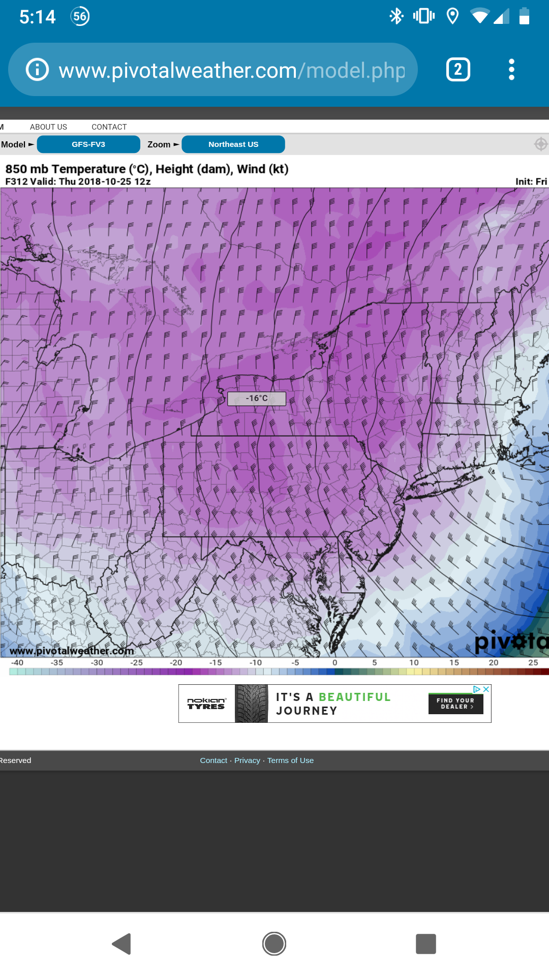
So did anyone else see this on the GFS-fv3? Absolutely nuts to see that level of cold on a weather model before Halloween. Hopefully we don't see too much cold, because it'll drain the lakes of their warmth so early
-
Upstate/Eastern New York
southbuffalowx replied to BuffaloWeather's topic in Upstate New York/Pennsylvania
That's interesting. When is that supposed to begin? -
Upstate/Eastern New York
southbuffalowx replied to BuffaloWeather's topic in Upstate New York/Pennsylvania
I'm going to be camping in the Adirondacks that weekend, so it's safe to say I'm keeping an eye on that cold shot. Hoping to see some snow on the peaks, but we'll see.