

WinstonSalemArlington
-
Posts
2,091 -
Joined
-
Last visited
Content Type
Profiles
Blogs
Forums
American Weather
Media Demo
Store
Gallery
Posts posted by WinstonSalemArlington
-
-
-
-
-
The Color Purple
-
 1
1
-
-
-
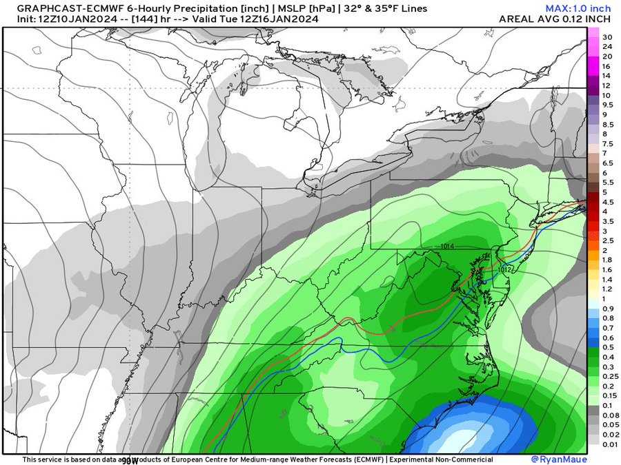
The research/experimental GraphCast for next Tuesday morning.
-
Hope is a dangerous thing
-
 1
1
-
-
Euro Tuesday PM
-
-
-
-
From QuagmireWx
-
1
-
 1
1
-
-
-
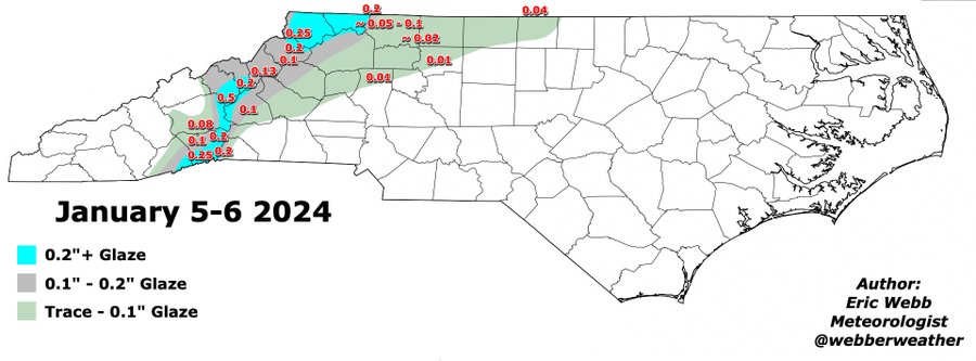
Credit Eric Webb
-
1
-
-
-
Dr Jonathan Wall:
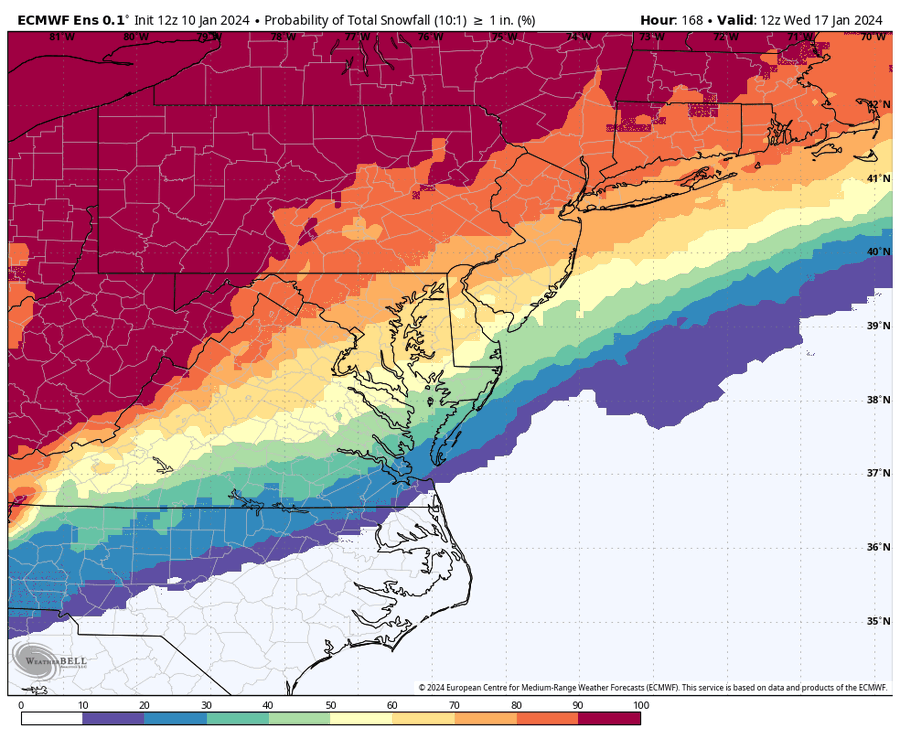
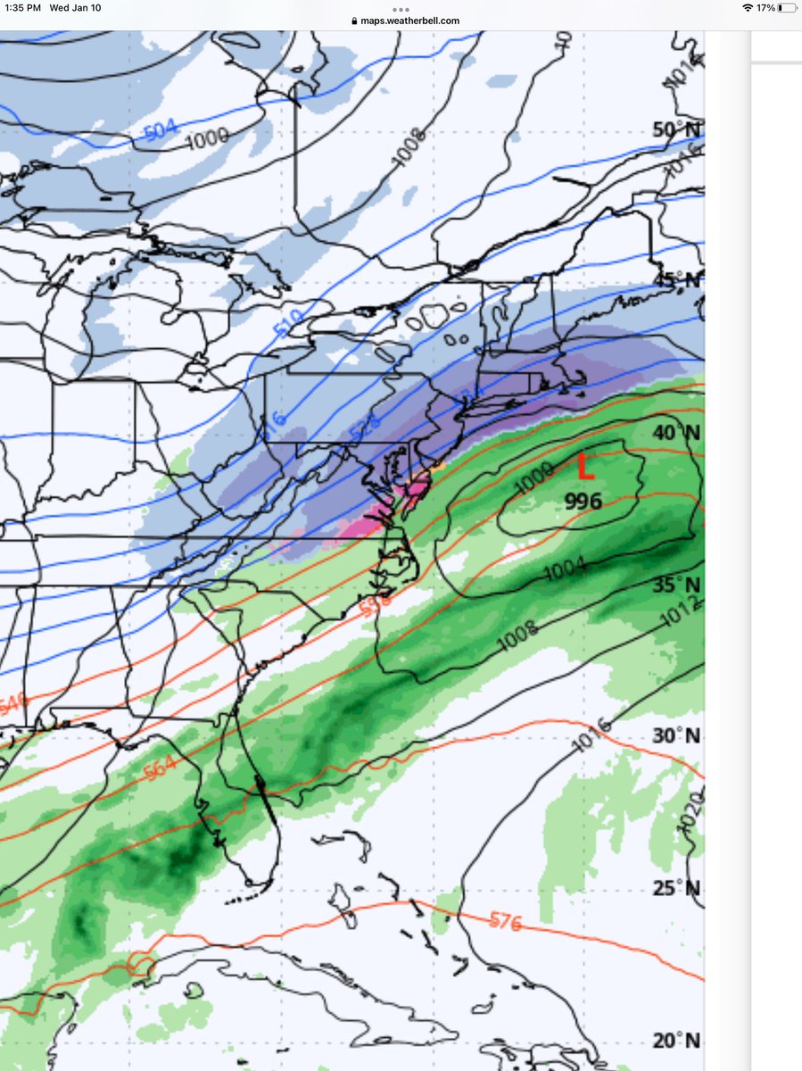
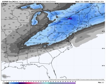
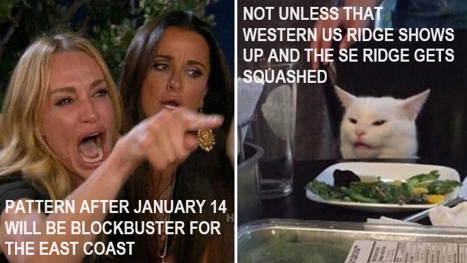
Upper air pattern is favorable for a snowstorm in NC 1/17+ (see analog on right for big NC snows) — there’s just one problem: we need a STJ s/w instead of a northern stream dominate s/w and so far that classic split flow has yet to appear. If pattern holds, possibly 1/20-1/30?
-
1
-
-
-
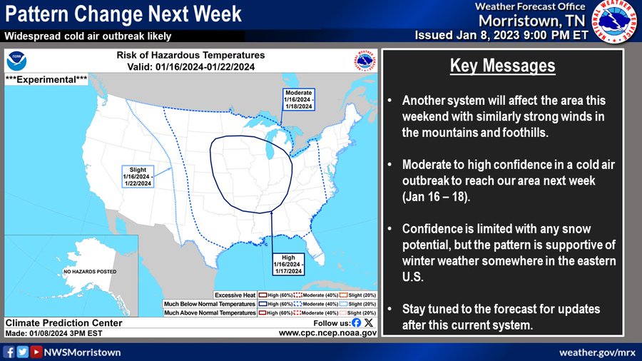
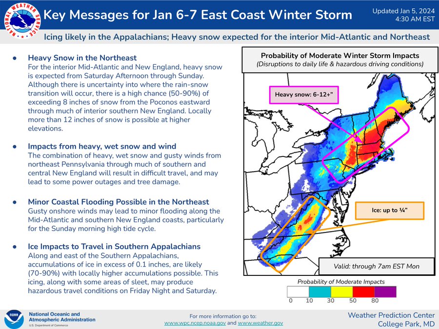
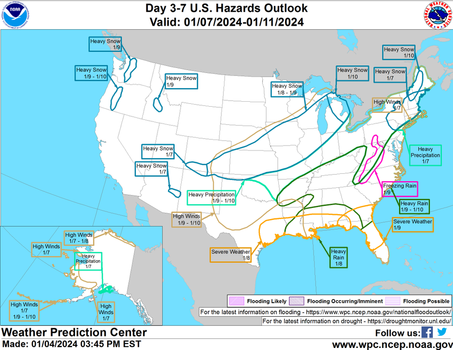
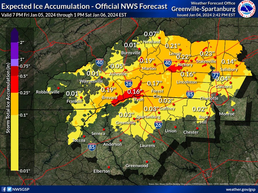
NWS special message
-
1
-
-
Nikhil Trivedi:
After a quiet December, we've entered a very active period of weather which won't be shutting down anytime soon. What will change, however, is who is favored to see snow.
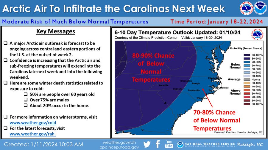
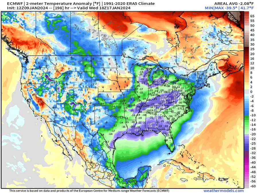
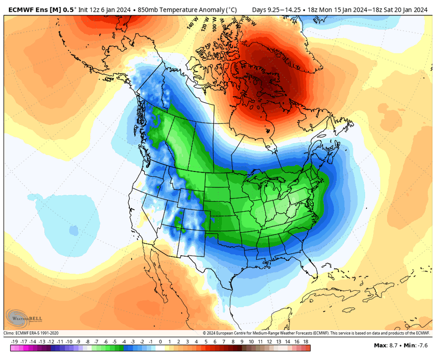
This pattern will force a major storm cutting through the Great Lakes (Jan 10), bringing some much needed snow to the Midwest. This storm should push deep into Canada and greatly amplify our -NAO. Our Pacific ridge will build poleward in tandem with this.We start with our retracted jet inducing a Pacific ridge and Western US trough.
This frankly ridiculous high-latitude blocking regime should squeeze our polar vortex into Southern Canada, which will likely force an arctic outbreak in the US in 7-10 days. The associated arctic high should force a mountain torque event which intensifies the jet.
This should allow our trough to surge east in 10-14 days, opening the door for our next Eastern US snow opportunity. Given the suppressive nature of the Arctic-influenced pattern, it could honestly be one that favors the Southeast for snow. We'll see.
-
3
-
-
Jumpin January
-
2
-
-
-
Eric Webb:
This is the first time all winter that I’ve seen a pattern that has legit potential to produce significant wintry weather in the southern tier of the country. (Mainly talking about near-just after mid-January)
It’s still a long shot even in a good pattern, but the ingredients are there.
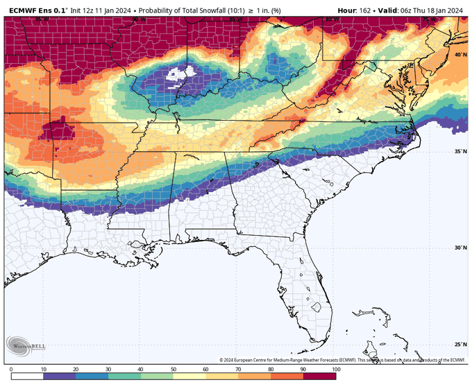
For ex, to get a good storm in the south, you typically like to see the southern edge of the snowpack over the CONUS get down to about the I-70 corridor or so. This is generally what the EPS is forecasting here
-
3
-
-
Forecast: the sanitarium is full
-


Mid to Long Range Discussion ~ 2024
in Southeastern States
Posted