MazooWeather
-
Posts
3,866 -
Joined
-
Last visited
Content Type
Profiles
Blogs
Forums
American Weather
Media Demo
Store
Gallery
Everything posted by MazooWeather
-

2024 Short/Medium Range Severe Weather Discussion
MazooWeather replied to Chicago Storm's topic in Lakes/Ohio Valley
2% TOR and 15% WIND for Central MI, Northern IN and Extreme NW OH -
Spring/Summer '24 Banter and Complaint Thread
MazooWeather replied to IWXwx's topic in Lakes/Ohio Valley
C- Noth said -
2024 Short/Medium Range Severe Weather Discussion
MazooWeather replied to Chicago Storm's topic in Lakes/Ohio Valley
We're all super glad it missed you -
2024 Short/Medium Range Severe Weather Discussion
MazooWeather replied to Chicago Storm's topic in Lakes/Ohio Valley
I know it's kinda the thing everyone says lately but the SPC really dropped the ball this evening when it was obvious the event was uptrending, they didn't even increase the areas that got hit by likely violent tornadoes to a slight risk until the 9PM update. -
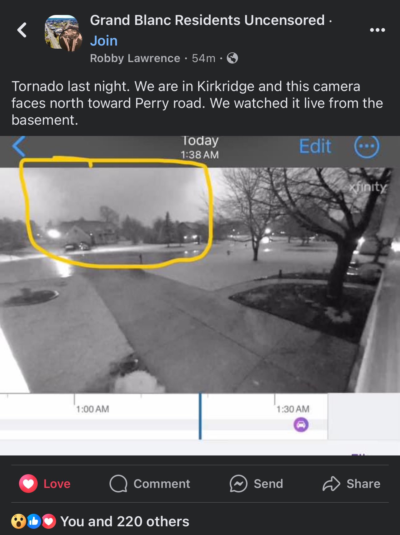
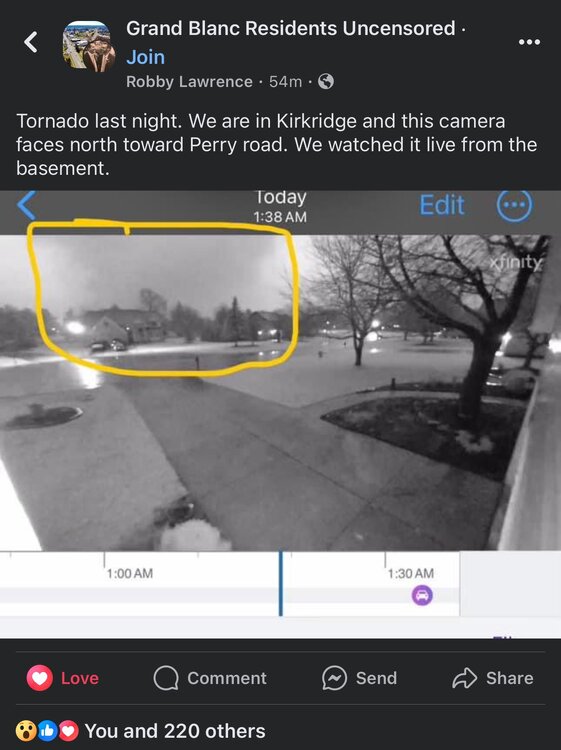
Cleveland area getting some nice LES
-
Reed posted a Facebook screencap of it Was pretty damn big, especially for MI
-
Looks to quickly go back to a much warmer than normal pattern with lots of chances for rain and storms. Morch incoming?
-
Right turner heading into Kalamazoo
-
Southern Lower MI is in prime position to get slammed from this LEWP
-
Tornado otg on the La Salle storm too on Reeds stream
-
Storm motion is going way more easterly than forecast which will be more tornado producing
-
That supercell that went up in the Quad Cities CWA has to be one of the fastest formations to SVR Warnings I've ever seen, around 10 mins
-
Initiation going in NE Illinois
-
10% sig tor introduced for South of Chicago into NW Indiana
-
Mesoanalysis looking spicy
-
lol the SPC basically ignored Michigan in the text
-
10% sig for tors and 30% sig for wind in Southern Indiana too
-
Suns coming out here which wasn't supposed to happen til like 3 PM today
-
Spc holds with a slight risk with 5% Tor and 15% sig hail, cams and high res models are showing a higher end event with the 0Z suite however
-
Winter 2023/24 Medium/Long Range Discussion
MazooWeather replied to Chicago Storm's topic in Lakes/Ohio Valley
Day 6 and 7 slight risks introduced -
Winter 2023/24 Medium/Long Range Discussion
MazooWeather replied to Chicago Storm's topic in Lakes/Ohio Valley
Models are hinting at potential for severe weather on the 27/28th with wrap around snow after -
Winter '23-'24 Piss and Moan/Banter Thread
MazooWeather replied to IWXwx's topic in Lakes/Ohio Valley
What are some lesser remembered events that formed you all's love of weather? For me it's January 7th, 2008, going from a zero risk at all locally in the morning to being under a Tornado Watch by the evening and losing our sheds roof to the storms that came through. Event is also notable for having a PDS watch issued in 5% TOR areas. -
Had an unexpected popup thunderstorm roll through here about 900 pm tonight with pea sized hail and lightning
-
2024 Short/Medium Range Severe Weather Discussion
MazooWeather replied to Chicago Storm's topic in Lakes/Ohio Valley
Spc kinda dropping the ball with no watch in effect with this many supercells popping -
GFS finally has storms in the fantasy range again, the most boring stretch is almost over